Blato sredina, Živogošće Beach, Croatia
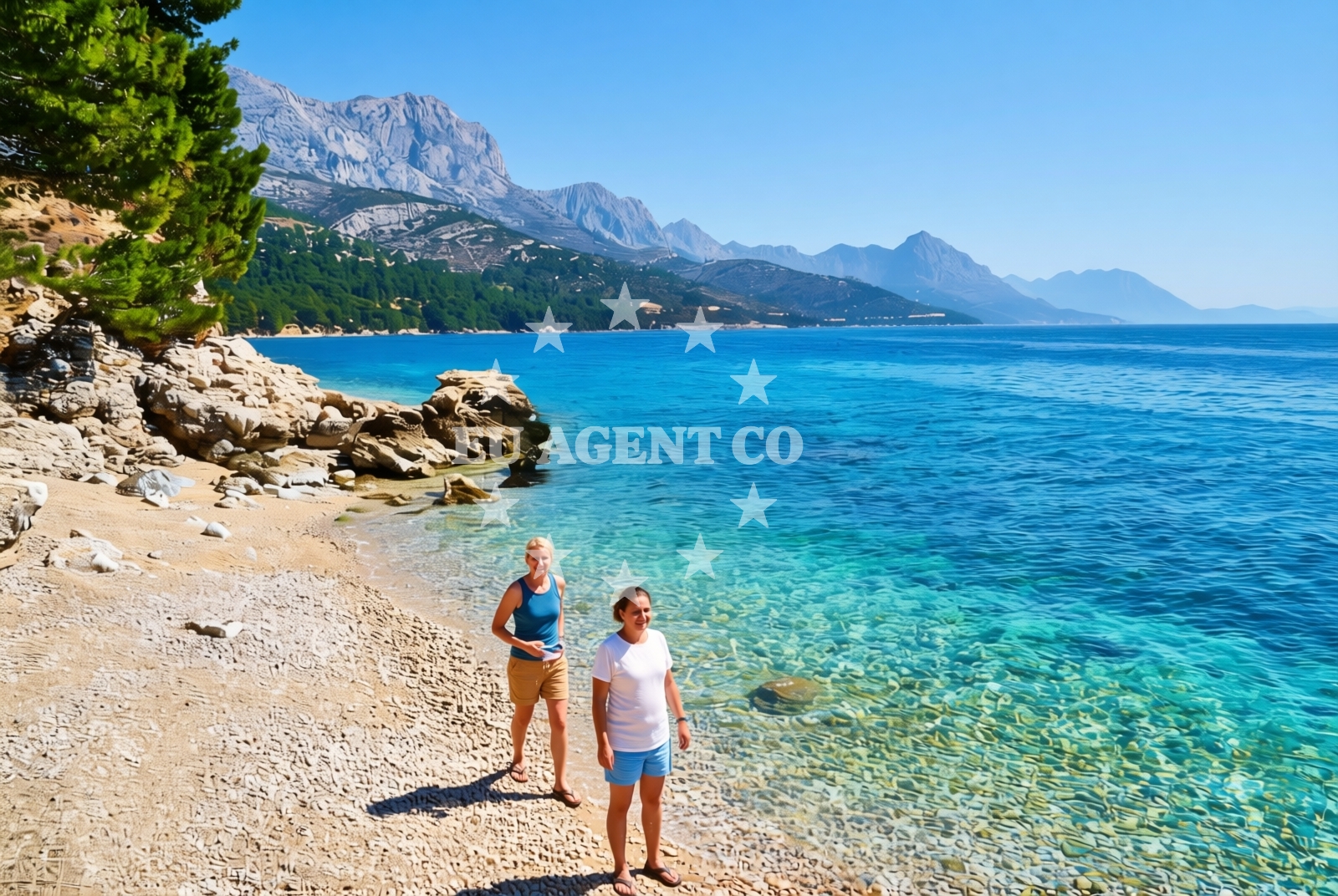
About this beach
Blato sredina, Živogošće
Beach: Blato sredina
Location: Živogošće
Characteristics and facilities
Gravel, rocks
50 m
Natural shade
Beach character
The beach's composition of gravel and rocks creates a rugged shoreline that stands apart from the smooth sands of many Adriatic beaches. At 50 meters in length, it is a relatively short stretch of coast, with the natural shade provided by surrounding terrain offering intermittent respite from direct sunlight. The rocky character suggests the beach may be more suited to visitors comfortable with uneven surfaces, though the exact accessibility of the shoreline remains unspecified in official records.Swimming and shore
The gravel and rock composition of the beach may present challenges for swimming, with potential for uneven footing and limited sandy areas for relaxation. The shore's rocky nature suggests it may be less ideal for families with young children or those seeking easy access to the water. However, the beach's natural features create a distinct environment that could appeal to visitors looking for a more unconventional coastal experience.Facilities and activities
Official records do not list specific facilities at Blato sredina, Živogošće Beach. The absence of structured amenities means visitors should not expect services such as showers, restrooms, or designated parking areas. The beach's characteristics suggest it may be more suited to casual visits rather than extended stays, though the exact nature of permitted activities remains unspecified in authoritative sources.Access and location
Located in Živogošće, this beach is part of Croatia's Split-Dalmatia County, an area known for its historical sites and coastal landscapes. The beach's proximity to the broader Dalmatian coast places it within reach of popular sailing destinations, though specific details about nearby settlements, roads, or transportation infrastructure are not provided in official records. Visitors should consider the beach's remote character when planning their visit.What to expect
Visitors to Blato sredina, Živogošće Beach should expect a short, gravel-and-rock shoreline with limited natural shade. The beach's unique composition creates a distinct environment that differs from the region's more common sandy beaches. While no specific facilities are listed, the beach's location within the Dalmatian coast suggests it may offer opportunities to explore nearby coastal areas, though the exact nature of these connections remains unspecified in official records.Practical tips
Given the beach's gravel and rock composition, visitors may want to consider appropriate footwear for navigating the shoreline. The natural shade provided by surrounding terrain offers intermittent relief from direct sunlight, though visitors should still take standard sun protection measures. The beach's short length suggests it may be best experienced as a brief stop rather than an extended visit.Exploring the coast by yacht
Blato sredina's location within the Dalmatian coast places it in a region renowned for its sailing opportunities. The Adriatic Sea's clear waters and coastal inlets make this area a popular destination for yacht charter guests. While specific marinas or anchorages near this beach are not detailed in official records, the broader region offers well-established sailing routes and ports that cater to both motor and sail boats.Regional Context
Živogošće is part of the Split-Dalmatia County, an area with a rich history dating back to ancient Roman times. The region is known for its medieval fortresses, vineyards, and coastal landscapes. While Blato sredina itself is a small beach, the broader area offers cultural and historical attractions that may interest visitors combining beach visits with inland exploration.Anchorages in the surrounding area
Anchorages in the surrounding area include Drvenik and Hvar, offering nearby mooring options.
- Anchorage — drvenik — 2.5 NM from beach
- Anchorage — sucuraj — hvar — 2.7 NM from beach
- Anchorage — sucuraj — hvar — 3.0 NM from beach
- Anchorage — sucuraj — hvar — 3.2 NM from beach
- Anchorage — sucuraj — hvar — 3.6 NM from beach
- Anchorage — selca kod bogomolja — hvar — 3.8 NM from beach
- Anchorage — selca kod bogomolja — hvar — 3.8 NM from beach
- Anchorage — selca kod bogomolja — hvar — 4.3 NM from beach
Distances are straight-line geographic distances, not sailing routes.
Mooring buoys in the surrounding area
Mooring buoys in the surrounding area include the Drvenik Ferry Dock and jetties in Sućuraj, Hvar.
- Drvenik - Ferry dock — drvenik ferry dock — 2.6 NM from beach
- Jetty — sucuraj — hvar — 2.6 NM from beach
- Kraj - Soline — kraj soline — drasnice — 4.8 NM from beach
- Konoba Gambo buoys — selca kod bogomolja — hvar — 5.1 NM from beach
- Brist — 6.3 NM from beach
Distances are straight-line geographic distances, not sailing routes.
Marine fuel stations
- Ina — makarska — 10.9 NM from beach
- Fuel station — ploce — 12.7 NM from beach
- Fuel station — korcula — 13.0 NM from beach
- Fuel station — sumartin — brac — 16.2 NM from beach
Distances are straight-line geographic distances, not sailing routes.
Harbours in the surrounding area
Harbours in the surrounding area include Živogošće, Drvenik, Sućuraj, Igrane, Zaostrog, and Drašnice.
- Živogošće — zivogosce — 2.0 NM from beach
- Drvenik — 2.4 NM from beach
- Sućuraj — sucuraj — hvar — 2.6 NM from beach
- Igrane — 2.8 NM from beach
- Zaostrog — 4.1 NM from beach
- Drašnice — drasnice — 4.6 NM from beach
Distances are straight-line geographic distances, not sailing routes.
Marinas in the surrounding area
- Marina Tučepi — marina tucepi — 8.2 NM from beach
- ACI Marina Korčula — korcula — 12.9 NM from beach
- Marina Ramova — krvavica — 13.1 NM from beach
- Marina Lumbarda — korcula — 14.7 NM from beach
- Marina Baška Voda — marina baska voda — 15.7 NM from beach
Distances are straight-line geographic distances, not sailing routes.
Restaurants near the beach
Restaurants near the beach include options in Sućuraj, Hvar, offering local cuisine.
- Restaurant — sucuraj — hvar — 2.6 NM from beach
- Riblji Restoran — sucuraj — hvar — 2.6 NM from beach
- Mlaska — sucuraj — hvar — 2.9 NM from beach
Distances are straight-line geographic distances, not sailing routes.
Navigation guides for the surrounding area
Navigation guides for the surrounding area include Hvar, Drvenik, Podgora, and Uvala Kozja.
- OTOK HVAR — 2.7 NM from beach
- Uvala Drvenik (Donja Vala) — 2.8 NM from beach
- Podgora — 6.6 NM from beach
- Uvala Kozja — 7.0 NM from beach
- Uvala Duboka — 7.2 NM from beach
Distances are straight-line geographic distances, not sailing routes.
Yachts from nearby departure bases
Yachts from nearby departure bases include Tučepi Port, Makarska Port, and Ploče City Port, offering various vessel types.
Sailing yachts
- Bavaria 40 Cruiser (LADY BUTTERFLY) — Tučepi Port — 8.2 NM from departure base to beach
- Elan 40 Impression (Karleta) — Ploče City Port — 12.6 NM from departure base to beach
- Sun Odyssey 419 (Luka Ploce) — Ploče City Port — 12.6 NM from departure base to beach
- Elan 514 Impression (Cesarica III) — Ploče City Port — 12.6 NM from departure base to beach
Catamarans
- Lagoon 450 Fly (Alba Mouse) — Ploče City Port — 12.6 NM from departure base to beach
Motor yachts
- Princess V53 (Chablis) — Makarska Port — 10.6 NM from departure base to beach
Motor boats
- Jeanneau NC 37 (Black Pearl) — Makarska Port — 10.6 NM from departure base to beach
- Galeon 430 Skydeck (Bellagio) — Makarska Port — 10.6 NM from departure base to beach
- Galeon 430 Skydeck (BELLAGIO) — Makarska Port — 10.6 NM from departure base to beach
- Jeanneau NC 37 (Black Pearl) — Makarska Port — 10.6 NM from departure base to beach
Distances are straight-line geographic distances, not sailing routes.