Bijeli Potok, Gornji Karin Beach, Croatia
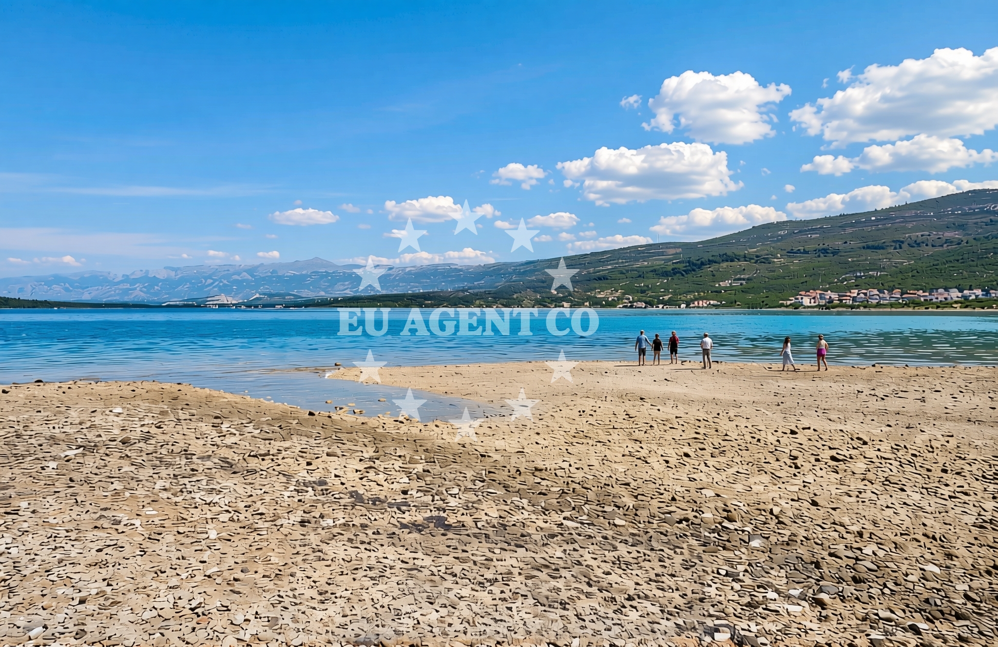
About this beach
Bijeli potok, Gornji Karin
Beach: Bijeli potok
Location: Gornji Karin
Characteristics and facilities
Gravel, rocks
290 m
Natural shade
Beach character
The beach consists primarily of gravel and exposed rock formations, creating a terrain that is more suited to walking than swimming. Its natural shade, provided by the surrounding landscape, offers respite from direct sunlight. The absence of artificial structures or amenities emphasizes its untouched character, aligning with the broader tradition of Croatia's more secluded coastal areas. The beach's orientation and composition suggest it is best experienced during low tide, when the rocky seabed becomes more accessible for exploration.Swimming and shore
Swimming is not practical due to the gravel and rock composition, but the shoreline provides opportunities for walking along the water's edge. The natural shade from overhanging terrain creates microclimates that can be cooler than surrounding areas. The beach's position within the Dalmatian Coast means it is subject to typical Adriatic sea conditions, with waves that can vary depending on wind patterns and tidal movements.Facilities and activities
There are no formal facilities or amenities at the beach, consistent with its undeveloped character. Activities are limited to walking along the shore and exploring the rocky terrain. The beach's location in Gornji Karin places it near traditional Dalmatian villages, where visitors might find local cultural experiences or hiking trails in the surrounding hills. No structured activities are offered at the beach itself.Access and location
Access to the beach is via the village of Gornji Karin, which is part of the municipality of Biograd na Drini. The beach's coordinates (44.133903, 15.623252) place it along the northern Adriatic coast, within reach of major Dalmatian ports such as Split and Dubrovnik. The area is served by regional roads connecting to the broader Adriatic coastline, though specific transportation details for the beach itself are not documented.What to expect
Visitors should expect a rugged, undeveloped shoreline composed of gravel and rock. The beach is best suited for those seeking a natural coastal experience rather than conventional beach amenities. The 290-meter length provides space for walking along the shore, with natural shade available in certain areas. The beach's position in Gornji Karin means it is part of a region known for its traditional Dalmatian villages and scenic coastal routes.Practical tips
Wear sturdy footwear for walking on gravel and rock surfaces. The beach's natural shade can be limited to specific areas, so sun protection is recommended. Check tide times before visiting, as the rocky seabed may be more accessible during low tide. The surrounding area offers opportunities to explore nearby villages and hiking trails.Exploring the coast by yacht
The Dalmatian Coast, where Gornji Karin Beach is located, is a popular sailing region with numerous marinas and anchorages along the Adriatic Sea. Yacht charter guests exploring this area may find the surrounding coastline offers opportunities for coastal cruising, with nearby ports providing access to traditional Dalmatian towns and cultural sites. For yacht charter inquiries, visit Euro-Agent's Yacht Search page to explore available options in the region.Regional Context
The beach is situated in a region of Croatia known for its rugged coastline and historic villages. The Dalmatian Coast stretches from Split to Dubrovnik, featuring a mix of rocky shores, islands, and traditional settlements. Nearby areas include the town of Biograd na Drini, which serves as a gateway to the northern Adriatic's less-visited coastal stretches.Anchorages in the surrounding area
Anchorages in the surrounding area include Karin dock and nearby anchorage points in Karin and Novigrad.
- Karin dock — 0.2 NM from beach
- Anchorage — karin — 0.7 NM from beach
- Anchorage — novigrad — 3.2 NM from beach
- Anchorage — maslenica — 4.9 NM from beach
- Anchorage — vinjerac — 10.2 NM from beach
- Sv. Katarina — sv katarina — sveta katarina — 14.7 NM from beach
- Otok Veli Duzac — biograd na moru — 14.8 NM from beach
- Anchorage — mrljane — pasman — 14.9 NM from beach
Distances are straight-line geographic distances, not sailing routes.
Mooring buoys in the surrounding area
Mooring buoys in the surrounding area include Crvena Luka jetty and buoy fields in Sukosan.
- Crvena Luka jetty — 14.5 NM from beach
- Buoy field — sukosan — 14.6 NM from beach
- Buoy field — sukosan — 14.7 NM from beach
Distances are straight-line geographic distances, not sailing routes.
Marine fuel stations
Marine fuel stations in the vicinity include Ina in Biograd na Moru and fuel stations in Sukosan.
- Ina — biograd na moru — 14.1 NM from beach
- Fuel station — sukosan — 14.9 NM from beach
- Ina — zadar — 17.0 NM from beach
- Flash — murter — 18.6 NM from beach
Distances are straight-line geographic distances, not sailing routes.
Harbours in the surrounding area
Harbours in the surrounding area include Obrovac, Maslenica, and Vinjerac.
- Obrovac — 4.8 NM from beach
- Maslenica — 6.3 NM from beach
- Vinjerac — 10.2 NM from beach
- Seline — 10.7 NM from beach
- Starigrad Paklenica — 12.5 NM from beach
- Sv. Filip and Jakov — sv filip and jakov — sveti filip i jakov — 13.5 NM from beach
Distances are straight-line geographic distances, not sailing routes.
Marinas in the surrounding area
Marinas in the surrounding area include Dry dock marina Biograd and Molum Marine Club in Sveti Filip i Jakov.
- Dry dock marina Biograd — biograd na moru — 13.0 NM from beach
- Molum Marine Club — sveti filip i jakov — 13.5 NM from beach
- Marina Kornati — biograd na moru — 14.0 NM from beach
- Marina Šangulin — marina sangulin — biograd na moru — 14.0 NM from beach
- Marina Dalmacija — sukosan — 14.7 NM from beach
Distances are straight-line geographic distances, not sailing routes.
Navigation guides for the surrounding area
Navigation guides for the surrounding area include Posedarje and Starigrad-Paklenica.
- Posedarje (Novigradsko More) — 7.6 NM from beach
- Starigrad-Paklenica {Velebitski Kanai) — 12.3 NM from beach
- Filip Jakov — 13.4 NM from beach
- Turanj — 13.6 NM from beach
- Pakostane — 14.5 NM from beach
Distances are straight-line geographic distances, not sailing routes.
Yachts from nearby departure bases
Yachts from nearby departure bases include those based in Novigrad Dalmatia and Biograd Marina Kornati.
Sailing yachts
- Bavaria 38 Cruiser (Enigma) — Biograd Marina Kornati — 14.0 NM from departure base to beach
- Dufour 350 Grand (Miyabi) — Biograd Marina Kornati — 14.0 NM from departure base to beach
- Sun Odyssey 440 (Sea Star) — Biograd Marina Kornati — 14.0 NM from departure base to beach
- Hanse 320 (Annina) — Biograd Marina Kornati — 14.0 NM from departure base to beach
Catamarans
- Lucia 40 (Luce) — Biograd Marina Kornati — 14.0 NM from departure base to beach
Motor boats
- Merry Fisher 795 () — Novigrad Dalmatia — 4.4 NM from departure base to beach
- Merry Fisher 795 (Danica) — Biograd Marina Kornati — 14.0 NM from departure base to beach
- Sessa Key Largo 24 (Panda) — Biograd Marina Kornati — 14.0 NM from departure base to beach
- Zar 59 SL (Snow) — Biograd Marina Kornati — 14.0 NM from departure base to beach
- Nuova Jolly Prince 23 — Biograd Marina Kornati — 14.0 NM from departure base to beach
Distances are straight-line geographic distances, not sailing routes.