Benuška, Poreč Beach, Croatia
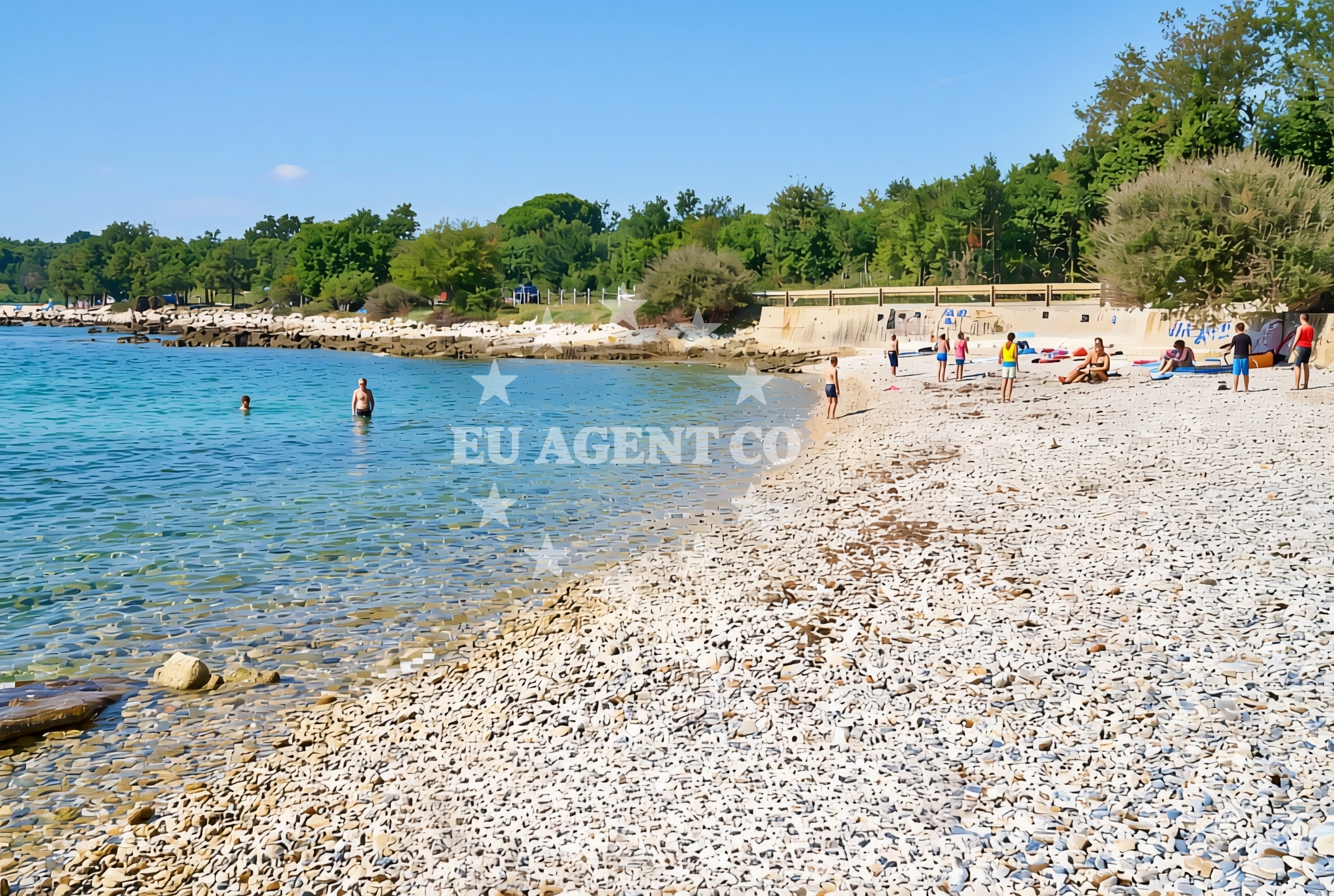
About this beach
Benuška, Poreč
Beach: Benuška
Location: Poreč
Characteristics and facilities
Gravel
140 m
Beach character
The beach’s defining feature is its gravel substrate, which extends along the shoreline in a relatively uniform pattern. This composition, while less common in the Istrian region, creates a firm surface that may appeal to visitors seeking a different tactile experience from sandy shores. The 140-meter length offers a modest but continuous expanse, though the absence of detailed natural features in the catalog suggests a relatively unadorned profile. The gravel may influence water clarity and temperature, though specific conditions are not documented in the beach’s authoritative records.Swimming and shore
Swimming conditions at Benuška Beach are not explicitly detailed in the catalog, but the gravel substrate may affect water access and comfort. Visitors should consider the beach’s unique surface when planning aquatic activities. The shoreline’s direct connection to the Adriatic Sea implies exposure to the broader regional currents, though specific wave patterns or depth measurements are not provided in the beach’s documentation.Facilities and activities
The beach does not list specific amenities or structured activities in its authoritative records. Visitors should assume minimal on-site facilities unless corroborated by local knowledge. The absence of detailed activity listings suggests a focus on passive enjoyment of the shoreline, though nearby Poreč offers cultural and historical attractions that may complement a visit.Access and location
Benuška Beach is located within Poreč, a town renowned for its Roman-era Euphrasius Basilica and well-preserved medieval architecture. The beach’s proximity to the town center likely facilitates easy access for pedestrians and cyclists. Poreč’s position on the northern coast of Istria places it within a sailing region characterized by sheltered bays, coastal towns, and maritime routes that connect to the wider Adriatic. The beach’s coordinates (45.253957° N, 13.595785° E) situate it near the convergence of the Adriatic Sea and the Istrian Peninsula’s rugged interior.What to expect
Visitors to Benuška Beach should anticipate a gravel shoreline that contrasts with the region’s more common sandy beaches. The 140-meter length provides a straightforward coastal experience, though the absence of detailed natural features in the catalog suggests a relatively unadorned profile. The beach’s location within Poreč, a town rich in Roman and medieval history, offers opportunities to explore cultural landmarks nearby. For those interested in maritime activities, the surrounding area’s sailing infrastructure and coastal routes may present additional options for exploration.Practical tips
The gravel surface may require sturdy footwear for walking along the shore. Visitors should consider the beach’s unique composition when planning activities, as it differs from the region’s typical sandy beaches. While no specific facilities are documented, the proximity to Poreč ensures access to town amenities and historical sites.Exploring the coast by yacht
For yacht charter guests, the Poreč area offers a gateway to the Adriatic’s diverse sailing routes. The region’s sheltered bays, coastal towns, and maritime heritage make it a popular destination for motor and sail yachts. Euro-Agent Yacht Charter provides access to vessels operating from nearby marinas, with options to explore the Istrian Peninsula’s coastline, including stops at Poreč and its surrounding anchorages. The beach’s location near the town may serve as a reference point for sailors navigating the area, though it is not explicitly marked as an anchorage or marina.Historical Context of Poreč
Poreč, home to Benuška Beach, is a town with over 2,000 years of history, marked by its Roman-era architecture and medieval fortifications. The town’s Euphrasius Basilica, a UNESCO World Heritage Site, reflects its ancient significance. This historical backdrop adds cultural depth to visits to the beach and the surrounding region.Anchorages in the surrounding area
Anchorages in Crvar, Poreč, and Novigrad Istarski are located near the Benuška, Poreč Beach.
- Anchorage — crvar — 0.2 NM from beach
- Anchorage — crvar — 0.9 NM from beach
- Anchorage — cervar porat — 1.4 NM from beach
- Anchorage — porec — 2.9 NM from beach
- Anchorage — porec — 3.2 NM from beach
- Anchorage — novigrad istarski — 3.4 NM from beach
- Anchorage — novigrad istarski — 3.6 NM from beach
- Anchorage — porec — 3.6 NM from beach
Distances are straight-line geographic distances, not sailing routes.
Mooring buoys in the surrounding area
Buoy fields in Poreč and Novigrad Istarski are situated close to the Benuška, Poreč Beach.
- Buoy field — porec — 1.7 NM from beach
- Buoy field — porec — 1.8 NM from beach
- Quay — cervar porat — 1.8 NM from beach
- Buoy field — novigrad istarski — 4.1 NM from beach
- Buoy field — novigrad istarski — 4.5 NM from beach
Distances are straight-line geographic distances, not sailing routes.
Marine fuel stations
- Fuel station — porec — 1.8 NM from beach
- Ina — porec — 1.8 NM from beach
- Crodux — novigrad istarski — 4.1 NM from beach
- Crodux — vrsar — 6.3 NM from beach
Distances are straight-line geographic distances, not sailing routes.
Harbours in the surrounding area
Harbours in Poreč, Novigrad Istarski, and other nearby locations are positioned near the Benuška, Poreč Beach.
- Harbour Poreč — harbour porec — 1.6 NM from beach
- Jedro — porec — 2.4 NM from beach
- Marina Servis Plava — porec — 2.8 NM from beach
- Mirna — novigrad istarski — 3.6 NM from beach
- Hotel Delphin — porec — 3.6 NM from beach
- Bijela Uvala — porec — 4.1 NM from beach
Distances are straight-line geographic distances, not sailing routes.
Marinas in the surrounding area
Marinas in Červar Porat, Poreč, and Novigrad Istarski are located in proximity to the Benuška, Poreč Beach.
- Marina Červar Porat — marina cervar porat — 1.3 NM from beach
- Marina Poreč — marina porec — 1.8 NM from beach
- Marina Parentium — porec — 3.0 NM from beach
- Marina Nautica — novigrad istarski — 4.2 NM from beach
- Marina Funtana — 4.6 NM from beach
Distances are straight-line geographic distances, not sailing routes.
Restaurants near the beach
Restaurants in Cervar Porat and Poreč are situated near the Benuška, Poreč Beach.
- Ribarica — cervar porat — 1.2 NM from beach
- Dino Ena — cervar porat — 1.2 NM from beach
- Tifany — cervar porat — 1.2 NM from beach
- Zalogajnica Ani — cervar porat — 1.2 NM from beach
- Ribarica 2 — cervar porat — 1.2 NM from beach
- Ćakula — cakula — porec — 1.6 NM from beach
- Peperoni — porec — 1.6 NM from beach
Distances are straight-line geographic distances, not sailing routes.
Navigation guides for the surrounding area
Navigation guides for Luka Crvar, Poree, and other nearby areas are relevant to the Benuška, Poreč Beach.
- Luka Crvar and Marina Crvar-Porat — 1.6 NM from beach
- Poree — 1.6 NM from beach
- Novi grad — 4.2 NM from beach
- Limski Kanai — 7.3 NM from beach
- Umag — 11.5 NM from beach
Distances are straight-line geographic distances, not sailing routes.
Yachts from nearby departure bases
Yachts departing from Marina Novigrad and Poreč Marina Funtana are based near the Benuška, Poreč Beach.
Sailing yachts
- Bavaria 35 Cruiser (Salsa) — Poreč Marina Funtana — 4.6 NM from departure base to beach
- Bavaria 46 Cruiser (Barbados) — Poreč Marina Funtana — 4.6 NM from departure base to beach
- Bavaria 49 (Claudia) — Poreč Marina Funtana — 4.6 NM from departure base to beach
- Bavaria 32 (Vroni) — Poreč Marina Funtana — 4.6 NM from departure base to beach
- Bavaria 40 (Conny) — Poreč Marina Funtana — 4.6 NM from departure base to beach
Catamarans
- Lagoon Power 44 (Monteki) — Poreč Marina Funtana — 4.6 NM from departure base to beach
Motor boats
- Prestige 46 Fly (Anima Maris) — Marina Novigrad — 4.2 NM from departure base to beach
- Maiora 20 (Sea Heaven) — Marina Novigrad — 4.2 NM from departure base to beach
- AC DC Daycruiser 12.0 — Marina Novigrad — 4.2 NM from departure base to beach
- Maiora 20 (Sea Heaven) — Marina Novigrad — 4.2 NM from departure base to beach
Distances are straight-line geographic distances, not sailing routes.