Barbat sredina, Zubovići (Pag) Beach, Croatia
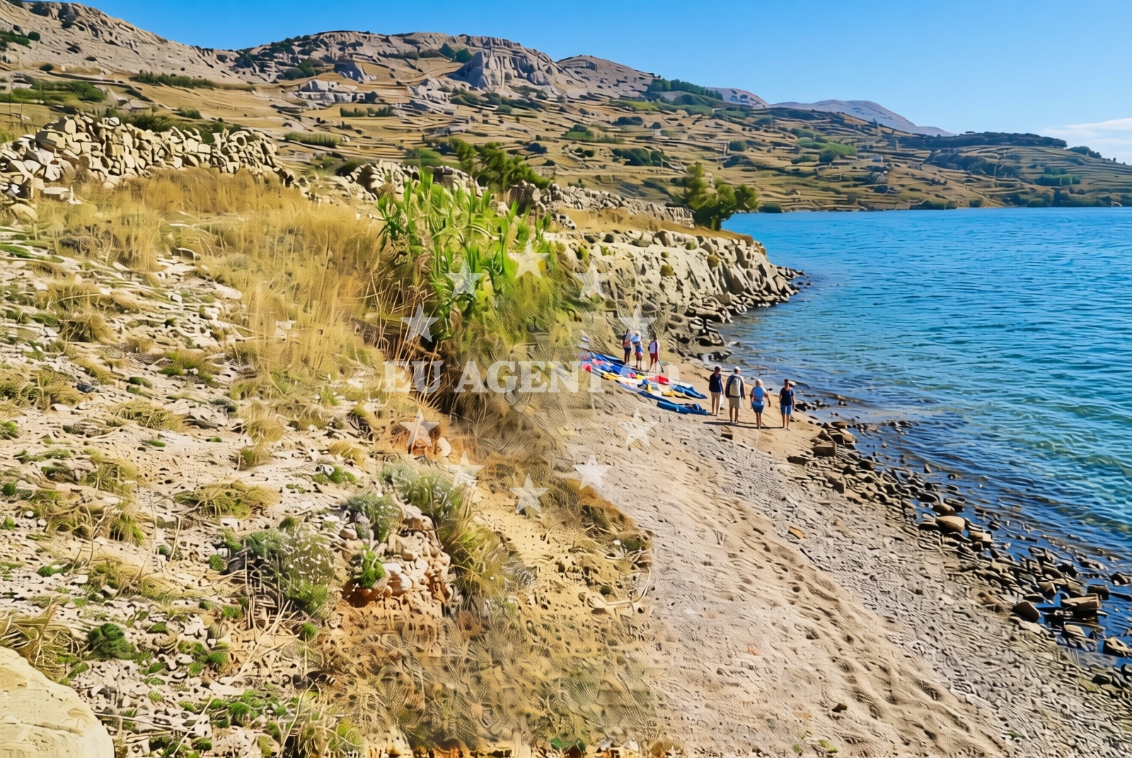
Barbat sredina, located in the village of Zubovići on the island of Pag, is a short, gravelly beach stretching approximately 50 meters along the Adriatic coast. Its rugged shoreline, composed primarily of gravel and rocks, defines its character as a more natural, less developed stretch of coastline. Situated on Pag—an island renowned for its pebble beaches, salt pans, and historic stone villages—this beach offers a glimpse into the island’s raw coastal landscape.
About this beach
Barbat sredina, Zubovići (Pag)
Beach: Barbat sredina
Location: Zubovići (Pag)
Characteristics and facilities
Gravel, rocks
50 m
Beach character
The beach’s surface is dominated by gravel and rocky outcrops, making it more suitable for walking or casual exploration than swimming. The lack of sand gives it a distinct texture compared to Pag’s more famous pebble beaches. The shoreline is relatively narrow, with limited space for sunbathing or relaxation. However, its simplicity and unspoiled nature make it a quiet spot for those seeking solitude away from busier coastal areas.
Swimming and shore
Due to its gravelly composition and limited depth, Barbat sredina is not ideal for swimming. The shore is more suited for leisurely strolls, with the rocky terrain offering opportunities to observe coastal flora and fauna. The beach’s proximity to the open sea means it is exposed to wave action, which may make it less comfortable for those seeking calm waters. Visitors should be mindful of the terrain when approaching the shore, as the gravel can be uneven underfoot.
Facilities and activities
No formal facilities are reported at Barbat sredina, including showers, toilets, or sunbeds. The beach’s minimal development aligns with its natural character. Activities are limited to walking along the shore or exploring the surrounding landscape. The nearby village of Zubovići offers basic amenities, though visitors to the beach may need to rely on services in larger towns like Novalja or the town of Pag for dining, shopping, or accommodations.
Access and location
Access to Barbat sredina is via local roads leading to the village of Zubovići on Pag. The beach is positioned along the island’s eastern coast, near the border with the mainland. Pag is accessible by ferry from Zadar or via road bridges connecting the island to the mainland. The beach’s location makes it a potential stop for visitors exploring Pag’s lesser-known coastal areas, though it is not a major tourist hub.
What to expect
Barbat sredina is a short, gravelly beach with a rugged shoreline, offering a stark contrast to Pag’s more well-known pebble beaches. Its 50-meter length and rocky terrain make it a quiet, undeveloped spot, ideal for those seeking a peaceful escape from busier coastal areas. The beach’s proximity to the open sea means it is exposed to wave action, which may limit its appeal for swimming. Visitors should expect minimal facilities and a natural, unspoiled environment. The surrounding area of Pag, however, offers opportunities to explore the island’s salt pans, historic stone villages, and scenic coastal drives.
Practical tips
Visitors should wear sturdy footwear to navigate the gravel and rocky terrain comfortably. Sun protection is recommended, as the beach lacks shaded areas. Since facilities are limited, bringing personal items such as water, snacks, and a towel is advisable. The beach’s remote nature means it is best suited for those prioritizing solitude over convenience.
Exploring the coast by yacht
For sailors and yacht charter guests, the broader Pag region offers a mix of sheltered bays and open coastal waters. The island’s eastern coast, where Barbat sredina is located, is part of a sailing area with moderate exposure to the Adriatic’s currents. Nearby marinas and anchorages, such as those in Novalja or the town of Pag, provide access points for exploring the island’s coastline. Yacht charter guests may find the surrounding waters appealing for short cruises, though Barbat sredina itself is not a designated anchorage.
Pag’s Coastal Landscape
The island of Pag is characterized by its unique combination of pebble beaches, salt pans, and rugged coastal cliffs. Barbat sredina reflects this natural diversity, with its gravelly shoreline contrasting with the island’s more famous pebble beaches. The area’s salt pans, a UNESCO-protected site, are a short drive from the beach and offer a glimpse into Pag’s historical and ecological significance.
Anchorages in the surrounding area
Anchorages in nearby areas such as Cesarica and Mandre on Pag provide options for mooring around Barbat sredina, Zubovići (Pag) Beach.
- Anchorage — cesarica — 2.9 NM from beach
- Anchorage — cesarica — 3.0 NM from beach
- Anchorage — cesarica — 3.2 NM from beach
- Anchorage — mandre — pag — 3.5 NM from beach
- Anchorage — mandre — pag — 3.5 NM from beach
- Anchorage — novalja — pag — 3.6 NM from beach
- Anchorage — mandre — pag — 3.9 NM from beach
- Anchorage — prizna — 4.9 NM from beach
Distances are straight-line geographic distances, not sailing routes.
Mooring buoys in the surrounding area
Mooring buoys in Zubovici and Simuni on Pag are located close to Barbat sredina, Zubovići (Pag) Beach.
- Jetty — zubovici — pag — 0.6 NM from beach
- Jetty — zubovici — pag — 0.8 NM from beach
- Jetty — simuni — pag — 3.6 NM from beach
- Buoy field — novalja — pag — 5.7 NM from beach
- Drljanda — stara novalja — pag — 7.3 NM from beach
Distances are straight-line geographic distances, not sailing routes.
Marine fuel stations
- Ina — rab — 17.5 NM from beach
- Ina — mali losinj — 22.7 NM from beach
- Adria Oil — mali losinj — 23.1 NM from beach
- Ina — zadar — 26.0 NM from beach
Distances are straight-line geographic distances, not sailing routes.
Harbours in the surrounding area
- Karlobag — 3.3 NM from beach
- Žigljen — zigljen — pag — 4.3 NM from beach
- Pag — 5.0 NM from beach
- Prizna — 5.2 NM from beach
- Novalja — pag — 5.5 NM from beach
- Stara Novalja — pag — 6.9 NM from beach
Distances are straight-line geographic distances, not sailing routes.
Marinas in the surrounding area
- ACI Marina Šimuni — simuni — pag — 3.3 NM from beach
- ACI Marina Rab — 17.4 NM from beach
- ACI Marina Supetarska Draga — rab — 20.6 NM from beach
- Y/C Marina Mali Lošinj — mali losinj — 22.9 NM from beach
- Marina Lošinj — mali losinj — 23.1 NM from beach
Distances are straight-line geographic distances, not sailing routes.
Restaurants near the beach
Restaurants in Simuni and Novalja on Pag are located near Barbat sredina, Zubovići (Pag) Beach.
- Maestral — simuni — pag — 3.2 NM from beach
- Bistro Šimuni — simuni — pag — 3.3 NM from beach
- Ribarska Koliba Šimuni — simuni — pag — 3.3 NM from beach
- Didova Kuča — simuni — pag — 3.3 NM from beach
- Pizzeria Villa Olea — simuni — pag — 3.4 NM from beach
- Margarita — novalja — pag — 4.9 NM from beach
- Restaurant — novalja — pag — 5.0 NM from beach
Distances are straight-line geographic distances, not sailing routes.
Navigation guides for the surrounding area
Navigation guides for Caska and Novalja provide context for routes near Barbat sredina, Zubovići (Pag) Beach.
- Caska — 3.4 NM from beach
- Novalja — 5.1 NM from beach
- Uvala Prizna — 5.1 NM from beach
- Uvala Bliznica — 6.7 NM from beach
- Uvala Zavratnica — 11.6 NM from beach
Distances are straight-line geographic distances, not sailing routes.
Yachts from nearby departure bases
Sailing yachts
- First 45 (Egeria) — Šimuni Kolan ACI Marina — 3.2 NM from departure base to beach
- Bavaria 46 Cruiser (DEA) — Mali Lošinj — 22.9 NM from departure base to beach
- Dufour 412 Grand large (Eva) — Mali Lošinj — 22.9 NM from departure base to beach
Motor yachts
- Absolute 50 Fly (Acrobat) — Rab ACI Marina — 17.4 NM from departure base to beach
Motor boats
- BWA Sport 22GT (BWA ) — Pag City Port — 5.1 NM from departure base to beach
- Balt 818 Titanium (Valentina) — Novalja — 5.4 NM from departure base to beach
- Balt 818 Titanium (Valentina 2) — Novalja — 5.4 NM from departure base to beach
- Merry Fisher 895 — Povljana Marina — 11.2 NM from departure base to beach
- Atlantic Sun Cruiser 730 — Mali Lošinj — 22.9 NM from departure base to beach
- Barracuda 530 RIB (Hvar) — Mali Lošinj — 22.9 NM from departure base to beach
Distances are straight-line geographic distances, not sailing routes.