Balun, Vrboska (Hvar) Beach, Croatia
About this beach
Balun, Vrboska (Hvar)
Beach: Balun
Location: Vrboska (Hvar)
Characteristics and facilities
Rocks
Beach character
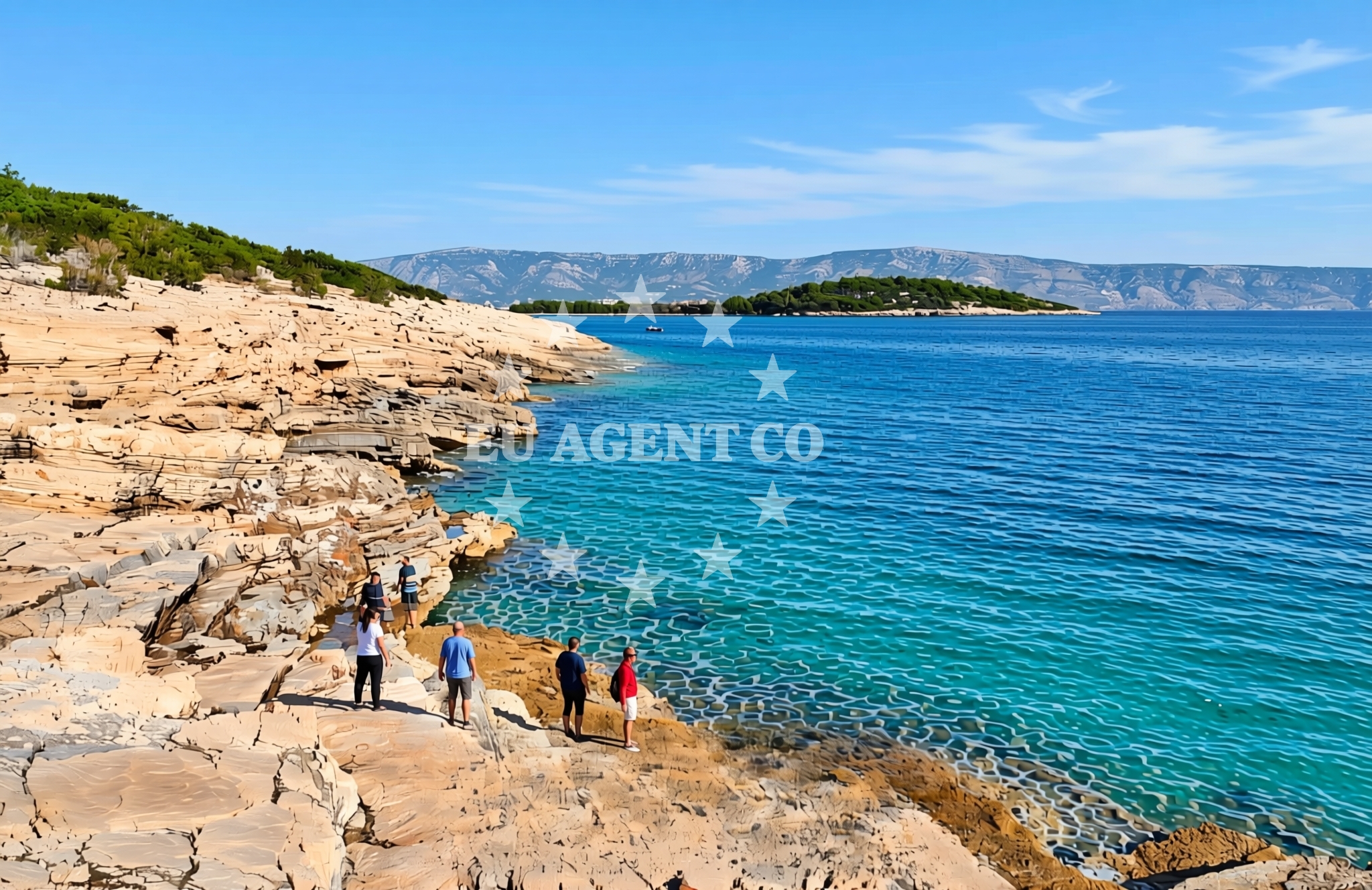
The beach is characterized by its rocky terrain, with uneven surfaces and natural formations that extend into the shallows. These features create a dynamic shoreline that changes with the tide, offering opportunities for exploration during low water levels. The absence of fine sand means this is not a traditional sunbathing destination, but the landscape provides a unique setting for those seeking a more rugged coastal experience.Swimming and shore
Swimming conditions here are influenced by the rocky seabed, with shallower areas near the shore and deeper water further out. The terrain makes it unsuitable for prolonged swimming but offers interesting tidal pools and crevices to explore during low tide. The shoreline's natural features create a habitat for marine life, making it a spot for casual observation of coastal ecosystems.Facilities and activities
There are no formal facilities or infrastructure at Balun Beach. The area remains largely undeveloped, preserving its natural character. Activities are limited to passive recreation such as walking along the shore or photographing the rocky formations. The beach's isolation from major roads or settlements means it is best accessed by local boat routes or short walks from nearby coastal paths.Access and location
Balun Beach is located in the village of Vrboska on the island of Hvar, part of the Split-Dalmatia County in Croatia. The nearest major settlement is Vrboska itself, which has limited accommodation and services. Access is primarily by foot from coastal trails or by boat from nearby harbors. The beach's position on the eastern side of Hvar places it within reach of other notable sites along the island's coast, including the historic town of Hvar and the Pakleni Islands.What to expect
Expect a natural, undeveloped shoreline with rocky formations and minimal infrastructure. The beach is best suited for visitors interested in exploring coastal geology or enjoying a quiet, secluded stretch of the Hvar coast. Its location near Vrboska means it can be combined with visits to the village's historic sites, including its 16th-century fortifications and traditional stone houses.Practical tips
Visitors should be mindful of the uneven terrain and potential for slippery surfaces near the water's edge. There are no designated parking areas or facilities, so bringing water and appropriate footwear is advisable. The beach is not marked on standard tourist maps, requiring local knowledge or navigation via coastal trails for access.Exploring the coast by yacht
For sailors and yacht charter guests, Balun Beach's proximity to Vrboska offers a convenient anchorage point within the Hvar sailing area. The nearby harbor of Vrboska provides mooring options for yachts exploring the southern Dalmatian coast. Charter boats may use this region as a base for excursions to Hvar Town, the Pakleni Islands, or the broader Adriatic coastline, with Balun serving as a natural waypoint along the island's eastern shore.Regional Context
Vrboska is one of the oldest settlements on Hvar Island, with a history dating back to the 13th century. The village is known for its well-preserved medieval architecture and its role as a strategic coastal outpost. Visitors to Balun Beach may combine their visit with a tour of Vrboska's historic sites, including the Church of St. Nicholas and the surrounding vineyards that contribute to the region's winemaking tradition.Anchorages in the surrounding area
Anchorages in Vrboska and Hvar offer nearby options for mooring close to Balun Beach.
- Anchorage — vrboska — hvar — 0.3 NM from beach
- Anchorage — hvar — 0.5 NM from beach
- Anchorage — vrboska — hvar — 1.1 NM from beach
- Uvala Basina — vrbanj — hvar — 1.9 NM from beach
- Anchorage — hvar — 2.6 NM from beach
- Anchorage — hvar — 2.6 NM from beach
- Anchorage — hvar — 2.7 NM from beach
- Anchorage — hvar — 2.8 NM from beach
Distances are straight-line geographic distances, not sailing routes.
Mooring buoys in the surrounding area
- Quay — hvar — 0.6 NM from beach
- Jetty — vrbanj — hvar — 1.9 NM from beach
- Jetty — vrbanj — hvar — 1.9 NM from beach
- Jetty — zavala — hvar — 3.5 NM from beach
- Buoy field — stari grad — hvar — 4.5 NM from beach
Distances are straight-line geographic distances, not sailing routes.
Marine fuel stations
Fuel stations in Vrboska and Hvar ensure refueling options for vessels near Balun Beach.
- Ina — vrboska — hvar — 1.0 NM from beach
- Fuel station — bol — brac — 5.1 NM from beach
- Fuel station — sumartin — brac — 9.6 NM from beach
- Fuel station — hvar — 11.1 NM from beach
Distances are straight-line geographic distances, not sailing routes.
Harbours in the surrounding area
- Vrboska — hvar — 1.0 NM from beach
- Port Jelsa — hvar — 1.1 NM from beach
- Stari Grad — hvar — 4.6 NM from beach
- Bol — brac — 5.1 NM from beach
- Marina Bilo Idro — sveta nedjelja — hvar — 5.6 NM from beach
- Sumartin — brac — 9.9 NM from beach
Distances are straight-line geographic distances, not sailing routes.
Marinas in the surrounding area
The ACI Marina Vrboska offers a nearby marina for vessels visiting Balun Beach.
- ACI Marina Vrboska — hvar — 0.9 NM from beach
- Marina Korkyra — vela luka — korcula — 13.3 NM from beach
- ACI Marina Palmižana — aci marina palmizana — st klement — 13.3 NM from beach
- ACI Marina Milna — milna brac — 13.9 NM from beach
- Marina Milna Kanarija — milna brac — 14.1 NM from beach
Distances are straight-line geographic distances, not sailing routes.
Restaurants near the beach
Restaurants in Vrboska and Jelsa serve meals for visitors to Balun Beach.
- Restoran Luka — vrboska — hvar — 0.9 NM from beach
- Bonaca — vrboska — hvar — 1.0 NM from beach
- Trica Gardelin — vrboska — hvar — 1.1 NM from beach
- Me and Mrs Jones — jelsa — hvar — 1.1 NM from beach
- Arsenal — jelsa — hvar — 1.1 NM from beach
- Konoba Lem — vrboska — hvar — 1.1 NM from beach
- Restaurant Pizzeria Skojic — vrboska — hvar — 1.1 NM from beach
Distances are straight-line geographic distances, not sailing routes.
Navigation guides for the surrounding area
Navigation guides for Otocic Zecevo, Jelsa, and Zavala assist in exploring the Balun Beach vicinity.
- Otocic Zecevo — 0.5 NM from beach
- Vrboska — 0.6 NM from beach
- Jelsa — 1.1 NM from beach
- Uvala Basina — 1.6 NM from beach
- Zavala (Pitavska Plaza) — 3.6 NM from beach
Distances are straight-line geographic distances, not sailing routes.
Yachts from nearby departure bases
Yachts departing from Milna and Baška Voda provide access to Balun Beach from nearby bases.
Sailing yachts
- Hanse 455 (AURUM 1) — Milna Marina Vlaška — 14.3 NM from departure base to beach
- Hanse 388 (BANJO) — Milna Marina Vlaška — 14.3 NM from departure base to beach
- Hanse 505 (AVALON) — Milna Marina Vlaška — 14.3 NM from departure base to beach
- Bavaria 46 Cruiser (MO) — Milna Marina Vlaška — 14.3 NM from departure base to beach
- Elan Impression 40 (KARLETA) — Baška Voda Port — 15.2 NM from departure base to beach
- Oceanis 43 (BLACK SHEEP) — Baška Voda — 15.3 NM from departure base to beach
- Elan 50 Impression (FINES DE CLAIRES) — Baška Voda — 15.3 NM from departure base to beach
Catamarans
- Lagoon 450 (LAMANTIN) — Baška Voda — 15.3 NM from departure base to beach
Motor yachts
- Canados 86 (Karisma) — Baška Voda — 15.3 NM from departure base to beach
Motor boats
- Pearl Sea 31 Hard Top (Aero) — Baška Voda Port — 15.2 NM from departure base to beach
Distances are straight-line geographic distances, not sailing routes.