Bajnice sredina, Jesenice Beach, Croatia
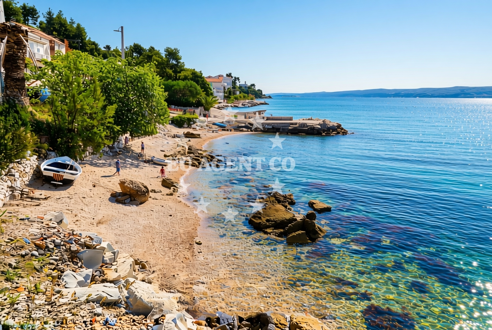
Bajnice sredina, Jesenice Beach lies along the Adriatic coast in Croatia, offering a rugged shoreline of gravel and rock. Stretching approximately 50 meters, the beach is defined by its natural terrain and sparse vegetation, creating a stark contrast to the more developed coastal areas of the region. While lacking formal amenities, the site provides limited natural shade, making it a unique spot for visitors seeking a raw coastal experience.
About this beach
Bajnice sredina, Jesenice
Beach: Bajnice sredina
Location: Jesenice
Characteristics and facilities
Gravel, rocks
50 m
Natural shade
Beach character
The beach's composition of gravel and rock dominates its profile, with no sandy sections reported. This makes it more suitable for foot traffic than swimming, though the shallow waters may appeal to those comfortable with rocky shorelines. Natural shade is available in scattered patches, likely from low-lying vegetation or rock formations. The beach's short length and lack of infrastructure suggest it is not a primary tourist destination but may serve as a local access point or stopover for those exploring the Jesenice area.
Swimming and shore
Swimming conditions at Bajnice sredina are uncertain due to the absence of detailed water quality reports. The gravel and rock composition may create uneven entry points into the sea, requiring caution. The shore itself is unmarked for recreational activities, and no lifeguard services or safety equipment are noted in the catalog. Visitors should be prepared for a rugged shoreline experience rather than a conventional beach day.
Facilities and activities
No formal facilities are listed for Bajnice sredina, Jesenice Beach. The absence of amenities such as restrooms, showers, or parking suggests it is not designed for large groups or extended stays. Recreational activities are not explicitly documented, though the natural terrain may support walking or photography. The beach's primary value appears to be its role as a geographical reference point rather than an active tourist destination.
Access and location
Located in the Jesenice area, the beach is accessible via local roads connecting to the broader Adriatic coastline. Its proximity to the village of Jesenice may provide limited local services, though no specific transport links are detailed in the catalog. The coordinates (43.464298, 16.588553) place it within a region known for its rugged coastlines and historic settlements, suggesting it may be part of a larger network of lesser-known coastal sites.
What to expect
Visitors to Bajnice sredina, Jesenice Beach should anticipate a rugged, undeveloped shoreline characterized by gravel and rock. The beach's short length and lack of amenities make it unsuitable for large groups or extended stays. Natural shade is available in limited areas, and the absence of formal facilities means visitors must bring their own supplies. The site appears to function more as a geographical marker than a recreational destination, with potential value for those exploring the Jesenice region's coastal geography.
Practical tips
Wear sturdy footwear to navigate the gravel and rock terrain. Bring sun protection despite the limited natural shade. Check local regulations for any restrictions on coastal access, as the beach's undeveloped nature may subject it to seasonal or legal limitations.
Exploring the coast by yacht
For yacht charter guests, Bajnice sredina's location along the Adriatic coast places it within sailing routes connecting the Dalmatian coast to the Istrian Peninsula. Nearby marinas in the Jesenice area may serve as bases for exploring the region's rocky shorelines and historic settlements. While the beach itself is not a docking point, its coordinates align with areas popular for anchoring and day trips to nearby coastal villages.
Regional Context
The Jesenice area is part of the broader Dubrovnik-Neretva region, known for its medieval architecture and coastal trails. Nearby settlements may offer cultural attractions or hiking opportunities, though specific details require local verification. The beach's proximity to the Adriatic Sea highlights the region's mix of rugged coastlines and historic sites.
Anchorages in the surrounding area
- Anchorage — splitska — brac — 5.2 NM from beach
- Anchorage — supetar — brac — 5.3 NM from beach
- Anchorage — postira — brac — 5.4 NM from beach
- Anchorage — postira — brac — 6.5 NM from beach
- Konopjikova — postira — brac — 7.1 NM from beach
- Anchorage — split — 7.2 NM from beach
- Uvala Likva — sutivan — brac — 7.2 NM from beach
- Stipanska — brac — 8.3 NM from beach
Distances are straight-line geographic distances, not sailing routes.
Mooring buoys in the surrounding area
- Jetty — podstrana — 1.1 NM from beach
- Quay — postira — brac — 7.2 NM from beach
- Promenade — split — 7.3 NM from beach
- Nautical Anchorage Bobovišća — bobovisce — brac — 8.7 NM from beach
- Nautical Anchorage Bobovišća — bobovisce — brac — 8.8 NM from beach
Distances are straight-line geographic distances, not sailing routes.
Marine fuel stations
Marine fuel stations can be found in Split and Kastel Gomilica, with additional options in Milna on Brac.
- Ina — split — 7.3 NM from beach
- Ina — split — 7.6 NM from beach
- Flash — kastel gomilica — 9.3 NM from beach
- Ina — milna brac — 10.4 NM from beach
Distances are straight-line geographic distances, not sailing routes.
Harbours in the surrounding area
Harbours in the surrounding area include Krilo in Jesenice, Dugi Rat, and Stobreč, with options extending to Omis.
- Krilo — jesenice — 0.5 NM from beach
- Sumpetar — dugi rat — 1.8 NM from beach
- Dugi Rat — 2.6 NM from beach
- Clubharbour Podstrana — 3.2 NM from beach
- Stobreč — stobrec — 3.5 NM from beach
- Omiš — omis — 4.8 NM from beach
Distances are straight-line geographic distances, not sailing routes.
Marinas in the surrounding area
Marinas in the surrounding area are located in Podstrana, Split, and Kastel Gomilica, with additional options on Brac.
- Marina Lav — podstrana — 2.8 NM from beach
- ACI Marina Split — 7.2 NM from beach
- Marina Kaštela — marina kastela — kastel gomilica — 9.5 NM from beach
- ACI Marina Milna — milna brac — 10.3 NM from beach
- Marina Vlaška — milna brac — 10.4 NM from beach
Distances are straight-line geographic distances, not sailing routes.
Restaurants near the beach
Restaurants near the beach include options in Podstrana, Supetar on Brac, and Omis.
- Leonis — podstrana — 2.8 NM from beach
- Skampino — podstrana — 2.8 NM from beach
- Fabio — podstrana — 2.9 NM from beach
- Konoba Milo — omis — 4.7 NM from beach
- Mala Kate — supetar — brac — 5.0 NM from beach
Distances are straight-line geographic distances, not sailing routes.
Navigation guides for the surrounding area
Navigation guides for the surrounding area cover points such as Dugi Rat, Omis, and Postira.
- Kairos — 2.7 NM from beach
- Dugi Rat (Uvala Orisac) — 2.7 NM from beach
- Omis — 5.1 NM from beach
- Uvala Spliska (Splitska) — 5.3 NM from beach
- Postire — 5.6 NM from beach
Distances are straight-line geographic distances, not sailing routes.
Yachts from nearby departure bases
Yachts from nearby departure bases include options based in Dugi Rat, Sumpetar, and Podstrana Marina Lav.
Sailing yachts
- Jeanneau 53 (Win Win) — Podstrana Marina Lav — 2.8 NM from departure base to beach
Catamarans
- Lagoon 450 Fly (Falco) — Sumpetar Port — 1.8 NM from departure base to beach
Motor yachts
- Motoryacht (Adriatic Escape) — Podstrana Marina Lav — 2.8 NM from departure base to beach
- Ferretti 500 (Anna) — Podstrana Marina Lav — 2.8 NM from departure base to beach
- Princess 62 (Sassy) — Podstrana Marina Lav — 2.8 NM from departure base to beach
Gulets / Cruisers
- Gulet cruiser (AGORA) — Dugi Rat Luka Krilo — 0.5 NM from departure base to beach
- Gulet (Altair) — Sumpetar Port — 1.8 NM from departure base to beach
- Gulet (Cataleya) — Sumpetar Port — 1.8 NM from departure base to beach
Motor boats
- Bavaria Virtess 420 Fly (Zanngi) — Podstrana Marina Lav — 2.8 NM from departure base to beach
- Scanner 710 (Nerezine) — Podstrana Marina Lav — 2.8 NM from departure base to beach
Distances are straight-line geographic distances, not sailing routes.