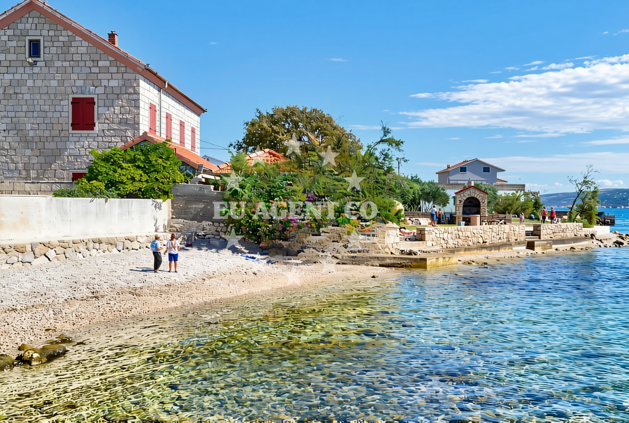
Argyruntum, Starigrad Beach, Croatia
About this beach
Argyruntum, Starigrad
Beach: Argyruntum
Location: Starigrad
Characteristics and facilities
Gravel, concrete / stone slabs
15 m
Restaurant / snack bar
Caffe bar / Drinks stand
Children's playground
Beach character
The shoreline of Argyruntum, Starigrad Beach is defined by its gravel and concrete/stone slabs, which may indicate a mix of natural and constructed elements. The 15-meter section of the beach appears to be the primary accessible area, though the exact orientation (east-west or north-south) is not specified. The presence of a children's playground suggests the beach is designed to accommodate family visitors, though no details are available about shade coverage, seating, or changing facilities.Swimming and shore
Official records do not specify swimming conditions or water depth at this beach. The gravel and stone slab composition of the shoreline may affect water access, though no explicit warnings about currents or wave activity are documented. The beach's primary function appears to be recreational rather than aquatic, given the absence of structured swimming facilities in the catalog data.Facilities and activities
The beach includes a restaurant/snack bar and a cafe bar/drinks stand, indicating basic food and beverage services for visitors. A children's playground is present, though no details about its size, safety features, or maintenance schedule are available. No structured activities beyond general beach use are listed in the catalog, and there is no mention of rental equipment, sports facilities, or organized events.Access and location
Situated in Starigrad, Argyruntum, the beach is positioned along Croatia's Adriatic coast. Coordinates (44.29335°N, 15.43878°E) place it in a region known for its maritime heritage and coastal tourism. While no specific road access details are provided, the presence of a 15-meter shoreline section suggests the beach is accessible via local pathways. The area's proximity to other coastal settlements in the region may offer additional exploration opportunities for visitors.What to expect
Visitors should anticipate a beach with a gravel and stone slab shoreline, featuring a 15-meter accessible section. The site includes a restaurant/snack bar, a cafe bar/drinks stand, and a children's playground. No specific details about water conditions, crowd levels, or seasonal variations are available in official records. The beach appears to serve as a local recreational area with basic amenities rather than a major tourist destination.Practical tips
Given the absence of detailed facility information, visitors may wish to confirm operating hours for the restaurant/snack bar and cafe bar/drinks stand. The beach's gravel and stone slab composition may affect comfort during hot weather, so shaded seating or sun protection measures could be advisable.Exploring the coast by yacht
As part of Croatia's Adriatic coastline, the area around Argyruntum is within reach of several sailing routes popular with Euro-Agent charter clients. While the beach itself is not marked as an anchorage or marina in official records, the broader region offers access to coastal towns, bays, and sailing areas that may be of interest to yacht charter guests exploring the eastern Adriatic.Regional Context
The Starigrad area is part of the larger Argyruntum region, which has historically been a hub for maritime activity. While no specific marinas or anchorages are detailed for this exact location, the surrounding coast includes settlements that serve as bases for yachting excursions. Visitors with boats may find nearby harbors or fuel stations through Euro-Agent's POI maps, though specific distances are not documented for this beach.Anchorages in the surrounding area
Anchorages in the surrounding area include Vinjerac, Rtina, and Ljubac, offering nearby mooring options to Argyruntum, Starigrad Beach.
- Anchorage — vinjerac — 2.4 NM from beach
- Anchorage — rtina — 6.1 NM from beach
- Anchorage — rtina — 6.2 NM from beach
- Anchorage — ljubac — 6.5 NM from beach
- Anchorage — ljubac — 6.6 NM from beach
- Anchorage — tribanj — 7.6 NM from beach
- Anchorage — maslenica — 7.7 NM from beach
- Anchorage — novigrad — 9.6 NM from beach
Distances are straight-line geographic distances, not sailing routes.
Mooring buoys in the surrounding area
- Šibuljina Point — sibuljina point — 5.0 NM from beach
- Jetty — ljubac — 6.6 NM from beach
- Jetty — zadar — 13.7 NM from beach
- Jetty — zadar — 13.8 NM from beach
- Punta Skala — petrcane — 14.0 NM from beach
Distances are straight-line geographic distances, not sailing routes.
Marine fuel stations
No marine fuel stations are listed within the immediate vicinity of Argyruntum, Starigrad Beach.
- Ina — zadar — 13.9 NM from beach
- Fuel station — sukosan — 15.7 NM from beach
- Ina — preko — ugljan — 16.7 NM from beach
- Ina — biograd na moru — 21.3 NM from beach
Distances are straight-line geographic distances, not sailing routes.
Harbours in the surrounding area
Harbours in the surrounding area include Starigrad Paklenica, located just 0.07 nautical miles from Argyruntum, Starigrad Beach.
- Starigrad Paklenica — 0.1 NM from beach
- Seline — 1.8 NM from beach
- Vinjerac — 2.4 NM from beach
- Ražanac — razanac — 4.0 NM from beach
- Maslenica — 6.2 NM from beach
- Miškovići — miskovici — pag — 9.4 NM from beach
Distances are straight-line geographic distances, not sailing routes.
Marinas in the surrounding area
- Vitrenjak Zadar — 13.8 NM from beach
- Marina Zadar — 13.8 NM from beach
- Marina Borik — zadar — 13.9 NM from beach
- Marina Dalmacija — sukosan — 15.6 NM from beach
- Olive Island Marina — sutomiscica — ugljan — 16.5 NM from beach
Distances are straight-line geographic distances, not sailing routes.
Restaurants near the beach
Restaurants near the beach include the Buffet Paklenica and Restaurant Starigrad Paklenica, offering dining options close to Argyruntum, Starigrad Beach.
- Restaurant — starigrad paklenica — 0.6 NM from beach
- Buffet Paklenica — starigrad paklenica — 0.7 NM from beach
- Restaurant — seline — 2.0 NM from beach
- Gostionica Ivan — seline — 2.2 NM from beach
Distances are straight-line geographic distances, not sailing routes.
Navigation guides for the surrounding area
Navigation guides for the surrounding area include Starigrad-Paklenica and Posedarje, providing route information relevant to Argyruntum, Starigrad Beach.
- Starigrad-Paklenica {Velebitski Kanai) — 0.2 NM from beach
- VELESITSKI KANAL (S) — 3.6 NM from beach
- Posedarje (Novigradsko More) — 5.4 NM from beach
- KrusCica and Uvala KrusCica Duboka — 6.0 NM from beach
- Privlaka — 13.7 NM from beach
Distances are straight-line geographic distances, not sailing routes.
Yachts from nearby departure bases
Sailing yachts
- Bavaria C46 (Eileen) — Zadar Marina — 13.8 NM from departure base to beach
- Elan 40 Impression (ALGIZ) — Zadar Marina — 13.8 NM from departure base to beach
Catamarans
- Delta F40-XT (Veronchie) — Zadar Marina — 13.8 NM from departure base to beach
- Bali 4.6 (Jako 2) — Zadar Marina — 13.8 NM from departure base to beach
Motor boats
- Merry Fisher 795 () — Novigrad Dalmatia — 8.2 NM from departure base to beach
- Rancraft RS Cinque.5 — Zadar Diklo Port — 13.2 NM from departure base to beach
- Rancraft RM21 (Dugi otok) — Zadar Diklo Port — 13.2 NM from departure base to beach
- Rancraft RM19 (Daycruiser) — Zadar Diklo Port — 13.2 NM from departure base to beach
- Tempest 650 (CAPELLI) — Zadar Marina — 13.8 NM from departure base to beach
- Balt 918 Titanium (Wanderer) — Zadar Marina — 13.8 NM from departure base to beach
Distances are straight-line geographic distances, not sailing routes.