Rat, Sreser Beach, Croatia
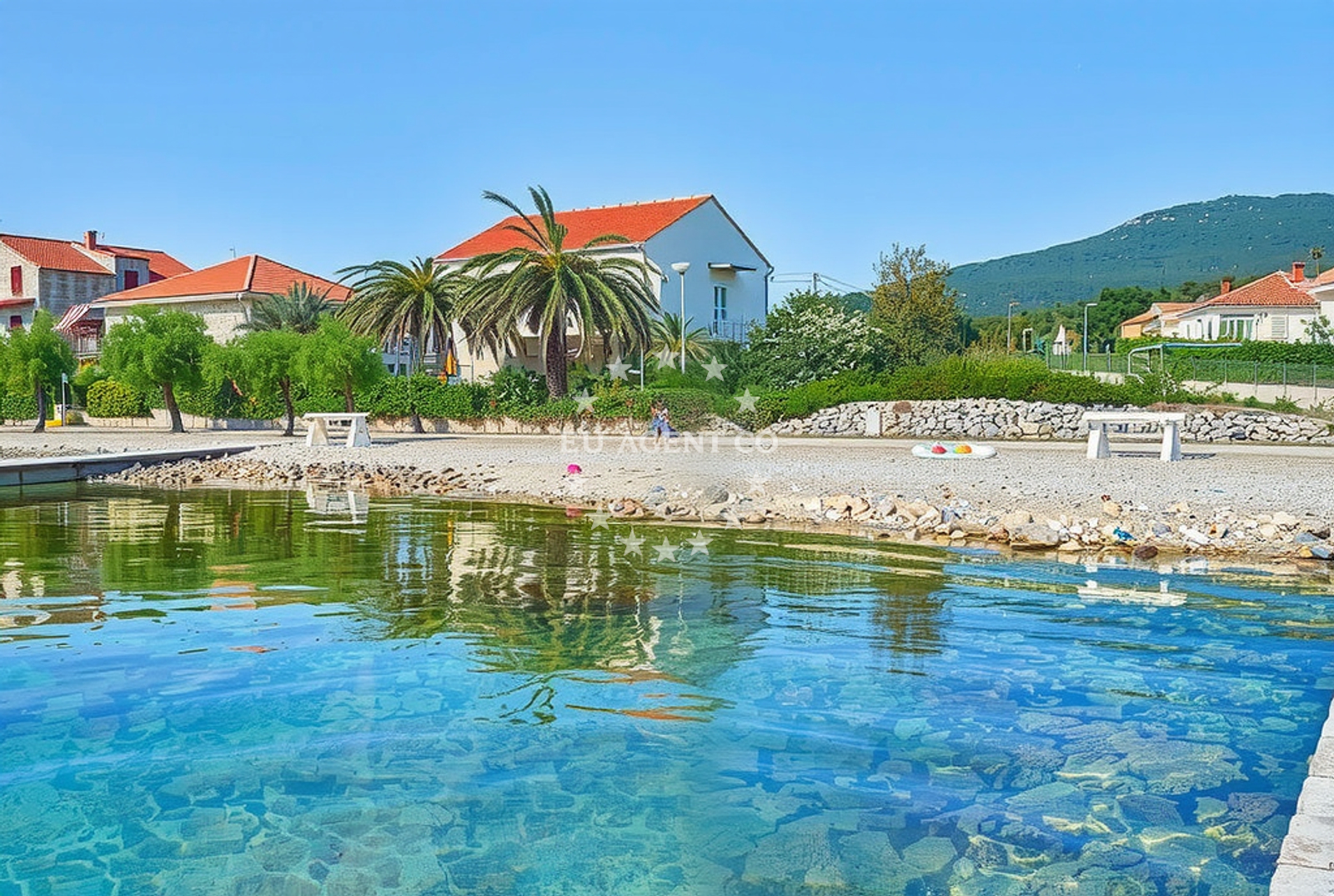
About this beach
Rat, Sreser
Beach: Rat
Location: Sreser
Characteristics and facilities
Pebbles, gravel, concrete / stone slabs
100 m
Beach character
The beach's surface is defined by a mix of pebbles and gravel, with sections of concrete and stone slabs creating a unique walking experience. The 100-meter length offers limited space for sunbathing or relaxation, but the exposed position provides panoramic views of the open sea. The absence of sand creates a distinct tactile experience, ideal for visitors seeking a more authentic coastal encounter. The beach's orientation and elevation offer clear sightlines to passing boats, making it a natural vantage point for maritime observation.Swimming and shore
The shallow waters near the shore are suitable for cautious swimming, though the pebbly seabed may make wading uncomfortable for some. The beach's position on the Rat coastline means it is exposed to open-sea conditions, with waves that can intensify during stronger winds. The rocky terrain extends into the water, creating natural pools and tidal variations that shape the shoreline. While not ideal for children's play, the area attracts visitors interested in coastal geology and the interplay between land and sea.Facilities and activities
No formal facilities are present at Sreser Beach, reflecting its status as a relatively undeveloped coastline. There are no marked parking areas, restrooms, or changing rooms. The beach's character is defined by its natural state, with no commercial concessions or seasonal infrastructure. Activities are limited to passive enjoyment of the landscape, though the exposed position makes it a popular spot for photography and coastal walks. The nearby settlement of Rat offers basic services for visitors seeking additional amenities.Access and location
Sreser Beach is situated in the village of Rat, a coastal settlement on the eastern Adriatic. The beach is accessible via local roads that wind through the rocky coastline, with the exact route dependent on the visitor's starting point. The coordinates (42.9503° N, 17.4426° E) place it within a region known for its rugged terrain and maritime traditions. The beach's proximity to the open sea means it is best reached by car during daylight hours, with limited infrastructure for alternative access.What to expect
Visitors should expect a beach defined by its natural composition rather than modern comforts. The pebbly shore and exposed position create an environment suited to those seeking solitude and a connection to the raw coastline. The 100-meter length offers limited space for group activities, but the beach's vantage point provides uninterrupted views of the Adriatic. The lack of facilities means visitors should bring their own supplies, with the nearby village of Rat serving as the primary source for food, water, and shelter.Practical tips
Wear sturdy footwear to navigate the pebbly shore comfortably. Sun protection is essential due to the lack of shade. The beach's exposure to the open sea means conditions can change rapidly; check local weather forecasts before visiting. The nearby village of Rat offers basic amenities for those requiring additional support.Exploring the coast by yacht
For yacht charter guests exploring the eastern Adriatic, Sreser Beach provides a rare glimpse of Croatia's less-visited coastal landscapes. Its position on the Rat coastline places it within reach of popular sailing routes between the Pelješac Peninsula and the islands of Vis and Hvar. While not a formal anchorage, the beach's visibility from the water makes it a potential waypoint for sailors navigating the region. For detailed yacht availability and sailing area information, visit the Euro-Agent Yacht Search page.Regional Context
Rat is part of the Dubrovnik-Neretva County, an area characterized by its medieval history and rugged coastline. The village's economy has traditionally relied on fishing and small-scale agriculture, with tourism playing a growing role. The surrounding waters are part of a broader nautical corridor connecting the Adriatic's major ports to the islands of the southern Dalmatian coast.Anchorages in the surrounding area
Anchorages in Trstenik, Duba, and Zuljana lie within 3.5 nautical miles of Rat, Sreser Beach.
- Anchorage — trstenik — 2.6 NM from beach
- Anchorage — trstenik — 2.7 NM from beach
- Anchorage — duba — 2.7 NM from beach
- Anchorage — trstenik — 2.8 NM from beach
- Anchorage — crikvice — 3.3 NM from beach
- Anchorage — blace — 3.4 NM from beach
- Anchorage — zuljana — 3.5 NM from beach
- Anchorage — zuljana — 3.9 NM from beach
Distances are straight-line geographic distances, not sailing routes.
Mooring buoys in the surrounding area
- Jetty — blace — 3.5 NM from beach
- Brijesta — 4.7 NM from beach
- Buoy — mljet — 10.0 NM from beach
- Restaurant Dalmatinac quay — mljet — 10.0 NM from beach
- Konoba Joseph dock — polace — mljet — 10.1 NM from beach
Distances are straight-line geographic distances, not sailing routes.
Marine fuel stations
Fuel stations in Ploce, Korcula, and Sobra provide refueling options up to 15 nautical miles from Rat, Sreser Beach.
- Fuel station — ploce — 6.1 NM from beach
- Fuel station — korcula — 12.9 NM from beach
- Fuel station — sobra — mljet — 15.0 NM from beach
- Ina — makarska — 27.9 NM from beach
Distances are straight-line geographic distances, not sailing routes.
Harbours in the surrounding area
Harbors in Sresar, Trstenik, and Ploce are situated within 6.7 nautical miles of the beach.
- Sresar — rat — 0.2 NM from beach
- Drače — drace — 1.3 NM from beach
- Trstenik — 2.8 NM from beach
- Žuljana — zuljana — 3.6 NM from beach
- Ploče — ploce — 6.2 NM from beach
- Opuzen — 6.8 NM from beach
Distances are straight-line geographic distances, not sailing routes.
Marinas in the surrounding area
Marinas in Korcula, Slano, and Tučepi are located between 12 and 29 nautical miles from Rat, Sreser Beach.
- Marina Lumbarda — korcula — 12.0 NM from beach
- ACI Marina Korčula — korcula — 13.5 NM from beach
- ACI Marina Slano — 22.1 NM from beach
- Marina Tučepi — marina tucepi — 25.3 NM from beach
- Marina Solitudo — lastovo — 29.5 NM from beach
Distances are straight-line geographic distances, not sailing routes.
Restaurants near the beach
Restaurants in Zuljana, such as Bistro Ankora and Konoba Riva, are within 3.6 nautical miles of the beach.
- Bistro Ankora — zuljana — 3.6 NM from beach
- Konoba Riva — zuljana — 3.6 NM from beach
Distances are straight-line geographic distances, not sailing routes.
Navigation guides for the surrounding area
- Trstenik — 2.7 NM from beach
- Bl ace — 3.5 NM from beach
- Uvala Kljemtine — 5.2 NM from beach
- Uvala Klek — 5.4 NM from beach
- Uvala Lopata — 5.9 NM from beach
Distances are straight-line geographic distances, not sailing routes.
Yachts from nearby departure bases
Sailing yachts
- Elan 40 Impression (Karleta) — Ploče City Port — 6.1 NM from departure base to beach
- Sun Odyssey 349 (Visnjica) — Ploče City Port — 6.1 NM from departure base to beach
- More 55 (MRS. ROBINSON) — Ploče City Port — 6.1 NM from departure base to beach
- Salona 44 (SAMOA) — Ploče City Port — 6.1 NM from departure base to beach
- Sun Odyssey 419 (Luka Ploce) — Ploče City Port — 6.1 NM from departure base to beach
- Elan 514 Impression (Cesarica III) — Ploče City Port — 6.1 NM from departure base to beach
- Sun Odyssey 349 (Porto Tolero) — Ploče City Port — 6.1 NM from departure base to beach
- Oceanis 45 (Mambo 1) — Slano ACI Marina — 22.1 NM from departure base to beach
Catamarans
- Lagoon 450 Fly (Alba Mouse) — Ploče City Port — 6.1 NM from departure base to beach
- MY 44 (Fusion) — Slano ACI Marina — 22.1 NM from departure base to beach
Distances are straight-line geographic distances, not sailing routes.