Rasohatica istok, Žrnovo (Korčula) Beach, Croatia
About this beach
Rasohatica istok, Žrnovo (Korčula)
Beach: Rasohatica istok
Location: Žrnovo (Korčula)
Characteristics and facilities
Gravel, concrete / stone slabs
Beach character
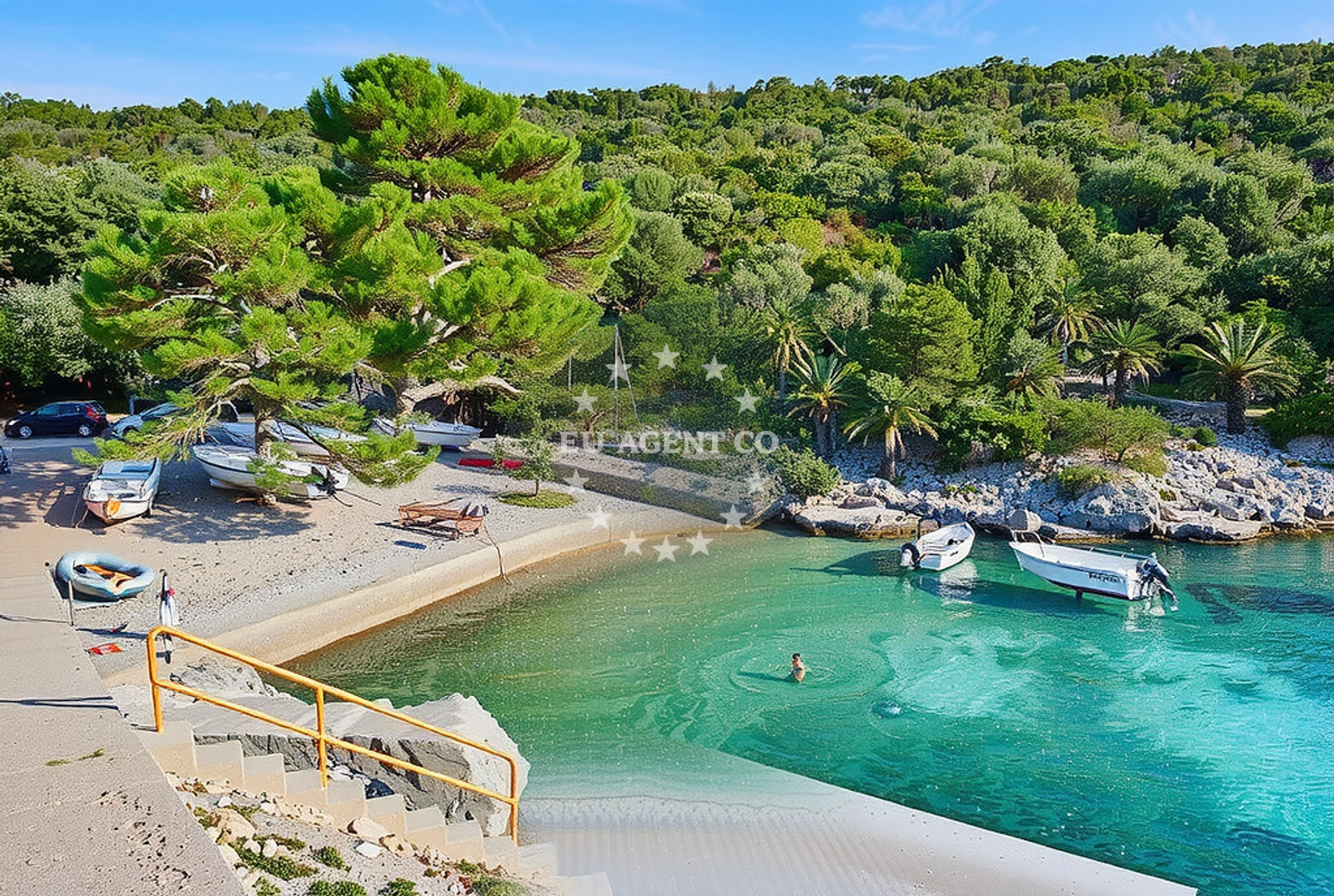
The beach consists of gravel and concrete/stone slabs, which define its texture and usability. This type of shoreline is less common on Korčula’s coast, where most beaches feature sand or pebbles. The lack of natural sand or fine gravel may make it less ideal for sunbathing or swimming compared to other nearby shores. However, its rocky and concrete composition could offer a unique vantage point for observing coastal erosion patterns or the interplay between land and sea in this part of the Adriatic.Swimming and shore
Swimming conditions at Rasohatica istok are not explicitly documented in the beach’s profile. The gravel and stone slabs may create uneven footing along the shore, which could pose challenges for swimmers entering or exiting the water. The surrounding waters of Korčula are generally known for their clarity and moderate currents, but specific details about water temperature, depth, or safety at this location are not available. Visitors should exercise caution, as the beach’s surface may not provide stable access to the sea.Facilities and activities
No facilities or structured activities are listed for Rasohatica istok. The beach does not appear to have amenities such as showers, restrooms, parking, or lifeguard services. Its primary feature is its geological composition, which may appeal to those interested in coastal geology or photography of rocky shorelines. Nearby, Žrnovo and Korčula Town offer cultural and culinary experiences, but specific details about direct access to these services from the beach are not provided in the catalog.Access and location
Rasohatica istok is situated in Žrnovo, a village on the island of Korčula, part of the Split-Dalmatia County in Croatia. The beach lies on the island’s eastern coast, near the Strait of Korčula, which connects the island to the mainland and separates it from the nearby island of Mljet. Access to the beach likely involves local roads within Žrnovo, though specific details about parking or pathways are not included in the beach’s profile. Korčula itself is a destination for yacht charter guests, with marinas in Korčula Town and nearby villages serving as bases for exploring the Adriatic.What to expect
Visitors to Rasohatica istok should expect a shoreline composed of gravel and concrete/stone slabs, which may not be suitable for those seeking traditional sandy beaches. The beach’s character is distinct from the island’s more common pebble or sand shores, offering a different perspective on Korčula’s coastal landscape. While no facilities are explicitly listed, the beach’s location in Žrnovo places it near cultural and historical sites on the island, including Korčula Town’s medieval fortifications and the Žrnovo Monastery. The surrounding waters are part of a sailing region with opportunities to explore nearby islands and the broader Adriatic.Practical tips
Given the beach’s gravel and stone composition, visitors may want to wear sturdy footwear for walking along the shore. The lack of detailed access information means planning for parking or local road conditions is advisable. For those interested in yacht charter, the proximity to Korčula’s marinas and the island’s position in the Adriatic make it a potential starting point for sailing excursions to nearby islands such as Mljet or the Pelješac Peninsula.Exploring the coast by yacht
For yacht charter guests, the area around Rasohatica istok is part of a sailing region with well-established routes along the Dalmatian coast. Korčula’s marinas, including those in Korčula Town, provide bases for exploring the Adriatic, with opportunities to anchor near other beaches, historic sites, and natural attractions. The strait near the island offers scenic passages and connections to the mainland, though specific anchorage details for this exact location are not included in the catalog. Yacht charter companies operating in the region can provide further guidance on navigating these waters.Historical Context of Žrnovo and Korčula
Žrnovo, the village hosting Rasohatica istok, is historically significant as the birthplace of the renowned 15th-century painter Giorgione. The village’s name is linked to the Žrnovo Monastery, a 12th-century Benedictine site that reflects the region’s medieval heritage. Korčula itself is famed for its medieval town, a UNESCO World Heritage Site, and its role in the Venetian Republic. These cultural elements add depth to the island’s appeal beyond its natural landscapes.Anchorages in the surrounding area
Anchorages in Korčula and Lumbarda offer nearby mooring options for boats.
- Anchorage — korcula — 0.1 NM from beach
- Anchorage — korcula — 1.1 NM from beach
- Anchorage — lumbarda — korcula — 1.7 NM from beach
- Anchorage — korcula — 2.1 NM from beach
- Anchorage — korcula — 2.5 NM from beach
- Anchorage — lumbarda — korcula — 2.5 NM from beach
- Anchorage — badija — 2.7 NM from beach
- Anchorage — korcula — 2.9 NM from beach
Distances are straight-line geographic distances, not sailing routes.
Mooring buoys in the surrounding area
- Quay — vrnik — 2.2 NM from beach
- Vrnik Arts Club buoys — 2.2 NM from beach
- Fuel jetty — korcula — 2.6 NM from beach
- Jetty — korcula — 2.9 NM from beach
- Restaurant Moro buoys — stupe — 4.0 NM from beach
Distances are straight-line geographic distances, not sailing routes.
Marine fuel stations
- Fuel station — korcula — 2.6 NM from beach
- Fuel station — ploce — 15.8 NM from beach
- Ina — ubli — lastovo — 16.8 NM from beach
- Ina — vela luka — korcula — 18.5 NM from beach
Distances are straight-line geographic distances, not sailing routes.
Harbours in the surrounding area
- Tatinja — lumbarda — korcula — 2.2 NM from beach
- Korčula E harbour — korcula — 2.9 NM from beach
- Korčula W harbour — korcula — 3.0 NM from beach
- Kučišće — kucisce — 4.1 NM from beach
- Orebić — orebic — 4.2 NM from beach
- Viganj — 4.4 NM from beach
Distances are straight-line geographic distances, not sailing routes.
Marinas in the surrounding area
Marinas in Lumbarda and Korčula provide泊位 options near the beach.
- Marina Lumbarda — korcula — 2.0 NM from beach
- ACI Marina Korčula — korcula — 2.8 NM from beach
- Marina Solitudo — lastovo — 16.2 NM from beach
- Marina Korkyra — vela luka — korcula — 18.6 NM from beach
- Marina Tučepi — marina tucepi — 21.3 NM from beach
Distances are straight-line geographic distances, not sailing routes.
Restaurants near the beach
Restaurants in Lumbarda and Korčula serve local cuisine near the beach.
- Agroturizam Bire — lumbarda — korcula — 1.6 NM from beach
- Agroturizam Zure — lumbarda — korcula — 1.7 NM from beach
- Konoba Belin — korcula — 1.8 NM from beach
- Dusica — lumbarda — korcula — 1.8 NM from beach
- Agroturizam Lovric — lumbarda — korcula — 1.8 NM from beach
- Konoba More — lumbarda — korcula — 1.8 NM from beach
- Konoba Fjaka — lumbarda — korcula — 1.9 NM from beach
Distances are straight-line geographic distances, not sailing routes.
Navigation guides for the surrounding area
Navigation guides for Lumbarda and Badija assist in local sailing routes.
- Uvala Racisce — 1.9 NM from beach
- Lumbarda — 2.1 NM from beach
- Otocic Badija — 2.8 NM from beach
- Uvala Banja — 2.9 NM from beach
- Uvala Vrbovica — 3.2 NM from beach
Distances are straight-line geographic distances, not sailing routes.
Yachts from nearby departure bases
Sailing yachts
- Elan 40 Impression (Karleta) — Ploče City Port — 15.7 NM from departure base to beach
- Salona 44 (SAMOA) — Ploče City Port — 15.7 NM from departure base to beach
- More 55 (MRS. ROBINSON) — Ploče City Port — 15.7 NM from departure base to beach
- Sun Odyssey 349 (Visnjica) — Ploče City Port — 15.7 NM from departure base to beach
- Sun Odyssey 419 (Luka Ploce) — Ploče City Port — 15.7 NM from departure base to beach
- Elan 514 Impression (Cesarica III) — Ploče City Port — 15.7 NM from departure base to beach
- Sun Odyssey 349 (Porto Tolero) — Ploče City Port — 15.7 NM from departure base to beach
- Bavaria 40 Cruiser (LADY BUTTERFLY) — Tučepi Port — 21.3 NM from departure base to beach
Catamarans
- Lagoon 450 Fly (Alba Mouse) — Ploče City Port — 15.7 NM from departure base to beach
Motor yachts
- Princess V53 (Chablis) — Makarska Port — 23.3 NM from departure base to beach
Distances are straight-line geographic distances, not sailing routes.