Rasoha II Beach, Croatia
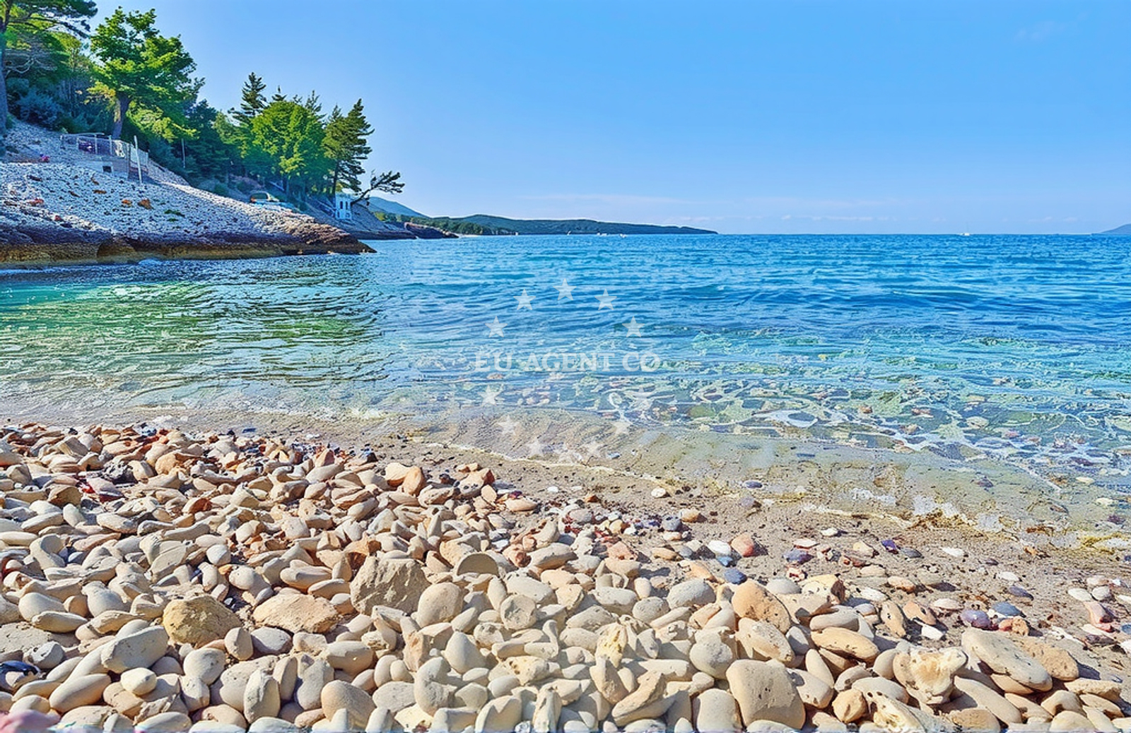
Rasoha II Beach is a small cove located in Smokvica, a quiet village on Croatia's Adriatic coast. Nestled between mountain slopes and the sea, the beach features a 20-meter by 10-meter expanse of white pebbles, creating a stark contrast with the surrounding rocky terrain. Its moderate depth increase and proximity to the village make it a distinctive spot for those familiar with the region's coastal geography.
Beach character
The beach's defining feature is its pebbly composition, which extends across the entire shoreline. Unlike sandy beaches, Rasoha II's surface is composed of rounded white stones, requiring visitors to wear appropriate footwear. The beach is flanked by low-lying mountains, which contribute to its sheltered character. Depth increases gradually from the shore, making it suitable for cautious swimmers. The absence of structured amenities means the beach retains its natural, unspoiled appearance.
Swimming and shore
Swimming conditions are generally manageable due to the moderate depth increase, though the pebble-covered seabed may make wading uncomfortable for some. The shore itself is relatively flat, with no significant elevation changes. The beach's orientation within the cove creates a microclimate that is somewhat protected from direct wind exposure, though this varies with seasonal weather patterns.
Facilities and activities
No formal facilities are present at Rasoha II Beach. There are no designated parking areas, restrooms, or lifeguard services. The lack of infrastructure aligns with its status as a lesser-known coastal site. Activities are limited to passive recreation such as sunbathing and casual swimming. The beach's natural setting makes it unsuitable for organized sports or water-based activities requiring equipment.
Access and location
Access to the beach is via a short path from the village of Smokvica, which is located at Brna bb. The exact route is not documented in available records, but the beach's proximity to the village suggests it is reachable by foot or vehicle. Its location on the Adriatic coast places it within sailing distance of several major Croatian ports, though specific navigational details are not provided in the catalog.
What to expect
Visitors should expect a natural, undeveloped beach experience. The white pebble surface requires appropriate footwear, and there are no facilities for refreshments or rest. The beach's moderate crowd index during high season indicates it is not a major tourist destination, offering a more secluded experience compared to busier Adriatic beaches. Cleanliness is noted as good, suggesting minimal litter or pollution.
Practical tips
Bring sturdy footwear to navigate the pebble-covered shoreline. Sun protection is recommended due to the exposed coastal position. Arrive early to secure a spot during peak hours. The absence of facilities means visitors should bring their own supplies for extended stays.
Exploring the coast by yacht
For yacht charter guests exploring the Adriatic coast, Rasoha II Beach represents one of many natural anchorages in the region. While no specific marinas are mentioned in the catalog, the beach's location near Smokvica places it within reach of sailing routes connecting major Croatian ports. Those interested in chartering a vessel in this area may find the Yacht Search Page useful for identifying available boats and planning coastal excursions.
Geographical Context
Smokvica is a small village in the municipality of Šibenik, situated along the eastern Adriatic coast. The area is characterized by rugged terrain and scattered coastal settlements, with Rasoha II Beach representing a typical example of the region's diverse shoreline features. The beach's coordinates (42.96679, 16.90982) place it near the northern edge of the Šibenik-Knin County, an area known for its historical significance and natural beauty.
Anchorages in the surrounding area
Anchorages in the surrounding area include Rasoha and nearby locations in Korčula.
- Rasoha — korcula — 0.2 NM from beach
- Anchorage — korcula — 0.8 NM from beach
- Anchorage — korcula — 3.4 NM from beach
- Anchorage — korcula — 3.7 NM from beach
- Anchorage — korcula — 3.8 NM from beach
- Grahova — brna — korcula — 4.3 NM from beach
- Anchorage — brna — korcula — 4.3 NM from beach
- Istruga — brna — korcula — 4.4 NM from beach
Distances are straight-line geographic distances, not sailing routes.
Mooring buoys in the surrounding area
Mooring buoys in the surrounding area are found near Lovište and Konoba Estravaganca in Lovište.
- Jetty — loviste — 5.2 NM from beach
- Konoba Estravaganca buoys - Duba — konoba estravaganca buoys duba — loviste — 6.0 NM from beach
- Restaurant Korkyra xyz buoys — loviste — 6.3 NM from beach
- Jetty — loviste — 6.3 NM from beach
- Quay — vela luka — korcula — 6.9 NM from beach
Distances are straight-line geographic distances, not sailing routes.
Marine fuel stations
- Ina — vela luka — korcula — 8.6 NM from beach
- Fuel station — korcula — 10.5 NM from beach
- Ina — ubli — lastovo — 13.9 NM from beach
- Ina — vrboska — hvar — 16.4 NM from beach
Distances are straight-line geographic distances, not sailing routes.
Harbours in the surrounding area
Harbours in the surrounding area include Zavalatica and Brna in Korčula.
- Zavalatica — korcula — 3.4 NM from beach
- Brna — korcula — 4.3 NM from beach
- Prigradica — korcula — 4.4 NM from beach
- Račišće — racisce — korcula — 4.9 NM from beach
- Lovište — loviste — 6.3 NM from beach
- Viganj — 8.4 NM from beach
Distances are straight-line geographic distances, not sailing routes.
Marinas in the surrounding area
Marinas in the surrounding area are located in Vela Luka and Korčula.
- Marina Korkyra — vela luka — korcula — 8.7 NM from beach
- ACI Marina Korčula — korcula — 10.0 NM from beach
- Marina Lumbarda — korcula — 11.8 NM from beach
- Marina Solitudo — lastovo — 12.7 NM from beach
- ACI Marina Vrboska — hvar — 16.4 NM from beach
Distances are straight-line geographic distances, not sailing routes.
Restaurants near the beach
Restaurants near the beach include options in Prigradica and Brna.
- Bistro Prigradica — korcula — 4.3 NM from beach
- Galeb — brna — korcula — 4.4 NM from beach
- Dragan — brna — korcula — 4.4 NM from beach
- Restaurant — korcula — 4.7 NM from beach
- Konoba Mijo — korcula — 4.7 NM from beach
- Vala — racisce — korcula — 4.8 NM from beach
Distances are straight-line geographic distances, not sailing routes.
Navigation guides for the surrounding area
Navigation guides for the surrounding area cover locations such as Uvala Zavalatica and Brna.
- Uvala Zavalatica — 3.6 NM from beach
- Brna — 4.4 NM from beach
- Luka Racisce — 5.1 NM from beach
- Uvala Kneza — 6.2 NM from beach
- Uvala Prizba Mali — 6.3 NM from beach
Distances are straight-line geographic distances, not sailing routes.
Yachts from nearby departure bases
Yachts from nearby departure bases include vessels based in Tučepi Port and Makarska Port.
Sailing yachts
- Bavaria 40 Cruiser (LADY BUTTERFLY) — Tučepi Port — 19.0 NM from departure base to beach
- Elan 40 Impression (Karleta) — Ploče City Port — 23.5 NM from departure base to beach
- Salona 44 (SAMOA) — Ploče City Port — 23.5 NM from departure base to beach
- More 55 (MRS. ROBINSON) — Ploče City Port — 23.5 NM from departure base to beach
Catamarans
- Lagoon 450 Fly (Alba Mouse) — Ploče City Port — 23.5 NM from departure base to beach
Motor yachts
- Princess V53 (Chablis) — Makarska Port — 20.1 NM from departure base to beach
Motor boats
- Jeanneau NC 37 (Black Pearl) — Makarska Port — 20.1 NM from departure base to beach
- Galeon 430 Skydeck (BELLAGIO) — Makarska Port — 20.1 NM from departure base to beach
- Jeanneau NC 37 (Black Pearl) — Makarska Port — 20.1 NM from departure base to beach
- Galeon 430 Skydeck (Bellagio) — Makarska Port — 20.1 NM from departure base to beach
Distances are straight-line geographic distances, not sailing routes.