Rajska Cesta Beach, Croatia
Rajska Cesta lies along the Adriatic coast in Njivice, a small settlement in Split-Dalmatia County. This 50-meter-long beach stretches along a natural shoreline characterized by boulders that form both the beach cover and the sea floor. The beach's moderate depth increase and exposed positioning make it a distinctive coastal feature in this part of Croatia.
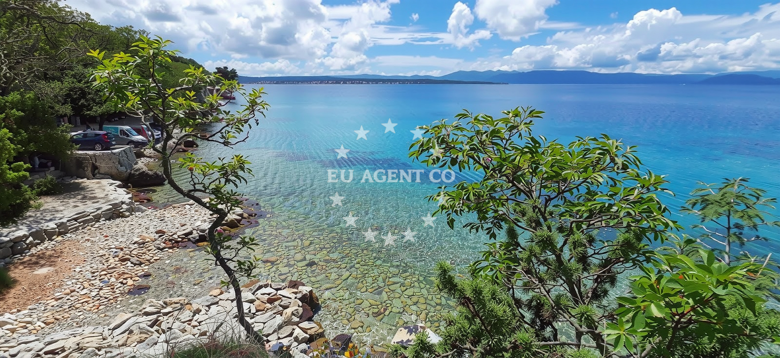
Beach character
The beach's most striking characteristic is its natural composition. Boulders form the shoreline, creating a rugged yet accessible beach environment. The lack of artificial structures means visitors encounter an unmodified coastal landscape. The beach is explicitly marked as recommended for nudists, though no specific facilities or designated areas are indicated in the catalog. The moderate cleanliness index suggests visitors should expect natural conditions rather than fully maintained amenities.
Swimming and shore
Snorkeling is the primary water activity associated with Rajska Cesta, likely facilitated by the boulder-strewn sea floor that creates underwater topography. The beach's straight shoreline and moderate depth progression make it suitable for swimmers comfortable with exposed coastal conditions. The natural boulder formations may create sheltered pockets along the shore, though the beach's overall exposure means wave action is likely more pronounced than in cove-like beaches.
Facilities and activities
No structured amenities are listed in the catalog, including restrooms, showers, or parking facilities. The sole activity explicitly mentioned is snorkeling, though the boulder-strewn environment may incidentally support rockpool exploration. The beach's nudist designation implies a specific visitor demographic, though no infrastructure catering to this community is documented.
Access and location
Located at Gromačine 41 in Njivice, the beach is positioned along the mainland coast near the town of Split. Its coordinates (45°08'45"N, 14°31'8"E) place it within the broader Split-Dalmatia region, a popular sailing area with connections to the islands of Brač and Hvar. The beach's accessibility is not detailed in the catalog, but its mainland location suggests it is likely reachable by road from nearby settlements.
What to expect
Visitors should expect a natural beach environment with boulder formations defining both the shoreline and underwater terrain. The beach is explicitly associated with nudist activity, though no specific facilities or services are indicated. Snorkeling is the primary water activity, with the boulder-strewn sea floor creating an underwater landscape. The moderate cleanliness index suggests natural conditions rather than fully maintained amenities. The beach's exposure to open water means wave action is likely more pronounced than in sheltered coves.
Practical tips
Given the beach's nudist designation, visitors should consider local norms regarding attire. The absence of structured amenities means bringing personal items for comfort is advisable. The boulder-strewn environment may create uneven walking surfaces along the shore, suggesting caution when navigating the beach area.
Exploring the coast by yacht
The Split-Dalmatia region, where Rajska Cesta is located, is a well-established sailing destination with connections to the islands of Brač, Hvar, and Šolta. Yacht charter companies operating in this area often include the mainland coast as part of their itineraries, providing access to both coastal beaches and island destinations. While no specific marinas are mentioned in relation to this beach, the broader region includes several ports and harbors that support yacht charter operations.
Regional Context
The Split-Dalmatia County coastline is characterized by a mix of pebble and sandy beaches, with Rajska Cesta representing one of the more rugged shorelines. The area is known for its clear waters and sailing opportunities, with the nearby town of Split serving as a major maritime hub. The region's cultural heritage includes Roman ruins and medieval fortifications, though these are not directly associated with the beach itself.
Anchorages in the surrounding area
- Anchorage — njivice — krk — 0.4 NM from beach
- Anchorage — malinska — krk — 2.0 NM from beach
- Anchorage — porat — krk — 2.3 NM from beach
- Klimno — krk — 3.3 NM from beach
- Anchorage — krk — 3.7 NM from beach
- Anchorage — krk — 4.4 NM from beach
- Anchorage — krk — 4.5 NM from beach
- Camp Glavotok — krk — 4.9 NM from beach
Distances are straight-line geographic distances, not sailing routes.
Mooring buoys in the surrounding area
- Buoy field — omisalj — krk — 3.9 NM from beach
- Camp Glavotok — krk — 4.8 NM from beach
- Jetty — voz — krk — 5.7 NM from beach
- Jetty — kacjak — 6.3 NM from beach
- Jetty — risika — krk — 6.3 NM from beach
Distances are straight-line geographic distances, not sailing routes.
Marine fuel stations
- Fuel station — crikvenica — 7.1 NM from beach
- OMV — krk — 7.1 NM from beach
- Ina — krk — 7.5 NM from beach
- Flash — krk — 7.6 NM from beach
Distances are straight-line geographic distances, not sailing routes.
Harbours in the surrounding area
- Haludovo — malinska — krk — 0.7 NM from beach
- Haludovo — malinska — krk — 0.7 NM from beach
- Njivice — krk — 1.3 NM from beach
- Porat — krk — 2.0 NM from beach
- Vantačić — vantacic — vantacici — 2.1 NM from beach
- Čižići — cizici — krk — 3.0 NM from beach
Distances are straight-line geographic distances, not sailing routes.
Marinas in the surrounding area
- Omišalj Docks — omisalj — krk — 3.9 NM from beach
- Šilo — silo — krk — 5.9 NM from beach
- Marina Punat — krk — 8.1 NM from beach
- Marina Novi — novi vinodolski — 11.0 NM from beach
- Mitan Marina — novi vinodolski — 11.9 NM from beach
Distances are straight-line geographic distances, not sailing routes.
Restaurants near the beach
- Restaurant — malinska — krk — 0.7 NM from beach
- Restaurant — malinska — krk — 0.7 NM from beach
- Rivica — njivice — krk — 1.3 NM from beach
- Restaurant Obala — malinska — krk — 1.3 NM from beach
- Porat — krk — 2.0 NM from beach
- Picolla Venezia — porat — krk — 2.1 NM from beach
- Gostiona Sidro — porat — krk — 2.1 NM from beach
Distances are straight-line geographic distances, not sailing routes.
Navigation guides for the surrounding area
- Luka Kijac — 0.4 NM from beach
- Njivice — 1.4 NM from beach
- Uvala Sapan — 3.5 NM from beach
- Uvala Cavlena — 3.6 NM from beach
- Omisaljski Zaljev — 4.3 NM from beach
Distances are straight-line geographic distances, not sailing routes.
Yachts from nearby departure bases
Sailing yachts
- Sun Odyssey 29.2 (Mirabai) — Malinska Hotel Malin port — 1.6 NM from departure base to beach
- Bavaria 36 (Tamra) — Kraljevica Port Porto — 7.9 NM from departure base to beach
- Bavaria 32 (Andromeda) — Kraljevica Port Porto — 7.9 NM from departure base to beach
- Oceanis 51.1 (Bambi) — Krk Marina Punat — 8.1 NM from departure base to beach
- Dufour 470 (Asterix) — Krk Marina Punat — 8.1 NM from departure base to beach
Catamarans
- Lagoon 42 (Marianne) — Krk Marina Punat — 8.1 NM from departure base to beach
Motor yachts
- Sunseeker 64 (MARITA) — Krk Marina Punat — 8.1 NM from departure base to beach
Motor boats
- Barracuda 590 (Solta) — Crikvenica City Port — 7.2 NM from departure base to beach
- Barracuda 590 (Barracuda 12) — Crikvenica City Port — 7.2 NM from departure base to beach
- Zaffiro 34 (Sanmar) — Krk Marina Punat — 8.1 NM from departure base to beach
Distances are straight-line geographic distances, not sailing routes.