Radocin dol Beach - Stari Grad, Croatia
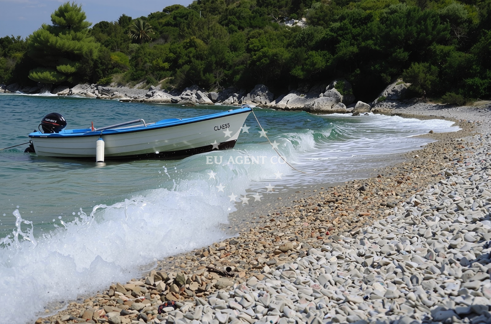
Radocin dol is a secluded cove beach nestled in Uvala Sv.Antonij, Stari Grad, Croatia. This 100-meter-long stretch of white pebbles lies at the foot of the surrounding mountains, offering a tranquil setting for those seeking natural beauty and quiet relaxation. The beach's modest size and sheltered position make it a favored spot for hikers and leisure travelers looking to escape busier coastal areas.
Beach character
The beach is defined by its distinctive cove shape, with the shoreline composed entirely of white pebbles. The sea floor extends gradually into the water, with a moderate depth increase that makes it suitable for cautious swimmers. The surrounding landscape is dominated by rugged mountain terrain, creating a dramatic contrast between the land and the sea. The absence of artificial structures or modern amenities preserves the beach's natural character, though visitors should note that there are no official facilities such as showers, toilets, or parking areas.
Swimming and shore
The pebble-covered shore provides a stable base for entering the water, though visitors may want to bring shoes for comfort. The sea floor is composed of pebbles that extend outward, with depths increasing gradually. While the beach is not marked as particularly sheltered, its cove formation offers some protection from direct wind exposure. The water quality is generally good, reflecting the region's overall cleanliness standards.
Facilities and activities
Radocin dol does not have formal amenities or structured activities. The beach's appeal lies in its natural setting, making it ideal for solitary relaxation, photography, or short walks along the shoreline. The surrounding mountains provide opportunities for hiking, though trails are not directly accessible from the beach itself. Visitors should be prepared for minimal infrastructure and focus on enjoying the unspoiled coastal environment.
Access and location
Radocin dol is located in Uvala Sv.Antonij, a small coastal area within Stari Grad, a historic settlement on the island of Hvar. The beach's coordinates (43.18936° N, 16.54008° E) place it near the southern coast of Hvar, within reach of other popular Adriatic destinations. Access is via local roads connecting to Stari Grad, though the exact route is not specified in available records. The beach's remote character means it is less frequented than larger resorts in the region.
What to expect
Visitors to Radocin dol should expect a quiet, natural beach experience with minimal infrastructure. The white pebble shore and mountain backdrop create a serene environment, though there are no facilities for food, drink, or rest. The beach is best suited for those seeking solitude and connection with the landscape. Its location in Stari Grad places it within proximity to cultural sites and other coastal attractions, though the beach itself remains focused on its natural character.
Practical tips
Given the pebble shoreline, visitors may want to bring shoes for comfort. The beach's remote nature means there are no nearby restaurants or shops, so provisions should be brought from Stari Grad. The area's mountainous surroundings offer hiking opportunities, but trails are not directly accessible from the beach. Check local conditions for any temporary restrictions or seasonal changes.
Exploring the coast by yacht
Radocin dol's location on the southern coast of Hvar places it within a region popular with yacht charter guests. The surrounding Adriatic waters offer opportunities for sailing, with nearby marinas and anchorages accessible via the Euro-Agent Yacht Search platform. While the beach itself is not a formal docking point, its proximity to Stari Grad and other coastal settlements makes it a potential stop for sailors exploring the Hvar coastline. For detailed yacht availability and sailing area information, visit the Yacht Search page.
Regional Context and Nearby Settlements
Stari Grad, where Radocin dol is located, is a historic town on the island of Hvar, known for its medieval architecture and vineyards. The beach's mountainous surroundings reflect the broader geography of the Hvar coast, which features a mix of rugged cliffs and fertile land. Nearby, the town of Hvar itself offers more developed amenities, while the quieter villages of Jelsa and Vrboska provide alternative bases for visitors exploring the area.
Anchorages in the surrounding area
Anchorages in Stari Grad and nearby Hvar offer convenient mooring options close to Radocin dol.
- Anchorage — stari grad — hvar — 0.0 NM from beach
- Anchorage — stari grad — hvar — 0.8 NM from beach
- Anchorage — stari grad — hvar — 1.1 NM from beach
- Maslinica — stari grad — hvar — 1.4 NM from beach
- Anchorage — stari grad — hvar — 1.7 NM from beach
- Anchorage — stari grad — hvar — 1.9 NM from beach
- Anchorage — stari grad — hvar — 1.9 NM from beach
- Anchorage — brusje — hvar — 2.0 NM from beach
Distances are straight-line geographic distances, not sailing routes.
Mooring buoys in the surrounding area
- Jetty — stari grad — hvar — 0.0 NM from beach
- Stiniva — stari grad — hvar — 0.5 NM from beach
- Stari Grad A Malo Stupisce — hvar — 1.4 NM from beach
- Buoy field Zavala — stari grad — hvar — 1.5 NM from beach
- Buoy field — stari grad — hvar — 1.6 NM from beach
Distances are straight-line geographic distances, not sailing routes.
Marine fuel stations
Fuel stations in Hvar, Vrboska, and nearby Brac ensure refueling options for vessels traveling to Radocin dol.
- Fuel station — hvar — 4.4 NM from beach
- Ina — vrboska — hvar — 5.9 NM from beach
- Fuel station — bol — brac — 6.6 NM from beach
- Ina — milna brac — 9.3 NM from beach
Distances are straight-line geographic distances, not sailing routes.
Harbours in the surrounding area
- Stari Grad — hvar — 2.3 NM from beach
- Marina Bilo Idro — sveta nedjelja — hvar — 3.9 NM from beach
- Hvar — 4.5 NM from beach
- Vira — hvar — 4.9 NM from beach
- Vrboska — hvar — 5.9 NM from beach
- Bol — brac — 6.7 NM from beach
Distances are straight-line geographic distances, not sailing routes.
Marinas in the surrounding area
Marinas in Vrboska, Palmižana, and Milna Brac cater to yachts traveling to Radocin dol.
- ACI Marina Vrboska — hvar — 5.9 NM from beach
- ACI Marina Palmižana — aci marina palmizana — st klement — 6.6 NM from beach
- ACI Marina Milna — milna brac — 9.2 NM from beach
- Marina Milna Kanarija — milna brac — 9.3 NM from beach
- Marina Vlaška — milna brac — 9.5 NM from beach
Distances are straight-line geographic distances, not sailing routes.
Restaurants near the beach
Restaurants in Stari Grad and adjacent areas offer dining options near Radocin dol.
- Konoba Zavala — stari grad — hvar — 1.6 NM from beach
- Konoba Lučišće — brusje — hvar — 1.9 NM from beach
- Eremitaz — stari grad — hvar — 2.2 NM from beach
- Jerolim — stari grad — hvar — 2.2 NM from beach
- Restaurant — stari grad — hvar — 2.5 NM from beach
- Mola Podloza — stari grad — hvar — 2.5 NM from beach
- Đardin — stari grad — hvar — 2.5 NM from beach
Distances are straight-line geographic distances, not sailing routes.
Navigation guides for the surrounding area
Navigation guides for Uvala Glavna and surrounding waters assist in planning routes to Radocin dol.
- Uvala Gracisce — 0.7 NM from beach
- Luka Zavala — 1.7 NM from beach
- Uvala Glavna — 2.1 NM from beach
- Luka Vlaska — 2.4 NM from beach
- Dubovica — 2.7 NM from beach
Distances are straight-line geographic distances, not sailing routes.
Yachts from nearby departure bases
Sailing yachts
- Hanse 505 (AVALON) — Milna Marina Vlaška — 9.5 NM from departure base to beach
- Hanse 455 (AURUM 1) — Milna Marina Vlaška — 9.5 NM from departure base to beach
- Bavaria 46 Cruiser (MO) — Milna Marina Vlaška — 9.5 NM from departure base to beach
- Hanse 388 (BANJO) — Milna Marina Vlaška — 9.5 NM from departure base to beach
- Sun Odyssey 449 (Tortuga) — Šolta Rogač — 16.2 NM from departure base to beach
- Cyclades 43.4 (Himalaya) — Šolta Rogač — 16.2 NM from departure base to beach
Catamarans
- Lagoon 450 Fly (Falco) — Sumpetar Port — 16.1 NM from departure base to beach
- Lagoon 450 Flybridge (Samogon) — Šolta Rogač — 16.2 NM from departure base to beach
Gulets / Cruisers
- Gulet (Cataleya) — Sumpetar Port — 16.1 NM from departure base to beach
- Gulet (Altair) — Sumpetar Port — 16.1 NM from departure base to beach
Distances are straight-line geographic distances, not sailing routes.