Pupnat (Korčula): Beaches and Coves, Croatia
Pupnat, a coastal area on Korčula Island, is renowned for its rugged coastline, secluded coves, and clear Adriatic waters. As part of Croatia's Dalmatian Coast, this region offers a blend of natural landscapes and maritime heritage, making it a compelling destination for both beachgoers and sailors.
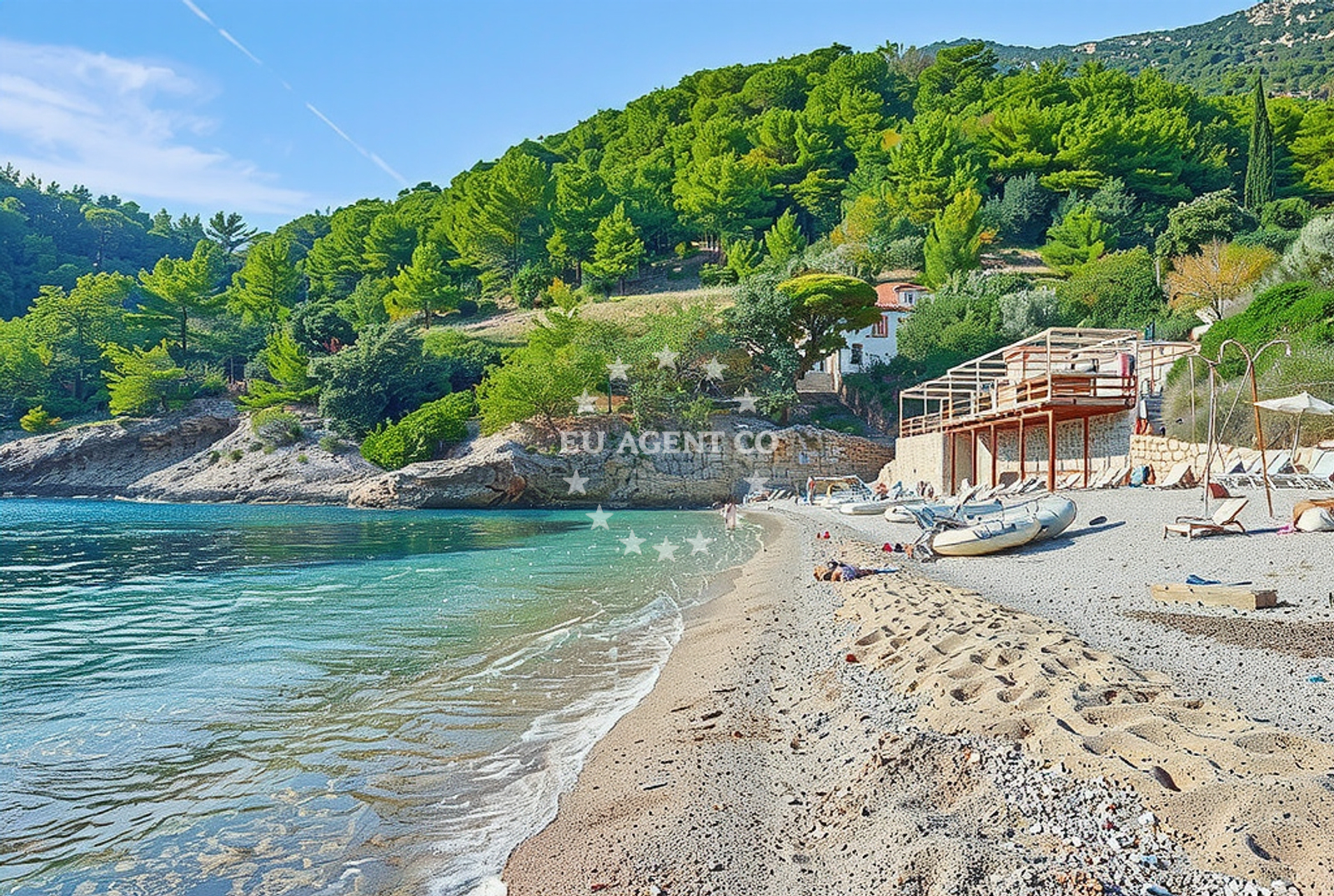
About this beach
Pupnat (Korčula): beaches and coves
Beach character
Pupnat's beaches and coves are characterized by their natural formations, including limestone cliffs and shallow, sheltered bays. The area's geography creates a mix of pebbled shores and rocky inlets, typical of the Dalmatian Coast. These features contribute to the region's appeal for those seeking tranquility and unspoiled coastal scenery.
Swimming and shore
The waters around Pupnat are generally clear and calm, ideal for swimming and snorkeling. The shorelines, while not uniformly sandy, offer accessible points for exploration, particularly in the more sheltered coves. The natural topography provides opportunities for both relaxation and light coastal activities.
Facilities and activities
Facilities at Pupnat are limited to the natural environment, with no structured amenities such as showers, toilets, or parking explicitly noted. Activities centered around the beach include swimming, snorkeling, and exploring the surrounding coastline. The area's appeal lies in its raw, unembellished natural state.
Access and location
Pupnat is located on Korčula Island, accessible via ferry services from the mainland and other Dalmatian islands. The nearest major settlement is Korčula Town, which serves as a gateway to the island's southern coast. The area's proximity to the Adriatic Sea makes it a strategic point for both land and sea travel.
What to expect
Visitors to Pupnat can expect a landscape defined by natural formations, with limited infrastructure and a focus on coastal exploration. The beaches and coves are best suited for those seeking solitude and a connection to the island's rugged terrain. The area's appeal is rooted in its unspoiled character and the opportunities it presents for maritime activities.
Practical tips
Given the lack of formal facilities, visitors are advised to bring necessary supplies for a day at the beach. The best times to visit are during the shoulder seasons, when the area is less crowded. Navigation around the coves should be done with care, respecting local maritime guidelines.
Exploring the coast by yacht
The waters around Pupnat are part of the broader Adriatic sailing routes, offering access to both sheltered bays and open sea. Yacht charter guests may find the area appealing for its combination of natural beauty and strategic location within the Dalmatian Coast. Nearby marinas and anchorages on Korčula provide bases for exploring the region's coastline and surrounding islands.
Cultural and Historical Context
Korčula Island, where Pupnat is located, has a rich medieval history, with Korčula Town itself a UNESCO-protected site. The island's cultural heritage, including its Renaissance architecture and wine production, adds depth to any visit. This historical context enhances the experience of exploring Pupnat's natural landscapes.
Anchorages in the surrounding area
Anchorages in the surrounding area, including Racisce and Korčula, are located near Pupnat (Korčula).
- Anchorage — racisce — korcula — 1.6 NM from beach
- Anchorage — racisce — korcula — 1.6 NM from beach
- Anchorage — korcula — 1.6 NM from beach
- Anchorage — korcula — 1.7 NM from beach
- Anchorage — korcula — 2.0 NM from beach
- Anchorage — korcula — 2.3 NM from beach
- Anchorage — korcula — 2.8 NM from beach
- Anchorage — korcula — 2.9 NM from beach
Distances are straight-line geographic distances, not sailing routes.
Mooring buoys in the surrounding area
Mooring buoys near the beach include those at Konoba Estravaganca in Loviste and jetty locations in Korčula.
- Konoba Estravaganca buoys - Duba — konoba estravaganca buoys duba — loviste — 3.1 NM from beach
- Jetty — korcula — 3.3 NM from beach
- Jetty — loviste — 3.4 NM from beach
- Jetty — loviste — 4.4 NM from beach
- Restaurant Korkyra xyz buoys — loviste — 4.8 NM from beach
Distances are straight-line geographic distances, not sailing routes.
Marine fuel stations
- Fuel station — korcula — 4.9 NM from beach
- Ina — vela luka — korcula — 14.1 NM from beach
- Ina — ubli — lastovo — 15.5 NM from beach
- Fuel station — ploce — 18.6 NM from beach
Distances are straight-line geographic distances, not sailing routes.
Harbours in the surrounding area
Harbours in the surrounding area, including Račišće and Lovište, are situated near Pupnat (Korčula).
- Račišće — racisce — korcula — 1.6 NM from beach
- Viganj — 3.4 NM from beach
- Kučišće — kucisce — 3.9 NM from beach
- Korčula W harbour — korcula — 4.4 NM from beach
- Korčula E harbour — korcula — 4.5 NM from beach
- Lovište — loviste — 4.6 NM from beach
Distances are straight-line geographic distances, not sailing routes.
Marinas in the surrounding area
Marinas in the surrounding area, such as ACI Marina Korčula and Marina Lumbarda, are located near Pupnat (Korčula).
- ACI Marina Korčula — korcula — 4.5 NM from beach
- Marina Lumbarda — korcula — 6.2 NM from beach
- Marina Korkyra — vela luka — korcula — 14.2 NM from beach
- Marina Solitudo — lastovo — 14.6 NM from beach
- Marina Tučepi — marina tucepi — 18.8 NM from beach
Distances are straight-line geographic distances, not sailing routes.
Restaurants near the beach
Restaurants near the beach include Stane and Konoba Mijo in Racisce, offering local cuisine.
- Stane — racisce — korcula — 1.5 NM from beach
- Vala — racisce — korcula — 1.6 NM from beach
- Konoba Mijo — korcula — 2.0 NM from beach
- Restaurant — korcula — 2.1 NM from beach
- Konoba Estravaganca — loviste — 3.1 NM from beach
- Restaurant — korcula — 3.2 NM from beach
- Mimi's Bistro at Tara's Lodge — korcula — 3.3 NM from beach
Distances are straight-line geographic distances, not sailing routes.
Navigation guides for the surrounding area
Navigation guides for the surrounding area include Luka Racisce and Uvala Kneza, providing detailed route information.
- Luka Racisce — 1.5 NM from beach
- Uvala Kneza — 1.6 NM from beach
- Uvala Vrbovica — 3.1 NM from beach
- Uvala Banja — 3.7 NM from beach
- Uvala Zavalatica — 4.8 NM from beach
Distances are straight-line geographic distances, not sailing routes.
Yachts from nearby departure bases
Sailing yachts
- Elan 40 Impression (Karleta) — Ploče City Port — 18.5 NM from departure base to beach
- Sun Odyssey 349 (Porto Tolero) — Ploče City Port — 18.5 NM from departure base to beach
- Elan 514 Impression (Cesarica III) — Ploče City Port — 18.5 NM from departure base to beach
- Sun Odyssey 419 (Luka Ploce) — Ploče City Port — 18.5 NM from departure base to beach
- More 55 (MRS. ROBINSON) — Ploče City Port — 18.5 NM from departure base to beach
- Salona 44 (SAMOA) — Ploče City Port — 18.5 NM from departure base to beach
- Sun Odyssey 349 (Visnjica) — Ploče City Port — 18.5 NM from departure base to beach
- Bavaria 40 Cruiser (LADY BUTTERFLY) — Tučepi Port — 18.8 NM from departure base to beach
Catamarans
- Lagoon 450 Fly (Alba Mouse) — Ploče City Port — 18.5 NM from departure base to beach
Motor yachts
- Princess V53 (Chablis) — Makarska Port — 20.5 NM from departure base to beach
Distances are straight-line geographic distances, not sailing routes.