Pristanište, Zlarin (Zlarin) Beach, Croatia
About this beach
Pristanište, Zlarin (Zlarin)
Beach: Pristanište
Location: Zlarin (Zlarin)
Characteristics and facilities
Gravel, concrete / stone slabs
Restaurant / snack bar
Caffe bar / Drinks stand
Training ground
Beach character
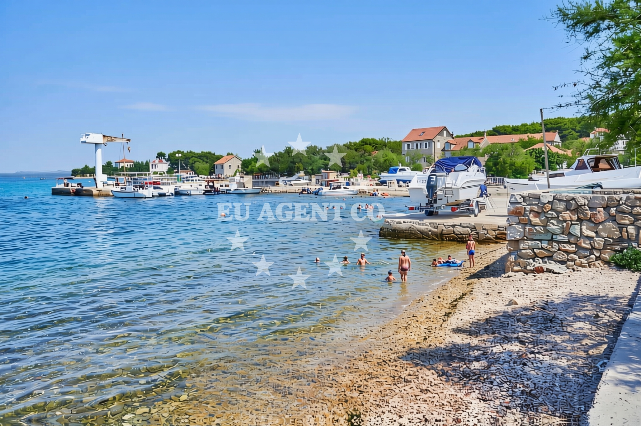
The beach consists of gravel and concrete/stone slabs, forming a utilitarian shoreline that contrasts with typical sandy beaches. This composition suggests it may be used for mooring, loading, or as a training ground. The lack of natural sand or soft terrain indicates it is not primarily a swimming beach but rather a transitional space between land and sea.Swimming and shore
While no specific swimming conditions are documented, the presence of a training ground nearby implies the area may be used for water-based activities or exercises. The shoreline's gravel composition could make direct swimming from the beach impractical, though access to the water from adjacent areas remains possible.Facilities and activities
Basic amenities include a restaurant/snack bar and a caffe bar/drinks stand, offering refreshments for visitors. The training ground facility suggests potential for organized activities, though details about its use are unspecified. No recreational facilities such as showers, changing rooms, or lifeguard services are noted in the beach's authoritative records.Access and location
Pristaniste Beach is situated in Zlarin, a coastal town on the island of Brač. Its coordinates (43.69906° N, 15.834984° E) place it near the central Adriatic, with easy access to the broader sailing network of the region. Visitors can reach Zlarin via road from Split or by ferry from nearby islands, with the beach itself accessible through local pathways connecting to the town's harbor area.What to expect
This beach is best approached as a functional coastal space rather than a traditional recreational shoreline. Expect gravel and stone surfaces along the shore, with dining options available at nearby establishments. The training ground facility may host activities, though specific details about its operation are not provided. The area's utility as a landing spot or transitional zone between land and sea is evident from its infrastructure.Practical tips
Visitors should consider the gravel terrain when planning footwear or transportation. The nearby restaurant and cafe options make it convenient for meals, though no specific hours or seasonal availability are documented. Those interested in water activities may want to inquire locally about the training ground's schedule.Exploring the coast by yacht
For yacht charter guests, Pristaniste Beach's proximity to Zlarin's harbor offers a convenient stopover point along the Adriatic coast. The area is part of a sailing network that includes nearby marinas in Split, Hvar, and Brač. Charter yachts navigating the northern Dalmatian coast may find this location useful for refueling, provisioning, or exploring the surrounding islands. For detailed yacht availability and sailing area information, visitors can use Euro-Agent's Yacht Search tool.Regional Context
Zlarin is a small town on Brač Island, known for its traditional fishing heritage and scenic coastal views. The broader area offers sailing opportunities with clear waters and access to the Pakleni Islands, Hvar, and the mainland coast. Local culture emphasizes maritime traditions, with seasonal festivals and artisanal seafood available in nearby villages.Anchorages in the surrounding area
Anchorages in the surrounding area include Zlarin, Jadria, and nearby locations.
- Anchorage — zlarin — 1.0 NM from beach
- Anchorage — jadria — 1.7 NM from beach
- Anchorage — zlarin — 2.0 NM from beach
- Anchorage — sibenik — 2.0 NM from beach
- Sepurine — prvic sepurine — 2.7 NM from beach
- Anchorage — prvic sepurine — 3.0 NM from beach
- Anchorage — tijat — 3.0 NM from beach
- Anchorage — zmajan — 3.0 NM from beach
Distances are straight-line geographic distances, not sailing routes.
Mooring buoys in the surrounding area
Mooring buoys in the surrounding area include Zlarin and other nearby fields.
- Buoy field — zlarin — 0.3 NM from beach
- Sv. Nikola — sv nikola — zablace — 1.6 NM from beach
- Buoy field — prvic — 2.2 NM from beach
- Jetty — obonjan — 2.3 NM from beach
- Obonjan N quay — 2.4 NM from beach
Distances are straight-line geographic distances, not sailing routes.
Marine fuel stations
- Lukoil — sibenik — 2.7 NM from beach
- Ina — sibenik — 3.2 NM from beach
- Ina — vodice — 4.2 NM from beach
- Petrol — tribunj — 4.9 NM from beach
Distances are straight-line geographic distances, not sailing routes.
Harbours in the surrounding area
Harbours in the surrounding area include Zlarin and nearby ports.
- Zlarin — 0.1 NM from beach
- Zablaće — zablace — 1.5 NM from beach
- Jadria — 1.6 NM from beach
- Konoba Stari Nanini at Prvić Port — prvic — 2.1 NM from beach
- Prvić Šepurine — prvic sepurine — 3.0 NM from beach
- Srima — 3.1 NM from beach
Distances are straight-line geographic distances, not sailing routes.
Marinas in the surrounding area
Marinas in the surrounding area include Sibenik and other regional bases.
- Amadria Yacht Marines — sibenik — 1.8 NM from beach
- Marina Mandalina — sibenik — 3.1 NM from beach
- ACI Marina Vodice — 4.3 NM from beach
- Marina Zaton — zaton near sibenik — 4.8 NM from beach
- Marina Tribunj — 5.0 NM from beach
Distances are straight-line geographic distances, not sailing routes.
Restaurants near the beach
Restaurants near the beach include Konoba Aldura and other local eateries in Zlarin.
- Konoba Aldura — zlarin — 0.0 NM from beach
- Koralj — zlarin — 0.1 NM from beach
- Konoba Prslika — zlarin — 0.1 NM from beach
- Ivana — zlarin — 0.2 NM from beach
- Pizzaria Zora — zablace — 1.5 NM from beach
- Punta — prvic — 2.1 NM from beach
- Mareta — prvic — 2.1 NM from beach
Distances are straight-line geographic distances, not sailing routes.
Navigation guides for the surrounding area
Navigation guides cover Zlarin and nearby areas like Šibenik and Vodice.
- Luka Zlarin — 0.1 NM from beach
- Tučepi — 2.3 NM from beach
- Šibenik — 3.3 NM from beach
- Krapanj — 4.1 NM from beach
- Vodice — 4.2 NM from beach
Distances are straight-line geographic distances, not sailing routes.
Yachts from nearby departure bases
Yachts from nearby departure bases include Šibenik Marina Mandalina and other regional marinas.
Sailing yachts
- Dufour 470 (Avanti) — Šibenik Marina Mandalina — 3.1 NM from departure base to beach
- Dufour 390 Grand (MERCURY) — Šibenik Marina Mandalina — 3.1 NM from departure base to beach
- Dufour 44 (Vera) — Šibenik Marina Mandalina — 3.1 NM from departure base to beach
Catamarans
- Bali Catspace (Free Flow) — Šibenik Marina Mandalina — 3.1 NM from departure base to beach
- Elba 45 (Alize) — Šibenik Marina Mandalina — 3.1 NM from departure base to beach
- Lagoon 42 (Maximus) — Šibenik Marina Mandalina — 3.1 NM from departure base to beach
Motor yachts
- Sunseeker Manhattan 73 (Goldeneye) — Šibenik Marina Mandalina — 3.1 NM from departure base to beach
- Cyrus 34 (Dream) — Šibenik Marina Mandalina — 3.1 NM from departure base to beach
Motor boats
- Bavaria Virtess 420 Fly (CALENI) — Šibenik Marina Mandalina — 3.1 NM from departure base to beach
- Marex 360 Cabriolet Cruiser (Day — Šibenik Marina Mandalina — 3.1 NM from departure base to beach
Distances are straight-line geographic distances, not sailing routes.