Priježba, Broce Beach, Croatia
About this beach
Priježba, Broce
Beach: Priježba
Location: Broce
Characteristics and facilities
Gravel, rocks
350 m
Natural shade
Beach character
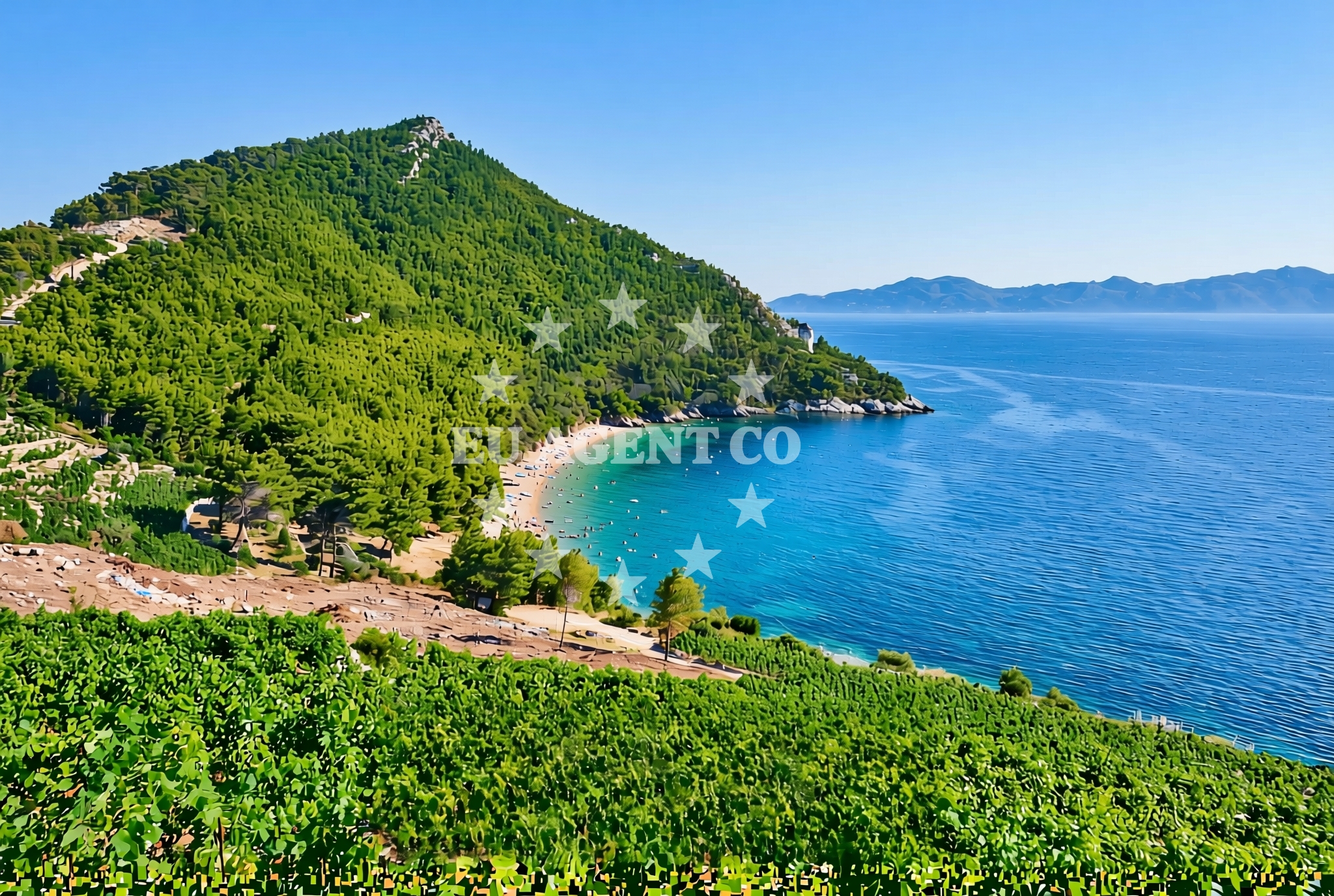
The beach's gravel and rock composition defines its profile, creating a terrain that is more suited to walking or casual exploration than swimming. The 350-meter length allows for a varied experience along its shoreline, with sections of exposed rock and areas where gravel gives way to flatter ground. Natural shade is a notable feature, likely provided by coastal vegetation or topographical formations. This characteristic makes the beach a potential spot for visitors seeking partial sun protection during peak daylight hours.Swimming and shore
Swimming conditions at Priježba, Broce Beach are influenced by its rocky and gravelly terrain. The shoreline's composition may create uneven entry points into the water, making it less ideal for swimmers compared to sandy beaches. The Adriatic Sea's currents and wave action in this area could further affect swimming comfort. However, the beach's natural features offer an opportunity to observe coastal geology and enjoy the sea from a vantage point above the waterline.Facilities and activities
The beach does not list any artificial facilities in its authoritative records. No specific activities are associated with the shoreline, though the natural environment may support passive recreation such as walking along the shore or observing coastal wildlife. The absence of structured amenities means visitors should plan accordingly, bringing their own provisions and equipment for any intended use of the beach.Access and location
Priježba, Broce Beach is situated in the settlement of Priježba, a coastal area in Croatia's Adriatic region. The beach's coordinates (42.789936°N, 17.750513°E) place it within a landscape shaped by the Mediterranean climate and historical maritime activity. While specific access details are not documented, the beach's location suggests proximity to local roads or pathways that may provide access to the shoreline. Visitors are encouraged to use available maps and local knowledge to navigate to the beach.What to expect
Visitors to Priježba, Broce Beach should anticipate a shoreline defined by gravel and rocky formations, with natural shade available in certain areas. The beach's 350-meter length offers a range of perspectives along the Adriatic coast, though its terrain may limit traditional beach activities. The lack of artificial facilities means that the experience will focus on the natural environment, making it suitable for those interested in exploring a less conventional coastal setting.Practical tips
Given the beach's gravel and rock composition, visitors may want to wear sturdy footwear for walking along the shoreline. Sun protection is recommended despite the presence of natural shade, as exposure to the sun can still be significant in open areas. Those planning to visit should check local conditions for any temporary changes to access or safety considerations.Exploring the coast by yacht
Priježba, Broce Beach is located within a region of the Adriatic coast that is popular with yacht charter guests. The surrounding waters offer opportunities for sailing, with nearby anchorages and marinas accessible to motor yachts and sailboats. While the beach itself is not a designated marina or anchorage, its proximity to the sea and the broader coastal landscape make it a potential waypoint for sailors exploring the area. Yacht charter guests may find the beach's natural setting appealing for shore excursions or as a scenic stop along a sailing itinerary.Regional Context
The Adriatic coastline near Priježba is characterized by a mix of rugged cliffs, sandy beaches, and rocky shorelines. This area has historically been a hub for maritime activity, with settlements like Priježba serving as points of interest for both residents and visitors. The broader region offers a range of sailing opportunities, with routes connecting to other coastal towns and islands in the Adriatic Sea.Anchorages in the surrounding area
- Anchorage — broce — 0.4 NM from beach
- Anchorage — broce — 0.9 NM from beach
- Anchorage — broce — 0.9 NM from beach
- Ribnja — broce — 1.6 NM from beach
- Anchorage — olipa — 1.8 NM from beach
- Anchorage — broce — 2.2 NM from beach
- Anchorage — prapratno — 3.6 NM from beach
- Anchorage — mali ston — 4.0 NM from beach
Distances are straight-line geographic distances, not sailing routes.
Mooring buoys in the surrounding area
Mooring buoys at Konoba Nico and Lukas Taverna jetties in Kobas are near Priježba, Broce Beach.
- Konoba Nico jetty — kobas — 0.9 NM from beach
- Lukas Taverna jetty — kobas — 0.9 NM from beach
- Quay — kobas — 0.9 NM from beach
- Quay — prapratno — 3.7 NM from beach
- Quay — slano — 4.4 NM from beach
Distances are straight-line geographic distances, not sailing routes.
Marine fuel stations
- Fuel station — sobra — mljet — 6.5 NM from beach
- Ina — dubrovnik — 16.5 NM from beach
- Ina — dubrovnik — 18.0 NM from beach
- Fuel station — ploce — 21.0 NM from beach
Distances are straight-line geographic distances, not sailing routes.
Harbours in the surrounding area
Harbors such as Doli and Prapranto Ferry Harbour in Prapratno are situated near Priježba, Broce Beach.
- Doli — 2.2 NM from beach
- Prapranto Ferry Harbour — prapratno — 3.4 NM from beach
- Ston — 3.5 NM from beach
- Mali Ston — 4.0 NM from beach
- Hodilje — 4.9 NM from beach
- Okuklje — mljet — 5.2 NM from beach
Distances are straight-line geographic distances, not sailing routes.
Marinas in the surrounding area
- ACI Marina Slano — 6.1 NM from beach
- Marina Frapa Dubrovnik — 16.6 NM from beach
- ACI Marina Dubrovnik — 18.0 NM from beach
- Marina Lumbarda — korcula — 26.7 NM from beach
- ACI Marina Korčula — korcula — 28.8 NM from beach
Distances are straight-line geographic distances, not sailing routes.
Restaurants near the beach
Restaurants such as Nico and Lukas Taverna in Kobas are close to Priježba, Broce Beach.
- Nico — kobas — 0.8 NM from beach
- Luka's Taverna — lukas taverna — kobas — 0.9 NM from beach
- Gastro Mare — kobas — 0.9 NM from beach
- Restaurant — prapratno — 3.7 NM from beach
- Bota Sare — mali ston — 4.0 NM from beach
- Restaurant — banici — 4.5 NM from beach
Distances are straight-line geographic distances, not sailing routes.
Navigation guides for the surrounding area
- Uvala Lupeska — 1.4 NM from beach
- Broce — 2.3 NM from beach
- Doli — 2.4 NM from beach
- Excursions — 3.3 NM from beach
- Mali Ston — 3.8 NM from beach
Distances are straight-line geographic distances, not sailing routes.
Yachts from nearby departure bases
Sailing yachts
- Elan 50 Impression (Timeless) — Slano ACI Marina — 6.1 NM from departure base to beach
- Oceanis 45 (Soul) — Slano ACI Marina — 6.1 NM from departure base to beach
- Elan 45 Impression (Skyfall) — Slano ACI Marina — 6.1 NM from departure base to beach
- Oceanis 45 (Mambo 1) — Slano ACI Marina — 6.1 NM from departure base to beach
- Oceanis 45 (Cancan) — Slano ACI Marina — 6.1 NM from departure base to beach
Catamarans
- Lagoon 42 (HAPPY KEY) — Slano ACI Marina — 6.1 NM from departure base to beach
- Lagoon 40 (SAILOR MOON) — Slano ACI Marina — 6.1 NM from departure base to beach
- Lagoon 450 Flybridge (MALA MARE) — Slano ACI Marina — 6.1 NM from departure base to beach
- Astrea 42 (Wave) — Slano ACI Marina — 6.1 NM from departure base to beach
- Lagoon 42 (MALA KATE I) — Slano ACI Marina — 6.1 NM from departure base to beach
Distances are straight-line geographic distances, not sailing routes.