Prihonja Zapad Beach, Vela Luka (Korčula), Croatia
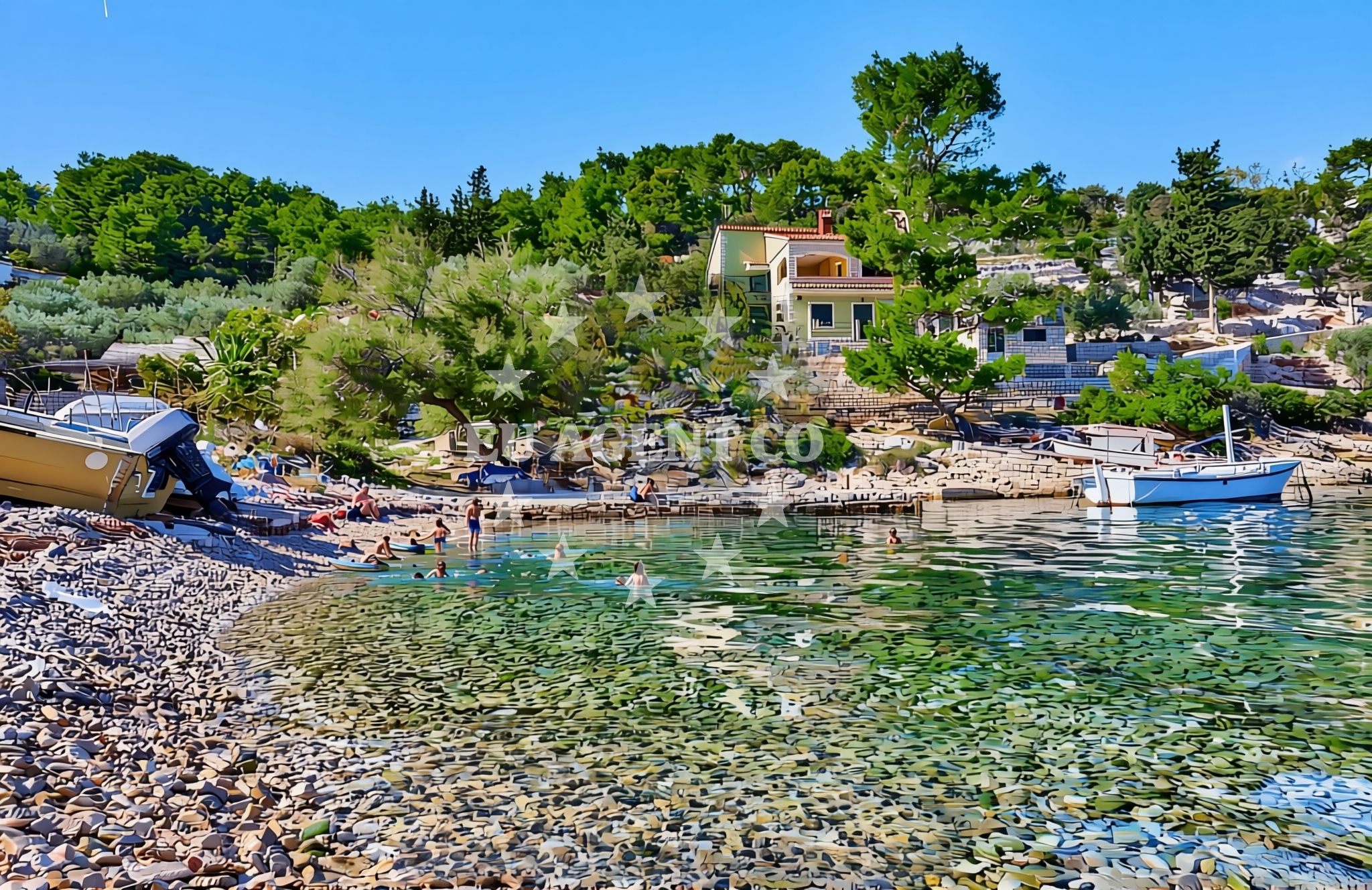
About this beach
Prihonja zapad, Vela Luka (Korčula)
Beach: Prihonja zapad
Location: Vela Luka (Korčula)
Characteristics and facilities
Gravel, concrete / stone slabs, rocks
Beach character
The beach's surface is composed of gravel, concrete slabs, and exposed rock formations, reflecting its function as a transitional zone between the town's infrastructure and the open sea. These features make it less suited for sunbathing but ideal for those seeking a rugged coastline experience. The beach's orientation toward the open waters of the Adriatic offers unobstructed views of the horizon, particularly during low tide when parts of the rocky shoreline are revealed. The lack of sand means visitors should expect a more utilitarian beach experience, though the area's proximity to Vela Luka's amenities compensates for this.Swimming and shore
Swimming conditions at Prihonja Zapad are influenced by its rocky terrain. While the beach itself lacks designated swimming areas, the adjacent waters of Vela Luka's harbor are generally calm and suitable for swimming during the summer months. The rocky shore may limit direct access to the water for some visitors, but the beach's position near the town's main harbor ensures easy access to alternative swimming locations within Vela Luka. The Adriatic's typical transparency and moderate temperatures make it a reliable environment for water activities in this region.Facilities and activities
There are no official facilities directly on Prihonja Zapad Beach. However, its proximity to Vela Luka means visitors can access the town's services, including restaurants, shops, and marinas. The beach itself does not host organized activities, but its location near the harbor makes it a convenient starting point for exploring Korčula's maritime heritage. The surrounding area offers opportunities for walking along the coastline and observing local fishing boats operating in the harbor.Access and location
Prihonja Zapad Beach is accessible via the main road leading into Vela Luka, with parking options available in the town center. The beach's position within Vela Luka—a key port on Korčula Island—connects it to the broader Adriatic sailing network. Yacht charter guests arriving at Vela Luka's marinas can easily reach the beach as part of their exploration of the town and island. The beach's proximity to the harbor also makes it a practical location for those seeking to combine land-based activities with maritime excursions.What to expect
Visitors to Prihonja Zapad should prepare for a beach experience centered on its natural rocky and gravelly terrain rather than traditional amenities. The area is best suited for those interested in the raw coastal landscape and its connection to Vela Luka's maritime character. The beach's position near the harbor ensures access to the town's services, though it lacks direct facilities such as showers or seating. The Adriatic's typical summer conditions—warm temperatures and clear waters—make it a reliable environment for casual coastal visits.Practical tips
Wear sturdy footwear to navigate the gravel and rocky sections of the beach. The area is ideal for short walks along the shoreline but may not be comfortable for prolonged sunbathing. Check tide times to avoid restricted access during high water. The nearest amenities, including cafes and restrooms, are located in Vela Luka's town center, a short walk from the beach.Exploring the coast by yacht
As part of Vela Luka's harbor area, Prihonja Zapad Beach is within easy reach of the yacht charter marinas that serve Korčula and the broader Adriatic. Charter guests arriving at Vela Luka's facilities can use this beach as a convenient vantage point for observing the town's maritime activity. The surrounding waters are part of the Adriatic's popular sailing routes, with Korčula serving as a gateway to the islands of Hvar, Brac, and the Pelješac Peninsula. For yacht charter inquiries, visit the Euro-Agent Yacht Search page to explore availability in this region.Historical Context of Vela Luka
Vela Luka, where Prihonja Zapad Beach is located, has long been a hub for maritime trade and fishing. The town's harbor, dating back to the 15th century, played a key role in the Venetian Republic's control of the Adriatic. Today, it remains a vital port for both commercial and leisure vessels, reflecting its enduring connection to the sea.Anchorages in the surrounding area
Anchorages in Vela Luka and Proizd offer nearby mooring options for vessels.
- Gradina — vela luka — korcula — 1.3 NM from beach
- Anchorage — vela luka — korcula — 2.9 NM from beach
- Proizd — 3.5 NM from beach
- Anchorage — vela luka — korcula — 3.8 NM from beach
- Anchorage — vela luka — korcula — 3.8 NM from beach
- Anchorage — vela luka — korcula — 3.8 NM from beach
- Anchorage — korcula — 4.0 NM from beach
- Anchorage — vela luka — korcula — 4.5 NM from beach
Distances are straight-line geographic distances, not sailing routes.
Mooring buoys in the surrounding area
- Gradina buoy field — vela luka — korcula — 1.3 NM from beach
- Buoy field — vela luka — korcula — 1.7 NM from beach
- Jetty — proizd — 3.4 NM from beach
- Jetty — vela luka — korcula — 3.7 NM from beach
- Quay — vela luka — korcula — 5.9 NM from beach
Distances are straight-line geographic distances, not sailing routes.
Marine fuel stations
Marine fuel stations in Vela Luka and nearby areas ensure refueling convenience for boaters.
- Ina — vela luka — korcula — 1.7 NM from beach
- Ina — vrboska — hvar — 11.6 NM from beach
- Fuel station — hvar — 15.5 NM from beach
- Ina — ubli — lastovo — 15.6 NM from beach
Distances are straight-line geographic distances, not sailing routes.
Harbours in the surrounding area
- Vela Luka — korcula — 1.7 NM from beach
- Prigradica — korcula — 5.1 NM from beach
- Brna — korcula — 8.7 NM from beach
- Marina Bilo Idro — sveta nedjelja — hvar — 10.1 NM from beach
- Port Jelsa — hvar — 10.5 NM from beach
- Zavalatica — korcula — 11.4 NM from beach
Distances are straight-line geographic distances, not sailing routes.
Marinas in the surrounding area
- Marina Korkyra — vela luka — korcula — 1.8 NM from beach
- ACI Marina Vrboska — hvar — 11.6 NM from beach
- Marina Solitudo — lastovo — 14.4 NM from beach
- ACI Marina Palmižana — aci marina palmizana — st klement — 16.9 NM from beach
- ACI Marina Korčula — korcula — 19.4 NM from beach
Distances are straight-line geographic distances, not sailing routes.
Restaurants near the beach
- Restaurant Šiloko — vela luka — korcula — 1.2 NM from beach
- Konoba Gulin — vela luka — korcula — 1.3 NM from beach
- Restoran More — vela luka — korcula — 1.6 NM from beach
- Pizzeria Alfa — vela luka — korcula — 1.6 NM from beach
- Konoba Skalinada — vela luka — korcula — 1.7 NM from beach
- Pod Bore — vela luka — korcula — 1.7 NM from beach
- Restaurant Luky — vela luka — korcula — 1.7 NM from beach
Distances are straight-line geographic distances, not sailing routes.
Navigation guides for the surrounding area
Navigation guides for Uvala Prihonja and surrounding areas assist with local waterway planning.
- Uvala Prihonja — 0.3 NM from beach
- Uvala Sveti Ivan (Uvala Gradina) — 1.2 NM from beach
- Uvala Poplat — 2.8 NM from beach
- Uvala Tri Luke — 3.9 NM from beach
- Luka Karbuni — 4.9 NM from beach
Distances are straight-line geographic distances, not sailing routes.
Yachts from nearby departure bases
Sailing yachts
- Bavaria 40 Cruiser (LADY BUTTERFLY) — Tučepi Port — 22.9 NM from departure base to beach
- Hanse 505 (AVALON) — Milna Marina Vlaška — 23.4 NM from departure base to beach
- Hanse 455 (AURUM 1) — Milna Marina Vlaška — 23.4 NM from departure base to beach
- Hanse 388 (BANJO) — Milna Marina Vlaška — 23.4 NM from departure base to beach
- Bavaria 46 Cruiser (MO) — Milna Marina Vlaška — 23.4 NM from departure base to beach
Motor yachts
- Princess V53 (Chablis) — Makarska Port — 23.1 NM from departure base to beach
Motor boats
- Jeanneau NC 37 (Black Pearl) — Makarska Port — 23.1 NM from departure base to beach
- Galeon 430 Skydeck (Bellagio) — Makarska Port — 23.1 NM from departure base to beach
- Jeanneau NC 37 (Black Pearl) — Makarska Port — 23.1 NM from departure base to beach
- Galeon 430 Skydeck (BELLAGIO) — Makarska Port — 23.1 NM from departure base to beach
Distances are straight-line geographic distances, not sailing routes.