Prihonja istok, Vela Luka (Korčula) Beach, Croatia
About this beach
Prihonja istok, Vela Luka (Korčula)
Beach: Prihonja istok
Location: Vela Luka (Korčula)
Characteristics and facilities
Gravel, concrete / stone slabs
Beach character
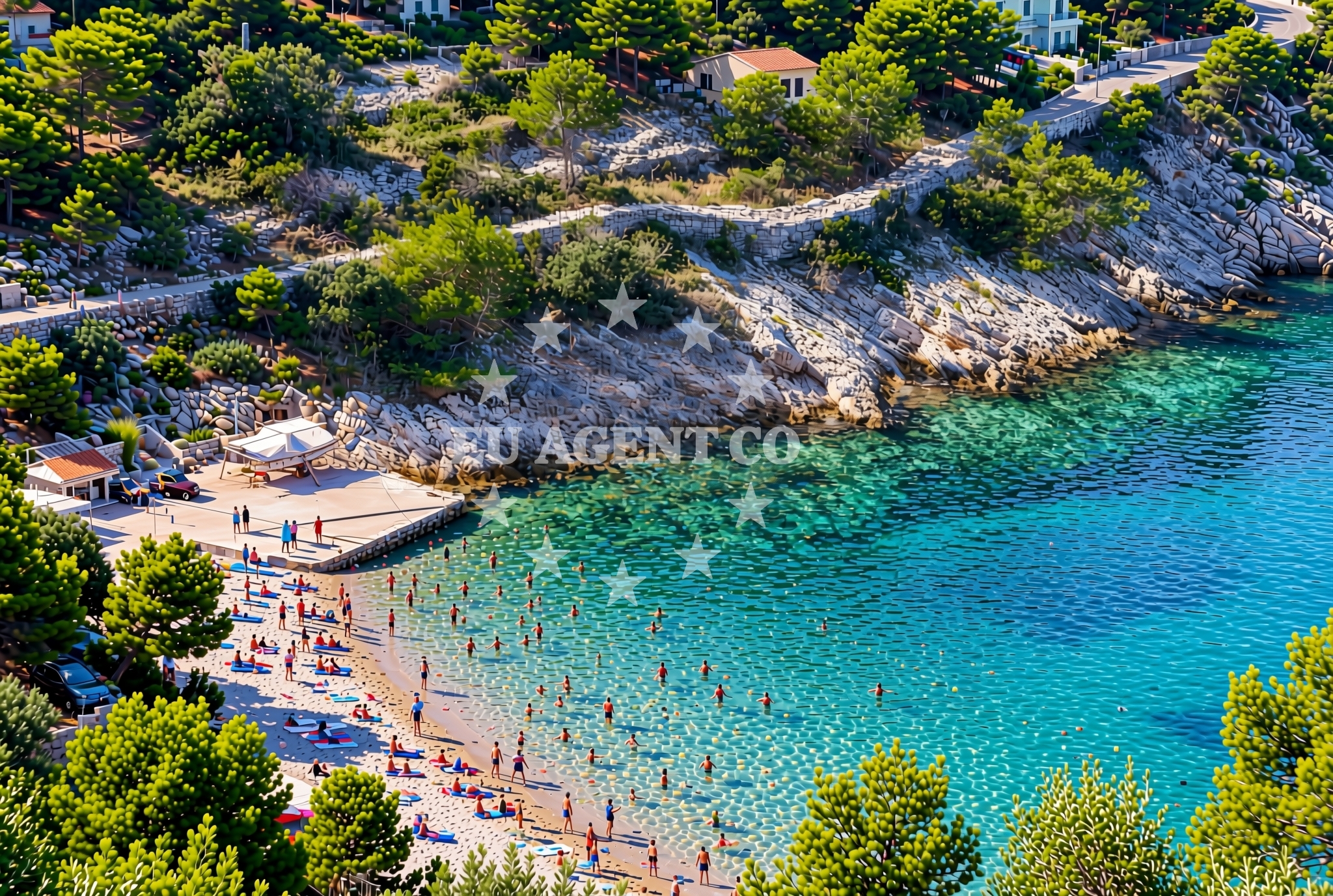
The beach’s primary feature is its gravel and stone composition, which extends along the shoreline in irregular patterns. This surface is firm underfoot, making it suitable for walking but less ideal for sunbathing. The lack of sand means it’s not a typical beach for swimming, though the adjacent waters of the Adriatic are known for their clarity and mild temperatures during the summer months. The area is relatively undeveloped, with no permanent structures or facilities directly on the beach itself.Swimming and shore
Swimming is possible from the beach, though the gravelly shore makes it less convenient for entering the water. The Adriatic’s currents here are generally gentle, and the sea floor slopes gradually offshore. The shore’s rocky sections may offer sheltered coves further along the coastline, which could be worth exploring for more secluded swimming spots. However, the beach itself is not marked as a primary swimming destination in local guides.Facilities and activities
There are no permanent facilities directly on the beach, such as showers, restrooms, or umbrellas. The area is best suited for short walks along the shore or as a transit point for those accessing nearby parts of Vela Luka. The gravel surface may appeal to hikers or those seeking a more rugged coastal experience. No structured activities are listed for the beach itself, though the surrounding region of Korčula offers opportunities for cycling, boat tours, and exploring the island’s historic sites.Access and location
Prihonja istok is located within Vela Luka, a major port on Korčula’s southern coast. The beach is accessible via local roads leading from the town center, with parking options available in nearby lots. Vela Luka itself is a hub for yacht charter operations, with marinas and boat rental services catering to visitors. The beach’s position near the harbor makes it a logical stop for those arriving by sea, though it is not a designated anchorage or docking point.What to expect
Visitors should expect a beach defined by its gravel and stone surfaces, which provide a firm walking path along the shore. The area lacks traditional beach amenities, making it more suitable for casual exploration than extended stays. The adjacent waters are generally safe for swimming, though the lack of sandy access points may deter some visitors. The beach’s proximity to Vela Luka’s marina and the island’s cultural sites means it is often used as a starting point for further exploration of Korčula’s coastline.Practical tips
Wear sturdy footwear for walking on the gravel and stone surfaces. The beach is not ideal for sunbathing but works well for short walks. Check local guides for nearby coves that may offer more secluded swimming opportunities. Those arriving by yacht may find the beach useful as a reference point for navigating Vela Luka’s harbor.Exploring the coast by yacht
For yacht charter guests, Prihonja istok’s location near Vela Luka’s marina offers convenient access to the broader Korčula coastline. The Adriatic’s sheltered waters around the island make it a popular sailing destination, with routes extending to nearby islands like Hvar and Brač. Charter yachts often use Vela Luka as a base for exploring the region, and the beach’s proximity to the harbor may serve as a landmark for navigation. However, the beach itself is not marked as an anchorage or docking area in maritime charts.Korčula’s Coastal Setting
Korčula, often referred to as the ‘Island of Hundred Windows,’ is renowned for its medieval architecture, vineyards, and clear waters. The island’s coastline is a mix of pebbly beaches, limestone cliffs, and sheltered bays, reflecting the Adriatic’s diverse geography. Vela Luka, as the island’s main port, is a gateway to these landscapes, with its marina serving as a hub for both local and international yacht charter operations.Anchorages in the surrounding area
Anchorages near Vela Luka, Korčula include Gradina and Proizd, offering nearby options for mooring.
- Gradina — vela luka — korcula — 1.4 NM from beach
- Anchorage — vela luka — korcula — 3.0 NM from beach
- Proizd — 3.7 NM from beach
- Anchorage — vela luka — korcula — 3.9 NM from beach
- Anchorage — vela luka — korcula — 3.9 NM from beach
- Anchorage — vela luka — korcula — 3.9 NM from beach
- Anchorage — korcula — 4.0 NM from beach
- Anchorage — vela luka — korcula — 4.5 NM from beach
Distances are straight-line geographic distances, not sailing routes.
Mooring buoys in the surrounding area
- Gradina buoy field — vela luka — korcula — 1.4 NM from beach
- Buoy field — vela luka — korcula — 1.7 NM from beach
- Jetty — proizd — 3.6 NM from beach
- Jetty — vela luka — korcula — 3.8 NM from beach
- Quay — vela luka — korcula — 5.8 NM from beach
Distances are straight-line geographic distances, not sailing routes.
Marine fuel stations
The Ina fuel station in Vela Luka, Korčula is the closest marine fuel option to the beach.
- Ina — vela luka — korcula — 1.7 NM from beach
- Ina — vrboska — hvar — 11.6 NM from beach
- Ina — ubli — lastovo — 15.6 NM from beach
- Fuel station — hvar — 15.6 NM from beach
Distances are straight-line geographic distances, not sailing routes.
Harbours in the surrounding area
Harbors like Vela Luka, Korčula and Prigradica, Korčula are within short distances of the beach.
- Vela Luka — korcula — 1.6 NM from beach
- Prigradica — korcula — 5.0 NM from beach
- Brna — korcula — 8.5 NM from beach
- Marina Bilo Idro — sveta nedjelja — hvar — 10.1 NM from beach
- Port Jelsa — hvar — 10.5 NM from beach
- Zavalatica — korcula — 11.2 NM from beach
Distances are straight-line geographic distances, not sailing routes.
Marinas in the surrounding area
Marina Korkyra in Vela Luka, Korčula is the nearest marina to the beach.
- Marina Korkyra — vela luka — korcula — 1.7 NM from beach
- ACI Marina Vrboska — hvar — 11.6 NM from beach
- Marina Solitudo — lastovo — 14.4 NM from beach
- ACI Marina Palmižana — aci marina palmizana — st klement — 17.1 NM from beach
- ACI Marina Korčula — korcula — 19.2 NM from beach
Distances are straight-line geographic distances, not sailing routes.
Restaurants near the beach
Restaurants such as Šiloko and Konoba Gulin in Vela Luka, Korčula are located near the beach.
- Restaurant Šiloko — vela luka — korcula — 1.3 NM from beach
- Konoba Gulin — vela luka — korcula — 1.4 NM from beach
- Restoran More — vela luka — korcula — 1.5 NM from beach
- Pizzeria Alfa — vela luka — korcula — 1.5 NM from beach
- Konoba Skalinada — vela luka — korcula — 1.6 NM from beach
- Pod Bore — vela luka — korcula — 1.6 NM from beach
- Konoba Ribar — vela luka — korcula — 1.7 NM from beach
Distances are straight-line geographic distances, not sailing routes.
Navigation guides for the surrounding area
Navigation guides for Uvala Prihonja and nearby bays assist with local waterway planning.
- Uvala Prihonja — 0.1 NM from beach
- Uvala Sveti Ivan (Uvala Gradina) — 1.4 NM from beach
- Uvala Poplat — 2.9 NM from beach
- Uvala Tri Luke — 3.9 NM from beach
- Luka Karbuni — 4.8 NM from beach
Distances are straight-line geographic distances, not sailing routes.
Yachts from nearby departure bases
Yachts based in Tučepi Port and Makarska Port operate within reach of Vela Luka, Korčula.
Sailing yachts
- Bavaria 40 Cruiser (LADY BUTTERFLY) — Tučepi Port — 22.8 NM from departure base to beach
- Hanse 388 (BANJO) — Milna Marina Vlaška — 23.5 NM from departure base to beach
- Hanse 505 (AVALON) — Milna Marina Vlaška — 23.5 NM from departure base to beach
- Hanse 455 (AURUM 1) — Milna Marina Vlaška — 23.5 NM from departure base to beach
- Bavaria 46 Cruiser (MO) — Milna Marina Vlaška — 23.5 NM from departure base to beach
Motor yachts
- Princess V53 (Chablis) — Makarska Port — 23.0 NM from departure base to beach
Motor boats
- Jeanneau NC 37 (Black Pearl) — Makarska Port — 23.0 NM from departure base to beach
- Galeon 430 Skydeck (Bellagio) — Makarska Port — 23.0 NM from departure base to beach
- Galeon 430 Skydeck (BELLAGIO) — Makarska Port — 23.0 NM from departure base to beach
- Jeanneau NC 37 (Black Pearl) — Makarska Port — 23.0 NM from departure base to beach
Distances are straight-line geographic distances, not sailing routes.