Prezida Gornja, Vir (Vir) Beach, Croatia
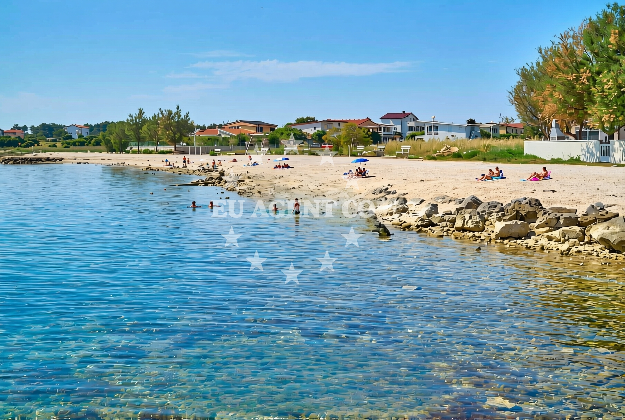
Prezida Gornja Beach is located on the island of Vir, part of Croatia's Kvarner Gulf region. This 180-meter stretch of shoreline features a mix of gravel, concrete slabs, and rocky terrain, making it a unique spot for visitors seeking a less conventional beach experience. The beach includes a children's playground, adding to its appeal for families. While not a traditional sandy beach, its proximity to Vir's historic settlements and the broader Adriatic sailing routes makes it a point of interest for both land and sea travelers.
About this beach
Prezida gornja, Vir (Vir)
Beach: Prezida gornja
Location: Vir (Vir)
Characteristics and facilities
Gravel, concrete / stone slabs, rocks
180 m
Children's playground
Beach character
The beach's surface consists of gravel, concrete slabs, and natural rock formations, creating a rugged yet accessible shoreline. This composition may make it less suitable for swimming but offers opportunities for walking, exploring tidal pools, or enjoying panoramic views of the Kvarner Gulf. The presence of a children's playground suggests a focus on family-friendly activities, though the rocky terrain may require caution for younger visitors. The beach's length of 180 meters provides enough space for small groups to spread out, though it is not extensive by coastal standards.
Swimming and shore
Swimming is not the primary activity at Prezida Gornja due to the rocky and gravelly shoreline. The water's depth and conditions near the beach are not specified in the catalog, but the rocky terrain suggests that the area may be more suitable for snorkeling or exploring intertidal zones. The shore itself is characterized by its natural rock formations and concrete slabs, which could be used for picnicking or as a vantage point to observe passing boats in the Kvarner Gulf.
Facilities and activities
The beach's only explicitly mentioned facility is a children's playground, indicating a focus on family-oriented recreation. Beyond this, the catalog does not list additional amenities such as showers, restrooms, or parking. Activities appear limited to walking along the rocky shoreline, using the playground, and potentially exploring nearby coastal trails. The absence of structured amenities means visitors should plan accordingly, bringing necessary supplies for a self-sufficient visit.
Access and location
Prezida Gornja Beach is situated on the island of Vir, a small yet historically significant island in Croatia's Kvarner Gulf. Vir is part of the larger Cres-Lošinj archipelago, known for its clear waters and proximity to the Istrian Peninsula. The beach's location near Vir's settlements offers easy access to local cultural sites, while its position in the Kvarner Gulf connects it to broader Adriatic sailing routes. Visitors arriving by land would likely find the beach accessible via local roads, though specific parking details are not provided in the catalog.
What to expect
Visitors to Prezida Gornja should expect a beach defined by its rocky and gravelly terrain rather than soft sand. The 180-meter shoreline includes a children's playground, making it a viable option for families seeking outdoor activities. The beach's natural rock formations may provide opportunities for exploration, though swimming is not the primary activity. Its location on the island of Vir places it within reach of the Kvarner Gulf's sailing routes, potentially offering scenic views for those traveling by boat.
Practical tips
Due to the beach's rocky surface, visitors are advised to wear sturdy footwear for comfort and safety. The children's playground suggests that families may want to bring along toys or picnic supplies for extended stays. As no specific amenities are listed, visitors should consider bringing water, snacks, and sunscreen for a self-sufficient experience.
Exploring the coast by yacht
The Kvarner Gulf, where Vir is located, is a well-known sailing destination in the Adriatic Sea. Yacht charter guests exploring this region may find Prezida Gornja Beach a convenient stop for a brief shore excursion, particularly given its proximity to Vir's settlements and the surrounding waters. While the beach itself is not a marina or anchorage, its location offers access to the broader sailing network of the Kvarner Gulf, which includes popular routes to islands like Cres, Lošinj, and the Istrian coast. Charter yachts navigating this area may use nearby marinas in Vir or the surrounding islands for refueling or overnight stays.
Historical and Cultural Context of Vir
The island of Vir has a rich history dating back to ancient times, with evidence of Roman settlements and medieval fortifications. Today, it is a quiet island known for its vineyards and connection to the famous wine region of the Kvarner Gulf. Visitors to Prezida Gornja may also be interested in exploring Vir's historic sites, such as the Church of St. Nicholas and the remnants of the Šćepan Polje fortress.
Anchorages in the surrounding area
Anchorages in the surrounding area include several in Vir and nearby locations.
- Anchorage — vir — 0.4 NM from beach
- Anchorage — vir — 1.5 NM from beach
- Anchorage — vir — 1.7 NM from beach
- Anchorage — privlaka — 1.7 NM from beach
- Anchorage — vir — 1.9 NM from beach
- Anchorage — povljana — pag — 2.2 NM from beach
- Anchorage — privlaka — 2.8 NM from beach
- Anchorage — povljana — pag — 2.9 NM from beach
Distances are straight-line geographic distances, not sailing routes.
Mooring buoys in the surrounding area
Mooring buoys in the surrounding area are located in Vir, Punta Skala, and other nearby spots.
- Vir — 1.7 NM from beach
- Punta Skala — petrcane — 6.1 NM from beach
- Jetty — ljubac — 7.6 NM from beach
- Jetty — ugljan — 9.4 NM from beach
- Buoy field — muline — ugljan — 9.4 NM from beach
Distances are straight-line geographic distances, not sailing routes.
Marine fuel stations
- Ina — zadar — 11.5 NM from beach
- Ina — preko — ugljan — 13.3 NM from beach
- Fuel station — sukosan — 16.3 NM from beach
- Ina — zaglav — dugi otok — 20.6 NM from beach
Distances are straight-line geographic distances, not sailing routes.
Harbours in the surrounding area
Harbours in the surrounding area include Privlaka, Povljana, and Nin.
- Privlaka — 1.7 NM from beach
- Povljana — pag — 3.2 NM from beach
- Nin — 3.8 NM from beach
- Mulo — nin — 4.3 NM from beach
- Miškovići — miskovici — pag — 5.2 NM from beach
- Košljun — kosljun pag — 6.4 NM from beach
Distances are straight-line geographic distances, not sailing routes.
Marinas in the surrounding area
Marinas in the surrounding area are located in Zadar, Ugljan, and Pag.
- Marina Borik — zadar — 10.5 NM from beach
- Vitrenjak Zadar — 10.7 NM from beach
- Marina Zadar — 11.4 NM from beach
- Olive Island Marina — sutomiscica — ugljan — 12.0 NM from beach
- ACI Marina Šimuni — simuni — pag — 12.9 NM from beach
Distances are straight-line geographic distances, not sailing routes.
Restaurants near the beach
Restaurants near the beach include options in Vir and nearby Povljana.
- Restaurant — vir — 0.2 NM from beach
- Grill Marion — vir — 0.8 NM from beach
- Restaurant — vir — 1.3 NM from beach
- Monica — vir — 1.6 NM from beach
- Viranka — 1.7 NM from beach
- Restaurant — vir — 1.7 NM from beach
- Mornar — povljana — pag — 3.2 NM from beach
Distances are straight-line geographic distances, not sailing routes.
Navigation guides for the surrounding area
Navigation guides for the surrounding area include Otok Pag, Privlaka, and other nearby locations.
- OTOK PAG — 1.4 NM from beach
- Privlaka — 1.7 NM from beach
- KrusCica and Uvala KrusCica Duboka — 9.1 NM from beach
- Muline — 9.4 NM from beach
- Ugljan — 9.8 NM from beach
Distances are straight-line geographic distances, not sailing routes.
Yachts from nearby departure bases
Yachts from nearby departure bases include Povljana Marina, Zadar Diklo Port, and Pag City Port.
Sailing yachts
- Oceanis 46.1 (Antonela M.) — Zadar Marina Borik — 10.5 NM from departure base to beach
- Oceanis 46.1 (Sevid) — Zadar Marina Borik — 10.5 NM from departure base to beach
Catamarans
- Sunreef 60 (SINATA) — Zadar Marina Borik — 10.5 NM from departure base to beach
Motor yachts
- Prestige 460 (ADUDU 2) — Zadar Marina Borik — 10.5 NM from departure base to beach
Motor boats
- Merry Fisher 895 — Povljana Marina — 3.4 NM from departure base to beach
- Rancraft RS Cinque.5 — Zadar Diklo Port — 9.2 NM from departure base to beach
- Rancraft RM21 (Dugi otok) — Zadar Diklo Port — 9.2 NM from departure base to beach
- Rancraft RM19 (Daycruiser) — Zadar Diklo Port — 9.2 NM from departure base to beach
- BWA Sport 22GT (BWA ) — Pag City Port — 9.6 NM from departure base to beach
- Merry Fisher 895 (Miami Vice) — Zadar Marina Borik — 10.5 NM from departure base to beach
Distances are straight-line geographic distances, not sailing routes.