Posedarje istok 2, Posedarje Beach, Croatia
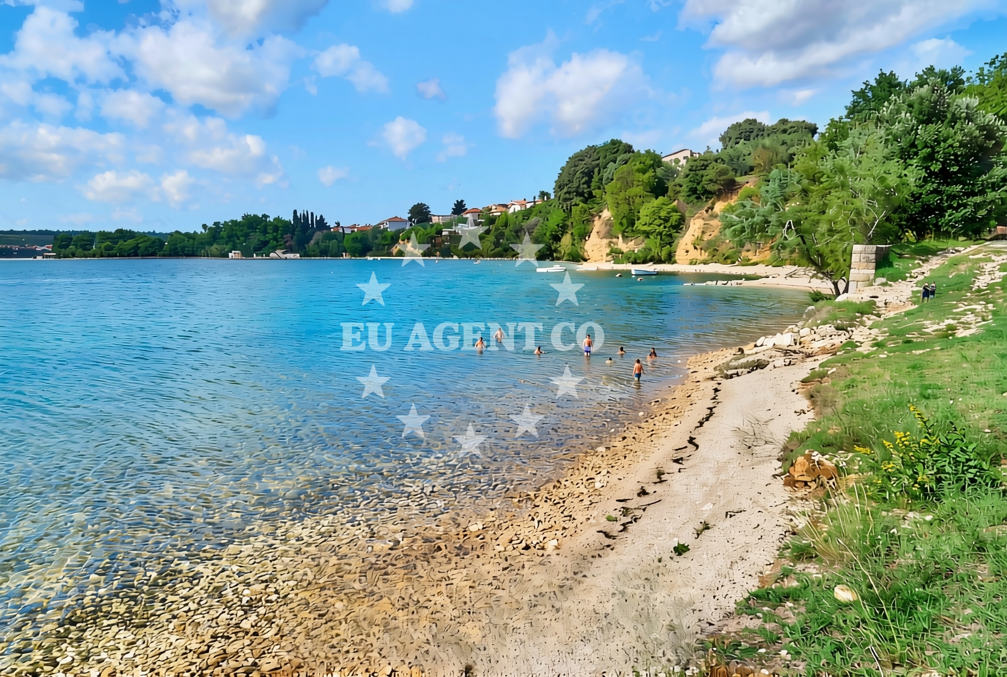
About this beach
Posedarje istok 2, Posedarje
Beach: Posedarje istok 2
Location: Posedarje
Characteristics and facilities
Gravel
100 m
Beach character
The beach is composed primarily of gravel, which defines its texture and accessibility. This composition suggests a natural, minimally developed shoreline, typical of many coastal areas in the Brač region. The 100-meter length provides a modest stretch of shoreline, suitable for those seeking a quiet, less crowded environment. The absence of detailed facilities in the catalog indicates that this beach may cater more to visitors looking for a basic, unspoiled coastal setting rather than a fully equipped recreational area.Swimming and shore
Swimming conditions at Posedarje istok 2 are likely influenced by the gravel substrate, which may make the shoreline less ideal for wading or extended water activities. The shore itself is characterized by the gravel mentioned in the catalog, with no additional features described. Visitors should consider the natural topography when planning activities, as the beach does not appear to include amenities such as docks, platforms, or designated swimming zones.Facilities and activities
The catalog does not list specific facilities or activities associated with Posedarje istok 2. This suggests that the beach may not have developed infrastructure such as showers, restrooms, or shaded seating areas. However, the surrounding area of Posedarje, a village on Brač, may offer nearby services or points of interest that complement a visit to the beach.Access and location
Posedarje istok 2 is located in the village of Posedarje, which lies on the eastern coast of Brač, one of the largest islands in the Adriatic Sea. The beach’s proximity to the mainland and other parts of Brač may influence accessibility, though specific road or maritime routes are not detailed in the catalog. Visitors can use the coordinates (44.211733° N, 15.491067° E) to locate the beach on maps or through local navigation systems.What to expect
Posedarje istok 2 is a gravel beach with a 100-meter stretch, offering a natural shoreline without developed facilities. The area is likely to appeal to visitors seeking a quiet, unspoiled coastal experience. While the catalog does not specify amenities, the surrounding village of Posedarje may provide nearby services or points of interest. The beach’s characteristics align with the rugged, minimally developed coastline typical of parts of Brač and the broader Dalmatian region.Practical tips
Given the gravel composition of the beach, visitors may wish to wear appropriate footwear for walking along the shore. As no facilities are listed, it is advisable to bring personal items such as water, sunscreen, and any necessary equipment for activities. The beach’s location in Posedarje, a village on Brač, may offer additional context for planning a visit, though specific local guidance is not provided in the catalog.Exploring the coast by yacht
The Dalmatian coast, where Posedarje istok 2 is located, is a well-known sailing region in the Adriatic Sea. Yacht charter guests exploring the area may find nearby anchorages or marinas in Posedarje or along the Brač coastline. The surrounding waters are part of a larger network of sailing routes that connect to other islands and coastal towns in the region, offering opportunities for exploration and relaxation.Regional Context and Nearby Attractions
Posedarje is a village on the island of Brač, which is part of the Split-Dalmatia County in Croatia. The island is renowned for its limestone landscapes, olive groves, and historic sites such as the Ston Town and the Škrip Fortress. Visitors to Posedarje may also consider exploring nearby areas of Brač, including the famous Zlatni Rat beach on the island’s western coast. The village itself is a small settlement with a traditional character, reflecting the cultural heritage of the region.Anchorages in the surrounding area
Anchorages near Posedarje Beach include Vinjerac, Maslenica, and Novigrad, offering nearby mooring options.
- Anchorage — vinjerac — 3.0 NM from beach
- Anchorage — maslenica — 3.5 NM from beach
- Anchorage — novigrad — 5.1 NM from beach
- Anchorage — karin — 7.3 NM from beach
- Karin dock — 7.4 NM from beach
- Anchorage — ljubac — 8.7 NM from beach
- Anchorage — ljubac — 8.8 NM from beach
- Anchorage — rtina — 9.4 NM from beach
Distances are straight-line geographic distances, not sailing routes.
Mooring buoys in the surrounding area
Mooring buoys in the vicinity include Ljubac Jetty and Sibuljina Point, providing additional anchoring possibilities.
- Jetty — ljubac — 9.0 NM from beach
- Šibuljina Point — sibuljina point — 10.0 NM from beach
- Buoy field — sukosan — 12.5 NM from beach
- Buoy field — sukosan — 12.6 NM from beach
- Jetty — zadar — 12.8 NM from beach
Distances are straight-line geographic distances, not sailing routes.
Marine fuel stations
- Ina — zadar — 12.6 NM from beach
- Fuel station — sukosan — 12.7 NM from beach
- Ina — preko — ugljan — 15.2 NM from beach
- Ina — biograd na moru — 16.5 NM from beach
Distances are straight-line geographic distances, not sailing routes.
Harbours in the surrounding area
Harbours such as Maslenica and Vinjerac are located nearby, offering access to the region's maritime infrastructure.
- Maslenica — 2.2 NM from beach
- Vinjerac — 3.0 NM from beach
- Seline — 4.0 NM from beach
- Starigrad Paklenica — 5.5 NM from beach
- Ražanac — razanac — 7.6 NM from beach
- Obrovac — 8.3 NM from beach
Distances are straight-line geographic distances, not sailing routes.
Marinas in the surrounding area
- Marina Dalmacija — sukosan — 12.5 NM from beach
- Marina Zadar — 12.6 NM from beach
- Vitrenjak Zadar — 12.9 NM from beach
- Marina Borik — zadar — 13.1 NM from beach
- Kukljica — ugljan — 14.9 NM from beach
Distances are straight-line geographic distances, not sailing routes.
Restaurants near the beach
Restaurants in Seline and Starigrad Paklenica are close to the beach, offering dining options for visitors.
- Gostionica Ivan — seline — 3.8 NM from beach
- Restaurant — seline — 3.9 NM from beach
- Buffet Paklenica — starigrad paklenica — 4.8 NM from beach
- Restaurant — starigrad paklenica — 4.9 NM from beach
Distances are straight-line geographic distances, not sailing routes.
Navigation guides for the surrounding area
- Posedarje (Novigradsko More) — 0.5 NM from beach
- Starigrad-Paklenica {Velebitski Kanai) — 5.3 NM from beach
- VELESITSKI KANAL (S) — 8.4 NM from beach
- KrusCica and Uvala KrusCica Duboka — 11.0 NM from beach
- Zdrelac (Uvala Sv. Luka) — 14.9 NM from beach
Distances are straight-line geographic distances, not sailing routes.
Yachts from nearby departure bases
Sailing yachts
- Oceanis 38.1 (ARIELA ) — Sukošan Marina Dalmacija — 12.5 NM from departure base to beach
Catamarans
- Lagoon 450 Fly (LADIES&GENT) — Sukošan Marina Dalmacija — 12.5 NM from departure base to beach
Motor yachts
- Focus Power 44 (Boha) — Sukošan Marina Dalmacija — 12.5 NM from departure base to beach
Motor boats
- Merry Fisher 795 () — Novigrad Dalmatia — 3.0 NM from departure base to beach
- Merry Fisher 695 — Sukošan Brodogradilište Filipi — 12.5 NM from departure base to beach
- Elan 650 (Biokovo) — Sukošan Brodogradilište Filipi — 12.5 NM from departure base to beach
- Quicksilver Activ 555 — Sukošan Brodogradilište Filipi — 12.5 NM from departure base to beach
- Zar 57 WD — Sukošan Brodogradilište Filipi — 12.5 NM from departure base to beach
- Zar 61 Suite (Tucepi) — Sukošan Brodogradilište Filipi — 12.5 NM from departure base to beach
- Zar 65 Suite — Sukošan Brodogradilište Filipi — 12.5 NM from departure base to beach
Distances are straight-line geographic distances, not sailing routes.