Portić sjever, Kustići (Pag) Beach, Croatia
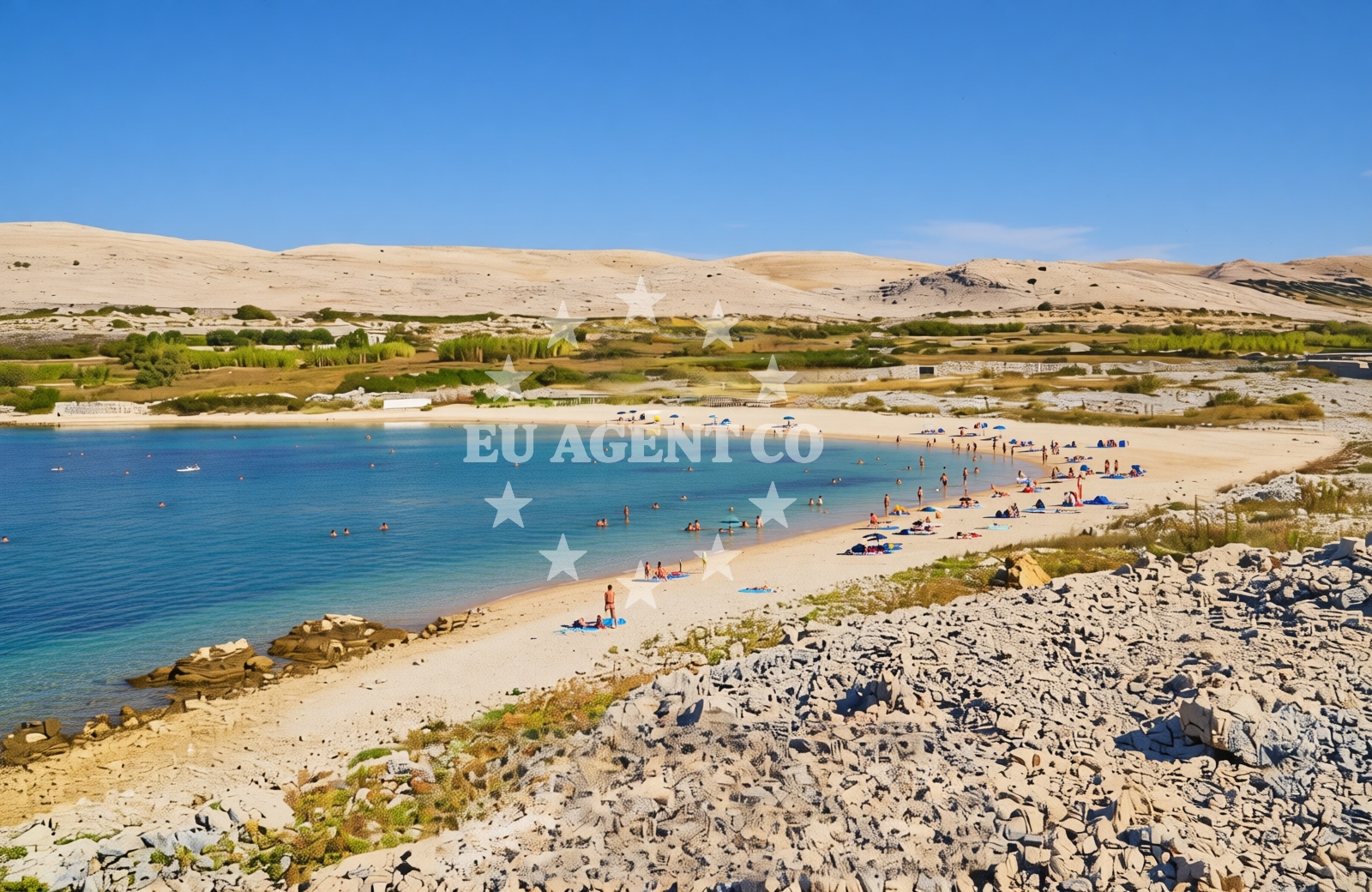
About this beach
Portić sjever, Kustići (Pag)
Beach: Portić sjever
Location: Kustići (Pag)
Characteristics and facilities
Gravel
200 m
Beach character
The beach is composed entirely of gravel, a feature that distinguishes it from the more common sandy or pebbly shores found elsewhere on Pag. This composition creates a firm, uneven surface that may be challenging for barefoot walking but provides a stable base for activities like sunbathing or picnicking. The 200-meter length offers limited space for visitors, though the surrounding landscape—characterized by low-lying terrain and sparse vegetation—provides a minimalist setting that emphasizes the raw coastal environment.Swimming and shore
Due to its gravel composition, Portić sjever is not suited for swimming or water-based activities. The shoreline's firm surface and lack of natural indentation mean it lacks the typical features of a sheltered cove or bay. However, the beach's position on the northern coast of Pag places it within sight of the open Adriatic Sea, where sailing and motorboat activity are common during the summer months.Facilities and activities
There are no official facilities or services listed for Portić sjever in the beach catalog. The absence of amenities such as parking, restrooms, or shaded seating aligns with the beach's minimalistic profile. Visitors should expect a basic, unstructured experience without infrastructure typically found at more developed coastal sites.Access and location
Access to Portić sjever is via the village of Kustići, a small settlement on Pag's northern shore. The beach lies within a short walking distance from the village, though no specific trails or pathways are documented in the catalog. Pag itself is accessible via ferry services from Zadar and other mainland ports, making it a destination for those seeking to explore the island's diverse coastline.What to expect
Visitors to Portić sjever should prepare for a beach experience defined by its gravel surface and limited amenities. The shoreline offers a quiet, unspoiled stretch of coast that contrasts with the more tourist-oriented beaches of Pag. While the lack of facilities may deter some, the beach's location provides an opportunity to observe the Adriatic's maritime activity from a vantage point away from the island's more crowded areas.Practical tips
Wear sturdy footwear to navigate the gravel surface comfortably. The beach's proximity to Kustići means visitors can combine a visit with a brief exploration of the village, which offers basic services and a glimpse into Pag's rural character.Exploring the coast by yacht
Portić sjever's position on the northern coast of Pag places it within the broader sailing region of the Adriatic. The island is a popular base for yacht charters, with nearby marinas in Zadar and nearby islands offering access to the open sea. For those interested in maritime exploration, Euro-Agent's yacht search page provides options for motor yachts and sailing boats operating in the surrounding waters.Regional Context: Pag's Coastal Landscape
Pag, the largest island in the Zadar archipelago, is known for its unique geological features, including its karst terrain and long stretches of pebble beaches. Portić sjever represents one of the island's more unconventional shorelines, contrasting with the famous Zlatni Rat in Bol. The island's northern coast, where this beach is located, is less developed than the southern side, offering a more tranquil alternative for visitors seeking to avoid crowds.Anchorages in the surrounding area
- Anchorage — novalja — pag — 1.7 NM from beach
- Anchorage — mandre — pag — 2.3 NM from beach
- Anchorage — mandre — pag — 2.6 NM from beach
- Anchorage — cesarica — 2.9 NM from beach
- Anchorage — mandre — pag — 3.0 NM from beach
- Anchorage — cesarica — 3.3 NM from beach
- Anchorage — cesarica — 3.4 NM from beach
- Straško — novalja — pag — 3.4 NM from beach
Distances are straight-line geographic distances, not sailing routes.
Mooring buoys in the surrounding area
- Jetty — zubovici — pag — 1.1 NM from beach
- Jetty — zubovici — pag — 1.3 NM from beach
- Buoy field — novalja — pag — 3.8 NM from beach
- Jetty — simuni — pag — 4.4 NM from beach
- Drljanda — stara novalja — pag — 5.5 NM from beach
Distances are straight-line geographic distances, not sailing routes.
Marine fuel stations
Marine fuel stations in Rab and Mali Losinj offer refueling options for vessels traveling to Portić sjever beach.
- Ina — rab — 15.8 NM from beach
- Ina — mali losinj — 21.1 NM from beach
- Adria Oil — mali losinj — 21.5 NM from beach
- Tifon — nerezine — losinj — 25.3 NM from beach
Distances are straight-line geographic distances, not sailing routes.
Harbours in the surrounding area
- Žigljen — zigljen — pag — 2.9 NM from beach
- Novalja — pag — 3.7 NM from beach
- Prizna — 4.1 NM from beach
- Karlobag — 5.0 NM from beach
- Stara Novalja — pag — 5.1 NM from beach
- Pag — 6.7 NM from beach
Distances are straight-line geographic distances, not sailing routes.
Marinas in the surrounding area
- ACI Marina Šimuni — simuni — pag — 3.8 NM from beach
- ACI Marina Rab — 15.8 NM from beach
- ACI Marina Supetarska Draga — rab — 18.9 NM from beach
- Y/C Marina Mali Lošinj — mali losinj — 21.2 NM from beach
- Marina Lošinj — mali losinj — 21.4 NM from beach
Distances are straight-line geographic distances, not sailing routes.
Restaurants near the beach
Restaurants in Novalja, Pag, offer dining options for visitors to Portić sjever beach.
- Margarita — novalja — pag — 3.1 NM from beach
- Restaurant — novalja — pag — 3.1 NM from beach
- Konoba Grill Matulo — novalja — pag — 3.2 NM from beach
- Restaurant — novalja — pag — 3.2 NM from beach
- Restaurant — novalja — pag — 3.2 NM from beach
- Konoba Reful — novalja — pag — 3.2 NM from beach
- La Tortilla — novalja — pag — 3.2 NM from beach
Distances are straight-line geographic distances, not sailing routes.
Navigation guides for the surrounding area
Navigation guides for Caska and Novalja assist in route planning near Portić sjever beach.
- Caska — 1.6 NM from beach
- Novalja — 3.2 NM from beach
- Uvala Prizna — 4.2 NM from beach
- Uvala Bliznica — 8.5 NM from beach
- Uvala Jakisnica — 9.9 NM from beach
Distances are straight-line geographic distances, not sailing routes.
Yachts from nearby departure bases
Sailing yachts
- First 45 (Egeria) — Šimuni Kolan ACI Marina — 3.7 NM from departure base to beach
- First 31.7 (Ruta) — Mali Lošinj — 21.2 NM from departure base to beach
- Elan 50 Impression (Vuschi) — Mali Lošinj — 21.2 NM from departure base to beach
Motor yachts
- Absolute 50 Fly (Acrobat) — Rab ACI Marina — 15.8 NM from departure base to beach
Motor boats
- Balt 818 Titanium (Valentina 2) — Novalja — 3.5 NM from departure base to beach
- Balt 818 Titanium (Valentina) — Novalja — 3.5 NM from departure base to beach
- BWA Sport 22GT (BWA ) — Pag City Port — 6.8 NM from departure base to beach
- Merry Fisher 895 — Povljana Marina — 12.8 NM from departure base to beach
- Antares 36 (Joia) — Mali Lošinj — 21.2 NM from departure base to beach
- Invictus 200FX (1255ML) — Mali Lošinj — 21.2 NM from departure base to beach
Distances are straight-line geographic distances, not sailing routes.