Poretak, Gradac Beach, Croatia
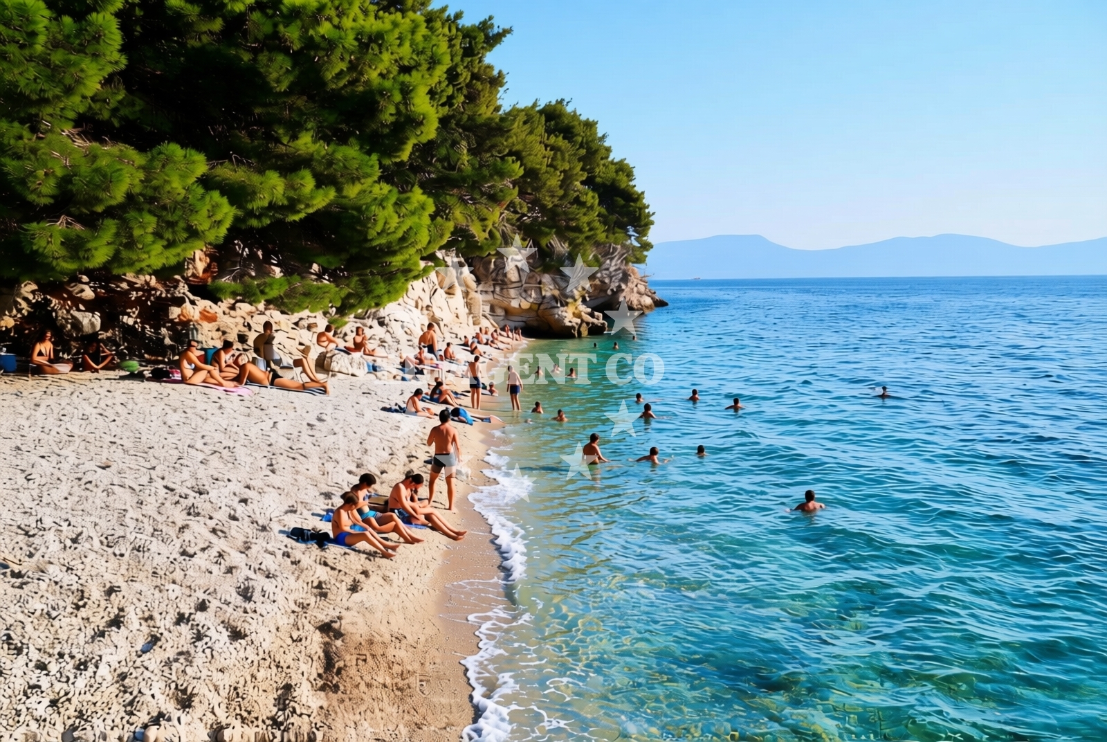
About this beach
Poretak, Gradac
Beach: Poretak
Location: Gradac
Characteristics and facilities
Gravel
80 m
Natural shade
Beach character
The beach is composed entirely of gravel, a rarity in this part of the coast. This texture defines the walking surface and may influence the experience of those accustomed to finer sands. The 80-meter length provides a modest stretch for visitors, with natural shade available from the terrain rather than artificial structures. The absence of formal amenities or infrastructure suggests a focus on raw, unaltered coastal access. The gravel composition may offer a stable surface for walking but could pose challenges for those unaccustomed to it, particularly in wet conditions.Swimming and shore
Swimming conditions at Gradac Beach are not explicitly detailed in available records. The gravel shoreline may affect water entry comfort, though the Adriatic's generally mild temperatures make summer visits viable. The shore itself is defined by its gravel composition, with no mention of underwater features, depth, or marine life in the catalog. The beach's orientation and exposure to waves are not specified, but its location in the Adriatic suggests moderate wave activity during typical sailing seasons.Facilities and activities
There are no formal facilities listed for Gradac Beach, including parking, restrooms, or changing rooms. The absence of structured amenities aligns with its characterization as a more natural, low-impact shoreline. Activities associated with the beach are not explicitly documented, though the surrounding region of Poretak offers broader coastal and maritime opportunities. The beach itself appears to be a passive space for observation rather than a hub for organized recreation.Access and location
Gradac Beach is located within the town of Poretak, a coastal settlement on the island of Brač in Croatia. Its coordinates (43.092309, 17.351702) place it along the southern Adriatic, near the popular sailing routes connecting Brač to the mainland and other Dalmatian islands. The beach's proximity to Poretak's main settlement suggests accessibility via local roads, though specific transport details are not provided in the catalog. The region's well-developed infrastructure for yacht charter and sailing tourism implies that visitors arriving by boat may find nearby anchorages or marinas within reasonable reach.What to expect
Visitors to Poretak, Gradac Beach should anticipate a gravel shoreline with limited formal amenities. The beach's 80-meter length and natural shade offer a simple, unaltered coastal setting. Its location in Poretak, a hub for Adriatic sailing, suggests potential for nearby maritime exploration. The absence of structured facilities means visitors should prepare for a more rustic experience, with no expectation of services such as parking, showers, or餐饮 options directly on-site.Practical tips
The gravel surface may require sturdy footwear for comfortable traversal. Visitors should be prepared for a natural, minimally developed shoreline without artificial amenities. Those planning to combine a beach visit with yacht charter activities may find nearby marinas or anchorages in the Poretak area useful for boat access.Exploring the coast by yacht
The Adriatic coast around Poretak is a popular region for yacht charter, with well-established routes connecting Brač to the mainland and other Dalmatian islands. While Gradac Beach itself is not a formal anchorage, its location near Poretak suggests proximity to marinas and sailing infrastructure. Charter guests exploring the area may find opportunities for coastal cruising, anchoring in nearby bays, or visiting Poretak's harbor for supplies and amenities.Regional Context and Sailing Opportunities
The broader Poretak area is part of Brač's coastal network, a key location for Adriatic sailing. Yacht charter guests often use Poretak as a base for exploring the island's eastern coast, the nearby mainland, and other Dalmatian islands. While Gradac Beach is not a primary anchorage, its proximity to the town's infrastructure makes it a potential stop for those seeking a quiet shoreline away from more crowded spots.Anchorages in the surrounding area
Anchorages in the surrounding area include Anchorage — ploce, Anchorage — drvenik, and others, offering nearby mooring options for Poretak, Gradac Beach.
- Anchorage — ploce — 2.1 NM from beach
- Anchorage — drvenik — 5.9 NM from beach
- Anchorage — trpanj — 6.0 NM from beach
- Anchorage — crikvice — 7.1 NM from beach
- Anchorage — sucuraj — hvar — 7.6 NM from beach
- Anchorage — blace — 7.8 NM from beach
- Anchorage — duba peljeska — 8.0 NM from beach
- Anchorage — sucuraj — hvar — 8.4 NM from beach
Distances are straight-line geographic distances, not sailing routes.
Mooring buoys in the surrounding area
- Brist — 2.1 NM from beach
- Drvenik - Ferry dock — drvenik ferry dock — 5.9 NM from beach
- Jetty — sucuraj — hvar — 7.4 NM from beach
- Jetty — blace — 7.8 NM from beach
- Restaurant Moro buoys — stupe — 10.6 NM from beach
Distances are straight-line geographic distances, not sailing routes.
Marine fuel stations
Marine fuel stations in the surrounding area include Fuel station — ploce, Fuel station — korcula, and others, offering nearby refueling options for Poretak, Gradac Beach.
- Fuel station — ploce — 4.4 NM from beach
- Fuel station — korcula — 12.2 NM from beach
- Ina — makarska — 19.1 NM from beach
- Fuel station — sobra — mljet — 24.3 NM from beach
Distances are straight-line geographic distances, not sailing routes.
Harbours in the surrounding area
- Gradac — 0.9 NM from beach
- Zaostrog — 4.3 NM from beach
- Ploče — ploce — 4.3 NM from beach
- Drvenik — 6.0 NM from beach
- Trpanj — 6.1 NM from beach
- Sućuraj — sucuraj — hvar — 7.5 NM from beach
Distances are straight-line geographic distances, not sailing routes.
Marinas in the surrounding area
Marinas in the surrounding area include ACI Marina Korčula, Marina Lumbarda, and others, offering nearby mooring options for Poretak, Gradac Beach.
- ACI Marina Korčula — korcula — 12.4 NM from beach
- Marina Lumbarda — korcula — 12.8 NM from beach
- Marina Tučepi — marina tucepi — 16.5 NM from beach
- Marina Ramova — krvavica — 21.3 NM from beach
- Marina Baška Voda — marina baska voda — 23.8 NM from beach
Distances are straight-line geographic distances, not sailing routes.
Navigation guides for the surrounding area
Navigation guides for the surrounding area include Gradac, Place (Kardeljeva), and others, providing relevant information near Poretak, Gradac Beach.
- Gradac — 0.7 NM from beach
- Place (Kardeljeva) — 4.5 NM from beach
- Uvala Drvenik (Donja Vala) — 5.7 NM from beach
- Trpanj — 6.0 NM from beach
- OTOK HVAR — 6.8 NM from beach
Distances are straight-line geographic distances, not sailing routes.
Yachts from nearby departure bases
Yachts from nearby departure bases include Elan 40 Impression (Karleta) and others from Ploče City Port, providing options for departure near Poretak, Gradac Beach.
Sailing yachts
- Elan 40 Impression (Karleta) — Ploče City Port — 4.3 NM from departure base to beach
- Sun Odyssey 349 (Visnjica) — Ploče City Port — 4.3 NM from departure base to beach
- More 55 (MRS. ROBINSON) — Ploče City Port — 4.3 NM from departure base to beach
- Sun Odyssey 419 (Luka Ploce) — Ploče City Port — 4.3 NM from departure base to beach
- Salona 44 (SAMOA) — Ploče City Port — 4.3 NM from departure base to beach
- Elan 514 Impression (Cesarica III) — Ploče City Port — 4.3 NM from departure base to beach
- Sun Odyssey 349 (Porto Tolero) — Ploče City Port — 4.3 NM from departure base to beach
- Bavaria 40 Cruiser (LADY BUTTERFLY) — Tučepi Port — 16.5 NM from departure base to beach
Catamarans
- Lagoon 450 Fly (Alba Mouse) — Ploče City Port — 4.3 NM from departure base to beach
Motor yachts
- Princess V53 (Chablis) — Makarska Port — 18.9 NM from departure base to beach
Distances are straight-line geographic distances, not sailing routes.