Porat, Vir (Vir) Beach, Croatia
About this beach
Porat, Vir (Vir)
Beach: Porat
Location: Vir (Vir)
Characteristics and facilities
Gravel, concrete / stone slabs
200 m
Restaurant / snack bar
Caffe bar / Drinks stand
Natural shade
Beach character
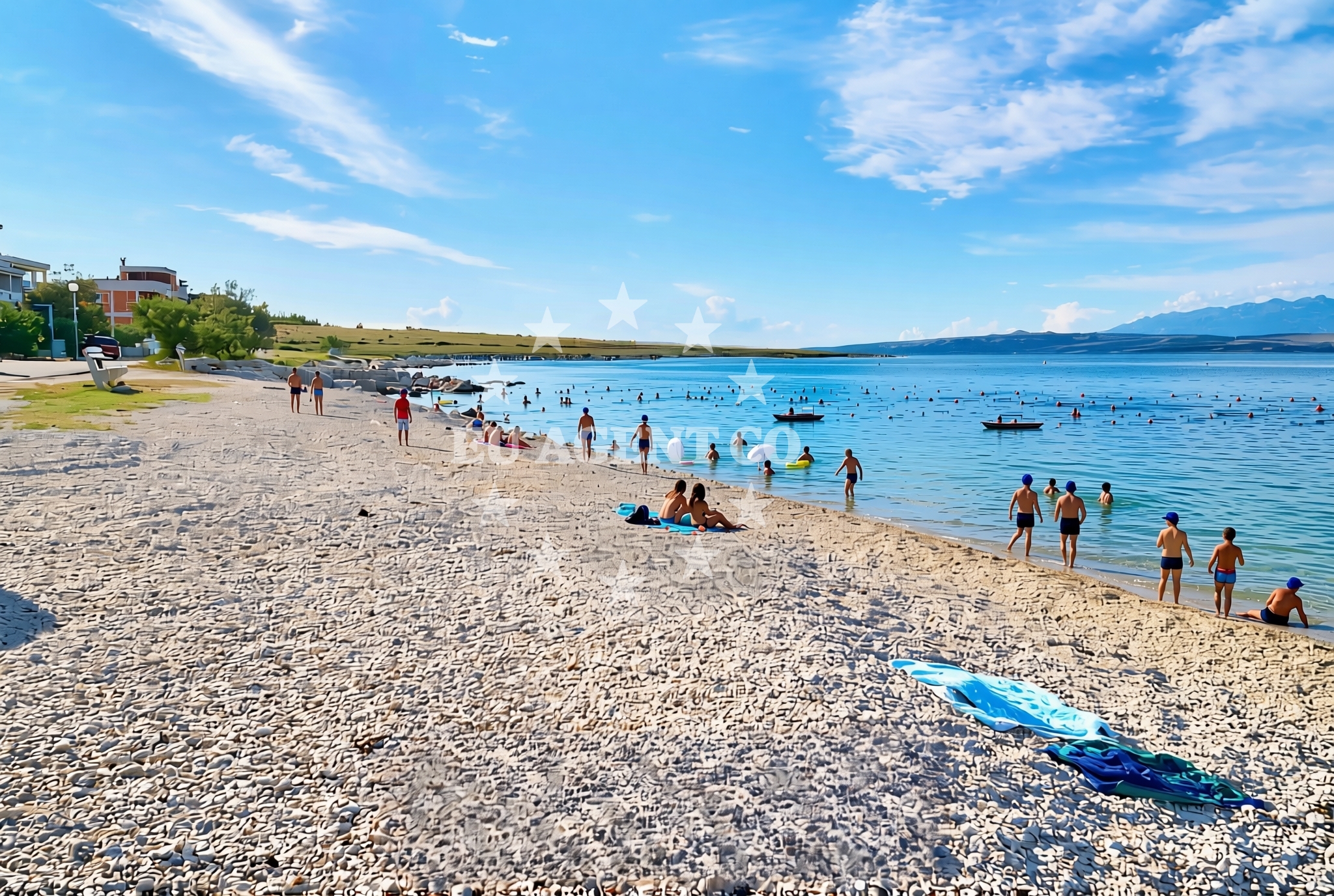
The beach's surface consists primarily of gravel and concrete/stone slabs, which may appeal to visitors seeking a more rugged shoreline experience. The 200-meter length accommodates a modest number of visitors, though the lack of detailed crowd information means conditions can vary. Natural shade is available from nearby vegetation, providing relief from the sun. The absence of explicit details about water depth or swimming suitability means visitors should approach the water with caution, particularly given the non-sandy substrate.Swimming and shore
Swimming conditions at Porat, Vir (Vir) Beach are not explicitly detailed in the beach's authoritative features. The gravel and stone slabs suggest the shoreline may be less ideal for swimming compared to sandy beaches, though the Adriatic Sea's generally mild temperatures make it a viable option for short dips. The shore itself is characterized by its rocky and concrete composition, which may limit activities such as sunbathing or building sandcastles. However, the presence of natural shade offers a practical advantage for those seeking respite from direct sunlight.Facilities and activities
The beach includes a restaurant and snack bar, providing on-site dining options for visitors. A separate drinks stand is also available, catering to those seeking refreshments. No structured activities are listed in the beach's features, though the presence of food and beverage services suggests it may serve as a casual gathering spot. The lack of explicit details about additional facilities means visitors should not assume amenities such as showers, restrooms, or parking are available.Access and location
Porat, Vir (Vir) Beach is located on the island of Vir, part of Croatia's Dalmatian coast. The island is accessible via ferry services from nearby mainland towns such as Rijeka and Omiš, though specific transportation details are not provided in the beach's catalog. Its position on Vir places it within proximity to other Adriatic islands and coastal routes, making it a potentially useful waypoint for those traveling by sea or land.What to expect
Visitors to Porat, Vir (Vir) Beach should expect a shoreline composed of gravel and concrete/stone slabs, with a total length of 200 meters. On-site facilities include a restaurant, snack bar, and drinks stand, though no additional amenities such as restrooms or parking are explicitly mentioned. The beach offers natural shade from surrounding vegetation, which can be a practical feature for sun protection. Given the lack of detailed information about water conditions, swimmers should exercise caution, particularly due to the non-sandy substrate.Practical tips
Given the gravel and stone slab surface, visitors may wish to wear sturdy footwear for comfort. The on-site dining options make it a convenient spot for a meal or snack, though those requiring more extensive facilities should plan accordingly. The natural shade can be a useful feature during peak sun hours.Exploring the coast by yacht
Porat, Vir (Vir) Beach's location on the island of Vir positions it within the broader Adriatic sailing region, a popular area for yacht charters. While the beach itself is not described as an anchorage or marina, its proximity to Vir's coastal routes may make it a useful reference point for sailors exploring the area. The Adriatic's generally sheltered waters and scenic islands make it a sought-after destination for charter guests, with nearby ports and marinas offering docking options.Historical Context of Vir Island
Vir, home to Porat Beach, has a rich history tied to the Adriatic's maritime traditions. The island was once a key stop for sailors navigating the region, and its strategic location continues to attract those interested in coastal exploration. While the beach itself does not highlight historical landmarks, the island's broader cultural heritage adds context to its appeal for visitors.Anchorages in the surrounding area
Anchorages near Vir, including Lozice and Vir anchorage points.
- Anchorage — lozice — vir — 0.2 NM from beach
- Anchorage — lozice — vir — 0.9 NM from beach
- Anchorage — vir — 1.6 NM from beach
- Anchorage — vir — 1.7 NM from beach
- Anchorage — vir — 2.0 NM from beach
- Anchorage — vir — 2.1 NM from beach
- Anchorage — povljana — pag — 2.4 NM from beach
- Anchorage — vir — 3.1 NM from beach
Distances are straight-line geographic distances, not sailing routes.
Mooring buoys in the surrounding area
Mooring buoys in the area, such as Vir and Punta Skala.
- Vir — 1.8 NM from beach
- Punta Skala — petrcane — 8.5 NM from beach
- Jetty — simuni — pag — 9.3 NM from beach
- Jetty — molat — 9.6 NM from beach
- Jetty — sestrunj — 10.4 NM from beach
Distances are straight-line geographic distances, not sailing routes.
Marine fuel stations
Marine fuel stations in Zadar and surrounding regions.
- Ina — zadar — 14.2 NM from beach
- Ina — preko — ugljan — 15.7 NM from beach
- Fuel station — sukosan — 19.1 NM from beach
- Ina — zaglav — dugi otok — 22.5 NM from beach
Distances are straight-line geographic distances, not sailing routes.
Harbours in the surrounding area
Harbours in Pag and nearby areas, including Povljana and Privlaka.
- Povljana — pag — 2.5 NM from beach
- Privlaka — 4.2 NM from beach
- Košljun — kosljun pag — 4.7 NM from beach
- Nin — 7.0 NM from beach
- Miškovići — miskovici — pag — 7.5 NM from beach
- Pag — 7.5 NM from beach
Distances are straight-line geographic distances, not sailing routes.
Marinas in the surrounding area
Marinas in Pag and Zadar, such as ACI Marina Šimuni and Marina Borik.
- ACI Marina Šimuni — simuni — pag — 10.1 NM from beach
- Marina Borik — zadar — 13.2 NM from beach
- Vitrenjak Zadar — 13.4 NM from beach
- Marina Veli Rat — dugi otok — 13.8 NM from beach
- Marina Zadar — 14.1 NM from beach
Distances are straight-line geographic distances, not sailing routes.
Restaurants near the beach
Restaurants in Vir and nearby locations, including Viranka and Monica.
- Restaurant — vir — 1.7 NM from beach
- Viranka — 1.7 NM from beach
- Monica — vir — 1.9 NM from beach
- Restaurant — vir — 2.1 NM from beach
- Grill Marion — vir — 2.6 NM from beach
- Lanterna — povljana — pag — 2.6 NM from beach
- Villa Kaštel — povljana — pag — 2.7 NM from beach
Distances are straight-line geographic distances, not sailing routes.
Navigation guides for the surrounding area
Navigation guides for Pag and surrounding areas, including Otok Pag and Uvala Bliznica.
- OTOK PAG — 2.7 NM from beach
- Privlaka — 4.3 NM from beach
- Luka Jazi — 9.3 NM from beach
- Uvala Bliznica — 10.0 NM from beach
- Uvala Lucina (Molat) Fl.R.3s6m4M — 10.1 NM from beach
Distances are straight-line geographic distances, not sailing routes.
Yachts from nearby departure bases
Yachts departing from bases in Pag and Zadar, such as Povljana Marina and Zadar Marina Borik.
Sailing yachts
- First 45 (Egeria) — Šimuni Kolan ACI Marina — 10.2 NM from departure base to beach
- Bavaria Cruiser 37 (JULIA) — Zadar Marina Borik — 13.2 NM from departure base to beach
Catamarans
- Leopard 50 (Solaia) — Zadar Marina Borik — 13.2 NM from departure base to beach
Motor yachts
- Prestige 460 (ADUDU 2) — Zadar Marina Borik — 13.2 NM from departure base to beach
Motor boats
- Merry Fisher 895 — Povljana Marina — 2.7 NM from departure base to beach
- BWA Sport 22GT (BWA ) — Pag City Port — 7.5 NM from departure base to beach
- Rancraft RM21 (Dugi otok) — Zadar Diklo Port — 11.9 NM from departure base to beach
- Rancraft RS Cinque.5 — Zadar Diklo Port — 11.9 NM from departure base to beach
- Rancraft RM19 (Daycruiser) — Zadar Diklo Port — 11.9 NM from departure base to beach
- Antares 9 OB (Queen Mary) — Zadar Marina Borik — 13.2 NM from departure base to beach
Distances are straight-line geographic distances, not sailing routes.