Poplat sjever, Vela Luka (Korčula) Beach, Croatia
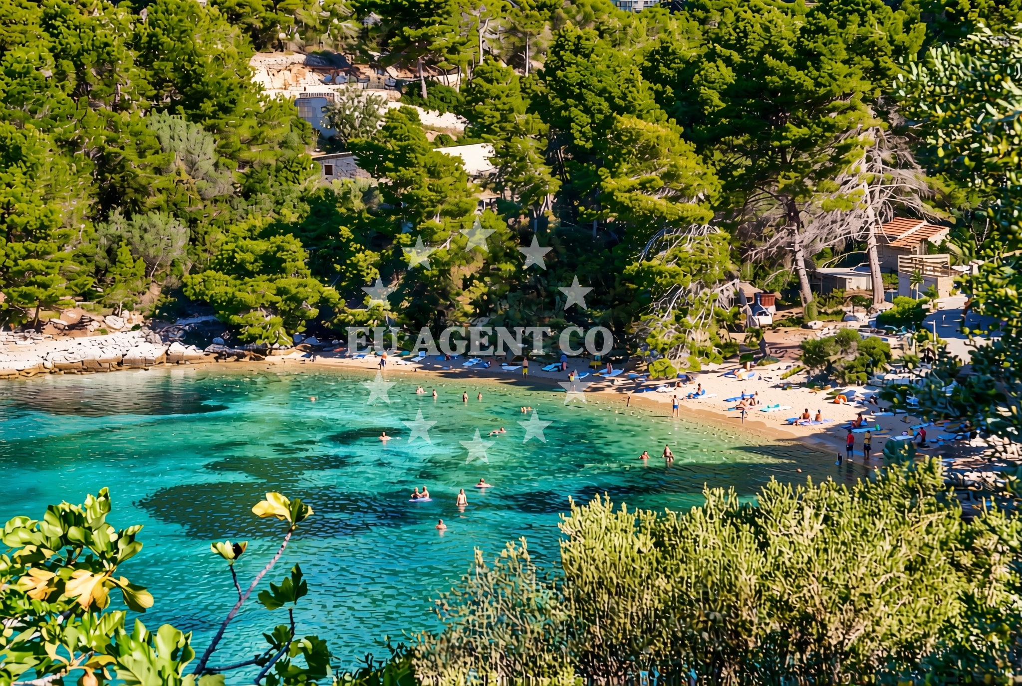
About this beach
Poplat sjever, Vela Luka (Korčula)
Beach: Poplat sjever
Location: Vela Luka (Korčula)
Characteristics and facilities
Gravel, rocks
Natural shade
Beach character
The beach's defining feature is its gravel and rock substrate, which extends along the shoreline in uneven patterns. The rocks form natural seating areas and provide shelter from direct sunlight, though the gravel may be uncomfortable for prolonged barefoot walking. The absence of sand creates a stark contrast to more typical Mediterranean beaches, offering a tactile experience of coarse grains and uneven surfaces. The natural topography includes depressions and crevices that collect water during high tide, creating temporary pools that may attract small marine life.Swimming and shore
Swimming conditions depend on tidal patterns, with the gravel shoreline offering limited areas for wading. The rocky sections create natural barriers that can provide shelter from waves, though deeper water access requires navigating around the boulders. The beach's orientation on the southern coast of Korčula means it receives ample sunlight during the day, with the rocky formations casting shadows in the afternoon. The surrounding waters are known for their clarity, typical of the Adriatic, though the lack of sandy beaches means fewer opportunities for sunbathing on the shore itself.Facilities and activities
The beach lacks formal facilities such as restrooms, showers, or lifeguard services. No structured activities are available on-site, though the rocky terrain may encourage exploration and photography opportunities. The absence of commercial infrastructure means visitors should bring their own supplies, including water, snacks, and sun protection. The site's natural character makes it more suitable for solitary relaxation than group gatherings, with the gravel surface limiting the practicality of beach games or large equipment.Access and location
Poplat sjever is situated within the town of Vela Luka, a major port on Korčula's northern coast. The beach is accessible via local roads that connect to the island's main thoroughfares, with parking options available in the surrounding residential areas. Vela Luka itself is a hub for maritime activity, with ferry connections to the mainland and other Dalmatian islands. The beach's proximity to the town center means it is within walking distance of restaurants, shops, and other attractions in Vela Luka, though its rugged nature makes it less frequented than the island's more developed beaches.What to expect
Visitors to Poplat sjever should expect a beach experience centered on its natural geological features rather than traditional amenities. The gravel and rock composition creates a unique environment that may appeal to those seeking a quieter, less commercialized shoreline. The natural shade from overhanging rocks offers respite from the sun, though the lack of seating structures means visitors should bring their own cushions or towels. The beach's location within Vela Luka provides easy access to the town's services, but its rugged terrain makes it less suitable for families with young children or those seeking a fully equipped recreational space.Practical tips
Wear sturdy footwear to navigate the gravel and rocky areas comfortably. Bring a towel or mat to sit on, as the gravel may be uncomfortable for prolonged periods. Check tide times to avoid being stranded on the beach during low tide. The lack of facilities means bringing sufficient water and snacks is essential for extended stays.Exploring the coast by yacht
For yacht charter guests exploring the Dalmatian Coast, Poplat sjever's location in Vela Luka offers convenient access to the island of Korčula and its surrounding waters. The nearby port of Vela Luka is a common stop for sailing itineraries, with marinas available for docking. The beach's proximity to the open sea makes it a potential anchorage point for yachts seeking a secluded spot, though the rocky shoreline may require careful navigation. The surrounding area is part of a larger sailing region that includes the channels between Korčula, Hvar, and the mainland, offering opportunities for both coastal cruising and open-sea sailing.Historical Context of Vela Luka
Vela Luka has a long history as a maritime hub, dating back to the medieval period when it was a key port for the Republic of Venice. The town's development as a modern tourist destination began in the 20th century, with its natural harbors and strategic location making it a focal point for both commercial and recreational boating. The area around Poplat sjever retains traces of this maritime heritage, with some rocky outcrops showing signs of historical use by fishermen and sailors.Anchorages in the surrounding area
Anchorages in the surrounding area include options within Vela Luka, Korčula.
- Anchorage — vela luka — korcula — 0.1 NM from beach
- Anchorage — vela luka — korcula — 1.0 NM from beach
- Anchorage — vela luka — korcula — 1.0 NM from beach
- Anchorage — vela luka — korcula — 1.1 NM from beach
- Anchorage — vela luka — korcula — 1.7 NM from beach
- Gradina — vela luka — korcula — 1.7 NM from beach
- Anchorage — korcula — 2.2 NM from beach
- Pržnjak Veli and Mali — prznjak veli and mali — 2.5 NM from beach
Distances are straight-line geographic distances, not sailing routes.
Mooring buoys in the surrounding area
- Jetty — vela luka — korcula — 0.9 NM from beach
- Gradina buoy field — vela luka — korcula — 1.7 NM from beach
- Buoy field — vela luka — korcula — 2.1 NM from beach
- Jetty — proizd — 3.3 NM from beach
- Quay — vela luka — korcula — 5.1 NM from beach
Distances are straight-line geographic distances, not sailing routes.
Marine fuel stations
Marine fuel stations are located in Vela Luka and other nearby areas.
- Ina — vela luka — korcula — 2.2 NM from beach
- Ina — ubli — lastovo — 13.8 NM from beach
- Ina — vrboska — hvar — 14.1 NM from beach
- Fuel station — hvar — 16.7 NM from beach
Distances are straight-line geographic distances, not sailing routes.
Harbours in the surrounding area
Harbours in the surrounding area include Vela Luka and additional ports in the region.
- Vela Luka — korcula — 2.3 NM from beach
- Prigradica — korcula — 6.3 NM from beach
- Brna — korcula — 8.6 NM from beach
- Zavalatica — korcula — 11.8 NM from beach
- Marina Bilo Idro — sveta nedjelja — hvar — 12.0 NM from beach
- Port Jelsa — hvar — 13.1 NM from beach
Distances are straight-line geographic distances, not sailing routes.
Marinas in the surrounding area
Marinas in the surrounding area feature Marina Korkyra in Vela Luka and other facilities in the region.
- Marina Korkyra — vela luka — korcula — 2.1 NM from beach
- Marina Solitudo — lastovo — 12.7 NM from beach
- ACI Marina Vrboska — hvar — 14.1 NM from beach
- ACI Marina Palmižana — aci marina palmizana — st klement — 17.9 NM from beach
- ACI Marina Korčula — korcula — 20.5 NM from beach
Distances are straight-line geographic distances, not sailing routes.
Restaurants near the beach
Restaurants near the beach include dining options in Vela Luka.
- Restaurant — vela luka — korcula — 0.9 NM from beach
- Restaurant Šiloko — vela luka — korcula — 1.7 NM from beach
- Restaurant Luky — vela luka — korcula — 2.1 NM from beach
- Konoba Gulin — vela luka — korcula — 2.2 NM from beach
- Konoba Ribar — vela luka — korcula — 2.2 NM from beach
- Konoba Lucica — vela luka — korcula — 2.2 NM from beach
- Konoba Bata — vela luka — korcula — 2.2 NM from beach
Distances are straight-line geographic distances, not sailing routes.
Navigation guides for the surrounding area
Navigation guides for the surrounding area include Uvala Poplat and other nearby coastal features.
- Uvala Poplat — 0.1 NM from beach
- Uvala Tri Luke — 1.2 NM from beach
- Uvala Sveti Ivan (Uvala Gradina) — 1.7 NM from beach
- Uvala Prihonja — 3.0 NM from beach
- Luka Karbuni — 3.6 NM from beach
Distances are straight-line geographic distances, not sailing routes.
Yachts from nearby departure bases
Yachts from nearby departure bases include options based in Milna Marina Vlaška and Makarska Port.
Sailing yachts
- Hanse 505 (AVALON) — Milna Marina Vlaška — 25.3 NM from departure base to beach
- Bavaria 46 Cruiser (MO) — Milna Marina Vlaška — 25.3 NM from departure base to beach
- Hanse 388 (BANJO) — Milna Marina Vlaška — 25.3 NM from departure base to beach
- Hanse 455 (AURUM 1) — Milna Marina Vlaška — 25.3 NM from departure base to beach
- Bavaria 40 Cruiser (LADY BUTTERFLY) — Tučepi Port — 25.6 NM from departure base to beach
Motor yachts
- Princess V53 (Chablis) — Makarska Port — 25.9 NM from departure base to beach
Motor boats
- Galeon 430 Skydeck (BELLAGIO) — Makarska Port — 25.9 NM from departure base to beach
- Jeanneau NC 37 (Black Pearl) — Makarska Port — 25.9 NM from departure base to beach
- Galeon 430 Skydeck (Bellagio) — Makarska Port — 25.9 NM from departure base to beach
- Jeanneau NC 37 (Black Pearl) — Makarska Port — 25.9 NM from departure base to beach
Distances are straight-line geographic distances, not sailing routes.