Pojana istok, Županje (Krk) Beach, Croatia
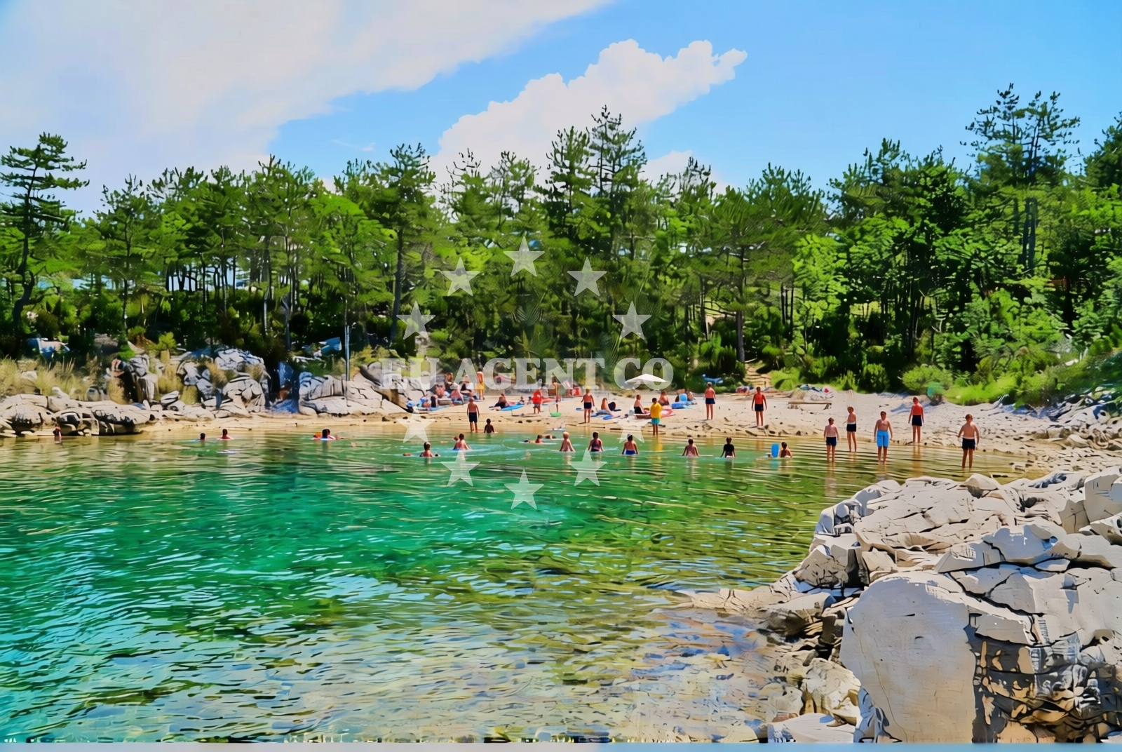
About this beach
Pojana istok, Županje (Krk)
Beach: Pojana istok
Location: Županje (Krk)
Characteristics and facilities
Gravel, rocks
30 m
Beach character
The beach consists of gravel and exposed rock formations, with no sandy areas or developed shoreline features. Its brevity—just 30 meters in length—makes it a modest stretch of coast, ideal for brief exploration rather than extended sunbathing. The rocky terrain suggests the area may be more suited to activities like rock-hopping or shoreline walking than swimming. The absence of structured facilities means visitors should expect a raw, undeveloped coastal experience. The beach's character aligns with the natural geography of Krk, where rugged coastlines and cliffs are common along the island's eastern and northern shores.Swimming and shore
Swimming conditions at Pojana istok are not explicitly documented, but the gravel and rocky shoreline suggest limited suitability for swimming. The beach's short length and lack of sandy areas mean it is unlikely to be a primary swimming destination. However, the clear Adriatic waters surrounding Krk are generally favorable for snorkeling or brief dips in sheltered coves. The shore itself is composed of uneven rocks and gravel, which may make walking along the beach more challenging than on softer sands. Visitors should be mindful of tide changes and potential slippery conditions on the rocky sections.Facilities and activities
There are no listed facilities at Pojana istok, Županje (Krk) Beach. The absence of amenities such as parking, restrooms, or shade structures means visitors should plan self-sufficient visits. Activities here are limited to exploring the rocky shoreline, walking along the coast, or using the beach as a starting point for nearby excursions. The beach's proximity to Županje and Krk's broader coastal network may offer opportunities for hiking, cycling, or exploring the island's historic sites, though these are not directly tied to the beach itself.Access and location
Pojana istok is located in Županje, a small coastal village on Krk Island's eastern shore. Access to the beach requires reaching Županje, which is connected to the mainland via the Krk Bridge—a major infrastructure link between the island and the Istrian Peninsula. Visitors arriving by car can reach Županje via the island's road network, while those arriving by ferry may need to connect through nearby ports such as Opatija or Rijeka on the mainland. The beach's remote character means it is not a high-traffic destination, offering a more tranquil alternative to Krk's busier coastal areas.What to expect
Visitors to Pojana istok, Županje (Krk) Beach should expect a natural, undeveloped shoreline composed of gravel and rocks. The beach's short length (30 meters) and lack of facilities mean it is not designed for extended relaxation or typical beach activities. The terrain may be uneven and challenging to navigate, particularly for those unaccustomed to rocky coastlines. The area is best suited for brief exploration, photography, or as a scenic stop during broader trips to Krk Island. The absence of amenities necessitates bringing personal supplies, and visitors should be prepared for a rugged, authentic coastal experience.Practical tips
Bring sturdy footwear for walking on gravel and rocky surfaces. Carry water and sun protection, as there are no facilities for purchase or storage. Check tide times if planning to explore the shoreline, as conditions may change rapidly. Consider combining a visit with nearby attractions in Županje or Krk's historic sites for a more comprehensive experience.Exploring the coast by yacht
For yacht charter guests, Pojana istok's location on Krk Island offers proximity to the Adriatic's scenic sailing routes. Krk is a popular base for exploring the northern Adriatic, with nearby anchorages and marinas along the island's coast. Yacht charter companies operating in the region may include Krk in itineraries that combine coastal cruising with visits to historic sites, vineyards, and other islands. While Pojana istok itself is not a primary anchorage, the surrounding waters are part of the broader sailing network that connects Krk to the mainland and other Adriatic destinations.Geological Context of Krk's Coast
The rocky coastline of Pojana istok reflects Krk's geological history, shaped by glacial deposits and coastal erosion. The island's northern and eastern shores feature similar rugged terrain, with cliffs and outcrops that provide habitats for marine life and nesting birds. These natural formations contribute to Krk's status as a protected area with ecological significance.Anchorages in the surrounding area
Anchorages in the surrounding area include locations such as Anchorage — krk, Klimno — krk, and Silo — krk, all within a few nautical miles.
- Anchorage — krk — 1.5 NM from beach
- Klimno — krk — 1.6 NM from beach
- Anchorage — silo — krk — 1.6 NM from beach
- Anchorage — dramalj — 2.2 NM from beach
- Anchorage — krk — 2.3 NM from beach
- Anchorage — krk — 2.4 NM from beach
- Anchorage — kacjak — 2.6 NM from beach
- Anchorage — kacjak — 2.7 NM from beach
Distances are straight-line geographic distances, not sailing routes.
Mooring buoys in the surrounding area
Mooring buoys in the surrounding area feature buoy fields in Crikvenica and jetties in Dramalj and Selce, situated near the beach.
- Buoy field — crikvenica — 2.2 NM from beach
- Jetty — dramalj — 2.2 NM from beach
- Jetty — dramalj — 2.3 NM from beach
- Jetty — kacjak — 2.5 NM from beach
- Jetty — selce — 3.1 NM from beach
Distances are straight-line geographic distances, not sailing routes.
Marine fuel stations
- Fuel station — crikvenica — 2.3 NM from beach
- INA — novi vinodolski — 6.5 NM from beach
- Flash — krk — 8.6 NM from beach
- Ina — krk — 8.7 NM from beach
Distances are straight-line geographic distances, not sailing routes.
Harbours in the surrounding area
Harbours in the surrounding area include Klimno — krk and Šilo — silo — krk, located at short distances from the beach.
- Klimno — krk — 1.0 NM from beach
- Šilo — silo — krk — 1.2 NM from beach
- Čižići — cizici — krk — 1.8 NM from beach
- Slivanjska — rudine — krk — 2.1 NM from beach
- Podvorska — crikvenica — 2.1 NM from beach
- Crikvenica — 2.1 NM from beach
Distances are straight-line geographic distances, not sailing routes.
Marinas in the surrounding area
- Šilo — silo — krk — 1.3 NM from beach
- Omišalj Docks — omisalj — krk — 4.9 NM from beach
- Marina Novi — novi vinodolski — 6.4 NM from beach
- Mitan Marina — novi vinodolski — 7.4 NM from beach
- Marina Punat — krk — 7.8 NM from beach
Distances are straight-line geographic distances, not sailing routes.
Restaurants near the beach
Restaurants near the beach include Val — klimno — krk and Restaurant — silo — krk, situated in close proximity to the beach.
- Val — klimno — krk — 0.9 NM from beach
- Zal — klimno — krk — 0.9 NM from beach
- Oleander — klimno — krk — 0.9 NM from beach
- Restaurant — silo — krk — 1.1 NM from beach
- Restaurant — silo — krk — 1.1 NM from beach
- Restaurant — silo — krk — 1.2 NM from beach
- Restaurant — cizici — krk — 1.9 NM from beach
Distances are straight-line geographic distances, not sailing routes.
Navigation guides for the surrounding area
Navigation guides for the surrounding area include Uvala Stipanja and Crikvenica, providing key references for the region.
- Uvala Stipanja {Silo) — 1.4 NM from beach
- Crikvenica — 2.4 NM from beach
- Se Ice — 3.4 NM from beach
- Uvala Sv. Marak — 3.5 NM from beach
- Uvala Siana — 3.6 NM from beach
Distances are straight-line geographic distances, not sailing routes.
Yachts from nearby departure bases
Sailing yachts
- Sun Odyssey 29.2 (Mirabai) — Malinska Hotel Malin port — 5.7 NM from departure base to beach
- Elan E6 (BALI) — Vinodolski Novi Marina — 6.4 NM from departure base to beach
- Sun Odyssey 36i (Mia) — Vinodolski Novi Marina — 6.4 NM from departure base to beach
- Bavaria C38 (Popaj) — Vinodolski Novi Marina — 6.4 NM from departure base to beach
Catamarans
- Aventura 34 (Marlon) — Vinodolski Novi Marina — 6.4 NM from departure base to beach
- Excess 12 (Kiss Me Twice) — Vinodolski Novi Marina — 6.4 NM from departure base to beach
- Bali 4.6 (MY QUEEN) — Vinodolski Novi Marina — 6.4 NM from departure base to beach
Motor boats
- Barracuda 590 (Solta) — Crikvenica City Port — 2.4 NM from departure base to beach
- Barracuda 590 (Barracuda 12) — Crikvenica City Port — 2.4 NM from departure base to beach
- Adriana 36 (Gaja) — Vinodolski Novi Marina — 6.4 NM from departure base to beach
Distances are straight-line geographic distances, not sailing routes.