Podkapeć, Podaca Beach, Croatia
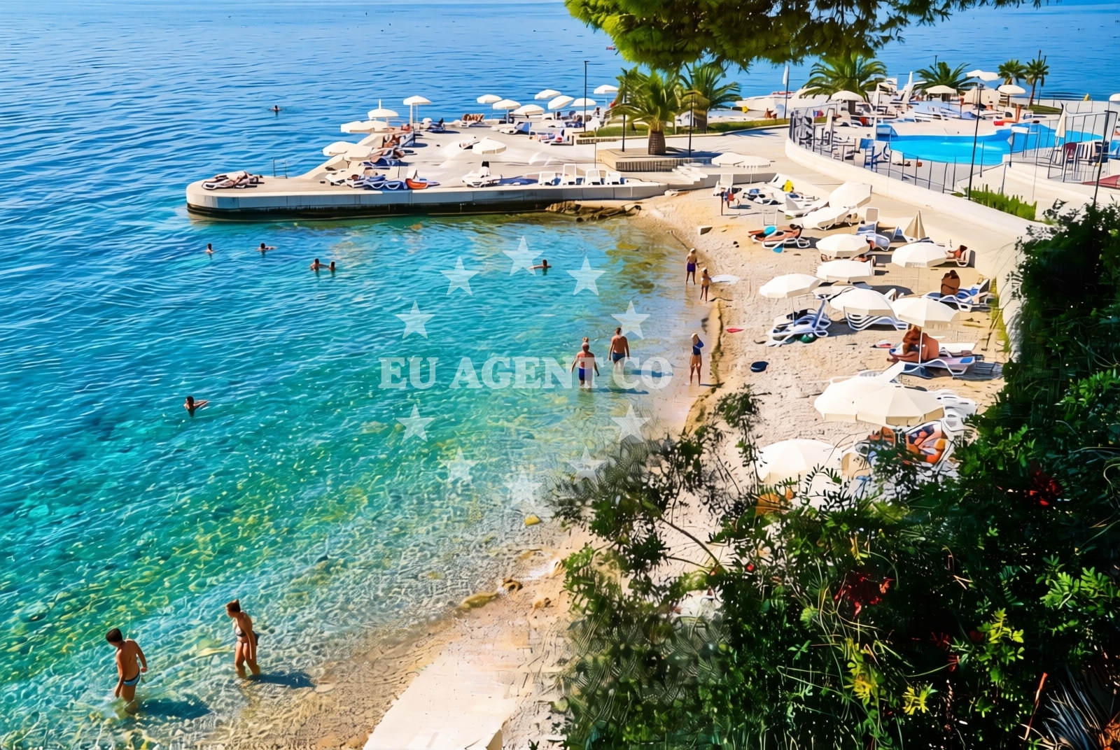
About this beach
Podkapeć, Podaca
Beach: Podkapeć
Location: Podaca
Characteristics and facilities
Pebbles, gravel, concrete / stone slabs
210 m
Restaurant / snack bar
Caffe bar / Drinks stand
Natural shade
shower
Beach character
The beach's surface is composed of pebbles, gravel, and concrete slabs, creating a textured walking experience that contrasts with the region's more common sandy shores. This composition suits those who prefer a firm footing over sand, though it may require more effort for swimming. The beach's length provides ample space for relaxation, and its proximity to the sea ensures easy access to the water. The presence of natural shade offers respite from the sun, a rare feature on many of Croatia's exposed coastlines.Swimming and shore
Swimming conditions are influenced by the beach's rocky and pebbled terrain, which may make entry into the water less straightforward than on sandy beaches. The shore itself is a mix of gravel and concrete slabs, ideal for walking but not for sunbathing. The sea's clarity and temperature align with the broader Adriatic profile, though specific water quality details are not documented for this location.Facilities and activities
The beach includes a restaurant and snack bar for meals, a caffe bar for drinks, and a shower facility. No structured activities are listed, but the surrounding area of Podkapeć offers opportunities for coastal exploration, hiking, and visiting nearby settlements. The absence of explicit activity labels suggests a focus on passive relaxation rather than organized recreation.Access and location
Located in Podkapeć, the beach is part of the Dalmatian coast's network of settlements, many of which are accessible via coastal roads. The exact road access details are not specified in the catalog, but the beach's proximity to Podkapeć implies it is within reach of local infrastructure. Its coordinates (43.129921, 17.286382) place it near the broader Adriatic sailing routes, though no specific marinas or anchorages are mentioned for this exact location.What to expect
Visitors should anticipate a beach with a pebbled and gravelly shoreline, suitable for walking but less ideal for sunbathing. The 210-meter stretch offers space for relaxation, with a restaurant, snack bar, and caffe bar available for meals and drinks. Natural shade is a notable feature, providing relief from the sun. The shower facility supports practical needs, though no additional amenities like parking or toilets are documented.Practical tips
Consider wearing sturdy footwear for the pebbled shoreline. The shower facility is useful for rinsing off after swimming. The nearby restaurant and caffe bar make it easy to enjoy meals without leaving the beach area. Due to the lack of detailed access information, arriving early may help secure a spot, especially during peak season.Exploring the coast by yacht
For yacht charter guests, the broader Dalmatian coast offers a range of sailing opportunities, with nearby marinas and anchorages accessible via the Adriatic. While this specific beach is not marked as a formal anchorage, its location near Podkapeć places it within reach of sailing routes that explore the region's islands and coastal towns. Charterers may find the surrounding area appealing for short cruises or stops during longer voyages.Regional Context
Podkapeć is part of the Split-Dalmatia County, a region known for its historic towns, medieval fortresses, and vibrant coastal culture. The area is a hub for both land-based tourism and nautical exploration, with nearby towns like Supetar and Bol offering additional amenities for visitors.Anchorages in the surrounding area
Anchorages in the surrounding area include Drvenik and Sucuraj, offering nearby mooring options.
- Anchorage — drvenik — 2.3 NM from beach
- Anchorage — sucuraj — hvar — 4.5 NM from beach
- Anchorage — sucuraj — hvar — 5.4 NM from beach
- Anchorage — ploce — 5.7 NM from beach
- Anchorage — sucuraj — hvar — 6.0 NM from beach
- Anchorage — selca kod bogomolja — hvar — 6.4 NM from beach
- Anchorage — sucuraj — hvar — 6.4 NM from beach
- Anchorage — selca kod bogomolja — hvar — 6.4 NM from beach
Distances are straight-line geographic distances, not sailing routes.
Mooring buoys in the surrounding area
- Brist — 1.7 NM from beach
- Drvenik - Ferry dock — drvenik ferry dock — 2.2 NM from beach
- Jetty — sucuraj — hvar — 4.3 NM from beach
- Konoba Gambo buoys — selca kod bogomolja — hvar — 8.2 NM from beach
- Kraj - Soline — kraj soline — drasnice — 9.4 NM from beach
Distances are straight-line geographic distances, not sailing routes.
Marine fuel stations
- Fuel station — ploce — 8.0 NM from beach
- Fuel station — korcula — 12.2 NM from beach
- Ina — makarska — 15.4 NM from beach
- Fuel station — sumartin — brac — 20.8 NM from beach
Distances are straight-line geographic distances, not sailing routes.
Harbours in the surrounding area
Harbours in the surrounding area include Zaostrog and Drvenik, offering nearby port facilities.
- Zaostrog — 0.7 NM from beach
- Drvenik — 2.4 NM from beach
- Gradac — 2.8 NM from beach
- Sućuraj — sucuraj — hvar — 4.3 NM from beach
- Živogošće — zivogosce — 6.6 NM from beach
- Trpanj — 7.2 NM from beach
Distances are straight-line geographic distances, not sailing routes.
Marinas in the surrounding area
Marinas in the surrounding area include Korcula and Tučepi, providing dockage options for yachts.
- ACI Marina Korčula — korcula — 12.2 NM from beach
- Marina Tučepi — marina tucepi — 12.8 NM from beach
- Marina Lumbarda — korcula — 13.3 NM from beach
- Marina Ramova — krvavica — 17.7 NM from beach
- Marina Baška Voda — marina baska voda — 20.2 NM from beach
Distances are straight-line geographic distances, not sailing routes.
Restaurants near the beach
Restaurants near the beach include those in Sucuraj, Hvar, offering dining options close to the shore.
- Riblji Restoran — sucuraj — hvar — 4.4 NM from beach
- Restaurant — sucuraj — hvar — 4.4 NM from beach
Distances are straight-line geographic distances, not sailing routes.
Navigation guides for the surrounding area
Navigation guides for the surrounding area include Uvala Drvenik and Gradac, assisting with route planning near the beach.
- Uvala Drvenik (Donja Vala) — 2.0 NM from beach
- Gradac — 3.1 NM from beach
- OTOK HVAR — 3.7 NM from beach
- Trpanj — 7.1 NM from beach
- Uvala Divna — 7.6 NM from beach
Distances are straight-line geographic distances, not sailing routes.
Yachts from nearby departure bases
Yachts from nearby departure bases include those based in Ploče City Port and Tučepi Port, offering sail and motor yacht options.
Sailing yachts
- Elan 40 Impression (Karleta) — Ploče City Port — 8.0 NM from departure base to beach
- Elan 514 Impression (Cesarica III) — Ploče City Port — 8.0 NM from departure base to beach
- Sun Odyssey 349 (Visnjica) — Ploče City Port — 8.0 NM from departure base to beach
- More 55 (MRS. ROBINSON) — Ploče City Port — 8.0 NM from departure base to beach
- Sun Odyssey 419 (Luka Ploce) — Ploče City Port — 8.0 NM from departure base to beach
- Salona 44 (SAMOA) — Ploče City Port — 8.0 NM from departure base to beach
- Sun Odyssey 349 (Porto Tolero) — Ploče City Port — 8.0 NM from departure base to beach
- Bavaria 40 Cruiser (LADY BUTTERFLY) — Tučepi Port — 12.8 NM from departure base to beach
Catamarans
- Lagoon 450 Fly (Alba Mouse) — Ploče City Port — 8.0 NM from departure base to beach
Motor yachts
- Princess V53 (Chablis) — Makarska Port — 15.2 NM from departure base to beach
Distances are straight-line geographic distances, not sailing routes.