Podgradina istok, Podgradina (Posedarje) Beach, Croatia
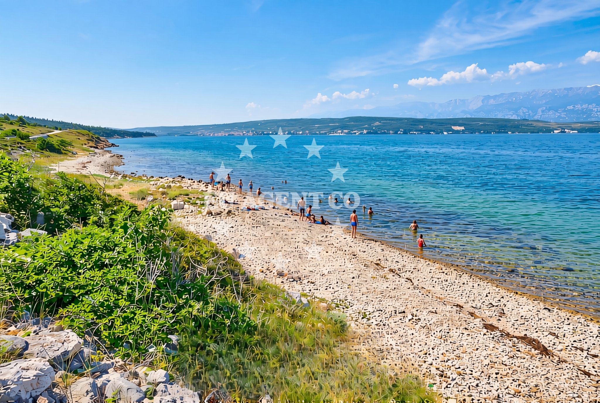
Podgradina istok Beach lies on the eastern shore of Podgradina, a small coastal settlement in the Posedarje municipality of Croatia. This 190-meter stretch of gravel and rock coastline offers a stark contrast to the sandy beaches of the region, presenting a rugged shoreline that reflects the natural contours of the Adriatic coast. While not a typical swimming destination, the beach provides a unique vantage point for observing the interplay between land and sea in this part of Dalmatia.
About this beach
Podgradina istok, Podgradina (Posedarje)
Beach: Podgradina istok
Location: Podgradina (Posedarje)
Characteristics and facilities
Gravel, rocks
190 m
Beach character
The beach is composed primarily of gravel and rocky outcrops, creating a terrain that is more suited to walking or exploring than to sunbathing. The shoreline extends approximately 190 meters along the coast, with the landward side featuring a mix of natural rock formations and sparse vegetation. The absence of artificial structures or amenities means visitors encounter an unmodified coastal environment, typical of many lesser-developed stretches of the Croatian coastline.
Swimming and shore
Due to its rocky composition, the beach is not ideal for swimming. The shoreline's uneven surface and limited sandy areas make it more suitable for leisurely walks or photography. The adjacent waters, however, are part of the broader Adriatic Sea, which supports recreational boating and sailing activities in the region. The beach's position offers views of the open sea, though swimmers should be mindful of the rocky terrain and potential for strong currents in deeper waters.
Facilities and activities
No formal facilities or services are listed for this beach. The lack of infrastructure aligns with its status as a natural, undeveloped shoreline. Activities here are limited to passive recreation such as walking along the shore or observing marine life from the rocky areas. The beach does not appear to host organized events or seasonal activities, maintaining its character as a quiet, unspoiled coastal spot.
Access and location
Podgradina istok Beach is located in the village of Podgradina, which is part of the Posedarje municipality on the island of Brač. The nearest larger settlement is Supetar, a popular tourist hub on Brač known for its marinas and cultural heritage. Visitors can reach the beach via local roads connecting Podgradina to the main island routes. The beach's proximity to Brač's western coast places it within reach of other coastal attractions, though its remote character makes it less frequented by mass tourism.
What to expect
Visitors should expect a rugged, undeveloped shoreline composed of gravel and rocks. The beach is not suited for sunbathing or swimming but offers a chance to experience the raw coastline of Brač. The area's natural character means there are no amenities such as restrooms, showers, or parking facilities. Those visiting should plan for a short, scenic walk along the shore and be prepared for the terrain's uneven surface.
Practical tips
Wear sturdy footwear to navigate the gravel and rocky terrain comfortably. Bring water for hydration, as there are no facilities for refilling. The beach's remote nature means it is best visited during off-peak hours to avoid crowds. Photography enthusiasts may appreciate the dramatic coastal vistas, though tripods or equipment requiring stable ground may be challenging to use on the uneven surface.
Exploring the coast by yacht
For yacht charter guests, the beach's location on Brač's western coast places it within reach of several popular sailing routes in the Adriatic. The nearby marina in Supetar serves as a common base for charters exploring the Brač coastline and surrounding islands. While the beach itself is not a docking point, its proximity to the open sea offers a natural vantage point for observing yacht traffic and enjoying the broader maritime landscape of the region.
Regional Context and Coastal Setting
The beach lies within the Posedarje municipality, a region known for its traditional fishing communities and historic stone architecture. Brač, the island on which Podgradina is located, is part of the Central Dalmatia County and features a coastline characterized by limestone cliffs and secluded coves. The area's natural beauty has made it a destination for both local residents and international visitors seeking authentic coastal experiences.
Anchorages in the surrounding area
- Anchorage — maslenica — 3.2 NM from beach
- Anchorage — novigrad — 4.3 NM from beach
- Anchorage — vinjerac — 4.8 NM from beach
- Anchorage — karin — 5.9 NM from beach
- Karin dock — 6.0 NM from beach
- Anchorage — ljubac — 9.8 NM from beach
- Anchorage — ljubac — 10.0 NM from beach
- Anchorage — rtina — 10.7 NM from beach
Distances are straight-line geographic distances, not sailing routes.
Mooring buoys in the surrounding area
Mooring buoys at Ljubac and Sukosan are located in the vicinity of Podgradina istok beach.
- Jetty — ljubac — 10.2 NM from beach
- Šibuljina Point — sibuljina point — 11.6 NM from beach
- Buoy field — sukosan — 11.7 NM from beach
- Buoy field — sukosan — 11.9 NM from beach
- Jetty — zadar — 12.8 NM from beach
Distances are straight-line geographic distances, not sailing routes.
Marine fuel stations
Fuel stations at Sukosan and Zadar serve the area surrounding Podgradina istok beach.
- Fuel station — sukosan — 11.9 NM from beach
- Ina — zadar — 12.6 NM from beach
- Ina — preko — ugljan — 14.9 NM from beach
- Ina — biograd na moru — 15.0 NM from beach
Distances are straight-line geographic distances, not sailing routes.
Harbours in the surrounding area
Harbors in Maslenica and Vinjerac are situated near Podgradina istok beach.
- Maslenica — 2.6 NM from beach
- Vinjerac — 4.8 NM from beach
- Seline — 5.7 NM from beach
- Starigrad Paklenica — 7.2 NM from beach
- Obrovac — 7.7 NM from beach
- Ražanac — razanac — 9.1 NM from beach
Distances are straight-line geographic distances, not sailing routes.
Marinas in the surrounding area
- Marina Dalmacija — sukosan — 11.8 NM from beach
- Marina Zadar — 12.5 NM from beach
- Vitrenjak Zadar — 12.9 NM from beach
- Marina Borik — zadar — 13.1 NM from beach
- Dry dock marina Biograd — biograd na moru — 13.9 NM from beach
Distances are straight-line geographic distances, not sailing routes.
Navigation guides for the surrounding area
Navigation guides for Posedarje and Starigrad-Paklenica support travel to Podgradina istok beach.
- Posedarje (Novigradsko More) — 1.8 NM from beach
- Starigrad-Paklenica {Velebitski Kanai) — 7.1 NM from beach
- VELESITSKI KANAL (S) — 10.0 NM from beach
- KrusCica and Uvala KrusCica Duboka — 12.6 NM from beach
- Turanj — 13.8 NM from beach
Distances are straight-line geographic distances, not sailing routes.
Yachts from nearby departure bases
Yachts departing from Novigrad Dalmatia and Sukosan Brodogradilište Filipi are based near Podgradina istok beach.
Sailing yachts
- Oceanis 45 (VESNA) — Sukošan Marina Dalmacija — 11.8 NM from departure base to beach
Catamarans
- Lagoon 50 (CELESTE DEL MAR) — Sukošan Marina Dalmacija — 11.8 NM from departure base to beach
Motor yachts
- Manhattan 52 (CICO) — Sukošan Marina Dalmacija — 11.8 NM from departure base to beach
Motor boats
- Merry Fisher 795 () — Novigrad Dalmatia — 1.8 NM from departure base to beach
- Merry Fisher 695 — Sukošan Brodogradilište Filipi — 11.7 NM from departure base to beach
- Zar 61 Suite (Tucepi) — Sukošan Brodogradilište Filipi — 11.7 NM from departure base to beach
- Zar 65 Suite — Sukošan Brodogradilište Filipi — 11.7 NM from departure base to beach
- Elan 650 (Biokovo) — Sukošan Brodogradilište Filipi — 11.7 NM from departure base to beach
- Quicksilver Activ 555 — Sukošan Brodogradilište Filipi — 11.7 NM from departure base to beach
- Zar 57 WD — Sukošan Brodogradilište Filipi — 11.7 NM from departure base to beach
Distances are straight-line geographic distances, not sailing routes.