Podgrad zapad, Drače Beach, Croatia
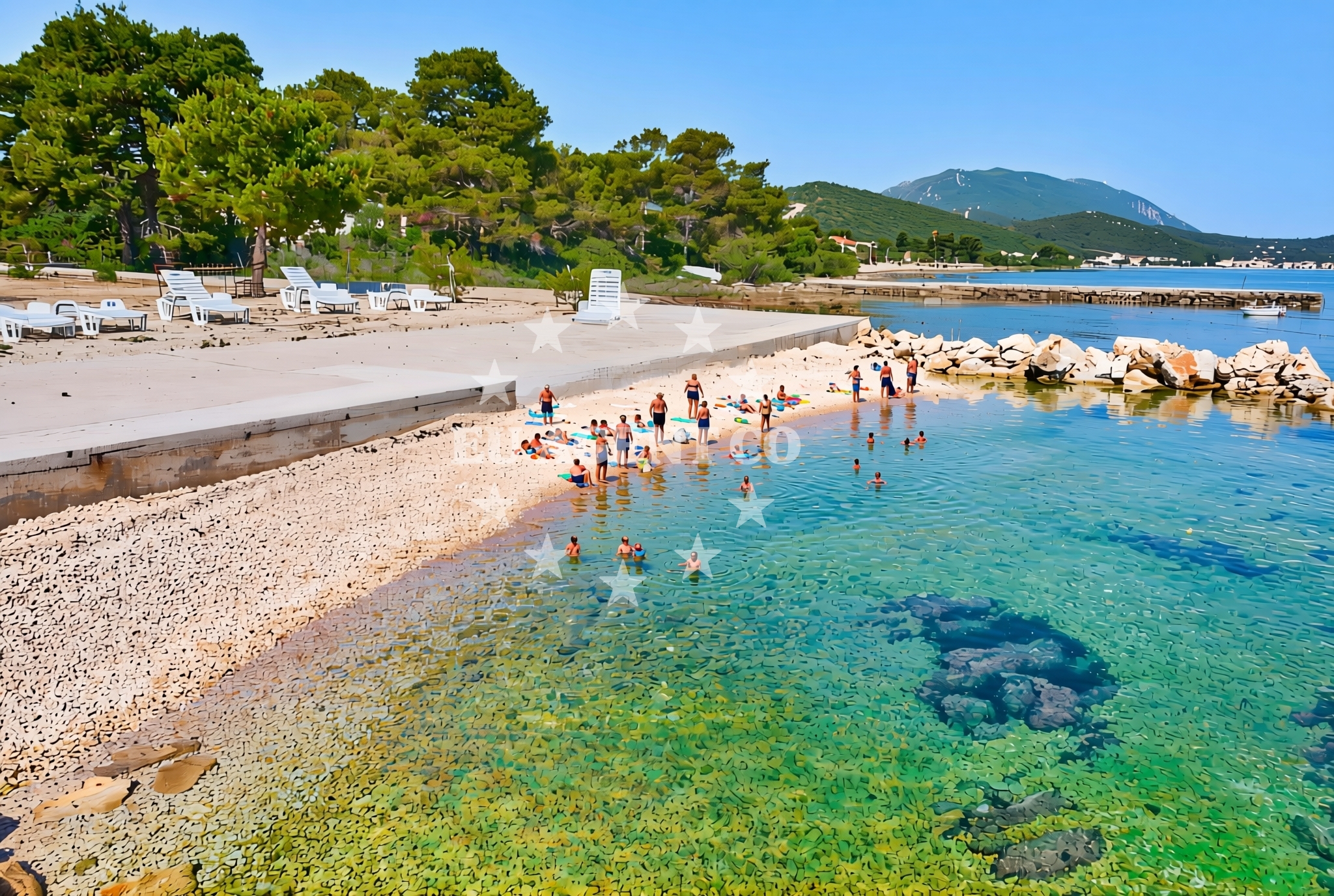
About this beach
Podgrad zapad, Drače
Beach: Podgrad zapad
Location: Drače
Characteristics and facilities
Gravel, concrete / stone slabs, rocks
60 m
Beach character
The beach consists of a mix of gravel, concrete slabs, and natural rock formations, with a total length of 60 meters. This composition suggests a shoreline that has been shaped by both natural processes and human activity, possibly reflecting historical land use patterns in the area. The absence of fine sand or soft terrain means this is not a beach suited for sunbathing on smooth surfaces, but rather a place where visitors might encounter uneven ground and rocky outcrops.Swimming and shore
Swimming conditions at Drače Beach are not explicitly documented in available records. The presence of gravel and rock suggests that the shoreline may be challenging for wading, though the exact water depth and wave action remain unspecified. Visitors should exercise caution when entering the water, as the beach's rocky nature could make navigation difficult, particularly for those unaccustomed to such terrain.Facilities and activities
No specific facilities or activities are listed for Drače Beach in official records. The beach appears to be a natural, undeveloped shoreline without apparent infrastructure such as lifeguard stations, showers, or seating areas. Its primary appeal seems to lie in its unaltered coastal character rather than in organized recreational offerings.Access and location
Drače Beach is located in Podgrad zapad, a coastal settlement on the Adriatic coast of Croatia. The beach's coordinates (42.920517°N, 17.464441°E) place it within a region known for its rugged coastline and historic maritime connections. While no specific access routes are detailed in available records, the beach's proximity to the village of Podgrad zapad suggests it may be reachable via local roads or footpaths. The surrounding area includes other beaches and coastal landmarks that form part of the broader Adriatic sailing network.What to expect
Visitors to Drače Beach should expect a shoreline composed primarily of gravel, concrete slabs, and rocky formations. The beach's 60-meter length offers limited space for activities, and its terrain may pose challenges for those seeking smooth surfaces for sunbathing or relaxation. The area appears to be relatively undeveloped, with no explicit facilities listed in official records. Those visiting should be prepared for uneven ground and potentially exposed conditions, particularly along the water's edge.Practical tips
Given the beach's rocky and gravelly composition, visitors may wish to wear sturdy footwear for walking along the shoreline. The lack of detailed facility information suggests that amenities such as restrooms, changing rooms, or shade structures are unlikely to be present. Those planning to visit should consider the beach's natural, unaltered character as a key feature of the experience.Exploring the coast by yacht
For yacht charter guests exploring the Adriatic coast, Drače Beach lies within a region known for its dramatic coastline and historic maritime significance. While the beach itself does not appear to be a designated anchorage or marina, its location offers opportunities to observe the rugged beauty of Croatia's southern coast. Nearby sailing areas may include other beaches and coastal landmarks that form part of the broader Adriatic route network. Yacht charter guests interested in exploring this region can use the Euro-Agent beaches map to identify other coastal points of interest.Regional Context and Coastal Character
The Adriatic coast near Podgrad zapad is characterized by steep cliffs, rocky inlets, and a sparse distribution of sandy beaches. This landscape reflects the geological history of the region, shaped by tectonic activity and long-term erosion. The area's maritime heritage is evident in the presence of historic coastal settlements and traditional fishing villages, many of which remain largely unchanged. Yacht charter guests navigating these waters may encounter similar coastal profiles, with opportunities to anchor in sheltered coves or explore nearby islands.Anchorages in the surrounding area
Anchorages in Zuljana and Trstenik lie within a few nautical miles of Podgrad zapad, Drače Beach.
- Anchorage — zuljana — 1.8 NM from beach
- Anchorage — zuljana — 2.2 NM from beach
- Anchorage — trstenik — 2.3 NM from beach
- Anchorage — trstenik — 2.6 NM from beach
- Anchorage — trstenik — 2.8 NM from beach
- Anchorage — brijesta — 3.0 NM from beach
- Anchorage — duba — 3.6 NM from beach
- Anchorage — duboka — 3.8 NM from beach
Distances are straight-line geographic distances, not sailing routes.
Mooring buoys in the surrounding area
- Brijesta — 3.1 NM from beach
- Jetty — blace — 4.9 NM from beach
- Buoy — mljet — 8.5 NM from beach
- Restaurant Dalmatinac quay — mljet — 8.5 NM from beach
- Konoba Joseph dock — polace — mljet — 8.8 NM from beach
Distances are straight-line geographic distances, not sailing routes.
Marine fuel stations
Fuel stations in Ploce and Korcula serve vessels traveling to Podgrad zapad, Drače Beach.
- Fuel station — ploce — 8.0 NM from beach
- Fuel station — sobra — mljet — 12.9 NM from beach
- Fuel station — korcula — 14.0 NM from beach
- Ina — makarska — 29.9 NM from beach
Distances are straight-line geographic distances, not sailing routes.
Harbours in the surrounding area
Drače harbor and nearby Sresar, Zuljana, and Trstenik harbors are within short distances of the beach.
- Drače — drace — 0.9 NM from beach
- Sresar — rat — 1.8 NM from beach
- Žuljana — zuljana — 1.9 NM from beach
- Trstenik — 2.9 NM from beach
- Opuzen — 7.4 NM from beach
- Ploče — ploce — 8.1 NM from beach
Distances are straight-line geographic distances, not sailing routes.
Marinas in the surrounding area
- Marina Lumbarda — korcula — 12.9 NM from beach
- ACI Marina Korčula — korcula — 14.6 NM from beach
- ACI Marina Slano — 20.4 NM from beach
- Marina Tučepi — marina tucepi — 27.2 NM from beach
- Marina Solitudo — lastovo — 29.7 NM from beach
Distances are straight-line geographic distances, not sailing routes.
Restaurants near the beach
Restaurants in Zuljana offer dining options close to Podgrad zapad, Drače Beach.
- Bistro Ankora — zuljana — 1.8 NM from beach
- Konoba Riva — zuljana — 1.9 NM from beach
Distances are straight-line geographic distances, not sailing routes.
Navigation guides for the surrounding area
Navigation guides for Trstenik and surrounding bays assist in planning routes to the beach area.
- Trstenik — 2.6 NM from beach
- Uvala Kljemtine — 4.4 NM from beach
- Uvala Klek — 4.6 NM from beach
- Uvala Lopata — 4.8 NM from beach
- Bl ace — 4.8 NM from beach
Distances are straight-line geographic distances, not sailing routes.
Yachts from nearby departure bases
Sailing yachts
- Elan 40 Impression (Karleta) — Ploče City Port — 8.0 NM from departure base to beach
- Salona 44 (SAMOA) — Ploče City Port — 8.0 NM from departure base to beach
- Sun Odyssey 349 (Visnjica) — Ploče City Port — 8.0 NM from departure base to beach
- Sun Odyssey 419 (Luka Ploce) — Ploče City Port — 8.0 NM from departure base to beach
- Elan 514 Impression (Cesarica III) — Ploče City Port — 8.0 NM from departure base to beach
- More 55 (MRS. ROBINSON) — Ploče City Port — 8.0 NM from departure base to beach
- Sun Odyssey 349 (Porto Tolero) — Ploče City Port — 8.0 NM from departure base to beach
- Oceanis 45 (Mambo 1) — Slano ACI Marina — 20.4 NM from departure base to beach
Catamarans
- Lagoon 450 Fly (Alba Mouse) — Ploče City Port — 8.0 NM from departure base to beach
- Astrea 42 (Wave) — Slano ACI Marina — 20.4 NM from departure base to beach
Distances are straight-line geographic distances, not sailing routes.