Podgrad istok, Drače Beach, Croatia
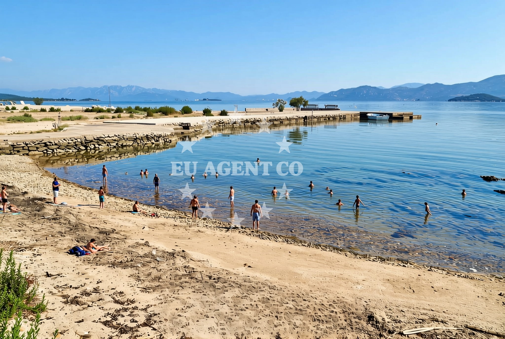
Podgrad istok, Drače Beach is a coastal stretch located in the Drače area of Podgrad istok. This beach extends approximately 40 meters along the shoreline, featuring a mix of sand, pebbles, gravel, and concrete/stone slabs. The presence of natural shade offers a practical benefit for visitors seeking respite from direct sunlight. While no formal amenities are listed, the beach’s composition and length suggest it may appeal to those looking for a more rugged, unspoiled shoreline experience.
About this beach
Podgrad istok, Drače
Beach: Podgrad istok
Location: Drače
Characteristics and facilities
Sand, pebbles, gravel, concrete / stone slabs
40 m
Natural shade
Beach character
The beach’s composition includes a combination of sand, pebbles, and gravel, with sections of concrete or stone slabs. This mix of textures creates a distinct tactile experience along the shore. The 40-meter length provides a modest stretch for visitors, though it is unlikely to accommodate large groups or extensive recreational activities. Natural shade is a notable feature, likely provided by nearby vegetation or topographical elements. The absence of structured facilities means the beach remains in its natural state, without artificial interventions such as sunbeds, umbrellas, or paved walkways.
Swimming and shore
The beach’s mix of sand and pebbles may influence swimming conditions, with softer sand areas potentially offering more comfort for wading. The gravel and stone slabs could create uneven terrain along the shore, which might affect accessibility. Natural shade is a practical asset for visitors, though the beach’s short length means it may not provide extensive shaded areas. Water depth and current information are not specified in the catalog, so swimmers should exercise caution and assess conditions on-site.
Facilities and activities
No formal amenities or structured activities are listed for Podgrad istok, Drače Beach. The beach appears to be in its natural state, without facilities such as showers, restrooms, or parking. Visitors are likely to find it suitable for basic activities like sunbathing, walking along the shore, or casual swimming. The lack of listed amenities suggests a focus on minimalistic, nature-oriented recreation rather than commercialized beach services.
Access and location
Podgrad istok, Drače Beach is situated in the Drače area of Podgrad istok, a coastal locality in Croatia. The beach’s coordinates (42.919991°N, 17.464928°E) place it within a region known for its rugged coastline and traditional maritime culture. While specific access routes or road connections are not detailed in the catalog, the beach’s location implies proximity to local settlements or rural areas typical of the Croatian Adriatic coast. Visitors should consider local transportation options or nearby towns for access points.
What to expect
Podgrad istok, Drače Beach offers a straightforward shoreline experience defined by its natural composition and modest size. Visitors can expect a mix of sand, pebbles, and gravel along the shore, with concrete or stone slabs adding to the beach’s textured character. The 40-meter length provides limited space for activities, making it more suitable for solitary relaxation or small group visits. Natural shade is available, though its extent depends on local vegetation. The absence of formal amenities means the beach remains unaltered, catering to those who prefer a minimalist, nature-focused visit.
Practical tips
Given the beach’s natural state, visitors may want to bring towels, water, and sun protection. The mix of sand and pebbles could make barefoot walking uneven, so sturdy footwear may be advisable for exploring the shore. The natural shade is a benefit, but visitors should still monitor sun exposure, especially during peak hours. As no facilities are listed, it is recommended to carry personal items such as snacks, drinks, and beach equipment.
Exploring the coast by yacht
Podgrad istok, Drače Beach is located along the Croatian Adriatic coast, a region popular with yacht charter guests due to its scenic coastline and accessible sailing routes. While the beach itself does not appear to be a designated anchorage or marina, its proximity to the shore may make it a point of interest for sailors exploring the area. Yacht charter guests navigating the region could consider this beach as a potential stop for informal shore excursions, though specific docking or mooring details are not provided in the catalog.
Regional Context
The Drače area of Podgrad istok is part of a broader coastal landscape characterized by rocky inlets, traditional fishing villages, and unspoiled natural scenery. This region is less developed compared to Croatia’s more tourist-centric coastlines, offering a quieter alternative for visitors seeking authenticity. The surrounding waters are part of the Adriatic Sea, known for its clear waters and favorable sailing conditions during the summer months.
Anchorages in the surrounding area
Anchorages in Zuljana and Trstenik provide nearby mooring options within 2.9 nautical miles of Podgrad istok, Drače Beach.
- Anchorage — zuljana — 1.8 NM from beach
- Anchorage — zuljana — 2.2 NM from beach
- Anchorage — trstenik — 2.3 NM from beach
- Anchorage — trstenik — 2.6 NM from beach
- Anchorage — trstenik — 2.9 NM from beach
- Anchorage — brijesta — 2.9 NM from beach
- Anchorage — duba — 3.6 NM from beach
- Anchorage — duboka — 3.8 NM from beach
Distances are straight-line geographic distances, not sailing routes.
Mooring buoys in the surrounding area
- Brijesta — 3.1 NM from beach
- Jetty — blace — 5.0 NM from beach
- Buoy — mljet — 8.5 NM from beach
- Restaurant Dalmatinac quay — mljet — 8.5 NM from beach
- Konoba Joseph dock — polace — mljet — 8.7 NM from beach
Distances are straight-line geographic distances, not sailing routes.
Marine fuel stations
- Fuel station — ploce — 8.0 NM from beach
- Fuel station — sobra — mljet — 12.9 NM from beach
- Fuel station — korcula — 14.1 NM from beach
- Ina — makarska — 29.9 NM from beach
Distances are straight-line geographic distances, not sailing routes.
Harbours in the surrounding area
- Drače — drace — 0.9 NM from beach
- Žuljana — zuljana — 1.8 NM from beach
- Sresar — rat — 1.9 NM from beach
- Trstenik — 2.9 NM from beach
- Opuzen — 7.4 NM from beach
- Ploče — ploce — 8.1 NM from beach
Distances are straight-line geographic distances, not sailing routes.
Marinas in the surrounding area
Marinas in Korčula, Slano, and Tučepi are located at increasing distances from Podgrad istok, Drače Beach.
- Marina Lumbarda — korcula — 12.9 NM from beach
- ACI Marina Korčula — korcula — 14.6 NM from beach
- ACI Marina Slano — 20.4 NM from beach
- Marina Tučepi — marina tucepi — 27.3 NM from beach
- Marina Solitudo — lastovo — 29.8 NM from beach
Distances are straight-line geographic distances, not sailing routes.
Restaurants near the beach
Restaurants in Zuljana provide nearby dining options within 1.87 nautical miles of Podgrad istok, Drače Beach.
- Bistro Ankora — zuljana — 1.8 NM from beach
- Konoba Riva — zuljana — 1.9 NM from beach
Distances are straight-line geographic distances, not sailing routes.
Navigation guides for the surrounding area
Navigation guides for Trstenik and Uvala Kljemtine assist with route planning near Podgrad istok, Drače Beach.
- Trstenik — 2.7 NM from beach
- Uvala Kljemtine — 4.3 NM from beach
- Uvala Klek — 4.6 NM from beach
- Uvala Lopata — 4.8 NM from beach
- Bl ace — 4.9 NM from beach
Distances are straight-line geographic distances, not sailing routes.
Yachts from nearby departure bases
Sailing yachts
- Elan 40 Impression (Karleta) — Ploče City Port — 8.0 NM from departure base to beach
- Sun Odyssey 349 (Visnjica) — Ploče City Port — 8.0 NM from departure base to beach
- Elan 514 Impression (Cesarica III) — Ploče City Port — 8.0 NM from departure base to beach
- Sun Odyssey 419 (Luka Ploce) — Ploče City Port — 8.0 NM from departure base to beach
- Salona 44 (SAMOA) — Ploče City Port — 8.0 NM from departure base to beach
- More 55 (MRS. ROBINSON) — Ploče City Port — 8.0 NM from departure base to beach
- Sun Odyssey 349 (Porto Tolero) — Ploče City Port — 8.0 NM from departure base to beach
- Oceanis 45 (Mambo 1) — Slano ACI Marina — 20.4 NM from departure base to beach
Catamarans
- Lagoon 450 Fly (Alba Mouse) — Ploče City Port — 8.0 NM from departure base to beach
- Lagoon 450 Flybridge (MALA MARE) — Slano ACI Marina — 20.4 NM from departure base to beach
Distances are straight-line geographic distances, not sailing routes.