Podgorje istok, Podgorje (Orebić) Beach, Croatia
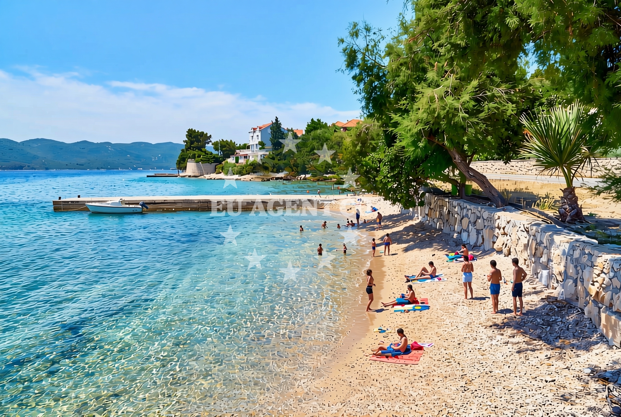
Podgorje istok, located in the town of Podgorje near Orebić on Croatia’s Adriatic coast, is a gravel and stone-slab beach stretching 70 meters. Its natural shade offers respite from the sun, making it a straightforward coastal spot for those seeking a simple shoreline experience.
About this beach
Podgorje istok, Podgorje (Orebić)
Beach: Podgorje istok
Location: Podgorje (Orebić)
Characteristics and facilities
Gravel, concrete / stone slabs
70 m
Natural shade
Beach character
The beach consists of gravel and concrete/stone slabs, a composition typical of coastal areas shaped by wave action. Its 70-meter length provides a modest stretch of shoreline, with natural shade from surrounding vegetation or topography. The lack of structured amenities means visitors should prepare for a basic, unembellished beach visit.
Swimming and shore
No specific data on water quality or swimming conditions is available for this beach. The gravel and stone surface may make direct water access uneven, though the shore itself is accessible for walking or light recreational use. As with all coastal areas, local currents and weather should be considered before entering the water.
Facilities and activities
No formal facilities or structured activities are listed for Podgorje istok. The beach appears to be a natural, unmanaged shoreline without designated amenities such as showers, restrooms, or lifeguard services. Visitors are advised to bring personal necessities for a self-sufficient visit.
Access and location
Podgorje istok lies within the municipality of Orebić, a coastal town in Dalmatia, Croatia. Its coordinates (42.974987°N, 17.144976°E) place it along the Adriatic Sea, near the broader sailing routes of the region. The area is part of a coastline that connects to larger settlements like Split and Dubrovnik, though specific local transport links or road access details are not outlined in the catalog.
What to expect
Visitors to Podgorje istok should expect a straightforward beach experience defined by its gravel and stone-slab surface, 70-meter length, and natural shade. There are no listed amenities, so self-sufficiency is key. The beach’s character is unadorned, focusing on raw coastal access rather than structured recreation. Its location in Orebić places it within reach of broader Adriatic sailing routes, though specific maritime details are not provided.
Practical tips
Given the gravel and stone-slab composition, wear appropriate footwear for walking on the beach. The natural shade can provide relief during peak sun hours, but sunscreen and hydration remain essential. As no facilities are listed, bring personal items such as water, snacks, and beach towels.
Exploring the coast by yacht
Podgorje istok’s location in Orebić situates it along Croatia’s Adriatic coastline, a region renowned for yacht charter opportunities. While the beach itself is not a marina or anchorage, the surrounding area offers access to sailing routes that extend toward the islands of Brač, Hvar, and Šolta. Yacht charter guests exploring the Dalmatian coast may find this beach a convenient stop for a brief shore excursion, though specific docking or anchoring details are not outlined here.
Regional Context
The Orebić area is part of the Split-Dalmatia region, known for its historical significance and proximity to major Adriatic ports. The coastline here transitions between rocky inlets and more open stretches, with Podgorje istok representing one of the latter. Local tourism often emphasizes cultural heritage, with nearby sites such as the town of Orebić itself offering historical and gastronomic interests.
Anchorages in the surrounding area
Anchorages in the surrounding area include Korcula and Badija, offering nearby mooring options.
- Anchorage — korcula — 1.3 NM from beach
- Anchorage — korcula — 1.5 NM from beach
- Anchorage — badija — 1.7 NM from beach
- Anchorage — korcula — 1.8 NM from beach
- Anchorage — korcula — 2.0 NM from beach
- Anchorage — korcula — 2.2 NM from beach
- Anchorage — lumbarda — korcula — 2.8 NM from beach
- Anchorage — duba peljeska — 3.6 NM from beach
Distances are straight-line geographic distances, not sailing routes.
Mooring buoys in the surrounding area
Mooring buoys in the surrounding area feature Korcula fuel jetties and Stupe restaurant buoys.
- Fuel jetty — korcula — 1.2 NM from beach
- Jetty — korcula — 1.8 NM from beach
- Restaurant Moro buoys — stupe — 2.1 NM from beach
- Vrnik Arts Club buoys — 2.4 NM from beach
- Quay — vrnik — 2.4 NM from beach
Distances are straight-line geographic distances, not sailing routes.
Marine fuel stations
- Fuel station — korcula — 1.2 NM from beach
- Fuel station — ploce — 13.6 NM from beach
- Ina — vela luka — korcula — 18.9 NM from beach
- Ina — ubli — lastovo — 19.8 NM from beach
Distances are straight-line geographic distances, not sailing routes.
Harbours in the surrounding area
Harbours in the surrounding area include Korcula's western and eastern harbors, as well as the nearby Orebić port.
- Korčula W harbour — korcula — 0.9 NM from beach
- Korčula E harbour — korcula — 1.0 NM from beach
- Orebić — orebic — 1.3 NM from beach
- Kučišće — kucisce — 1.4 NM from beach
- Viganj — 2.0 NM from beach
- Duba — duba peljeska — 3.2 NM from beach
Distances are straight-line geographic distances, not sailing routes.
Marinas in the surrounding area
Marinas in the surrounding area feature ACI Marina Korcula and Marina Lumbarda, with options extending to Tučepi and Lastovo.
- ACI Marina Korčula — korcula — 1.1 NM from beach
- Marina Lumbarda — korcula — 3.3 NM from beach
- Marina Tučepi — marina tucepi — 17.7 NM from beach
- Marina Solitudo — lastovo — 19.0 NM from beach
- Marina Korkyra — vela luka — korcula — 19.0 NM from beach
Distances are straight-line geographic distances, not sailing routes.
Restaurants near the beach
Restaurants near the beach are clustered in Korcula, offering dining choices within a short distance.
- Restaurant — korcula — 0.8 NM from beach
- Adio Mare — korcula — 0.9 NM from beach
- Restaurant Lesic Dimitri — korcula — 0.9 NM from beach
- Restaurant Filippi — korcula — 0.9 NM from beach
- Restaurant — korcula — 0.9 NM from beach
- Aterina — korcula — 0.9 NM from beach
- Restaurant — korcula — 1.0 NM from beach
Distances are straight-line geographic distances, not sailing routes.
Navigation guides for the surrounding area
Navigation guides for the surrounding area highlight key points such as Orebic and Otocic Badija, aiding route planning.
- Uvala Banja — 1.4 NM from beach
- Orebic — 1.5 NM from beach
- Otocic Badija — 1.7 NM from beach
- Uvala Vrbovica — 1.9 NM from beach
- Uvala Racisce — 3.0 NM from beach
Distances are straight-line geographic distances, not sailing routes.
Yachts from nearby departure bases
Yachts from nearby departure bases include vessels based in Ploče City Port and Tučepi Port, offering sail and motor boat options.
Sailing yachts
- Elan 40 Impression (Karleta) — Ploče City Port — 13.4 NM from departure base to beach
- More 55 (MRS. ROBINSON) — Ploče City Port — 13.4 NM from departure base to beach
- Sun Odyssey 349 (Visnjica) — Ploče City Port — 13.4 NM from departure base to beach
- Sun Odyssey 419 (Luka Ploce) — Ploče City Port — 13.4 NM from departure base to beach
- Elan 514 Impression (Cesarica III) — Ploče City Port — 13.4 NM from departure base to beach
- Salona 44 (SAMOA) — Ploče City Port — 13.4 NM from departure base to beach
- Sun Odyssey 349 (Porto Tolero) — Ploče City Port — 13.4 NM from departure base to beach
- Bavaria 40 Cruiser (LADY BUTTERFLY) — Tučepi Port — 17.7 NM from departure base to beach
Catamarans
- Lagoon 450 Fly (Alba Mouse) — Ploče City Port — 13.4 NM from departure base to beach
Motor yachts
- Princess V53 (Chablis) — Makarska Port — 19.8 NM from departure base to beach
Distances are straight-line geographic distances, not sailing routes.