Pod crkvu (Miramare), Njivice (Krk) Beach, Croatia
Pod crkvu (Miramare) Beach lies along the northern coast of Krk Island, a region known for its rugged coastline and historic settlements. This 270-meter stretch of shoreline combines natural elements with basic amenities, offering a straightforward beach experience for visitors seeking a quiet spot along Croatia’s Adriatic coast.
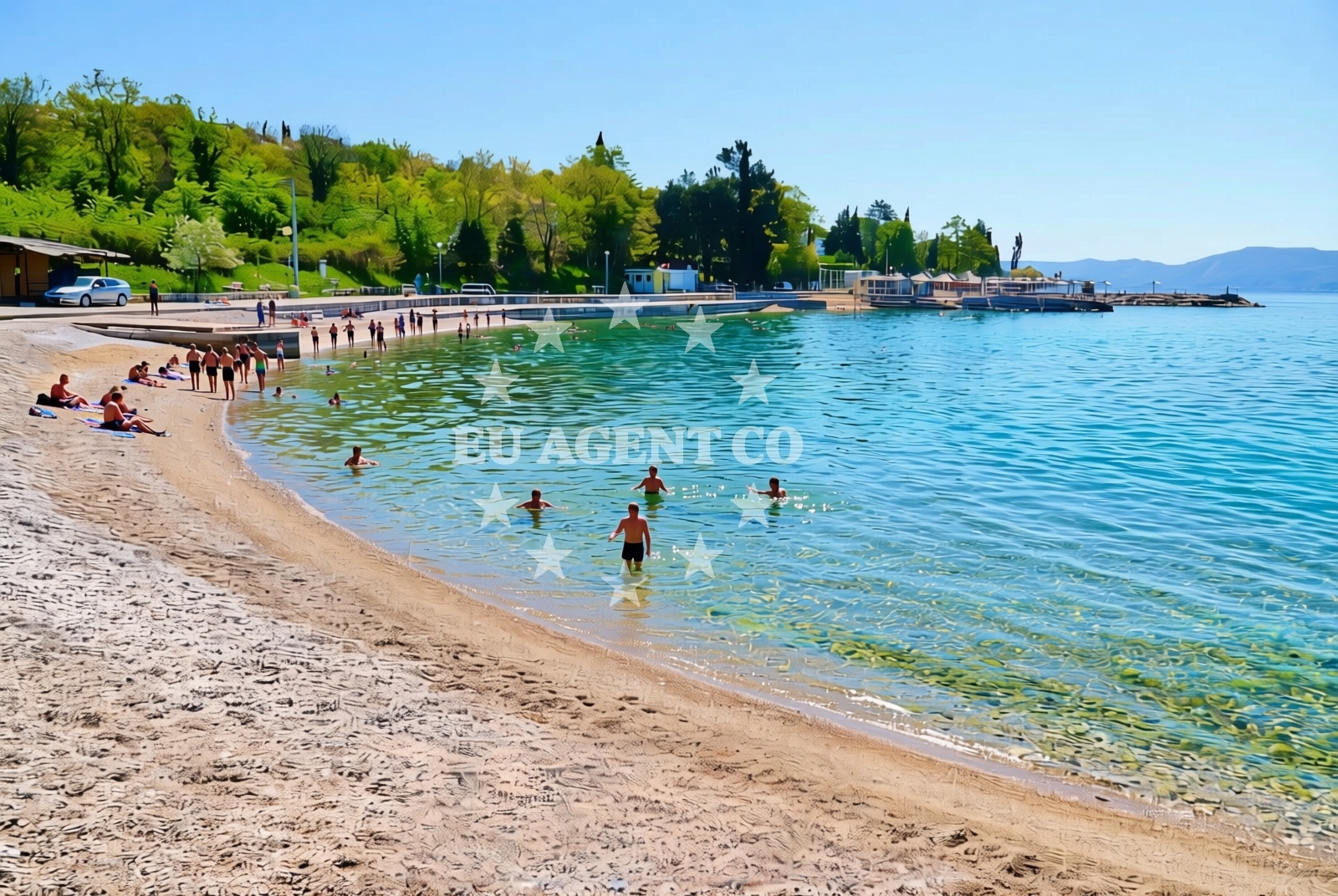
About this beach
Pod crkvu (Miramare), Njivice (Krk)
Beach: Pod crkvu (Miramare)
Location: Njivice (Krk)
Characteristics and facilities
Sand, gravel, concrete / stone slabs
270 m
Restaurant / snack bar
Caffe bar / Drinks stand
Natural shade
Beach character
The beach’s surface is a mix of sand, gravel, and concrete/stone slabs, reflecting its utilitarian design. Natural shade is available in certain areas, providing limited relief from the sun. While no structured facilities like showers or changing rooms are listed, the presence of a restaurant, snack bar, and drinks stand nearby suggests a minimal level of service for visitors.
Swimming and shore
The beach’s composition of sand and gravel may affect swimming comfort, though the exact water conditions are not specified. The shoreline appears to be accessible without significant barriers, making it suitable for casual use. The lack of detailed natural features in the catalog means further local knowledge would be needed to assess wave patterns or water clarity.
Facilities and activities
Pod crkvu (Miramare) Beach includes a restaurant, snack bar, and drinks stand within its immediate vicinity. These amenities suggest a focus on basic refreshments rather than extensive recreational offerings. No structured activities are listed in the catalog, though the beach’s location on Krk Island—a region with a strong maritime tradition—may imply opportunities for nearby exploration.
Access and location
Located in Njivice, Krk, the beach is part of a settlement that benefits from Krk’s position as a gateway to the Adriatic’s northern reaches. Access is likely via local roads connecting to the island’s main routes. For precise directions, the beach map provides a visual reference to its coordinates (45.163496, 14.540659).
What to expect
Pod crkvu (Miramare) Beach offers a no-frills coastal experience with a mix of natural and artificial surfaces. Visitors should expect a straightforward shoreline without extensive facilities, though nearby amenities like cafes and restaurants provide basic services. The beach’s character is defined by its utilitarian design and proximity to Krk’s historic and maritime elements.
Practical tips
Given the beach’s limited facilities, visitors may want to bring personal items like sunscreen or shaded seating. The presence of a restaurant and drinks stand suggests food and beverage options are available, though specific operating hours are not detailed in the catalog.
Exploring the coast by yacht
Krk Island’s coastline is a popular sailing destination, with its sheltered bays and historic ports attracting charter guests. While Pod crkvu (Miramare) Beach itself is not marked as an anchorage or marina, its location on Krk places it within reach of the island’s sailing routes. Nearby settlements may offer docking options for motor yachts, though specific details would require consultation with local charter providers.
Regional Context: Krk Island’s Coastal Appeal
Krk Island, where this beach is located, is a key point on Croatia’s northern Adriatic coast. Its mix of medieval towns, vineyards, and maritime routes makes it a destination for both cultural exploration and sailing. The island’s proximity to the mainland and its network of harbors support both day-trippers and longer charter voyages.
Anchorages in the surrounding area
Anchorages in the surrounding area include options near Njivice, Krk, offering convenient mooring spots.
- Anchorage — njivice — krk — 0.8 NM from beach
- Klimno — krk — 2.8 NM from beach
- Anchorage — malinska — krk — 3.2 NM from beach
- Anchorage — porat — krk — 3.3 NM from beach
- Anchorage — krk — 3.6 NM from beach
- Anchorage — voz — krk — 4.3 NM from beach
- Anchorage — voz — krk — 4.6 NM from beach
- Anchorage — klostar — 4.6 NM from beach
Distances are straight-line geographic distances, not sailing routes.
Mooring buoys in the surrounding area
- Buoy field — omisalj — krk — 2.8 NM from beach
- Jetty — voz — krk — 4.6 NM from beach
- Jetty — kacjak — 5.3 NM from beach
- Jetty — dramalj — 5.6 NM from beach
- Jetty — dramalj — 5.6 NM from beach
Distances are straight-line geographic distances, not sailing routes.
Marine fuel stations
Marine fuel stations are situated in areas like Crikvenica, ensuring refueling options for vessels in the region.
- Fuel station — crikvenica — 6.4 NM from beach
- OMV — krk — 8.3 NM from beach
- Ina — krk — 8.5 NM from beach
- Flash — krk — 8.5 NM from beach
Distances are straight-line geographic distances, not sailing routes.
Harbours in the surrounding area
Harbours in the surrounding area include the nearby Njivice, Krk, offering direct access to the beach.
- Njivice — krk — 0.1 NM from beach
- Haludovo — malinska — krk — 1.9 NM from beach
- Haludovo — malinska — krk — 1.9 NM from beach
- Čižići — cizici — krk — 2.5 NM from beach
- Porat — krk — 3.1 NM from beach
- Vantačić — vantacic — vantacici — 3.2 NM from beach
Distances are straight-line geographic distances, not sailing routes.
Marinas in the surrounding area
- Omišalj Docks — omisalj — krk — 2.8 NM from beach
- Šilo — silo — krk — 5.5 NM from beach
- Marina Punat — krk — 8.8 NM from beach
- Marina Novi — novi vinodolski — 10.7 NM from beach
- Mitan Marina — novi vinodolski — 11.6 NM from beach
Distances are straight-line geographic distances, not sailing routes.
Restaurants near the beach
Restaurants near the beach include Rivica in Njivice, Krk, offering dining options close to the shore.
- Rivica — njivice — krk — 0.1 NM from beach
- Restaurant — malinska — krk — 1.8 NM from beach
- Restaurant — malinska — krk — 1.9 NM from beach
- Restaurant Obala — malinska — krk — 2.4 NM from beach
- Restaurant — cizici — krk — 2.4 NM from beach
- Restaurant — cizici — krk — 2.4 NM from beach
- Restaurant — cizici — krk — 2.5 NM from beach
Distances are straight-line geographic distances, not sailing routes.
Navigation guides for the surrounding area
Navigation guides for the surrounding area include detailed information on Njivice, aiding in route planning near the beach.
- Njivice — 0.3 NM from beach
- Luka Kijac — 0.8 NM from beach
- Uvala Sapan — 2.4 NM from beach
- Omisaljski Zaljev — 3.2 NM from beach
- Uvala Cavlena — 4.7 NM from beach
Distances are straight-line geographic distances, not sailing routes.
Yachts from nearby departure bases
Yachts from nearby departure bases include options from Malinska Hotel Malin port and Krk Marina Punat, providing access to the beach area.
Sailing yachts
- Sun Odyssey 29.2 (Mirabai) — Malinska Hotel Malin port — 2.7 NM from departure base to beach
- Bavaria 32 (Andromeda) — Kraljevica Port Porto — 6.8 NM from departure base to beach
- Bavaria 36 (Tamra) — Kraljevica Port Porto — 6.8 NM from departure base to beach
- Dehler 42 (Vivid) — Krk Marina Punat — 8.8 NM from departure base to beach
- Solaris 44 (Trinity) — Krk Marina Punat — 8.8 NM from departure base to beach
Catamarans
- Lagoon 40 (SUNLIGHT) — Krk Marina Punat — 8.8 NM from departure base to beach
Motor yachts
- Galeon 500 Fly (Barbara) — Krk Marina Punat — 8.8 NM from departure base to beach
Motor boats
- Barracuda 590 (Solta) — Crikvenica City Port — 6.6 NM from departure base to beach
- Barracuda 590 (Barracuda 12) — Crikvenica City Port — 6.6 NM from departure base to beach
- Bavaria E40 Fly (Ivona) — Krk Marina Punat — 8.8 NM from departure base to beach
Distances are straight-line geographic distances, not sailing routes.