Plaza Zukamice Beach – Komiža, Croatia
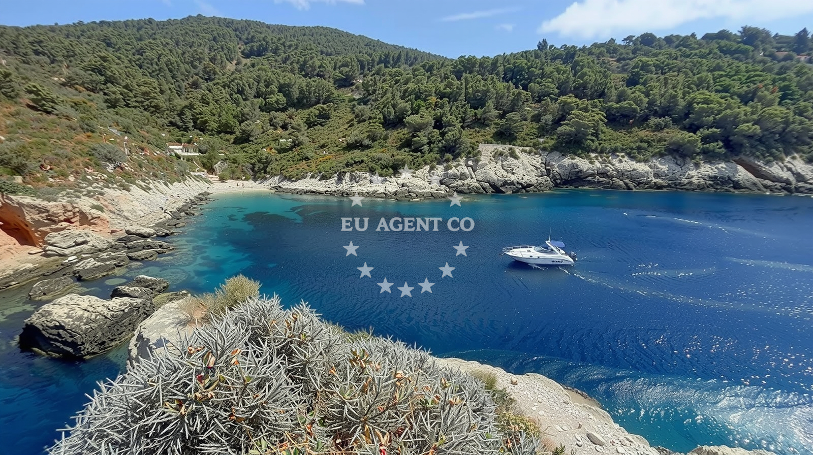
Beach character
The beach’s most striking feature is its geological contrast. The shoreline is composed of fine beige pebbles, while the sea floor drops sharply to boulders, creating a moderate depth gradient that makes it unsuitable for swimming but ideal for snorkeling in shallower areas. The cliffs rising behind the beach are covered in sparse vegetation, offering panoramic views of the Adriatic Sea. The beach’s orientation within a narrow cove means it is partially sheltered from direct winds, though the open sea beyond the rocks can be choppy during storms.Swimming and shore
Swimming is impractical due to the pebble-strewn shore and the abrupt drop-off to rocky seabeds. However, the beach’s location within a cove creates a microclimate of relative calm, making it a good spot for kayaking or stand-up paddleboarding in the shallows. The absence of facilities or lifeguards means it is not recommended for young children or inexperienced swimmers.Facilities and activities
There are no permanent facilities at Plaza Zukamice. The beach is accessed via a short trail from the village of Komiža, which offers basic amenities like restaurants and accommodations. The beach’s primary appeal lies in its proximity to hiking trails that wind through the surrounding mountains. These paths connect to higher elevations with views of the island’s interior and the broader Dalmatian Coast.Access and location
Plaza Zukamice is located in the village of Komiža, a historic fishing settlement on the island of Vis. The beach is accessible via a footpath that begins near the village’s main road, which is served by local buses and seasonal ferries connecting Vis to the mainland. The island’s lack of motor vehicles means the area retains a rustic character, though the nearby town of Komiza offers services for visitors. The beach is approximately 15 nautical miles from the marina in Split, making it a potential stop for yachts exploring the central Dalmatian coast.What to expect
Plaza Zukamice is a beach for those who prioritize natural beauty over convenience. Its pebble shore and lack of facilities mean it is not a typical tourist destination, but its isolation and scenic setting make it rewarding for hikers and photographers. The beach is best visited during shoulder seasons when crowds are minimal, though the moderate cleanliness index suggests visitors should bring their own waste disposal solutions. The area’s rugged terrain is a reminder of Vis’s status as a protected island, where development is limited to preserve its ecological and historical integrity.Practical tips
Wear sturdy footwear for the trail to the beach, as the path includes uneven terrain. Bring a reusable water bottle, as there are no drinking fountains nearby. The beach’s pebble surface makes it unsuitable for sunbathing, but the surrounding cliffs offer shaded vantage points.Exploring the coast by yacht
For yacht charter guests, the island of Vis and its surrounding waters are a key destination in the central Adriatic. The absence of large marinas on Vis means anchoring in sheltered bays like Plaza Zukamice’s cove is a common practice. Nearby, the town of Komiza offers fuel stations and provisioning services for sailors. The island’s position between the mainland and the Pelješac Peninsula makes it a strategic waypoint for itineraries exploring the Adriatic’s eastern coast.Komiža: A Village of Contrasts
The village of Komiža, just minutes from Plaza Zukamice, is a study in contrasts. Its white stone buildings and narrow streets reflect centuries of Venetian influence, yet its economy remains rooted in fishing and agriculture. The village’s annual festival, held in late July, celebrates local traditions with folk music, seafood feasts, and boat races. For visitors, Komiža serves as a base to explore Vis’s unspoiled landscapes, from its inland caves to its windswept northern coast.Hiking the Mountains of Vis
The trails near Plaza Zukamice are part of a larger network of paths that traverse Vis’s mountainous interior. The most popular route ascends to the peak of Hum, the island’s highest point, offering 360-degree views of the Adriatic. These trails are well-marked but challenging, with sections requiring scrambling over rocks. The lack of artificial structures along the way reinforces Vis’s reputation as a destination for those seeking untouched nature.Anchorages in the surrounding area
Anchorages in Komiza and Vis lie nearby, offering mooring options within a few nautical miles of Plaza Zukamice.
- Uvala Knezice — komiza — vis — 0.9 NM from beach
- Anchorage — komiza — vis — 1.5 NM from beach
- Anchorage — komiza — vis — 2.9 NM from beach
- Anchorage — bisevo — 5.2 NM from beach
- Porat — bisevo — 5.2 NM from beach
- Parja — vis — 5.4 NM from beach
- Stiniva — vis — 5.4 NM from beach
- Anchorage — vis — 5.5 NM from beach
Distances are straight-line geographic distances, not sailing routes.
Mooring buoys in the surrounding area
Mooring buoys in Komiza and Bisevo are situated near the beach and along nearby routes.
- Quay — vis — 0.5 NM from beach
- Komiza Buoy field — vis — 1.3 NM from beach
- Lucka Uprava buoys, Komiza — vis — 1.4 NM from beach
- Quay — bisevo — 5.0 NM from beach
- Quay — bisevo — 5.2 NM from beach
Distances are straight-line geographic distances, not sailing routes.
Marine fuel stations
- Petrol station Ina — vis — 5.5 NM from beach
- Fuel station — hvar — 18.0 NM from beach
- Fuel station — rogac — solta — 22.8 NM from beach
- Ina — milna brac — 23.2 NM from beach
Distances are straight-line geographic distances, not sailing routes.
Harbours in the surrounding area
- Komiža — komiza — vis — 1.5 NM from beach
- Luka — vis — 5.5 NM from beach
- Rogačić — vis — 5.6 NM from beach
- Kut — vis — 6.1 NM from beach
Distances are straight-line geographic distances, not sailing routes.
Marinas in the surrounding area
Marinas in St Klement, Solta, and Brac are located in nearby areas beyond the immediate vicinity of the beach.
- ACI Marina Palmižana — aci marina palmizana — st klement — 15.9 NM from beach
- Marina Martinis Marchi — maslinica — solta — 21.3 NM from beach
- Marina Vlaška — milna brac — 23.3 NM from beach
- Marina Milna Kanarija — milna brac — 23.3 NM from beach
- ACI Marina Milna — milna brac — 23.4 NM from beach
Distances are straight-line geographic distances, not sailing routes.
Restaurants near the beach
- Jastozera — komiza — vis — 1.4 NM from beach
- Barba — komiza — vis — 1.4 NM from beach
- Bako — komiza — vis — 1.4 NM from beach
- Restaurant — komiza — vis — 1.4 NM from beach
- Pizzeria Hum — komiza — vis — 1.5 NM from beach
- Fabrika — komiza — vis — 1.6 NM from beach
- Riblji Komiza — vis — 1.6 NM from beach
Distances are straight-line geographic distances, not sailing routes.
Navigation guides for the surrounding area
Navigation guides for Komiža and Uvala Stoncica assist with route planning in the surrounding waters.
- Komiža — 1.6 NM from beach
- Uvala Stoncica — 8.3 NM from beach
- Luka Soline — 14.8 NM from beach
Distances are straight-line geographic distances, not sailing routes.
Yachts from nearby departure bases
Sailing yachts
- Sun Odyssey 349 (Siberia) — Šolta Rogač — 22.7 NM from departure base to beach
- Oceanis 50 Family (Mississippi) — Šolta Rogač — 22.7 NM from departure base to beach
- Cyclades 43.4 (Tigris) — Šolta Rogač — 22.7 NM from departure base to beach
- Oceanis 46.1 (Everest) — Šolta Rogač — 22.7 NM from departure base to beach
- Sun Odyssey 449 (Odessa) — Šolta Rogač — 22.7 NM from departure base to beach
Catamarans
- Lagoon 42 (Galapagos) — Šolta Rogač — 22.7 NM from departure base to beach
- Lagoon 450 (Madagascar) — Šolta Rogač — 22.7 NM from departure base to beach
- Lagoon 450 Flybridge (Samogon) — Šolta Rogač — 22.7 NM from departure base to beach
- Lagoon 400 (Greenland) — Šolta Rogač — 22.7 NM from departure base to beach
- Lagoon 40 (Solentia) — Šolta Rogač — 22.7 NM from departure base to beach
Distances are straight-line geographic distances, not sailing routes.