Plaza Vlacica Beach, Croatia
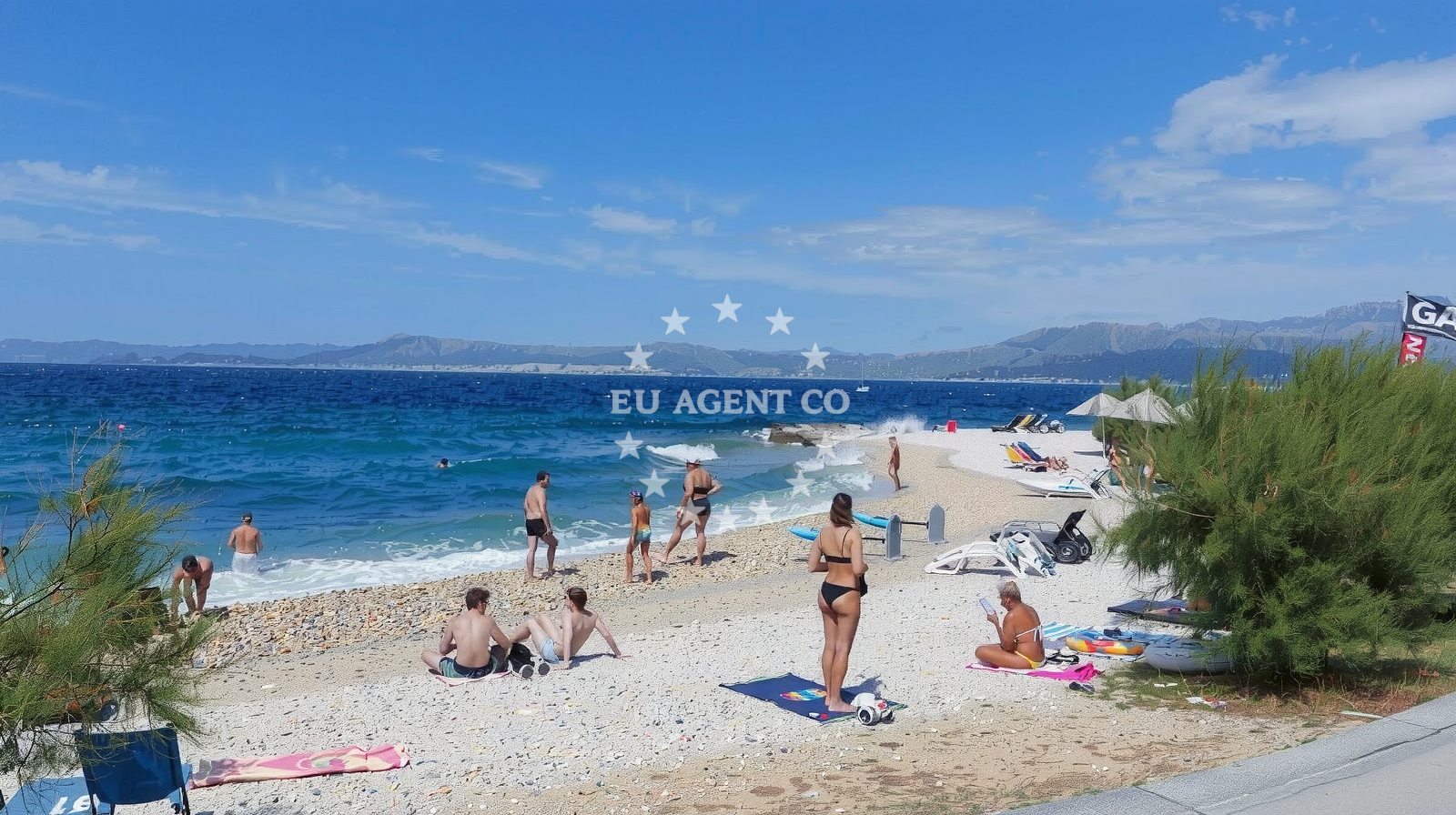
Beach character
The beach’s defining feature is its linear shape, framed by boulders that create natural shade and a textured shoreline. The sea floor consists of boulders, which visitors should note when entering the water. Depth increases gradually from the shore, offering a mix of shallows and deeper areas. The beach’s alignment with the coast allows for unobstructed views of the Adriatic Sea, though the rocky terrain requires caution for swimmers.Swimming and shore
Swimming conditions are influenced by the boulder-strewn seabed, which can make navigation challenging for inexperienced swimmers. The moderate depth increase means the beach is suitable for casual swimming but not ideal for deep-water activities. The shoreline’s natural boulders provide resting spots and contribute to the beach’s distinctive character. SUP and surfing are popular here, with the beach’s orientation offering favorable wave patterns for surfers.Facilities and activities
Plaza Vlacica lacks formal amenities like showers or toilets, though one reviewer noted a public shower available for 2 kuna per minute. Activities include stand-up paddleboarding, surfing, and general water entertainment. The beach’s proximity to Supetar means access to nearby town facilities, though no structured amenities are present on-site. The rocky terrain necessitates water shoes for comfort.Access and location
Located at Bana Josipa Jelčića 1A in Supetar, the beach is accessible via road networks connecting Brač to mainland Croatia and other Dalmatian islands. Its position on the island’s western coast places it within reach of marinas in Supetar and nearby villages. The beach’s coordinates (43.38579, 16.54995) situate it near the southern tip of Brač, with views of the Pelješac Peninsula to the south.What visitors say
Visitors report a mixed experience: one praised the beach as "nice" but noted the need for water shoes due to rocks, while another described it as "quite regular." Crowding is a recurring theme in high season, with one reviewer calling it "quite crowdy." Cleanliness is generally rated as good, though no formal services are available on-site. The beach’s appeal lies in its accessibility and the range of water activities.Practical tips
Wear water shoes to navigate the rocky shoreline comfortably. Be prepared for crowds during peak season, and check for public shower availability if needed. The beach’s natural terrain makes it ideal for SUP and surfing but less suited for those seeking soft sand.Exploring the coast by yacht
For yacht charter guests, Plaza Vlacica’s location on Brač’s western coast offers proximity to Supetar Marina, a key base for Adriatic sailing. The beach’s accessibility and surrounding coastline make it a convenient stop for crews exploring the Dalmatian coast. Nearby anchorages and marinas support extended stays, with the beach serving as a popular landing point for day trips.Crowd and Cleanliness Notes
The beach is marked as busy in high season, with visitors noting its cleanliness as "good." While no formal waste management facilities exist, the area’s popularity means regular maintenance by local authorities.Anchorages in the surrounding area
- Anchorage — supetar — brac — 0.6 NM from beach
- Anchorage — splitska — brac — 2.2 NM from beach
- Anchorage — postira — brac — 3.2 NM from beach
- Uvala Likva — sutivan — brac — 3.9 NM from beach
- Bobovišća — bobovisce — brac — 4.4 NM from beach
- Stiniva — brac — 4.5 NM from beach
- Stipanska — brac — 4.8 NM from beach
- Anchorage — postira — brac — 5.2 NM from beach
Distances are straight-line geographic distances, not sailing routes.
Mooring buoys in the surrounding area
Mooring buoys in the surrounding area are located in Bobovisce, Podstrana, Postira, and Milna Brac.
- Nautical Anchorage Bobovišća — bobovisce — brac — 4.3 NM from beach
- Nautical Anchorage Bobovišća — bobovisce — brac — 4.5 NM from beach
- Jetty — podstrana — 5.3 NM from beach
- Quay — postira — brac — 5.9 NM from beach
- Buoy — milna brac — 6.3 NM from beach
Distances are straight-line geographic distances, not sailing routes.
Marine fuel stations
- Ina — milna brac — 5.9 NM from beach
- Fuel station — bol — brac — 8.8 NM from beach
- Ina — split — 8.8 NM from beach
- Ina — split — 9.4 NM from beach
Distances are straight-line geographic distances, not sailing routes.
Harbours in the surrounding area
- Supetar — brac — 0.2 NM from beach
- Pod Mirca — brac — 1.3 NM from beach
- Splitska — brac — 2.5 NM from beach
- Sutivan — brac — 3.1 NM from beach
- Postira — brac — 3.4 NM from beach
- Bobovišće — bobovisce — brac — 4.4 NM from beach
Distances are straight-line geographic distances, not sailing routes.
Marinas in the surrounding area
Marinas in the surrounding area are found in Milna Brac, Podstrana, and Split.
- ACI Marina Milna — milna brac — 5.7 NM from beach
- Marina Milna Kanarija — milna brac — 5.8 NM from beach
- Marina Vlaška — milna brac — 5.9 NM from beach
- Marina Lav — podstrana — 6.4 NM from beach
- ACI Marina Split — 8.7 NM from beach
Distances are straight-line geographic distances, not sailing routes.
Restaurants near the beach
Restaurants near the beach include Neven, Lukin, Vinotoka, and other dining options in Supetar and nearby areas.
- Neven — supetar — brac — 0.1 NM from beach
- Lukin — supetar — brac — 0.2 NM from beach
- Vinotoka — supetar — brac — 0.2 NM from beach
- Mala Kate — supetar — brac — 0.3 NM from beach
- Mate — mirca — brac — 1.2 NM from beach
- Vala — splitska — brac — 2.5 NM from beach
- Konoba Kopačina — donji humac — brac — 2.8 NM from beach
Distances are straight-line geographic distances, not sailing routes.
Navigation guides for the surrounding area
Navigation guides for the surrounding area cover locations such as Uvala Spliska, Sutivan, Postire, and Dugi Rat.
- Uvala Spliska (Splitska) — 2.6 NM from beach
- Sutivan — 2.9 NM from beach
- Postire — 3.6 NM from beach
- Uvala Stipanska — 4.5 NM from beach
- Dugi Rat (Uvala Orisac) — 5.3 NM from beach
Distances are straight-line geographic distances, not sailing routes.
Yachts from nearby departure bases
Yachts from nearby departure bases include those based in Dugi Rat Luka Krilo, Sumpetar Port, Milna Marina Vlaška, and Podstrana Marina Lav.
Sailing yachts
- Hanse 388 (BANJO) — Milna Marina Vlaška — 5.9 NM from departure base to beach
- Hanse 505 (AVALON) — Milna Marina Vlaška — 5.9 NM from departure base to beach
- Hanse 455 (AURUM 1) — Milna Marina Vlaška — 5.9 NM from departure base to beach
- Bavaria 46 Cruiser (MO) — Milna Marina Vlaška — 5.9 NM from departure base to beach
- Jeanneau 53 (Win Win) — Podstrana Marina Lav — 6.4 NM from departure base to beach
Catamarans
- Lagoon 450 Fly (Falco) — Sumpetar Port — 5.1 NM from departure base to beach
Motor yachts
- Cranchi M44 HT (Brown Sugar 2) — Podstrana Marina Lav — 6.4 NM from departure base to beach
Gulets / Cruisers
- Gulet cruiser (AGORA) — Dugi Rat Luka Krilo — 4.9 NM from departure base to beach
- Gulet (Cataleya) — Sumpetar Port — 5.1 NM from departure base to beach
- Gulet (Altair) — Sumpetar Port — 5.1 NM from departure base to beach
Distances are straight-line geographic distances, not sailing routes.
Frequently asked questions
Is Plaza Vlacica suitable for families with young children?
The beach’s rocky terrain and lack of formal amenities may make it less ideal for very young children, though older children and adults will find it suitable for water activities.Are there facilities for water sports rentals?
No structured rental facilities are listed on-site, but the beach’s association with SUP and surfing suggests local operators may offer services in the area.Nearby beaches
Reviews
Nice public beach, of course with rocks, I recommend to wear water shoes. There is also a public shower which costs 2 kuna/ minute. You need to have coins of 2 kunas.
Just quite a regular beach, nothing impressive. 🤷🏻♂️
Beautiful place. Quite crowdy. Split-Dalmatia