Plaza Vickovo Mulo Beach, Croatia
Plaza Vickovo Mulo lies along the eastern coast of the island of Hvar, near the town of Starigrad. This 160-meter-long beach features a distinctive straight shoreline composed of small gray pebbles, with natural shade provided by the surrounding landscape. While not a traditional sandy beach, its unique character offers a different kind of coastal experience. The beach is particularly notable for its suitability to water sports, with activities like stand-up paddleboarding and surfing available in the moderate-depth waters beyond the boulder-strewn seabed.
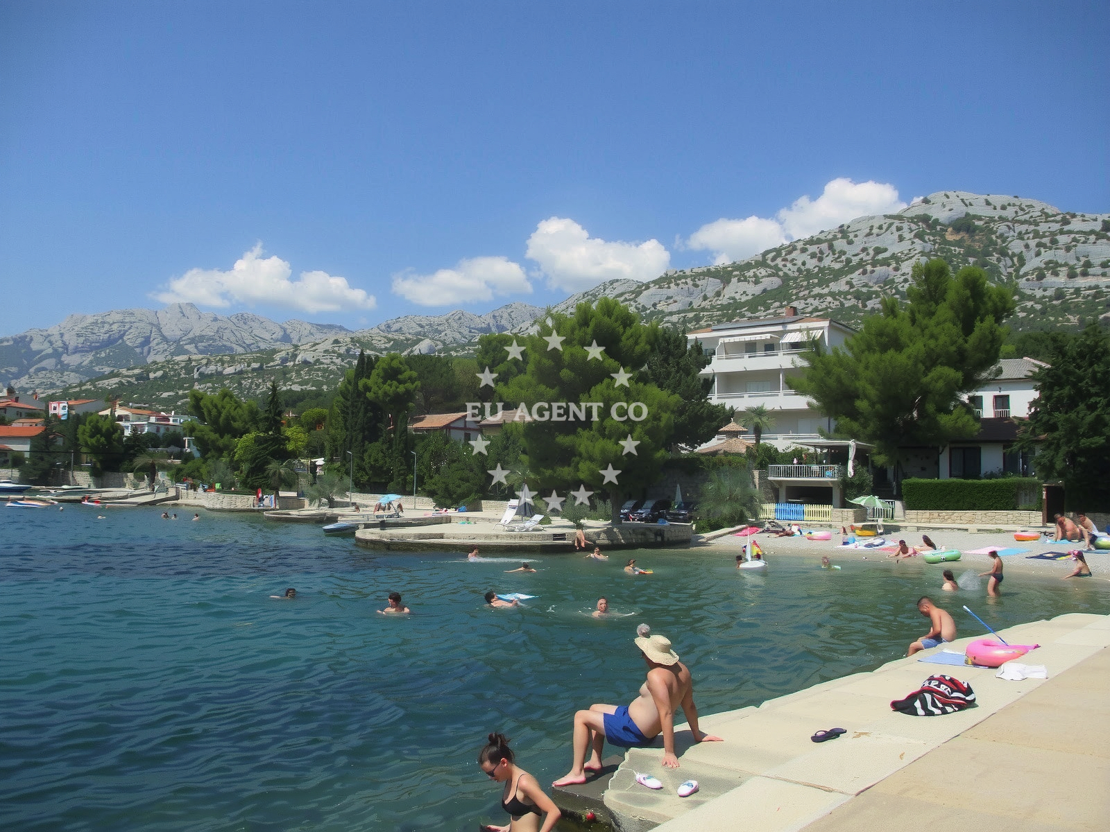
Beach character
The beach's natural features create a distinct environment. The shoreline is a straight, 30-meter-wide strip of small gray pebbles, with the sea floor extending into boulders that gradually increase in depth. This topography makes it less ideal for swimming with young children but creates favorable conditions for wave activity. The landscape provides natural shade, offering respite from the sun without artificial structures. The beach's orientation and surrounding geography contribute to its unique microclimate, with sea breezes moderating temperatures even during peak summer months.
Swimming and shore
The pebble composition of the beach creates a firm footing for visitors, though it may require appropriate footwear for comfort. The seabed transitions from pebbles to boulders, with depth increasing moderately beyond the shoreline. This configuration makes it more suitable for water-based activities than for swimming with toddlers. The moderate depth and wave action create conditions that support surfing and other water sports, with the boulders acting as natural breakwaters that shape the wave patterns.
Facilities and activities
While no formal facilities are listed, the beach's natural attributes support several activities. Stand-up paddleboarding is particularly well-suited to the conditions, with the pebble shore providing stable launching points. Surfing is possible due to the wave patterns created by the boulder-strewn seabed. Water entertainment options include rentals and guided sessions, though specific providers would need to be confirmed locally. The absence of formal amenities means visitors should bring their own equipment and supplies for extended stays.
Access and location
Located in Starigrad on the island of Hvar, the beach is part of a region known for its dramatic coastal landscapes and historic settlements. The nearby town of Starigrad offers traditional Dalmatian architecture and local cuisine, with connections to the broader Hvar island tourism network. The beach's position along the eastern coast places it within reach of other notable Adriatic destinations, with ferry routes connecting to Split and other major ports. The surrounding area includes vineyards and olive groves that contribute to the region's agricultural heritage.
What to expect
Visitors should expect a unique beach experience defined by its pebble shoreline and natural features. The beach is busy during peak season, with the crowd index indicating high activity levels. Cleanliness is maintained at a good standard, though the lack of formal facilities means visitors should plan accordingly. The beach's orientation and surrounding geography create a microclimate that remains comfortable even during hot summer days. The natural shade provided by the landscape offers respite from direct sunlight, making it a practical choice for extended stays.
Practical tips
Given the pebble composition, visitors are advised to wear appropriate footwear for comfort. The beach's suitability for water sports means that paddleboards and surf equipment should be considered. Due to the high crowd index during peak season, early arrival is recommended to secure preferred spots. The absence of formal facilities means that visitors should bring their own supplies for extended stays, including water, snacks, and sun protection.
Exploring the coast by yacht
For yacht charter guests exploring the Adriatic coast, Plaza Vickovo Mulo offers a strategic location within the Hvar sailing area. The beach's position along the eastern coast provides access to the broader Hvar island route, with connections to other marinas and anchorages in the region. While not a formal marina, the beach's proximity to Starigrad makes it a convenient stop for sailors seeking to explore the island's cultural sites and natural beauty. Yacht charter companies operating in the area can provide more specific information about sailing routes and docking options.
Regional Context and Cultural Connections
The beach's location in Starigrad places it within a region rich in cultural heritage. The town is known for its traditional architecture and historic landmarks, including the Church of St. Nicholas. The surrounding area includes vineyards producing the Plavac Mali grape variety, a local specialty. The beach's proximity to the Hvar Town ferry port provides connections to the island's main tourism hub, with regular services operating during the season. The region's maritime history is evident in the local fishing traditions and nautical infrastructure.
Anchorages in the surrounding area
Anchorages in the surrounding area include Vinjerac and Rtina in North Dalmatia.
- Anchorage — vinjerac — 2.6 NM from beach
- Anchorage — rtina — 5.9 NM from beach
- Anchorage — rtina — 6.0 NM from beach
- Anchorage — ljubac — 6.4 NM from beach
- Anchorage — ljubac — 6.5 NM from beach
- Anchorage — tribanj — 7.4 NM from beach
- Anchorage — maslenica — 8.0 NM from beach
- Anchorage — vlasici — pag — 9.5 NM from beach
Distances are straight-line geographic distances, not sailing routes.
Mooring buoys in the surrounding area
Mooring buoys in the surrounding area include Šibuljina Point and Ljubac Jetty in North Dalmatia.
- Šibuljina Point — sibuljina point — 4.7 NM from beach
- Jetty — ljubac — 6.5 NM from beach
- Jetty — zadar — 13.8 NM from beach
- Jetty — zadar — 13.8 NM from beach
- Punta Skala — petrcane — 13.9 NM from beach
Distances are straight-line geographic distances, not sailing routes.
Marine fuel stations
Marine fuel stations in the surrounding area include Zadar Ina and Sukosan Fuel Station in North Dalmatia.
- Ina — zadar — 13.9 NM from beach
- Fuel station — sukosan — 15.8 NM from beach
- Ina — preko — ugljan — 16.8 NM from beach
- Ina — biograd na moru — 21.5 NM from beach
Distances are straight-line geographic distances, not sailing routes.
Harbours in the surrounding area
Harbours in the surrounding area include Starigrad Paklenica and Seline in North Dalmatia.
- Starigrad Paklenica — 0.2 NM from beach
- Seline — 2.1 NM from beach
- Vinjerac — 2.6 NM from beach
- Ražanac — razanac — 3.8 NM from beach
- Maslenica — 6.5 NM from beach
- Miškovići — miskovici — pag — 9.2 NM from beach
Distances are straight-line geographic distances, not sailing routes.
Marinas in the surrounding area
Marinas in the surrounding area include Zadar Vitrenjak and Marina Zadar in North Dalmatia.
- Vitrenjak Zadar — 13.9 NM from beach
- Marina Zadar — 13.9 NM from beach
- Marina Borik — zadar — 13.9 NM from beach
- Marina Dalmacija — sukosan — 15.7 NM from beach
- Olive Island Marina — sutomiscica — ugljan — 16.6 NM from beach
Distances are straight-line geographic distances, not sailing routes.
Restaurants near the beach
Restaurants near the beach include Starigrad Paklenica Buffet and Seline Restaurant in North Dalmatia.
- Restaurant — starigrad paklenica — 0.8 NM from beach
- Buffet Paklenica — starigrad paklenica — 1.0 NM from beach
- Restaurant — seline — 2.2 NM from beach
- Gostionica Ivan — seline — 2.4 NM from beach
Distances are straight-line geographic distances, not sailing routes.
Navigation guides for the surrounding area
Navigation guides for the surrounding area include Starigrad-Paklenica and Velesitski Kanal (S) in North Dalmatia.
- Starigrad-Paklenica {Velebitski Kanai) — 0.4 NM from beach
- VELESITSKI KANAL (S) — 3.4 NM from beach
- Posedarje (Novigradsko More) — 5.7 NM from beach
- KrusCica and Uvala KrusCica Duboka — 5.7 NM from beach
- Privlaka — 13.6 NM from beach
Distances are straight-line geographic distances, not sailing routes.
Yachts from nearby departure bases
Yachts from nearby departure bases include those from Novigrad Dalmatia and Zadar Diklo Port in North Dalmatia.
Sailing yachts
- Elan 333 (Brik) — Zadar Marina — 13.9 NM from departure base to beach
- Bavaria 37 Cruiser (Rita) — Zadar Marina — 13.9 NM from departure base to beach
Catamarans
- Delta F40-XT (Veronchie) — Zadar Marina — 13.9 NM from departure base to beach
- Bali 4.6 (Jako 2) — Zadar Marina — 13.9 NM from departure base to beach
Motor boats
- Merry Fisher 795 () — Novigrad Dalmatia — 8.4 NM from departure base to beach
- Rancraft RM21 (Dugi otok) — Zadar Diklo Port — 13.2 NM from departure base to beach
- Rancraft RS Cinque.5 — Zadar Diklo Port — 13.2 NM from departure base to beach
- Rancraft RM19 (Daycruiser) — Zadar Diklo Port — 13.2 NM from departure base to beach
- Balt 918 Titanium (Wanderer) — Zadar Marina — 13.9 NM from departure base to beach
- Adriana 44 (Tina II) — Zadar Marina — 13.9 NM from departure base to beach
Distances are straight-line geographic distances, not sailing routes.