Plaza Slana Beach: History, Nature, and Coastal Insights in Metajna, Croatia
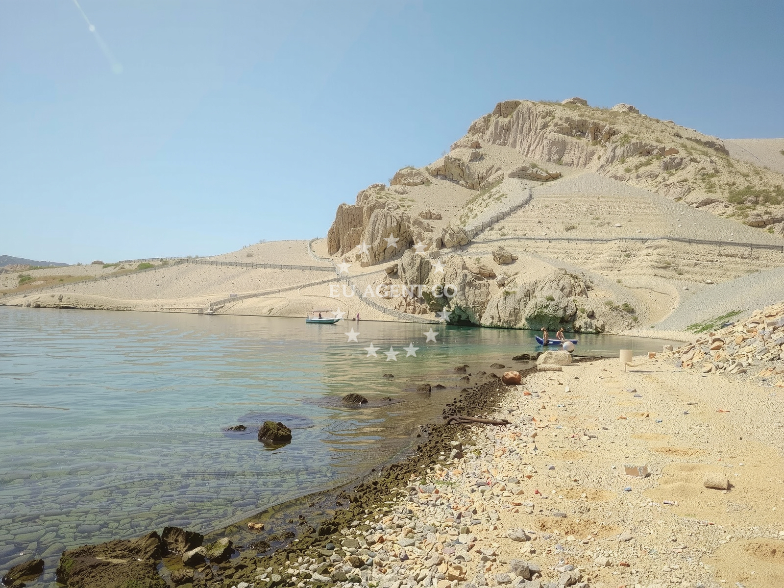
Beach character
Plaza Slana spans 160 meters in length and 20 meters in width, forming a narrow cove between steep cliffs and mountainous terrain. The beach is composed of beige pebbles, with a gently sloping seabed that transitions to deeper waters. The surrounding landscape features rugged cliffs and low-lying hills, creating a dramatic coastal panorama. Depth increases moderately as one moves away from the shore, making it unsuitable for swimming but offering vantage points for hiking and historical reflection.Swimming and shore
The pebbly shoreline and limited water depth make Plaza Slana unsuitable for swimming. However, the beach serves as a starting point for hiking trails that ascend the nearby hills, offering panoramic views of the Adriatic Sea. The area’s natural topography ensures minimal erosion, preserving the beach’s original contours.Facilities and activities
No formal facilities are present at Plaza Slana. The beach lacks amenities such as showers, restrooms, or parking, reflecting its status as a remote, historically significant site. The only activity explicitly noted is hiking, with the rugged terrain providing routes for moderate treks. The beach’s primary draw lies in its historical context rather than recreational offerings.Access and location
Plaza Slana is located in the village of Metajna, part of the municipality of Supetar on the island of Brač. The beach is accessible via a short walk from the village center, with no dedicated parking or road access. Its proximity to the Dalmatian coast places it within reach of yacht charter routes along the Adriatic, though no marinas or anchorages are directly associated with the site.What visitors say
Visitors have described Plaza Slana as a place of historical gravity rather than leisure. One reviewer noted the beach’s role as a landing site for ships carrying WWII prisoners, with remnants of an Ustasha concentration camp located just five minutes uphill. Another visitor highlighted the absence of commemorative plaques at the camp site, despite its significance as a location where over 10,000 people were killed in 1941. Both reviews emphasized the beach’s free public access and the preserved guardhouse nearby.Practical tips
Visitors should be prepared for uneven terrain when hiking near the beach. Comfortable footwear is recommended for exploring the surrounding hills. Due to the site’s historical sensitivity, respectful behavior is encouraged. There are no lifeguards or emergency services stationed at the beach.Exploring the coast by yacht
While Plaza Slana itself is not a marina or anchorage, its location on Brač Island places it within a popular yacht charter region. The Dalmatian coast, including nearby Supetar and Bol, offers numerous marinas and sailing routes. Charter guests exploring the area may use Plaza Slana as a reference point for navigating the island’s western coastline, though the beach is not typically included in sailing itineraries.Historical Context of Plaza Slana
The beach’s proximity to the remnants of an Ustasha concentration camp underscores its role in Croatia’s wartime history. Though the site lacks formal memorials, the preserved guardhouse and scattered foundations serve as silent testaments to the atrocities committed there. Local historians note that the camp operated between 1941 and 1942, with prisoners forced to labor under brutal conditions.Anchorages in the surrounding area
Anchorages in Mazurani and Cesarica offer nearby options for mooring in North Dalmatia and Istria-and-Kvarner regions.
- Anchorage — mazurani — 3.8 NM from beach
- Anchorage — cesarica — 3.9 NM from beach
- Anchorage — mazurani — 3.9 NM from beach
- Anchorage — cesarica — 4.1 NM from beach
- Anchorage — cesarica — 5.0 NM from beach
- Anchorage — proboj — pag — 5.7 NM from beach
- Anchorage — mandre — pag — 5.7 NM from beach
- Anchorage — mandre — pag — 6.0 NM from beach
Distances are straight-line geographic distances, not sailing routes.
Mooring buoys in the surrounding area
- Jetty — zubovici — pag — 3.3 NM from beach
- Jetty — zubovici — pag — 3.5 NM from beach
- Jetty — simuni — pag — 4.1 NM from beach
- Buoy field — novalja — pag — 8.4 NM from beach
- Drljanda — stara novalja — pag — 9.9 NM from beach
Distances are straight-line geographic distances, not sailing routes.
Marine fuel stations
Marine fuel stations in Rab and Zadar serve as refueling options in Istria-and-Kvarner and North-Dalmatia regions.
- Ina — rab — 19.9 NM from beach
- Ina — zadar — 24.0 NM from beach
- Ina — mali losinj — 25.2 NM from beach
- Adria Oil — mali losinj — 25.6 NM from beach
Distances are straight-line geographic distances, not sailing routes.
Harbours in the surrounding area
- Karlobag — 1.9 NM from beach
- Pag — 3.2 NM from beach
- Košljun — kosljun pag — 6.2 NM from beach
- Lukovo Šugarje — lukovo sugarje — rudelici — 6.3 NM from beach
- Žigljen — zigljen — pag — 6.6 NM from beach
- Prizna — 7.2 NM from beach
Distances are straight-line geographic distances, not sailing routes.
Marinas in the surrounding area
- ACI Marina Šimuni — simuni — pag — 4.4 NM from beach
- ACI Marina Rab — 19.9 NM from beach
- Marina Veli Rat — dugi otok — 22.9 NM from beach
- ACI Marina Supetarska Draga — rab — 23.0 NM from beach
- Marina Borik — zadar — 23.1 NM from beach
Distances are straight-line geographic distances, not sailing routes.
Restaurants near the beach
Restaurants in Pag, such as Konoba Bile and Dubrava, provide dining choices close to the beach.
- Konoba Bile — pag — 3.2 NM from beach
- Dubrava — pag — 3.2 NM from beach
- Pizzeria Villa Olea — simuni — pag — 4.2 NM from beach
- Didova Kuča — simuni — pag — 4.3 NM from beach
- Bistro Šimuni — simuni — pag — 4.3 NM from beach
- Ribarska Koliba Šimuni — simuni — pag — 4.3 NM from beach
- Maestral — simuni — pag — 4.4 NM from beach
Distances are straight-line geographic distances, not sailing routes.
Navigation guides for the surrounding area
Navigation guides for Uvala Bliznica, Caska, and Novalja assist in route planning near the beach.
- Uvala Bliznica — 4.0 NM from beach
- Caska — 6.1 NM from beach
- Uvala Prizna — 7.1 NM from beach
- Novalja — 7.8 NM from beach
- OTOK PAG — 11.2 NM from beach
Distances are straight-line geographic distances, not sailing routes.
Yachts from nearby departure bases
Sailing yachts
- First 45 (Egeria) — Šimuni Kolan ACI Marina — 4.4 NM from departure base to beach
- Dufour 560 (Anatoli) — Zadar Marina Borik — 23.1 NM from departure base to beach
Motor yachts
- Absolute 50 Fly (Acrobat) — Rab ACI Marina — 19.9 NM from departure base to beach
Motor boats
- BWA Sport 22GT (BWA ) — Pag City Port — 3.2 NM from departure base to beach
- Balt 818 Titanium (Valentina) — Novalja — 8.1 NM from departure base to beach
- Balt 818 Titanium (Valentina 2) — Novalja — 8.1 NM from departure base to beach
- Merry Fisher 895 — Povljana Marina — 9.3 NM from departure base to beach
- Rancraft RM19 (Daycruiser) — Zadar Diklo Port — 21.7 NM from departure base to beach
- Rancraft RM21 (Dugi otok) — Zadar Diklo Port — 21.7 NM from departure base to beach
- Rancraft RS Cinque.5 — Zadar Diklo Port — 21.7 NM from departure base to beach
Distances are straight-line geographic distances, not sailing routes.
Frequently asked questions
Is there any commemoration at the concentration camp site?
The site includes a cross and the remnants of a guardhouse, but no plaques or formal memorials mark the location. A memorial table once present at the beach was destroyed multiple times, leaving only hooks as evidence of its former existence.Nearby beaches
Reviews
The beach holds a dark history, serving as one of two locations where ships carrying Serb and Jewish prisoners landed during WWII. Just a brief five-minute walk from the shore lies the remnants of Ustasha's concentration camp, where a staggering 10,000 individuals were brutally slaughtered in a mere 2-3 months. Though some foundations of the barracks remain, the site is only marked by a cross and lacks any sort of commemorative plaque. Uphill to the east sits a well-preserved guardhouse. Unfortunately, the memorial table once located at the south end of Slana beach has been destroyed three times, leaving only the hooks that once held it in place.
Slana beach is a public beach that can be enjoyed by anyone for free. Additionally, above the beach, there are the remains of an Ustasha concentration camp that tragically saw the deaths of many Serbs, Jews, Croats, and other residents from different parts of Croatia in 1941.