Plaza Prodorica Beach, Croatia
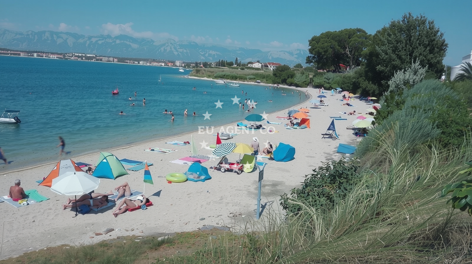
Plaza Prodorica stretches along the Adriatic coast near Nin, Croatia, offering a 970-meter shoreline of small beige pebbles. This straight, open beach is framed by natural shade and features a moderate depth increase, making it accessible for various water activities. While it lacks artificial amenities, its proximity to Nin’s cultural and coastal infrastructure provides a foundation for both leisure and nautical exploration.
Beach character
The beach’s defining feature is its unbroken shoreline, composed of small beige pebbles that extend 10 meters from the water’s edge. Natural shade from surrounding vegetation offers respite during peak hours, though the lack of structured amenities means visitors should plan accordingly. The sea floor consists of similar pebbles, with depth increasing gradually, supporting activities like snorkeling and stand-up paddling. The beach’s orientation and size make it a visible landmark along the Nin coastline.
Swimming and shore
Plaza Prodorica’s pebble beach is suitable for swimming, though the texture may require appropriate footwear. The beach is explicitly associated with three activities: stand-up paddleboarding (SUP), surfing, and general water entertainment. Its moderate depth and open shoreline provide conditions for these pursuits, though surfers should note that wave consistency may vary with seasonal winds. The beach’s high season crowd index indicates it can become densely populated during peak months.
Facilities and activities
No structured amenities or facilities are listed for Plaza Prodorica. Visitors should assume no showers, restrooms, or parking infrastructure are present. The beach’s activities are limited to the three explicitly noted: SUP, surfing, and water entertainment. These require personal equipment or local rentals, which may be available in nearby Nin.
Access and location
Located at Ciglarska ulica Nin 43, Nin, the beach is accessible via road networks connecting to the town of Nin and the broader Adriatic coast. Nin itself is a historic settlement on the island of Pag, known for its medieval architecture and proximity to the Pag salt pans. The beach’s position along the mainland coast contrasts with Pag’s island geography, offering a different perspective on the region’s coastal diversity.
What to expect
Plaza Prodorica presents a straightforward coastal experience centered on its natural features. Expect a pebble beach with no artificial amenities, suitable for leisurely sunbathing or active water use. The beach’s high season crowd level means visitors should anticipate shared space, particularly during summer. Cleanliness is noted as good, though the absence of facilities means waste management depends on visitor responsibility. The beach’s orientation and size make it a practical stop for those exploring the Nin area by land or sea.
Practical tips
Consider wearing grippy footwear for the pebble beach. Check local conditions for surf and SUP suitability, as these depend on wind patterns. Arrive early in high season to secure a spot. While no facilities are listed, nearby Nin offers accommodations and services for extended stays.
Exploring the coast by yacht
For yacht charter guests, Plaza Prodorica’s location along the mainland coast of Pag provides a convenient reference point for navigating the Adriatic. The surrounding waters are part of a broader sailing area that includes the island of Pag and the nearby Kvarner Gulf. Yachts based in nearby marinas, such as those in the town of Nin or the islands of Cres and Lošinj, can use this beach as a visual marker for coastal orientation. However, the beach itself is not designated as an anchorage or marina.
Cultural Context of Nin
Nin, the settlement near Plaza Prodorica, is a historic town with a medieval fortress and a legacy of salt production. Its proximity to the Pag salt pans and the island of Pag offers visitors a blend of coastal and cultural experiences. The town’s infrastructure supports both land-based tourism and maritime activities, making it a logical hub for yacht charter itineraries in the region.
Anchorages in the surrounding area
Anchorages near Nin provide convenient mooring options close to Plaza Prodorica.
- Anchorage — nin — 0.1 NM from beach
- Anchorage — nin — 0.8 NM from beach
- Anchorage — nin — 1.6 NM from beach
- Anchorage — vrsi — 2.2 NM from beach
- Anchorage — privlaka — 3.0 NM from beach
- Anchorage — privlaka — 3.7 NM from beach
- Anchorage — smokvica — 4.2 NM from beach
- Anchorage — ljubac — 4.2 NM from beach
Distances are straight-line geographic distances, not sailing routes.
Mooring buoys in the surrounding area
- Punta Skala — petrcane — 4.0 NM from beach
- Jetty — ljubac — 4.1 NM from beach
- Vir — 5.8 NM from beach
- Jetty — zadar — 7.2 NM from beach
- Jetty — zadar — 7.3 NM from beach
Distances are straight-line geographic distances, not sailing routes.
Marine fuel stations
Marine fuel stations in Zadar and Ugljan ensure refueling options for vessels traveling to the beach.
- Ina — zadar — 7.8 NM from beach
- Ina — preko — ugljan — 10.2 NM from beach
- Fuel station — sukosan — 12.4 NM from beach
- Ina — zaglav — dugi otok — 18.0 NM from beach
Distances are straight-line geographic distances, not sailing routes.
Harbours in the surrounding area
- Nin — 0.7 NM from beach
- Mulo — nin — 0.9 NM from beach
- Privlaka — 3.7 NM from beach
- Petrčane — petrcane — 4.0 NM from beach
- Miškovići — miskovici — pag — 5.5 NM from beach
- Ražanac — razanac — 6.8 NM from beach
Distances are straight-line geographic distances, not sailing routes.
Marinas in the surrounding area
Marinas in Zadar and Ugljan provide泊位 for vessels seeking to explore the area around Plaza Prodorica.
- Marina Borik — zadar — 7.0 NM from beach
- Vitrenjak Zadar — 7.2 NM from beach
- Marina Zadar — 7.8 NM from beach
- Olive Island Marina — sutomiscica — ugljan — 9.1 NM from beach
- Marina Preko — ugljan — 10.0 NM from beach
Distances are straight-line geographic distances, not sailing routes.
Restaurants near the beach
Restaurants in Nin and Vir offer dining options for visitors to the beach.
- Tomislav — nin — 0.7 NM from beach
- Branimir — nin — 0.7 NM from beach
- Restaurant — vir — 4.4 NM from beach
- Grill Marion — vir — 4.9 NM from beach
Distances are straight-line geographic distances, not sailing routes.
Navigation guides for the surrounding area
Navigation guides for Privlaka and Otok Pag assist in planning routes to the beach area.
- Privlaka — 3.5 NM from beach
- OTOK PAG — 5.5 NM from beach
- Ugljan — 8.0 NM from beach
- Ceprljanda — 8.0 NM from beach
- VELESITSKI KANAL (S) — 8.1 NM from beach
Distances are straight-line geographic distances, not sailing routes.
Yachts from nearby departure bases
Sailing yachts
- Oceanis 46.1 (Sevid) — Zadar Marina Borik — 7.0 NM from departure base to beach
- Bavaria Cruiser 37 (Porec) — Zadar Marina Borik — 7.0 NM from departure base to beach
Catamarans
- Sunreef 60 (SINATA) — Zadar Marina Borik — 7.0 NM from departure base to beach
- Leopard 50 (Solaia) — Zadar Marina Borik — 7.0 NM from departure base to beach
Motor yachts
- Prestige 550 Fly (Floria) — Zadar Marina Borik — 7.0 NM from departure base to beach
- Ferretti 780 (TESORO) — Zadar Marina Borik — 7.0 NM from departure base to beach
Motor boats
- Rancraft RS Cinque.5 — Zadar Diklo Port — 5.7 NM from departure base to beach
- Rancraft RM21 (Dugi otok) — Zadar Diklo Port — 5.7 NM from departure base to beach
- Rancraft RM19 (Daycruiser) — Zadar Diklo Port — 5.7 NM from departure base to beach
- Merry Fisher 895 (Bepo) — Zadar Marina Borik — 7.0 NM from departure base to beach
Distances are straight-line geographic distances, not sailing routes.