Plaza Mala Beach, Croatia
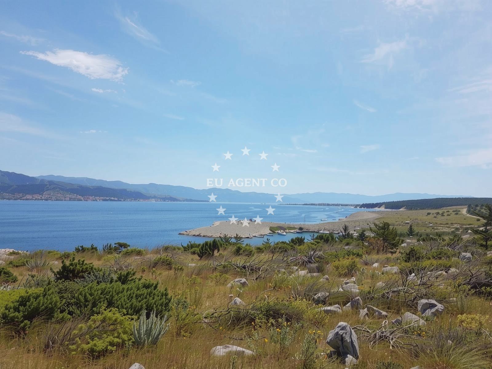
Beach character
Plaza Mala’s defining feature is its rocky terrain. The beach is composed of boulders that form a natural barrier along the shore, with the sea floor continuing in a similar pattern of large stones. This geological composition contributes to the cove’s moderate depth increase, making it a shallow but dynamic environment. The beach’s orientation and surrounding cliffs create a sheltered microclimate, though the presence of frequent boat traffic in the area has influenced its use as a diving spot. The lack of formal amenities underscores its character as a natural, unspoiled location, with visitors relying on the landscape’s inherent features for recreation.Swimming and shore
The beach’s shallow, boulder-strewn seabed makes it a viable spot for snorkeling, though divers are advised to use a buoy due to the high volume of passing boats. The water clarity is consistently good, revealing vibrant marine life against the rocky substrate. Swimming is possible in the shallower areas, but the uneven sea floor may make it less comfortable for general use. The absence of designated swim zones or lifeguards reflects the beach’s informal nature, with safety relying on self-awareness rather than infrastructure.Facilities and activities
No formal facilities are present at Plaza Mala. The beach lacks parking, restrooms, or changing areas, aligning with its status as a remote, natural site. However, its primary activity is snorkeling, with visitors drawn to the clear waters and underwater visibility. Freediving is also practiced, though the need for a buoy to avoid collisions with boats is a recurring note in visitor reports. The beach’s rocky terrain limits other recreational uses, making it a niche destination for those seeking solitude and direct interaction with the marine environment.Access and location
Access to Plaza Mala is challenging due to the absence of roads or footpaths leading directly to the beach. Visitors must navigate the rocky shoreline from the mainland, a process that requires careful footing. The beach’s coordinates (45.18052, 14.62122) place it within the broader coastal network of northern Dalmatia, an area known for its dramatic cliffs and sailing routes. While not a formal anchorage, the surrounding waters are part of a region frequented by yachts, with nearby marinas in towns like Rijeka and Opatija offering docking options for visitors exploring the area.What visitors say
Reviewers consistently highlight Plaza Mala’s scenic appeal and snorkeling potential, though several note challenges related to accessibility and boat traffic. One visitor described it as "a charming small bay with beautiful views, ideal for freediving," while another cautioned that "diving without a buoy is not advisable" due to the frequent presence of boats. Multiple reviewers mentioned the difficulty of reaching the beach from land, with one stating, "there are no footpaths or roads leading to it." Despite these hurdles, the beach’s natural beauty and tranquil atmosphere remain its strongest draws.Practical tips
Bring a buoy if snorkeling to avoid collisions with passing boats. Wear sturdy footwear for navigating the rocky shoreline. Arrive early to secure a spot on the beach, as the limited access points can become crowded during peak hours. Consider using nearby marinas in Klimno or neighboring towns for docking and amenities before heading to the beach.Exploring the coast by yacht
Plaza Mala lies within a sailing region characterized by its coastal inlets and maritime activity. While the beach itself is not a formal anchorage, the surrounding waters are part of a network of sailing routes that connect to larger marinas in the area. Yacht charter guests exploring the northern Adriatic may find the nearby port of Rijeka a convenient base for trips to this secluded cove. The beach’s proximity to these sailing hubs makes it a potential stop for those seeking a brief immersion in natural coastal landscapes during longer voyages.Regional Context and Coastal Exploration
The beach is situated in the Primorje-Gorski Kotar region, an area marked by its rugged coastline and historical significance as a maritime corridor. The nearby town of Klimno, located on the northern Adriatic coast, serves as a gateway to both the Istrian Peninsula and the broader Adriatic Sea. This region’s mix of rocky shores and sheltered bays creates diverse sailing conditions, with many anchorages and marinas catering to both leisure and commercial vessels. Visitors to Plaza Mala may also consider exploring the nearby islands of Cres and Lošinj, which are accessible via short ferry routes from Rijeka.Anchorages in the surrounding area
- Anchorage — krk — 0.1 NM from beach
- Klimno — krk — 1.7 NM from beach
- Anchorage — kacjak — 1.8 NM from beach
- Anchorage — kacjak — 1.8 NM from beach
- Anchorage — dramalj — 2.0 NM from beach
- Anchorage — klostar — 2.3 NM from beach
- Anchorage — jadranovo — 2.7 NM from beach
- Anchorage — voz — krk — 3.1 NM from beach
Distances are straight-line geographic distances, not sailing routes.
Mooring buoys in the surrounding area
Mooring buoys and jetties in Kacjak, Dramalj, and Omisalj are within a few nautical miles of Klimno.
- Jetty — kacjak — 1.9 NM from beach
- Jetty — dramalj — 2.0 NM from beach
- Jetty — dramalj — 2.0 NM from beach
- Buoy field — crikvenica — 2.9 NM from beach
- Buoy field — omisalj — krk — 3.5 NM from beach
Distances are straight-line geographic distances, not sailing routes.
Marine fuel stations
Fuel stations in Crikvenica, Novi Vinodolski, and Krk provide refueling options near the Klimno region.
- Fuel station — crikvenica — 3.1 NM from beach
- INA — novi vinodolski — 7.8 NM from beach
- Flash — krk — 9.6 NM from beach
- Ina — krk — 9.6 NM from beach
Distances are straight-line geographic distances, not sailing routes.
Harbours in the surrounding area
- Slivanjska — rudine — krk — 0.5 NM from beach
- Klimno — krk — 1.5 NM from beach
- Čižići — cizici — krk — 1.8 NM from beach
- Podvorska — crikvenica — 2.5 NM from beach
- Šilo — silo — krk — 2.7 NM from beach
- Marina Jadranovo — 2.8 NM from beach
Distances are straight-line geographic distances, not sailing routes.
Marinas in the surrounding area
- Šilo — silo — krk — 2.7 NM from beach
- Omišalj Docks — omisalj — krk — 3.5 NM from beach
- Marina Novi — novi vinodolski — 7.7 NM from beach
- Mitan Marina — novi vinodolski — 8.6 NM from beach
- Marina Punat — krk — 9.1 NM from beach
Distances are straight-line geographic distances, not sailing routes.
Restaurants near the beach
- Zal — klimno — krk — 1.4 NM from beach
- Val — klimno — krk — 1.4 NM from beach
- Oleander — klimno — krk — 1.5 NM from beach
- Restaurant — cizici — krk — 1.7 NM from beach
- Restaurant — cizici — krk — 1.8 NM from beach
- Restaurant — cizici — krk — 1.8 NM from beach
- Restaurant — silo — krk — 2.7 NM from beach
Distances are straight-line geographic distances, not sailing routes.
Navigation guides for the surrounding area
Navigation guides for Crikvenica, Njivice, and Omisaljski Zaljev assist in route planning from the Klimno region.
- Uvala Stipanja {Silo) — 2.9 NM from beach
- Crikvenica — 3.2 NM from beach
- Njivice — 3.3 NM from beach
- Uvala Sapan — 3.4 NM from beach
- Omisaljski Zaljev — 3.7 NM from beach
Distances are straight-line geographic distances, not sailing routes.
Yachts from nearby departure bases
Sailing yachts
- Sun Odyssey 29.2 (Mirabai) — Malinska Hotel Malin port — 5.6 NM from departure base to beach
- Bavaria 32 (Andromeda) — Kraljevica Port Porto — 6.2 NM from departure base to beach
- Bavaria 36 (Tamra) — Kraljevica Port Porto — 6.2 NM from departure base to beach
- Bavaria Cruiser 46 (Alexandra) — Vinodolski Novi Marina — 7.7 NM from departure base to beach
- Elan 40 Impression (VALHALLA) — Vinodolski Novi Marina — 7.7 NM from departure base to beach
Catamarans
- Bali 5.4 (Joza) — Vinodolski Novi Marina — 7.7 NM from departure base to beach
- Aventura 34 (Marlon) — Vinodolski Novi Marina — 7.7 NM from departure base to beach
Motor boats
- Barracuda 590 (Solta) — Crikvenica City Port — 3.2 NM from departure base to beach
- Barracuda 590 (Barracuda 12) — Crikvenica City Port — 3.2 NM from departure base to beach
- Adriana 36 (Gaja) — Vinodolski Novi Marina — 7.7 NM from departure base to beach
Distances are straight-line geographic distances, not sailing routes.
Frequently asked questions
Is there parking available near Plaza Mala?
No formal parking is available at the beach itself. Visitors must navigate the rocky shoreline from the mainland, as there are no roads or footpaths leading directly to the beach.Can I snorkel at Plaza Mala?
Yes, the beach is suitable for snorkeling due to its clear waters and boulder-strewn seabed. However, divers are advised to use a buoy to avoid collisions with passing boats.Are there any nearby marinas or docking facilities?
The nearest marinas are located in Klimno and larger ports such as Rijeka and Opatija, which are accessible via local roads or ferry services.Nearby beaches
Reviews
A charming small bay with beautiful views, ideal for freediving. However, be cautious as there are many boats frequenting the area, so diving without a buoy is not advisable. Unfortunately, there is no land access due to the numerous rocks blocking the way.
The small bay offers beautiful views and is great for freediving, but there are a lot of boats in the area so diving without a buoy is not recommended. Access to the bay from land is difficult due to the rocky terrain.
Getting to the beach from the mainland is a bit tricky since there are no footpaths or roads leading to it. However, the water is beautiful and perfect for snorkeling, and you can also take a refreshing dip in it. Primorje-Gorski Kotar