Plaza Barcica Beach - Stara Baška, Croatia
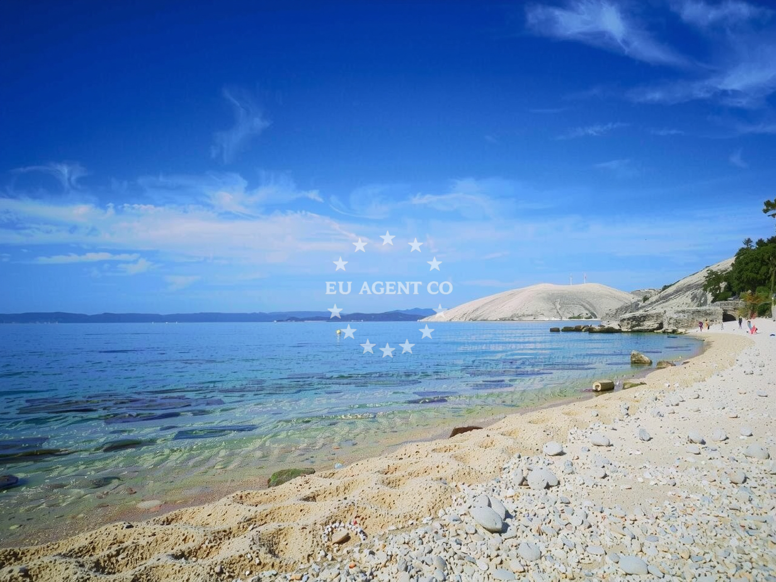
Beach character
The beach's predominant surface is composed of beige pebbles, with the shoreline interspersed by rocky outcrops that form natural coves. The depth increases gradually, creating a moderate profile that supports both wading and snorkeling. The presence of cliffs along parts of the beach adds to its distinct topography, offering elevated vantage points for observing the sea. This combination of pebbles, rock formations, and open water defines the beach's character as a naturally varied coastal environment.Swimming and shore
The pebble-covered shore provides a stable surface for walking, though footwear is recommended for comfort. The moderate depth increase allows for safe swimming in shallower areas while deeper sections remain accessible to more experienced swimmers. Snorkeling is a notable activity here, with the sea floor consisting of pebbles that may reveal marine life in clearer waters. The absence of artificial structures means the shoreline remains in its natural state, preserving the beach's original character.Facilities and activities
No formal amenities are listed for Plaza Barcica, reflecting its status as a naturally formed beach. The primary activity associated with the site is snorkeling, which aligns with the beach's underwater terrain. The lack of developed facilities emphasizes the beach's focus on unspoiled coastal access, appealing to visitors seeking a more authentic interaction with the environment.Access and location
Located in Stara Baška, a coastal settlement on the island of Pag, the beach is part of a region known for its rugged coastline and traditional fishing heritage. The area is accessible via roads connecting to the mainland and other parts of the island. While specific parking details are not documented, the proximity to Stara Baška suggests infrastructure typical of the region, which may include roadside parking options near the beach entrance.What to expect
Plaza Barcica is best suited for visitors seeking a naturally formed beach experience. The multi-cove structure offers varied shorelines, with some sections featuring more open access and others defined by cliffs. The beach is described as clean, with a 'Good' cleanliness index, and is recommended for families and leisure seekers. In high season, the beach becomes 'Packed,' indicating it is a popular destination during peak times. The absence of formal amenities means visitors should prepare for a beach that prioritizes natural conditions over developed facilities.Practical tips
Visitors should consider the pebble-covered shore when planning activities, as it may affect comfort levels. The beach's popularity in high season suggests arriving early to secure preferred spots. The moderate depth profile supports both casual swimming and snorkeling, making it a versatile option for different water activities.Exploring the coast by yacht
The island of Pag, where Plaza Barcica is located, is part of a sailing region known for its sheltered bays and clear waters. Yacht charter guests exploring the northern Adriatic may find the surrounding coastline appealing, with opportunities to anchor near traditional fishing villages and access other beaches like those in the nearby town of Novalja. The area's maritime character, combined with its natural beaches, makes it a relevant consideration for those seeking coastal experiences in Croatia.Regional Context: Stara Baška and the Island of Pag
Stara Baška is a coastal town on the island of Pag, renowned for its salt production and historic architecture. The island itself is characterized by its arid landscape, white stone buildings, and a coastline that transitions from rocky shores to sandy beaches. Plaza Barcica's location within this setting places it near other notable sites, including the medieval village of Baška and the nearby beaches of Bol and Zlatni Rat. The region's cultural heritage and natural beauty contribute to its appeal as a destination for both land and sea-based exploration.Anchorages in the surrounding area
Anchorages in Stara Baška and Krk offer nearby options for mooring within a few nautical miles of Plaza Barcica.
- Anchorage — stara baska — krk — 0.4 NM from beach
- Anchorage — krk — 0.7 NM from beach
- Anchorage — krk — 0.9 NM from beach
- Anchorage — krk — 1.1 NM from beach
- Anchorage — krk — 1.7 NM from beach
- Anchorage — krk — 2.0 NM from beach
- Golden Beach — stara baska — krk — 2.1 NM from beach
- Anchorage — krk — 2.3 NM from beach
Distances are straight-line geographic distances, not sailing routes.
Mooring buoys in the surrounding area
- Jetty — stara baska — krk — 0.4 NM from beach
- Jetty — stara baska — krk — 0.4 NM from beach
- Jetty — stara baska — krk — 0.4 NM from beach
- Buoy field — krk — 2.5 NM from beach
- Jetty — punat — krk — 4.9 NM from beach
Distances are straight-line geographic distances, not sailing routes.
Marine fuel stations
- Flash — krk — 6.1 NM from beach
- Ina — krk — 6.2 NM from beach
- OMV — krk — 9.0 NM from beach
- INA — novi vinodolski — 10.9 NM from beach
Distances are straight-line geographic distances, not sailing routes.
Harbours in the surrounding area
- Baška — baska — krk — 3.3 NM from beach
- Punat — krk — 4.5 NM from beach
- Krk — 6.1 NM from beach
- Vrbnik — krk — 7.2 NM from beach
- Melna — goli otok — 8.4 NM from beach
- San Marino — lopar — rab — 8.6 NM from beach
Distances are straight-line geographic distances, not sailing routes.
Marinas in the surrounding area
Marinas in Punat, Supetar, and Novi Vinodolski cater to yachts departing from bases near Plaza Barcica.
- Marina Punat — krk — 4.9 NM from beach
- ACI Marina Supetarska Draga — rab — 9.5 NM from beach
- Marina Novi — novi vinodolski — 11.0 NM from beach
- Mitan Marina — novi vinodolski — 11.0 NM from beach
- Šilo — silo — krk — 11.5 NM from beach
Distances are straight-line geographic distances, not sailing routes.
Restaurants near the beach
Restaurants in Stara Baška offer dining options directly adjacent to the beach.
- Mariana Restaurant — stara baska — krk — 0.4 NM from beach
- Nadia — stara baska — krk — 0.4 NM from beach
- Restaurant — stara baska — krk — 0.4 NM from beach
- Restaurant — krk — 2.5 NM from beach
- Restaurant — baska — krk — 3.2 NM from beach
- Restaurant — baska — krk — 3.3 NM from beach
- Konoba Ribice — punat — krk — 4.5 NM from beach
Distances are straight-line geographic distances, not sailing routes.
Navigation guides for the surrounding area
Navigation guides for Baška, Vrbnik, and Lopar assist with route planning from the surrounding area.
- Baška — 3.5 NM from beach
- Uvala Vela Luka — 5.5 NM from beach
- Vrbnik — 7.2 NM from beach
- Uvala Lopar — 7.4 NM from beach
- Uvala Sv. Marak — 8.8 NM from beach
Distances are straight-line geographic distances, not sailing routes.
Yachts from nearby departure bases
Yachts departing from Krk Punat port and Marina Punat are based near the beach with short travel distances.
Sailing yachts
- First 25.7 (Petra) — Krk Punat port — 4.5 NM from departure base to beach
- Salona 45 (Nati) — Krk Punat port — 4.5 NM from departure base to beach
- Bavaria 40 Cruiser (Star Philip) — Krk Marina Punat — 4.9 NM from departure base to beach
- Bavaria 34 (Theia) — Krk Marina Punat — 4.9 NM from departure base to beach
Catamarans
- Lagoon 380 (Xenia) — Krk Punat port — 4.5 NM from departure base to beach
- Lucia 40 (Idefix) — Krk Marina Punat — 4.9 NM from departure base to beach
- Lucia 40 (LUCE) — Krk Marina Punat — 4.9 NM from departure base to beach
Motor yachts
- Elegance 60 Fly (LIFESTYLE 1) — Krk Marina Punat — 4.9 NM from departure base to beach
- Sunseeker 64 (MARITA) — Krk Marina Punat — 4.9 NM from departure base to beach
Motor boats
- Atlantis 47 (B 747) — Krk Marina Punat — 4.9 NM from departure base to beach
Distances are straight-line geographic distances, not sailing routes.