Planike istok, Mimice Beach, Croatia
About this beach
Planike istok, Mimice
Beach: Planike istok
Location: Mimice
Characteristics and facilities
Gravel
40 m
Natural shade
Beach character
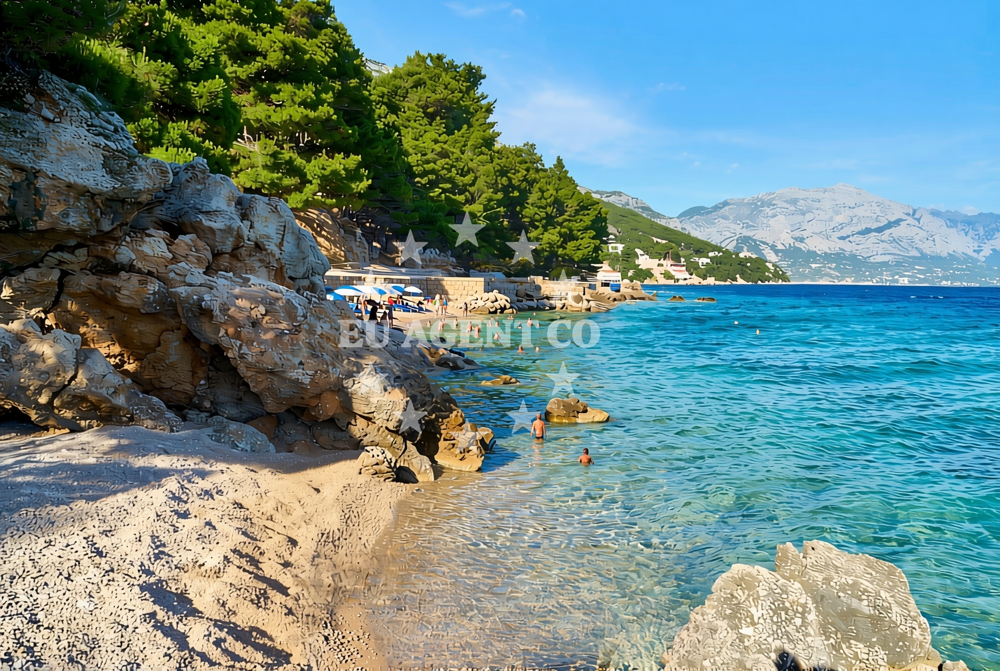
The beach's gravel composition defines its character, creating a surface that is more suited to walking than swimming. The 40-meter length is flanked by natural rock formations that contribute to the area's rugged appeal. Limited vegetation along the shore offers sporadic shade, though visitors should expect direct sunlight exposure for much of the day. The beach's simplicity reflects its status as a lesser-developed coastal area, with no formal amenities or infrastructure present.Swimming and shore
Due to its gravel substrate, Planike istok is not ideal for swimming. The shoreline's rocky nature creates shallow, uneven water conditions that would make swimming challenging and potentially hazardous. The beach's primary appeal lies in its natural setting rather than recreational water activities. The adjacent shoreline of Planike istok, however, may offer more conventional swimming opportunities for those willing to walk a short distance.Facilities and activities
There are no formal facilities or services at Planike istok, Mimice Beach. The absence of amenities such as restrooms, showers, or parking reflects the beach's undeveloped status. No structured activities are reported, though the natural environment may appeal to visitors interested in geological observation or photography. The surrounding Mimice area offers limited tourism infrastructure, with most services concentrated in nearby coastal settlements.Access and location
Planike istok is situated within the Mimice coastal area, part of the broader Planike istok region along Croatia's eastern Adriatic coast. Access to the beach requires reaching the Mimice settlement, which is connected to major coastal routes via local roads. The beach's precise location is defined by its proximity to the Planike istok shoreline, though specific directional details from nearby towns are not documented in available records.What to expect
Visitors should anticipate a basic, undeveloped beach experience at Planike istok. The gravel surface requires appropriate footwear, and the lack of amenities means preparation for minimal facilities. The beach's natural features, including its rocky terrain and limited vegetation, create an environment more suited to casual exploration than active recreation. Its location within the Planike istok coastline makes it a potential stop for those navigating this part of the Dalmatian coast.Practical tips
For visitors considering a trip to Planike istok, it is advisable to bring comfortable walking shoes due to the gravel surface. Sun protection is essential given the limited natural shade. Those seeking swimming opportunities should check the adjacent Planike istok shoreline for more suitable access points.Exploring the coast by yacht
For yacht charter guests exploring the Croatian coast, the Planike istok area offers a strategic vantage point along the Dalmatian coastline. While Planike istok itself is not a formal anchorage, the broader Mimice region and neighboring settlements provide access to the Adriatic's sailing routes. Yacht charter operators in this area typically focus on the more developed coastal towns, though the natural beauty of the Planike istok shoreline may appeal to sailors seeking scenic cruising opportunities.Regional Context
The Mimice area is part of the larger Planike istok coastline, which stretches along Croatia's eastern Adriatic shore. This region is characterized by its rugged terrain and sparse coastal development, contrasting with the more touristic hubs further south along the Dalmatian coast. Local settlements in the area are primarily focused on fishing and small-scale agriculture, with tourism infrastructure concentrated in select coastal locations.Anchorages in the surrounding area
Anchorages in the surrounding area near Povlja on Brac, offering nearby mooring options.
- Tri luke — povlja — brac — 3.8 NM from beach
- Anchorage — povlja — brac — 4.1 NM from beach
- Anchorage — povlja — brac — 4.1 NM from beach
- Anchorage — povlja — brac — 4.1 NM from beach
- Anchorage — povlja — brac — 4.1 NM from beach
- Anchorage — povlja — brac — 4.2 NM from beach
- Anchorage — povlja — brac — 4.4 NM from beach
- Anchorage — povlja — brac — 4.5 NM from beach
Distances are straight-line geographic distances, not sailing routes.
Mooring buoys in the surrounding area
Mooring buoys in the surrounding area, including Restaurant Pipo buoys and jetty in Povlja.
- Restaurant Pipo buoys — povlja — brac — 3.8 NM from beach
- Restaurant Pipo jetty — povlja — brac — 3.9 NM from beach
- Konoba Rojen jetty — povlja — brac — 3.9 NM from beach
- Quay — postira — brac — 5.7 NM from beach
- Baško Polje — basko polje — baska voda — 7.6 NM from beach
Distances are straight-line geographic distances, not sailing routes.
Marine fuel stations
Marine fuel stations in Sumartin, Bol, Ina Makarska, and Ina Vrboska across Brac and Hvar.
- Fuel station — sumartin — brac — 7.5 NM from beach
- Fuel station — bol — brac — 10.7 NM from beach
- Ina — makarska — 11.4 NM from beach
- Ina — vrboska — hvar — 14.5 NM from beach
Distances are straight-line geographic distances, not sailing routes.
Harbours in the surrounding area
Harbours in the surrounding area, including the nearby Mimice harbour.
- Mimice — 0.3 NM from beach
- Pisak — 2.6 NM from beach
- Pučišća harbour — pucisca — brac — 4.4 NM from beach
- Stomarica — 5.1 NM from beach
- Omiš — omis — 5.2 NM from beach
- Brela — 6.1 NM from beach
Distances are straight-line geographic distances, not sailing routes.
Marinas in the surrounding area
Marinas in the surrounding area, such as Marina Baška Voda and Marina Ramova.
- Marina Baška Voda — marina baska voda — 6.9 NM from beach
- Marina Ramova — krvavica — 9.2 NM from beach
- Marina Lav — podstrana — 12.7 NM from beach
- Marina Tučepi — marina tucepi — 14.0 NM from beach
- ACI Marina Vrboska — hvar — 14.6 NM from beach
Distances are straight-line geographic distances, not sailing routes.
Restaurants near the beach
Restaurants near the beach, including Hideaway Pipo and Konoba Rojen in Povlja.
- Hideaway Pipo — povlja — brac — 3.9 NM from beach
- Konoba Rojen — povlja — brac — 3.9 NM from beach
- Pizzeria Marin — pucisca — brac — 4.5 NM from beach
- Kala — povlja — brac — 4.5 NM from beach
- Stara Uljara — povlja — brac — 4.5 NM from beach
- Lado — pucisca — brac — 4.5 NM from beach
Distances are straight-line geographic distances, not sailing routes.
Navigation guides for the surrounding area
Navigation guides for the surrounding area, including Mi mice and Uvala Luka.
- Mi mice — 0.4 NM from beach
- Uvala Luka — 3.8 NM from beach
- Pucisca — 4.2 NM from beach
- Omis — 4.9 NM from beach
- Dugi Rat (Uvala Orisac) — 7.3 NM from beach
Distances are straight-line geographic distances, not sailing routes.
Yachts from nearby departure bases
Yachts from nearby departure bases, including Omiš City Port and Baška Voda Port.
Sailing yachts
- Elan Impression 40 (KARLETA) — Baška Voda Port — 6.8 NM from departure base to beach
- Bavaria Cruiser 36 (Nemo) — Baška Voda — 7.0 NM from departure base to beach
- Elan 384 Impression (Lissa) — Baška Voda — 7.0 NM from departure base to beach
- Sun Odyssey 439 (LADY LINDA) — Baška Voda — 7.0 NM from departure base to beach
Catamarans
- Lagoon 450 (LAMANTIN) — Baška Voda — 7.0 NM from departure base to beach
Motor yachts
- Canados 86 (Karisma) — Baška Voda — 7.0 NM from departure base to beach
Gulets / Cruisers
- Gulet (Trebenna) — Omiš City Port — 5.2 NM from departure base to beach
- Gulet (Primorac) — Omiš City Port — 5.2 NM from departure base to beach
- Gulet (PATRONICE) — Omiš City Port — 5.4 NM from departure base to beach
Motor boats
- Pearl Sea 31 Hard Top (Aero) — Baška Voda Port — 6.8 NM from departure base to beach
Distances are straight-line geographic distances, not sailing routes.