Perolin gat sjever, Prvić Šepurine (Prvić) Beach, Croatia
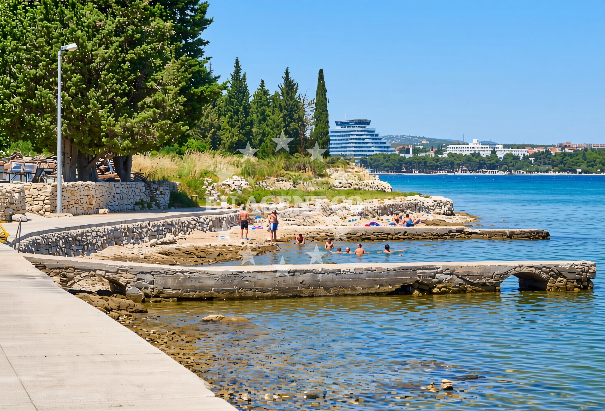
Perolin gat sjever, Prvić Šepurine (Prvić) Beach lies on the northern shore of the island of Prvić, part of the Šibenik-Knin County in Croatia. This stretch of coastline is characterized by its gravelly and rocky terrain, extending approximately 70 meters along the shoreline. The beach is situated in a region known for its rugged natural beauty and historical significance, with the nearby town of Prvić offering connections to the broader Dalmatian coast.
About this beach
Perolin gat sjever, Prvić Šepurine (Prvić)
Beach: Perolin gat sjever
Location: Prvić Šepurine (Prvić)
Characteristics and facilities
Gravel, concrete / stone slabs, rocks
70 m
Beach character
The beach consists primarily of gravel, concrete slabs, and exposed rock formations, creating a landscape that is more suited to those seeking a rugged coastal experience rather than a traditional sandy shoreline. The 70-meter length provides a modest but distinct section of coastline, with the terrain sloping gently from the water’s edge. The absence of soft sand or fine pebbles means this is not a typical sunbathing destination, but rather a place where visitors can observe the natural contours of the Adriatic coastline.
Swimming and shore
Swimming conditions at Perolin gat sjever are influenced by the rocky and gravelly seabed, which may make direct entry into the water challenging. The shore itself is uneven, with sections of exposed rock and concrete slabs that could pose difficulties for those unaccustomed to such terrain. The beach’s orientation and surrounding geography suggest it may be subject to varying wave conditions, though specific details about water depth or safety for swimmers are not documented in available records.
Facilities and activities
No structured facilities or amenities are explicitly listed for Perolin gat sjever. The beach appears to be a relatively undeveloped stretch of coastline, with no mention of showers, restrooms, parking, or other visitor services. Activities associated with the beach are not specified in the catalog, though the surrounding region of Prvić is known for its historical sites, cycling routes, and boat tours exploring the nearby islands of the Kornati archipelago.
Access and location
Perolin gat sjever is located on the northern part of the island of Prvić, which is accessible via ferry services from Šibenik and other mainland ports. The beach’s proximity to the town of Prvić means visitors may find limited local infrastructure, including small accommodations, restaurants, and shops. The exact road access to the beach is not detailed in available records, but the general area is part of a network of coastal roads connecting Prvić to other settlements on the island and along the Dalmatian coast.
What to expect
Visitors to Perolin gat sjever should expect a rugged, natural shoreline composed of gravel, concrete slabs, and rocks. The beach is not designed for conventional sunbathing or leisurely relaxation but offers a unique perspective on the Adriatic’s coastal geography. The area’s historical and cultural context, tied to the island of Prvić, provides opportunities to explore nearby landmarks, including medieval fortifications and traditional villages. The beach’s location also positions it as a potential starting point for boat trips to the Kornati National Park, a renowned sailing destination in the region.
Practical tips
Given the beach’s rocky and uneven terrain, visitors are advised to wear sturdy footwear. The lack of formal facilities means provisions such as water, snacks, and sun protection should be brought from elsewhere. Those interested in exploring the surrounding area may want to check local ferry schedules for access to Prvić and other nearby islands.
Exploring the coast by yacht
The beach’s location on the island of Prvić places it within a region highly regarded for its sailing opportunities. The Kornati archipelago, just offshore from Prvić, is a protected area with over 80 islands, islets, and reefs, offering calm waters and intricate coastlines ideal for motor yachts and sailboats. Nearby marinas, such as those in Šibenik and the town of Prvić itself, provide docking options for charter guests. The Adriatic’s clear waters and favorable winds make this area a popular choice for both short cruises and extended yacht holidays, with Perolin gat sjever serving as a potential anchorage or landing point for those exploring the coastline.
Historical and Cultural Context
The island of Prvić has a rich history dating back to ancient times, with archaeological evidence of Roman settlements and medieval fortifications. The town of Prvić itself retains elements of its past, including traditional stone buildings and a small harbor that has historically supported fishing and trade. Visitors interested in the region’s heritage may find value in exploring these sites, which are often included in guided tours from the mainland.
Anchorages in the surrounding area
Anchorages in the surrounding area include Prvić Šepurine, Tijat, and Zmajan, offering nearby mooring options.
- Anchorage — prvic sepurine — 0.1 NM from beach
- Sepurine — prvic sepurine — 0.6 NM from beach
- Anchorage — tijat — 1.6 NM from beach
- Anchorage — jadria — 2.7 NM from beach
- Anchorage — zmajan — 2.9 NM from beach
- Anchorage — zmajan — 3.0 NM from beach
- Anchorage — sibenik — 3.0 NM from beach
- Anchorage — tribunj — 3.2 NM from beach
Distances are straight-line geographic distances, not sailing routes.
Mooring buoys in the surrounding area
Mooring buoys in the surrounding area are located at Prvić Šepurine, Tijat, and other nearby points.
- Sepurine east — prvic sepurine — 0.1 NM from beach
- Buoy field — prvic sepurine — 0.6 NM from beach
- Buoy field — prvic — 1.0 NM from beach
- Spirito Summer Place jetty — tijat — 1.5 NM from beach
- Buoy field — tijat — 1.6 NM from beach
Distances are straight-line geographic distances, not sailing routes.
Marine fuel stations
Marine fuel stations in the vicinity include Ina in Vodice and Petrol in Tribunj.
- Ina — vodice — 1.2 NM from beach
- Petrol — tribunj — 1.9 NM from beach
- Ina — sibenik — 4.4 NM from beach
- Lukoil — sibenik — 4.6 NM from beach
Distances are straight-line geographic distances, not sailing routes.
Harbours in the surrounding area
- Prvić Šepurine — prvic sepurine — 0.3 NM from beach
- Srima — 0.6 NM from beach
- Konoba Stari Nanini at Prvić Port — prvic — 1.0 NM from beach
- Vodice — 1.2 NM from beach
- Tribunj — 2.1 NM from beach
- Jadria — 2.7 NM from beach
Distances are straight-line geographic distances, not sailing routes.
Marinas in the surrounding area
Marinas in the surrounding area include ACI Marina Vodice, Marina Tribunj, and Marina Zaton near Šibenik.
- ACI Marina Vodice — 1.2 NM from beach
- Marina Tribunj — 2.0 NM from beach
- Marina Zaton — zaton near sibenik — 3.0 NM from beach
- Amadria Yacht Marines — sibenik — 4.5 NM from beach
- Marina Mandalina — sibenik — 4.9 NM from beach
Distances are straight-line geographic distances, not sailing routes.
Restaurants near the beach
Restaurants near the beach include Konoba Bare, Ribarski Dvor, and Konoba Stari Nanini in Prvić.
- Konoba Bare — prvic sepurine — 0.3 NM from beach
- Ribarski Dvor — prvic sepurine — 0.5 NM from beach
- Konoba Stari Nanini — prvic — 0.9 NM from beach
- Nanini — prvic — 0.9 NM from beach
- Konoba Makina — prvic — 0.9 NM from beach
- Val — prvic — 1.0 NM from beach
- Mareta — prvic — 1.0 NM from beach
Distances are straight-line geographic distances, not sailing routes.
Navigation guides for the surrounding area
Navigation guides for the surrounding area cover Vodice, Tribunj, and Luka Zlarin with detailed route information.
- Vodice — 1.1 NM from beach
- Tribunj — 2.0 NM from beach
- Uvala Sovlje — 2.8 NM from beach
- Luka Zlarin — 3.1 NM from beach
- Zaton — 3.4 NM from beach
Distances are straight-line geographic distances, not sailing routes.
Yachts from nearby departure bases
Yachts from nearby departure bases in Vodice Port and Vodice ACI Marina offer motor and sail boat options.
Sailing yachts
- Dufour 412 Grand large (THEMISTO) — Vodice ACI Marina — 1.2 NM from departure base to beach
- Elan Impression 45 (Mirakul) — Vodice ACI Marina — 1.2 NM from departure base to beach
Motor boats
- Axopar 37 Sun Top (Axe) — Vodice port — 1.2 NM from departure base to beach
- Merry Fisher 795 (Brac) — Vodice Port — 1.2 NM from departure base to beach
- Salpa Sunsix (Ika) — Vodice Port — 1.2 NM from departure base to beach
- Salpa Soleil 26 (Podgora) — Vodice Port — 1.2 NM from departure base to beach
- Salpa Soleil 18 (Salpa) — Vodice Port — 1.2 NM from departure base to beach
- Marlin 790 Dynamic (Marlin) — Vodice Port — 1.2 NM from departure base to beach
- Salpa Soleil 20 (Salpa) — Vodice Port — 1.2 NM from departure base to beach
- Salpa Soleil 24.5 (Zaostrog) — Vodice Port — 1.2 NM from departure base to beach
Distances are straight-line geographic distances, not sailing routes.