Perna zapad, Kučište Beach, Croatia
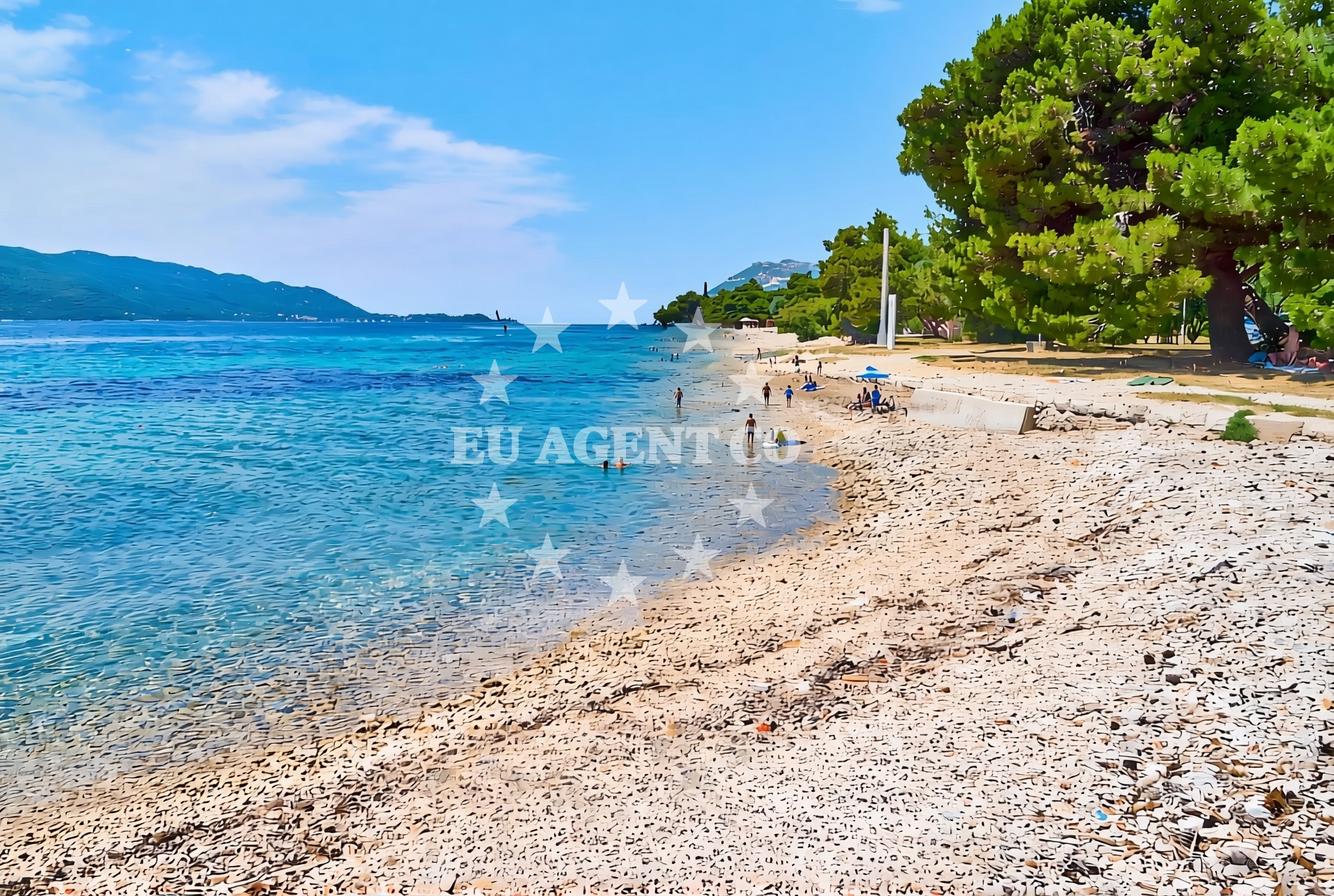
About this beach
Perna zapad, Kučište
Beach: Perna zapad
Location: Kučište
Characteristics and facilities
Gravel
190 m
Natural shade
Beach character
The beach's gravel composition sets it apart from more conventional sandy shores. This texture can make it less ideal for swimming but offers a stable surface for walking or sunbathing. The natural shade, likely provided by surrounding vegetation or rocky formations, creates a cooler microclimate along parts of the beach. Its relatively short length means visitors can easily explore the entire shoreline without extensive travel.Swimming and shore
Due to its gravelly nature, Perna zapad may not be the best spot for swimming. However, the beach's shore offers opportunities for exploring the rocky terrain and observing coastal flora. The absence of structured facilities means visitors should come prepared with their own amenities, though the natural setting provides a tranquil environment for those who prefer minimal intervention.Facilities and activities
There are no explicitly listed facilities or structured activities at Perna zapad, Kučište Beach. The beach's character is defined by its natural features rather than man-made amenities. Visitors are encouraged to engage with the environment through walking, photography, or simply enjoying the unspoiled landscape.Access and location
Located in Kučište, this beach is part of Croatia's diverse coastal landscape. Its coordinates (42.974686, 17.136263) place it in a region known for its rugged coastlines and historic settlements. Access to the beach likely involves navigating through the local area, which may include a mix of rural and coastal paths. The surrounding region offers a blend of natural beauty and cultural heritage, making it a point of interest for those exploring the area.What to expect
Visitors to Perna zapad, Kučište Beach should expect a gravelly shoreline with natural shade, ideal for those seeking a more rugged coastal experience. The beach's short length allows for easy exploration, and the absence of structured facilities means a focus on the natural environment. The area's connection to Croatia's broader coastal landscape provides context for those interested in the region's geography and history.Practical tips
Given the gravel composition, visitors may want to wear appropriate footwear for comfort. The beach's natural shade can be a benefit during warmer months, but sun protection is still advisable. As there are no facilities on-site, bringing personal items such as water or snacks is recommended.Exploring the coast by yacht
The surrounding area of Kučište is part of Croatia's extensive coastline, which is a popular region for yacht charter activities. While Perna zapad itself may not be a primary anchorage point, the nearby waters offer opportunities for sailing and exploration. Yacht charter guests in the region may find the coastal landscape and settlements of interest, providing a backdrop for leisurely cruises along the Adriatic.Regional Context and Nearby Exploration
The Kučište area is part of a broader coastal region in Croatia that features a mix of historic settlements, natural reserves, and scenic routes. Nearby, visitors may find opportunities to explore local culture, historic sites, or other coastal attractions. The area's geography, with its mix of rocky shores and open waters, supports both land-based and sea-based activities.Anchorages in the surrounding area
Anchorages in the surrounding area, including those near Korcula, are located close to Perna zapad, Kučište Beach.
- Anchorage — korcula — 1.2 NM from beach
- Anchorage — korcula — 1.3 NM from beach
- Anchorage — korcula — 1.5 NM from beach
- Anchorage — korcula — 1.7 NM from beach
- Anchorage — korcula — 1.8 NM from beach
- Anchorage — badija — 1.9 NM from beach
- Anchorage — lumbarda — korcula — 2.9 NM from beach
- Anchorage — korcula — 3.8 NM from beach
Distances are straight-line geographic distances, not sailing routes.
Mooring buoys in the surrounding area
- Fuel jetty — korcula — 1.3 NM from beach
- Jetty — korcula — 1.5 NM from beach
- Restaurant Moro buoys — stupe — 2.5 NM from beach
- Vrnik Arts Club buoys — 2.5 NM from beach
- Quay — vrnik — 2.6 NM from beach
Distances are straight-line geographic distances, not sailing routes.
Marine fuel stations
Marine fuel stations, including those in Korcula and Ploce, are located within reach of Perna zapad, Kučište Beach.
- Fuel station — korcula — 1.3 NM from beach
- Fuel station — ploce — 13.9 NM from beach
- Ina — vela luka — korcula — 18.5 NM from beach
- Ina — ubli — lastovo — 19.5 NM from beach
Distances are straight-line geographic distances, not sailing routes.
Harbours in the surrounding area
Harbours in the surrounding area, such as Korčula W Harbour and Viganj, are situated near Perna zapad, Kučište Beach.
- Korčula W harbour — korcula — 0.7 NM from beach
- Korčula E harbour — korcula — 0.9 NM from beach
- Kučišće — kucisce — 1.0 NM from beach
- Viganj — 1.6 NM from beach
- Orebić — orebic — 1.7 NM from beach
- Duba — duba peljeska — 3.4 NM from beach
Distances are straight-line geographic distances, not sailing routes.
Marinas in the surrounding area
Marinas in the surrounding area, including ACI Marina Korčula and Marina Lumbarda, are located close to Perna zapad, Kučište Beach.
- ACI Marina Korčula — korcula — 1.0 NM from beach
- Marina Lumbarda — korcula — 3.4 NM from beach
- Marina Tučepi — marina tucepi — 17.7 NM from beach
- Marina Korkyra — vela luka — korcula — 18.7 NM from beach
- Marina Solitudo — lastovo — 18.7 NM from beach
Distances are straight-line geographic distances, not sailing routes.
Restaurants near the beach
- Restaurant — korcula — 0.7 NM from beach
- Adio Mare — korcula — 0.8 NM from beach
- Restaurant — korcula — 0.8 NM from beach
- Restaurant Lesic Dimitri — korcula — 0.8 NM from beach
- Restaurant Filippi — korcula — 0.8 NM from beach
- Aterina — korcula — 0.8 NM from beach
- Restaurant — korcula — 0.9 NM from beach
Distances are straight-line geographic distances, not sailing routes.
Navigation guides for the surrounding area
Navigation guides for the surrounding area, including Uvala Banja and Orebic, are relevant to Perna zapad, Kučište Beach.
- Uvala Banja — 1.1 NM from beach
- Uvala Vrbovica — 1.5 NM from beach
- Otocic Badija — 1.9 NM from beach
- Orebic — 1.9 NM from beach
- Uvala Racisce — 3.1 NM from beach
Distances are straight-line geographic distances, not sailing routes.
Yachts from nearby departure bases
Yachts from nearby departure bases, including Ploče City Port and Tučepi Port, operate in the vicinity of Perna zapad, Kučište Beach.
Sailing yachts
- Elan 40 Impression (Karleta) — Ploče City Port — 13.8 NM from departure base to beach
- Sun Odyssey 349 (Porto Tolero) — Ploče City Port — 13.8 NM from departure base to beach
- Sun Odyssey 419 (Luka Ploce) — Ploče City Port — 13.8 NM from departure base to beach
- Elan 514 Impression (Cesarica III) — Ploče City Port — 13.8 NM from departure base to beach
- More 55 (MRS. ROBINSON) — Ploče City Port — 13.8 NM from departure base to beach
- Salona 44 (SAMOA) — Ploče City Port — 13.8 NM from departure base to beach
- Sun Odyssey 349 (Visnjica) — Ploče City Port — 13.8 NM from departure base to beach
- Bavaria 40 Cruiser (LADY BUTTERFLY) — Tučepi Port — 17.7 NM from departure base to beach
Catamarans
- Lagoon 450 Fly (Alba Mouse) — Ploče City Port — 13.8 NM from departure base to beach
Motor yachts
- Princess V53 (Chablis) — Makarska Port — 19.7 NM from departure base to beach
Distances are straight-line geographic distances, not sailing routes.