Perna sredina, Kučište Beach, Croatia
10 photos
About this beach
Perna sredina, Kučište
Beach: Perna sredina
Location: Kučište
Characteristics and facilities
Gravel, concrete / stone slabs
170 m
Restaurant / snack bar
Caffe bar / Drinks stand
Natural shade
Beach character
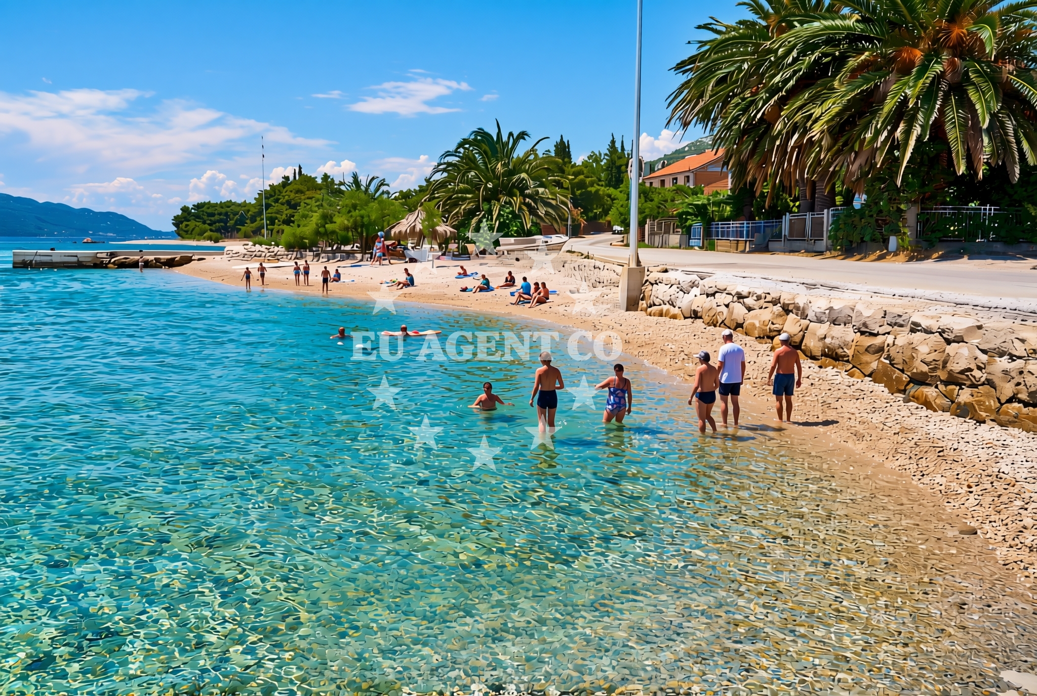
The beach's composition of gravel and stone slabs defines its character, offering a rugged yet accessible shoreline. At 170 meters in length, it provides ample space for relaxation or casual strolls. The presence of a restaurant and snack bar suggests a focus on convenience for visitors, while the caffe bar and drinks stand cater to those seeking light meals or beverages. Natural shade from nearby trees or rock formations creates a shaded area, though sun protection is still recommended for extended stays.Swimming and shore
The gravel and stone slabs along the shore may limit traditional swimming activities, but the beach remains suitable for leisurely walks or sunbathing. The absence of explicit swimming facilities in the catalog means water-based recreation is not highlighted. The shoreline's texture and composition are best experienced on foot, with the natural shade offering respite from direct sunlight.Facilities and activities
Kučište Beach includes a restaurant, snack bar, caffe bar, and drinks stand, ensuring visitors have access to food and beverages without leaving the area. No recreational activities or sports facilities are listed in the catalog, so the beach primarily serves as a spot for relaxation and casual dining. The on-site amenities make it a practical choice for those prioritizing convenience over active pursuits.Access and location
Situated in Perna sredina, Kučište Beach lies along the Dalmatian coast, a region renowned for its scenic beauty and maritime heritage. The exact coordinates (42.974698° N, 17.138635° E) place it near the broader coastal network of the Adriatic Sea. The area's proximity to other Dalmatian towns and islands positions it as a potential stop for yacht charter guests exploring the region. Local transportation options, such as roads and ferry routes, likely connect it to nearby settlements.What to expect
Kučište Beach provides a straightforward experience centered on its gravel shoreline and on-site amenities. Visitors can expect a 170-meter stretch of gravel and stone slabs, suitable for walking but not ideal for swimming. The presence of a restaurant, snack bar, caffe bar, and drinks stand ensures access to food and drinks. Natural shade from surrounding vegetation offers partial relief from the sun. The beach does not appear to prioritize recreational activities, making it a simple destination for relaxation and casual dining.Practical tips
Consider bringing sunscreen despite the natural shade, as sun exposure can still be significant. The on-site dining options make it easy to enjoy meals without leaving the beach area. Check for any local regulations regarding beach use or facility hours, though these are not specified in the catalog.Exploring the coast by yacht
For yacht charter guests, the Dalmatian coast offers a rich sailing environment, with Kučište Beach situated along a route that connects to other coastal towns and islands. Euro-Agent's yacht charter services operate in this region, allowing visitors to explore nearby anchorages, harbors, and scenic routes. While the beach itself is not marked as a marina or anchorage, its location provides a convenient reference point for sailors navigating the area.Regional Context
The Dalmatian coast, where Kučište Beach is located, is known for its dramatic cliffs, historic towns, and clear waters. Nearby settlements may offer additional cultural or recreational opportunities, though specific details are not included in the beach catalog. Yacht charter guests can use this area as a base to explore the broader Adriatic region.Anchorages in the surrounding area
- Anchorage — korcula — 1.3 NM from beach
- Anchorage — korcula — 1.3 NM from beach
- Anchorage — korcula — 1.5 NM from beach
- Anchorage — korcula — 1.8 NM from beach
- Anchorage — badija — 1.8 NM from beach
- Anchorage — korcula — 1.9 NM from beach
- Anchorage — lumbarda — korcula — 2.9 NM from beach
- Anchorage — duba peljeska — 3.8 NM from beach
Distances are straight-line geographic distances, not sailing routes.
Mooring buoys in the surrounding area
- Fuel jetty — korcula — 1.3 NM from beach
- Jetty — korcula — 1.6 NM from beach
- Restaurant Moro buoys — stupe — 2.4 NM from beach
- Vrnik Arts Club buoys — 2.5 NM from beach
- Quay — vrnik — 2.5 NM from beach
Distances are straight-line geographic distances, not sailing routes.
Marine fuel stations
- Fuel station — korcula — 1.3 NM from beach
- Fuel station — ploce — 13.8 NM from beach
- Ina — vela luka — korcula — 18.6 NM from beach
- Ina — ubli — lastovo — 19.5 NM from beach
Distances are straight-line geographic distances, not sailing routes.
Harbours in the surrounding area
- Korčula W harbour — korcula — 0.8 NM from beach
- Korčula E harbour — korcula — 0.9 NM from beach
- Kučišće — kucisce — 1.1 NM from beach
- Orebić — orebic — 1.6 NM from beach
- Viganj — 1.7 NM from beach
- Duba — duba peljeska — 3.3 NM from beach
Distances are straight-line geographic distances, not sailing routes.
Marinas in the surrounding area
- ACI Marina Korčula — korcula — 1.0 NM from beach
- Marina Lumbarda — korcula — 3.4 NM from beach
- Marina Tučepi — marina tucepi — 17.7 NM from beach
- Marina Solitudo — lastovo — 18.7 NM from beach
- Marina Korkyra — vela luka — korcula — 18.8 NM from beach
Distances are straight-line geographic distances, not sailing routes.
Restaurants near the beach
- Restaurant — korcula — 0.7 NM from beach
- Adio Mare — korcula — 0.8 NM from beach
- Restaurant — korcula — 0.8 NM from beach
- Restaurant Lesic Dimitri — korcula — 0.8 NM from beach
- Restaurant Filippi — korcula — 0.8 NM from beach
- Aterina — korcula — 0.8 NM from beach
- Restaurant — korcula — 0.9 NM from beach
Distances are straight-line geographic distances, not sailing routes.
Navigation guides for the surrounding area
- Uvala Banja — 1.2 NM from beach
- Uvala Vrbovica — 1.6 NM from beach
- Orebic — 1.8 NM from beach
- Otocic Badija — 1.9 NM from beach
- Uvala Racisce — 3.0 NM from beach
Distances are straight-line geographic distances, not sailing routes.
Yachts from nearby departure bases
Sailing yachts
- Elan 40 Impression (Karleta) — Ploče City Port — 13.7 NM from departure base to beach
- Salona 44 (SAMOA) — Ploče City Port — 13.7 NM from departure base to beach
- Sun Odyssey 349 (Visnjica) — Ploče City Port — 13.7 NM from departure base to beach
- Sun Odyssey 419 (Luka Ploce) — Ploče City Port — 13.7 NM from departure base to beach
- More 55 (MRS. ROBINSON) — Ploče City Port — 13.7 NM from departure base to beach
- Elan 514 Impression (Cesarica III) — Ploče City Port — 13.7 NM from departure base to beach
- Sun Odyssey 349 (Porto Tolero) — Ploče City Port — 13.7 NM from departure base to beach
- Bavaria 40 Cruiser (LADY BUTTERFLY) — Tučepi Port — 17.7 NM from departure base to beach
Catamarans
- Lagoon 450 Fly (Alba Mouse) — Ploče City Port — 13.7 NM from departure base to beach
Motor yachts
- Princess V53 (Chablis) — Makarska Port — 19.8 NM from departure base to beach
Distances are straight-line geographic distances, not sailing routes.
Frequently asked questions
Is swimming possible at Kučište Beach?
The beach's gravel and stone slabs suggest it is not ideal for swimming. Visitors should consider the shoreline's texture before entering the water.Are there facilities for food and drinks on-site?
Yes, the beach includes a restaurant, snack bar, caffe bar, and drinks stand.Nearby beaches
Perna zapad, Kučište Beach
Perna zapad
0.2 km
Perna istok, Kučište Beach
Perna istok
0.2 km
Plaza Perna
Perna 24, Orebić
0.4 km
Podgorje zapad, Podgorje (Orebić) Beach
Podgorje zapad
0.4 km
Komodor sredina, Kučište Beach
Komodor sredina
0.4 km
Podgorje istok, Podgorje (Orebić) Beach
Podgorje istok
0.5 km
Komodor zapad, Kučište Beach
Komodor zapad
0.5 km
Orebić zapad, Orebić Beach
Orebić zapad
0.6 km