Perna, Donja Vrućica Beach: A Natural Haven in Croatia's Adriatic Coast
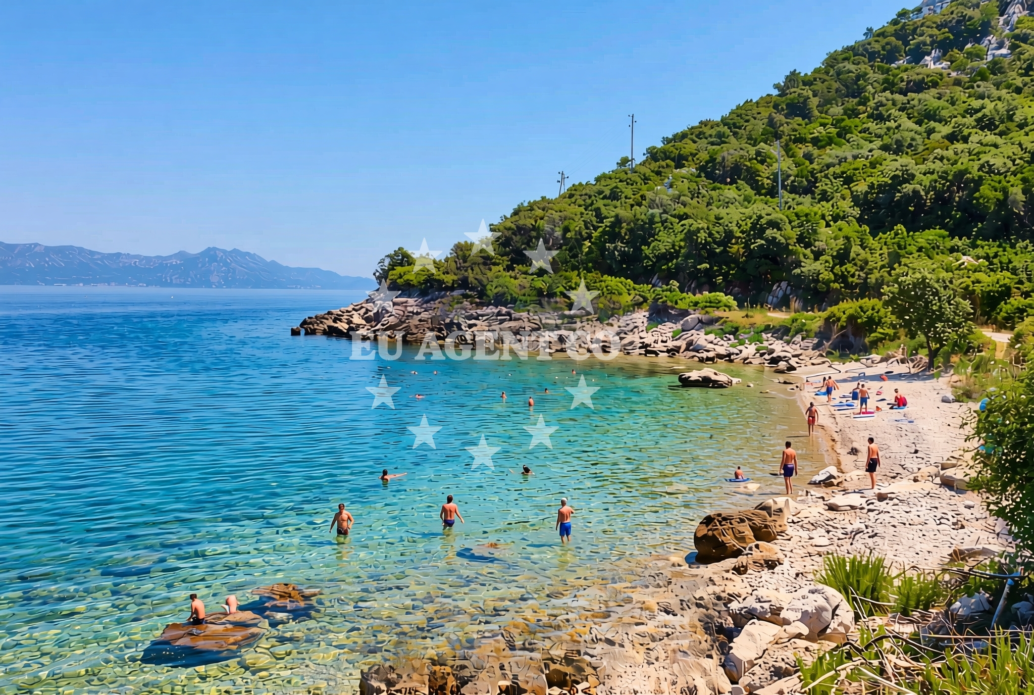
About this beach
Perna, Donja Vrućica
Beach: Perna
Location: Donja Vrućica
Characteristics and facilities
Gravel, rocks
80 m
Beach character
The beach's defining feature is its gravel and rock composition, which creates a terrain more suited to exploration than relaxation. The 80-meter length is flanked by uneven terrain, with no designated pathways or facilities. This natural state preserves the beach's authenticity, though it may pose challenges for those seeking traditional beach amenities. The shoreline's irregularity suggests it is likely influenced by coastal currents and seasonal erosion patterns typical of the Adriatic's rocky coastlines.Swimming and shore
Swimming conditions are not explicitly documented, but the gravel and rock substrate implies limited areas of sandy or flat-bottomed water. The beach's proximity to the open sea suggests exposure to Adriatic currents, which can affect water clarity and temperature. The rocky terrain may create sheltered coves or deeper water pockets, though these would require on-site verification. The absence of structured amenities means visitors must rely on natural shorelines for access.Facilities and activities
No formal facilities are listed for the beach itself, reflecting its minimal development. The lack of infrastructure aligns with its natural character, though nearby Perna may offer services such as restaurants or accommodations. Activities are not explicitly noted, but the rocky terrain could support rock climbing or geological observation. The beach's isolation makes it unlikely to host organized events or rentals.Access and location
Perna, Donja Vrućica Beach is located in the village of Perna, within Split-Dalmatia County, Croatia. The area is part of the broader Adriatic coast, which stretches from the Istrian Peninsula to the Pelješac Peninsula. Perna itself is a small coastal settlement with limited road infrastructure, suggesting access may require local transportation or boat travel. The beach's coordinates (43.019831, 17.184652) place it near the northern edge of the Šibenik-Knin County region, where the Adriatic Sea's rocky coastline is most pronounced.What to expect
Visitors should expect a rugged, undeveloped shoreline with gravel and rock dominating the beach's surface. The 80-meter length offers limited space for activities, with no facilities or amenities provided. The beach's natural state makes it suitable for those seeking solitude or geological interest, though it may not appeal to those prioritizing comfort. The surrounding area's lack of infrastructure means visitors should plan accordingly, with Perna itself likely serving as the primary hub for services.Practical tips
Wear sturdy footwear to navigate the gravel and rocky terrain. Bring water and snacks, as no facilities are available on-site. Check local guidelines for any restrictions on access or activities. The beach's exposure to the Adriatic Sea means conditions can vary, so prepare for changing weather and sea states.Exploring the coast by yacht
The Adriatic coast near Perna is a popular region for yacht charter, with sailing routes connecting to nearby islands such as Šolta and Hvar. The rocky coastline offers opportunities for anchoring in sheltered bays, though specific marinas or docking facilities are not detailed for this exact location. Yacht charter guests exploring the area may find the surrounding waters suitable for short excursions, with the beach serving as a potential vantage point for observing coastal landscapes.Regional Context and Coastal Features
The Perna area is characterized by its rugged coastline, with cliffs and rocky inlets defining much of the shoreline. This geological profile is typical of the Dalmatian coast, where erosion and sea action have shaped the landscape over millennia. The region's maritime history is reflected in nearby settlements, which have long relied on fishing and boat-building traditions. The Adriatic Sea's clear waters and moderate temperatures make it a year-round sailing destination, with seasonal variations influencing wind patterns and wave activity.Anchorages in the surrounding area
Anchorages in the surrounding area include Duba Peljeska, Badija, and Korcula, located near Perna.
- Anchorage — duba peljeska — 0.7 NM from beach
- Anchorage — badija — 4.3 NM from beach
- Anchorage — korcula — 4.4 NM from beach
- Anchorage — trpanj — 4.5 NM from beach
- Anchorage — korcula — 4.6 NM from beach
- Anchorage — korcula — 4.9 NM from beach
- Anchorage — korcula — 5.0 NM from beach
- Anchorage — korcula — 5.1 NM from beach
Distances are straight-line geographic distances, not sailing routes.
Mooring buoys in the surrounding area
Mooring buoys in the surrounding area include those at Restaurant Moro in Stupe and fuel jetty in Korcula.
- Restaurant Moro buoys — stupe — 3.5 NM from beach
- Fuel jetty — korcula — 4.2 NM from beach
- Jetty — korcula — 4.9 NM from beach
- Vrnik Arts Club buoys — 4.9 NM from beach
- Quay — vrnik — 5.0 NM from beach
Distances are straight-line geographic distances, not sailing routes.
Marine fuel stations
- Fuel station — korcula — 4.2 NM from beach
- Fuel station — ploce — 11.2 NM from beach
- Ina — makarska — 18.1 NM from beach
- Ina — vela luka — korcula — 20.9 NM from beach
Distances are straight-line geographic distances, not sailing routes.
Harbours in the surrounding area
Harbors in the surrounding area include Duba Peljeska, Orebić, and Trpanj, situated near Perna.
- Duba — duba peljeska — 0.7 NM from beach
- Orebić — orebic — 2.8 NM from beach
- Trpanj — 3.7 NM from beach
- Kučišće — kucisce — 3.9 NM from beach
- Korčula W harbour — korcula — 4.1 NM from beach
- Korčula E harbour — korcula — 4.2 NM from beach
Distances are straight-line geographic distances, not sailing routes.
Marinas in the surrounding area
Marinas in the surrounding area include ACI Marina Korcula and Marina Lumbarda, located in Korcula.
- ACI Marina Korčula — korcula — 4.2 NM from beach
- Marina Lumbarda — korcula — 5.8 NM from beach
- Marina Tučepi — marina tucepi — 15.7 NM from beach
- Marina Ramova — krvavica — 20.3 NM from beach
- Marina Korkyra — vela luka — korcula — 21.1 NM from beach
Distances are straight-line geographic distances, not sailing routes.
Restaurants near the beach
Restaurants near the beach include Moro in Stupe and several options in Korcula.
- Moro — stupe — 3.4 NM from beach
- Restaurant — korcula — 4.0 NM from beach
- Adio Mare — korcula — 4.1 NM from beach
- Restaurant Lesic Dimitri — korcula — 4.1 NM from beach
- Restaurant Filippi — korcula — 4.1 NM from beach
- Restaurant — korcula — 4.1 NM from beach
- Aterina — korcula — 4.1 NM from beach
Distances are straight-line geographic distances, not sailing routes.
Navigation guides for the surrounding area
Navigation guides cover nearby areas such as Uvala Divna, Orebic, and Trpanj, which are within a few nautical miles of the beach.
- Uvala Divna — 1.0 NM from beach
- Orebic — 2.8 NM from beach
- Trpanj — 3.8 NM from beach
- Otocic Badija — 4.2 NM from beach
- Uvala Banja — 4.6 NM from beach
Distances are straight-line geographic distances, not sailing routes.
Yachts from nearby departure bases
Sailing yachts
- Elan 40 Impression (Karleta) — Ploče City Port — 11.1 NM from departure base to beach
- Elan 514 Impression (Cesarica III) — Ploče City Port — 11.1 NM from departure base to beach
- More 55 (MRS. ROBINSON) — Ploče City Port — 11.1 NM from departure base to beach
- Sun Odyssey 349 (Visnjica) — Ploče City Port — 11.1 NM from departure base to beach
- Salona 44 (SAMOA) — Ploče City Port — 11.1 NM from departure base to beach
- Sun Odyssey 419 (Luka Ploce) — Ploče City Port — 11.1 NM from departure base to beach
- Sun Odyssey 349 (Porto Tolero) — Ploče City Port — 11.1 NM from departure base to beach
- Bavaria 40 Cruiser (LADY BUTTERFLY) — Tučepi Port — 15.7 NM from departure base to beach
Catamarans
- Lagoon 450 Fly (Alba Mouse) — Ploče City Port — 11.1 NM from departure base to beach
Motor yachts
- Princess V53 (Chablis) — Makarska Port — 17.9 NM from departure base to beach
Distances are straight-line geographic distances, not sailing routes.