Pelegrin, Stomorska (Šolta) Beach, Croatia
About this beach
Pelegrin, Stomorska (Šolta)
Beach: Pelegrin
Location: Stomorska (Šolta)
Characteristics and facilities
Gravel, rocks
Beach character
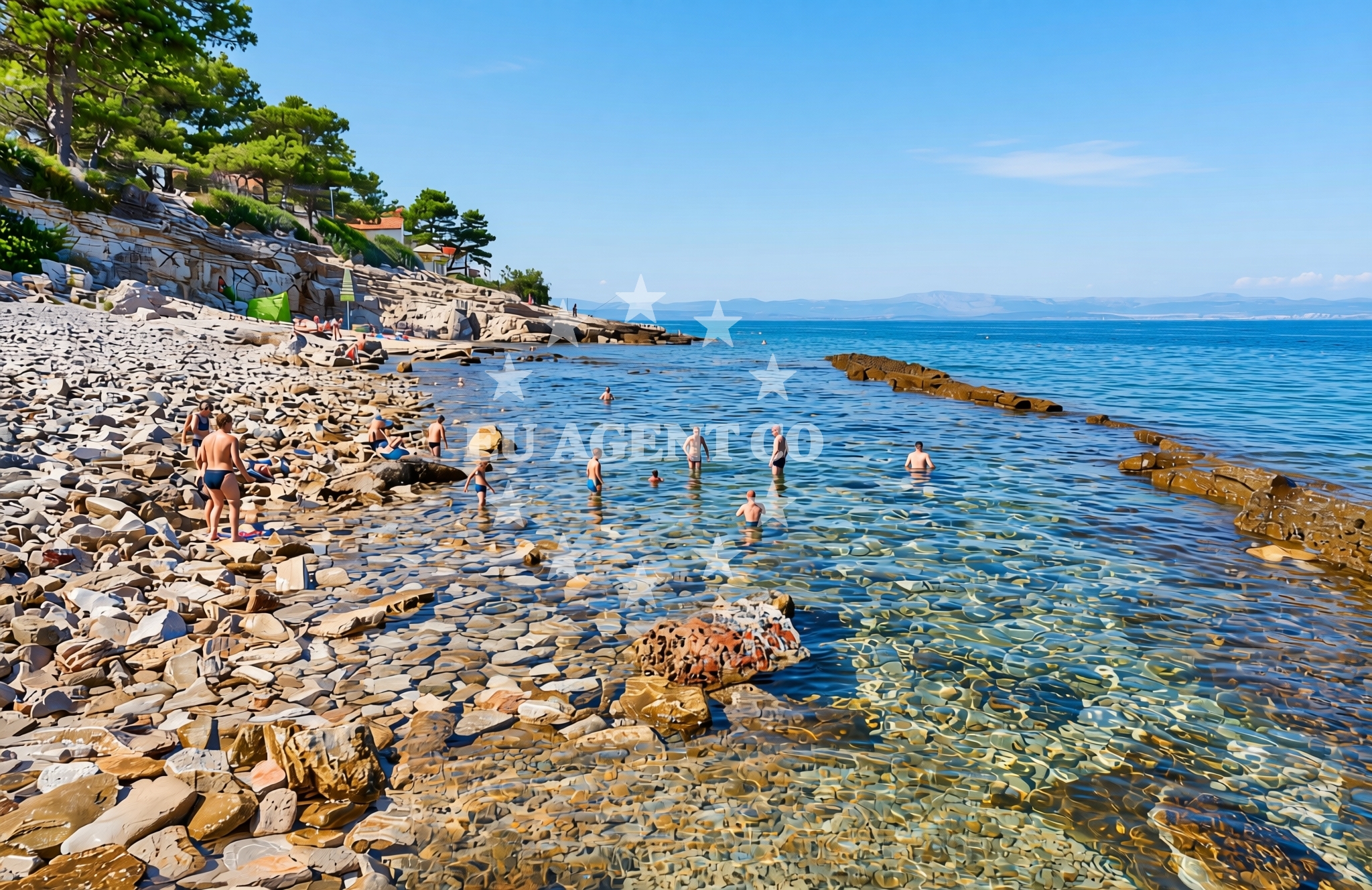
The beach's defining feature is its gravel and rocky composition, which contrasts with the sandy beaches more commonly found along Croatia's coast. This terrain suggests a shoreline shaped by natural erosion processes, with exposed rock formations and uneven surfaces. While not ideal for sunbathing, the beach may appeal to visitors seeking a more untamed coastal experience. The absence of structured amenities or facilities aligns with its character as a relatively undeveloped shoreline, preserving its natural state.Swimming and shore
Swimming conditions at Pelegrin Beach are influenced by its rocky shoreline. The gravel and stone substrate may create uneven footing along the water's edge, making it less suitable for young children or those seeking a gentle entry into the sea. However, the surrounding waters of Šolta's coast are generally known for their clarity and moderate currents, typical of the Adriatic's protected bays. The rocky shore could offer opportunities for exploring tidal pools or rock formations, though caution is advised when navigating the shoreline.Facilities and activities
No formal facilities or services are explicitly documented for Pelegrin Beach itself. The lack of structured amenities is consistent with its character as a more natural, less developed shoreline. Nearby Šolta Island, however, has a small village of the same name that serves as a base for local tourism, with simple accommodations and seasonal services. Activities likely revolve around the island's natural offerings, including hiking, cycling, and boat excursions to neighboring islands.Access and location
Pelegrin Beach is located on the western coast of Šolta Island, which lies approximately 10 nautical miles southeast of Split. The island is accessible by ferry from Split's port, with regular connections during the summer season. Šolta's position within the Adriatic's sailing triangle—bounded by Brač, Hvar, and the mainland—makes it a common stop for yachts exploring the region. The beach's proximity to the island's main village means it is likely reachable by foot or local transport, though specific access routes are not detailed in available records.What to expect
Visitors to Pelegrin Beach should expect a rugged, gravelly shoreline with exposed rock formations. The beach lacks the amenities of more developed coastal areas, making it a suitable destination for those seeking a quiet, natural setting. The surrounding waters of Šolta's coast are generally calm, with the island's position offering shelter from open-sea swells. While the beach itself may not be ideal for extended sunbathing, it provides a unique perspective on Šolta's geological character. The area's appeal lies in its integration with the island's broader natural and cultural landscape, which includes historic sites and scenic coastal routes.Practical tips
Footwear with good traction is recommended for navigating the gravel and rocky shoreline. Sun protection is essential, as the lack of shaded areas means exposure to direct sunlight. Visitors should be mindful of tidal changes, as the beach's rocky nature may create uneven access points during low tide. Šolta's small village offers basic services, but those planning extended stays may need to arrange accommodations elsewhere on the island.Exploring the coast by yacht
Šolta Island's position within the Adriatic's sailing network makes it a logical waypoint for yachts exploring the Dalmatian Coast. The island's sheltered waters and proximity to Split provide a convenient base for both short cruises and longer voyages along the coast. While Pelegrin Beach itself is not a formal anchorage, the surrounding waters of Šolta are part of a larger sailing area that includes popular marinas in nearby towns such as Bol (on Brač) and Stari Grad (on Hvar). Yacht charter guests may find the island's coastline appealing for day trips, with opportunities to explore hidden coves and anchor in sheltered bays.Šolta Island's Cultural and Natural Significance
Šolta Island has a rich history dating back to ancient times, with archaeological sites and medieval fortifications reflecting its strategic importance. The island's landscape is a mix of rugged hills, olive groves, and vineyards, with the Šolta River carving through the interior. The island's name is derived from the Latin 'Scola,' meaning 'school,' a reference to its historical role as a center of learning and religious activity. Today, Šolta remains a tranquil destination, with its natural beauty and cultural heritage attracting visitors seeking a slower pace of life.Anchorages in the surrounding area
- Anchorage — stomorska — solta — 0.8 NM from beach
- Anchorage — solta — 1.8 NM from beach
- Anchorage — solta — 1.9 NM from beach
- Anchorage — necujam — solta — 2.2 NM from beach
- Anchorage — solta — 2.3 NM from beach
- Anchorage — necujam — solta — 2.3 NM from beach
- Anchorage — necujam — solta — 2.3 NM from beach
- Anchorage — solta — 2.4 NM from beach
Distances are straight-line geographic distances, not sailing routes.
Mooring buoys in the surrounding area
- Jetty — necujam — solta — 1.8 NM from beach
- Resturant Sveti Petar bouy — necujam — solta — 2.0 NM from beach
- Buoy field — solta — 3.0 NM from beach
- Pasarela restaurant jetty — rogac — solta — 3.0 NM from beach
- Lonely Paradise restaurant buoys — solta — 3.2 NM from beach
Distances are straight-line geographic distances, not sailing routes.
Marine fuel stations
- Fuel station — rogac — solta — 3.1 NM from beach
- Ina — milna brac — 4.4 NM from beach
- Ina — split — 8.7 NM from beach
- Ina — split — 9.1 NM from beach
Distances are straight-line geographic distances, not sailing routes.
Harbours in the surrounding area
- Stomorska — solta — 0.4 NM from beach
- Rogač — rogac — solta — 3.1 NM from beach
- Milna — milna brac — 4.5 NM from beach
- Bobovišće — bobovisce — brac — 4.6 NM from beach
- Sutivan — brac — 5.2 NM from beach
- Pod Mirca — brac — 7.0 NM from beach
Distances are straight-line geographic distances, not sailing routes.
Marinas in the surrounding area
Marinas in the surrounding area include Milna Brac and Split, situated at several nautical miles from the beach.
- Marina Vlaška — milna brac — 4.2 NM from beach
- Marina Milna Kanarija — milna brac — 4.4 NM from beach
- ACI Marina Milna — milna brac — 4.6 NM from beach
- Marina Martinis Marchi — maslinica — solta — 7.0 NM from beach
- ACI Marina Split — 8.5 NM from beach
Distances are straight-line geographic distances, not sailing routes.
Restaurants near the beach
Restaurants near the beach include several options in Stomorska, located just a short distance away.
- Nevera — stomorska — solta — 0.4 NM from beach
- Volat — stomorska — solta — 0.4 NM from beach
- Konoba Kamenica — stomorska — solta — 0.4 NM from beach
- Komin — stomorska — solta — 0.4 NM from beach
- Zlato — stomorska — solta — 0.4 NM from beach
- O´la la — stomorska — solta — 0.4 NM from beach
- Konoba Luna — stomorska — solta — 0.4 NM from beach
Distances are straight-line geographic distances, not sailing routes.
Navigation guides for the surrounding area
Navigation guides for the surrounding area include routes near Stomorska and other coastal locations.
- Stomorska — 0.3 NM from beach
- Uvala Gornja Krusica — 0.9 NM from beach
- Uvala Stracinska — 2.0 NM from beach
- Uvala Necujam — 2.1 NM from beach
- Uvala Vela Travna — 2.6 NM from beach
Distances are straight-line geographic distances, not sailing routes.
Yachts from nearby departure bases
Yachts from nearby departure bases include vessels based at Šolta Rogač, offering access to the area.
Sailing yachts
- Oceanis 50 Family (Ganges) — Šolta Rogač — 3.1 NM from departure base to beach
- Cyclades 39.3 (Pharos) — Šolta Rogač — 3.1 NM from departure base to beach
- Sun Odyssey 349 (Siberia) — Šolta Rogač — 3.1 NM from departure base to beach
- Cyclades 43.4 (Niagara) — Šolta Rogač — 3.1 NM from departure base to beach
- Sun Odyssey 490 (Izzy) — Šolta Rogač — 3.1 NM from departure base to beach
Catamarans
- Lagoon 450 Flybridge (Samogon) — Šolta Rogač — 3.1 NM from departure base to beach
- Lagoon 450 (Madagascar) — Šolta Rogač — 3.1 NM from departure base to beach
- Lagoon 400 (Greenland) — Šolta Rogač — 3.1 NM from departure base to beach
- Lagoon 42 (Galapagos) — Šolta Rogač — 3.1 NM from departure base to beach
- Lagoon 40 (Solentia) — Šolta Rogač — 3.1 NM from departure base to beach
Distances are straight-line geographic distances, not sailing routes.