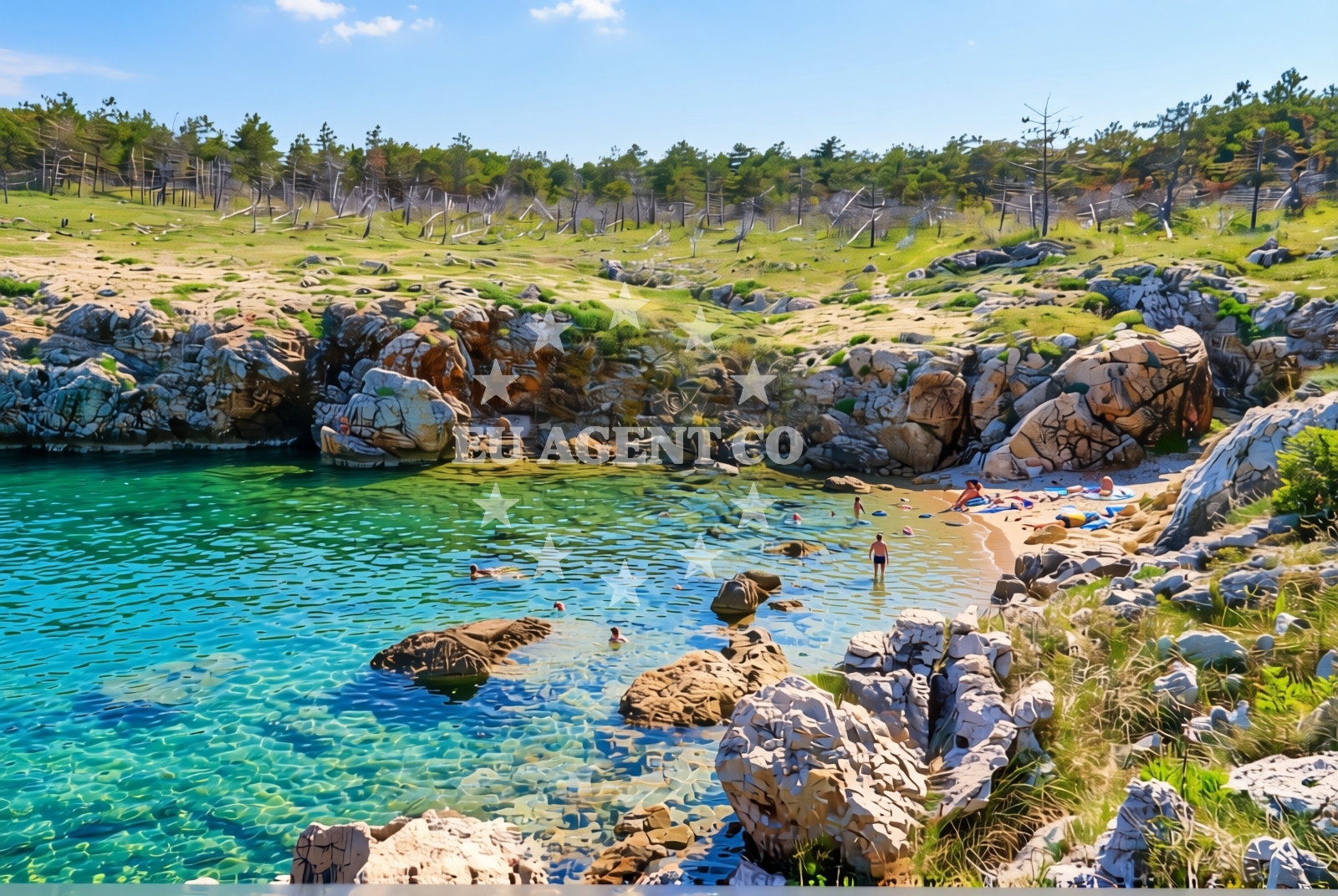
Pasjak, Šilo (Krk) Beach, Croatia
About this beach
Pasjak, Šilo (Krk)
Beach: Pasjak
Location: Šilo (Krk)
Characteristics and facilities
Gravel, rocks
10 m
Beach character
The beach's composition of gravel and rocks creates a distinct contrast to sandy shorelines commonly found along the Croatian coast. This rocky character may appeal to visitors seeking a more rugged coastal experience, though it may present challenges for those preferring soft sand. The 10-meter depth suggests relatively open water conditions, which could be suitable for experienced swimmers. The absence of structured facilities in the catalog indicates a natural, undeveloped shoreline that preserves its raw coastal character.Swimming and shore
Swimming conditions at Pasjak Beach depend on the rocky terrain's distribution along the shore. The 10-meter depth suggests sufficient water volume for swimming, though the gravel and rock composition may create uneven entry points. Visitors should exercise caution when entering the water, as the rocky substrate could pose tripping hazards. The northern Adriatic's generally clear waters may enhance visibility, but this is not explicitly confirmed in the catalog.Facilities and activities
The beach lacks explicitly listed facilities in the catalog, suggesting a minimalistic approach to infrastructure. No structured amenities such as showers, restrooms, or lifeguard services are mentioned. This aligns with the beach's natural character, though visitors may need to rely on nearby settlements like Šilo for basic services. The absence of activity-specific infrastructure means recreational opportunities are likely limited to passive enjoyment of the shoreline.Access and location
Located in Šilo, Krk Island, this beach is part of a coastal area accessible via ferry routes connecting Krk to the mainland and other islands. Šilo itself is a traditional village on Krk's western coast, known for its historic architecture and proximity to the Krk Bridge. The beach's position on the island places it within reach of other Adriatic destinations, with the Istrian Peninsula and the Kvarner Gulf forming the broader regional context.What to expect
Visitors should anticipate a natural shoreline with gravel and rocky features, distinct from the sandy beaches typical of many Adriatic locations. The beach's undeveloped character means there are no artificial structures or facilities. The 10-meter depth suggests open water conditions, though the exact water quality and temperature are not specified. The surrounding area of Šilo offers traditional village charm, with potential for exploring local culture and cuisine in nearby settlements.Practical tips
Given the gravel and rock composition, visitors may want to wear sturdy footwear for walking along the shore. The lack of facilities means bringing personal items like water, snacks, and sun protection is advisable. Those unfamiliar with the area should consider checking local tide information, as rocky shorelines can sometimes be affected by wave action.Exploring the coast by yacht
For yacht charter guests exploring the northern Adriatic, Pasjak Beach's location on Krk Island offers proximity to several sailing routes. The island's position between the Istrian Peninsula and the Kvarner Gulf provides access to both sheltered bays and open sea conditions. While the beach itself is not marked as an anchorage in the catalog, the surrounding Krk coastline includes marinas and harbors that may serve as bases for exploring the region. Yacht charter travelers might consider Šilo as a starting point for excursions to nearby islands or the mainland.Regional Context and Coastal Character
Krk Island, where Pasjak Beach is located, is one of the largest islands in the Croatian Adriatic. The island's coastline combines rocky inlets with more sheltered coves, reflecting the diverse geology of the region. Šilo, as a village on Krk's western coast, maintains a traditional character with stone buildings and narrow streets, offering a contrast to the more modernized coastal areas of the Istrian Peninsula. The surrounding waters are part of the Kvarner Gulf, known for its clear waters and maritime history.Anchorages in the surrounding area
Anchorages near Silo and Krk, including Uvala Stipanja.
- Anchorage — silo — krk — 0.2 NM from beach
- Anchorage — krk — 1.2 NM from beach
- Anchorage — krk — 1.5 NM from beach
- Anchorage — risika — krk — 2.5 NM from beach
- Anchorage — selce — 2.7 NM from beach
- Anchorage — krk — 2.7 NM from beach
- Anchorage — dramalj — 2.8 NM from beach
- Klimno — krk — 2.9 NM from beach
Distances are straight-line geographic distances, not sailing routes.
Mooring buoys in the surrounding area
Buoy fields in Crikvenica and Selce.
- Buoy field — crikvenica — 1.8 NM from beach
- Jetty — selce — 2.0 NM from beach
- Buoy field — selce — 2.0 NM from beach
- Jetty — selce — 2.0 NM from beach
- Buoy field — selce — 2.0 NM from beach
Distances are straight-line geographic distances, not sailing routes.
Marine fuel stations
Fuel stations in Crikvenica and other locations along Krk.
- Fuel station — crikvenica — 1.8 NM from beach
- INA — novi vinodolski — 5.0 NM from beach
- Flash — krk — 8.4 NM from beach
- Ina — krk — 8.5 NM from beach
Distances are straight-line geographic distances, not sailing routes.
Harbours in the surrounding area
Harbours in Silo, Crikvenica, and Selce.
- Šilo — silo — krk — 0.4 NM from beach
- Crikvenica — 1.8 NM from beach
- Selce — 2.0 NM from beach
- Podvorska — crikvenica — 2.2 NM from beach
- Klimno — krk — 2.3 NM from beach
- Čižići — cizici — krk — 3.2 NM from beach
Distances are straight-line geographic distances, not sailing routes.
Marinas in the surrounding area
Marinas in Šilo and Novi Vinodolski.
- Šilo — silo — krk — 0.3 NM from beach
- Marina Novi — novi vinodolski — 5.0 NM from beach
- Mitan Marina — novi vinodolski — 5.9 NM from beach
- Omišalj Docks — omisalj — krk — 6.4 NM from beach
- Marina Punat — krk — 7.2 NM from beach
Distances are straight-line geographic distances, not sailing routes.
Restaurants near the beach
Restaurants in Silo and Crikvenica.
- Restaurant — silo — krk — 0.4 NM from beach
- Restaurant — silo — krk — 0.4 NM from beach
- Restaurant — silo — krk — 0.4 NM from beach
- Restaurant — crikvenica — 1.8 NM from beach
- Tamaris — crikvenica — 1.8 NM from beach
- Oleander — klimno — krk — 2.3 NM from beach
- Val — klimno — krk — 2.3 NM from beach
Distances are straight-line geographic distances, not sailing routes.
Navigation guides for the surrounding area
Navigation guides including Uvala Stipanja and Crikvenica.
- Uvala Stipanja {Silo) — 0.3 NM from beach
- Crikvenica — 1.8 NM from beach
- Se Ice — 2.3 NM from beach
- Uvala Siana — 2.3 NM from beach
- Uvala Sv. Marak — 2.4 NM from beach
Distances are straight-line geographic distances, not sailing routes.
Yachts from nearby departure bases
Yachts departing from Crikvenica and Vinodolski Novi Marina.
Sailing yachts
- Elan E6 (BALI) — Vinodolski Novi Marina — 5.0 NM from departure base to beach
- Elan 444 Impression (MARIJANA 48) — Vinodolski Novi Marina — 5.0 NM from departure base to beach
- Elan 40 Impression (AVISA) — Vinodolski Novi Marina — 5.0 NM from departure base to beach
- Bavaria C38 (Mila) — Vinodolski Novi Marina — 5.0 NM from departure base to beach
Catamarans
- Bali 4.6 (MY QUEEN) — Vinodolski Novi Marina — 5.0 NM from departure base to beach
- Aventura 37 (THOMAS) — Vinodolski Novi Marina — 5.0 NM from departure base to beach
- Bali 5.4 (Joza) — Vinodolski Novi Marina — 5.0 NM from departure base to beach
Motor boats
- Barracuda 590 (Solta) — Crikvenica City Port — 1.8 NM from departure base to beach
- Barracuda 590 (Barracuda 12) — Crikvenica City Port — 1.8 NM from departure base to beach
- Adriana 36 (Gaja) — Vinodolski Novi Marina — 5.0 NM from departure base to beach
Distances are straight-line geographic distances, not sailing routes.