Paprenica, Dragove (Dugi otok) Beach, Croatia
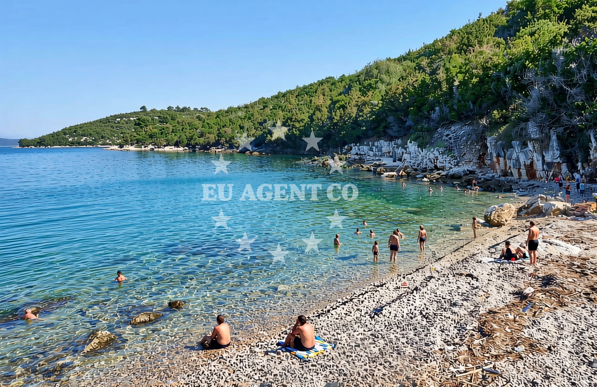
About this beach
Paprenica, Dragove (Dugi otok)
Beach: Paprenica
Location: Dragove (Dugi otok)
Characteristics and facilities
Gravel, rocks
Beach character
The beach's defining feature is its gravel and rock composition, which creates a rugged shoreline that contrasts with the smooth sands of Dugi Otok's more popular beaches. This terrain suggests a beach best suited for those who appreciate a more primitive coastal setting, though the rocky character may make swimming less accessible compared to other parts of the island. The beach's position on the island's northern coast means it faces open waters, offering views of the Kornati archipelago to the south and the broader Adriatic beyond. The lack of formal facilities aligns with the island's character as a destination that prioritizes natural landscapes over tourist infrastructure.Swimming and shore
Swimming conditions at Paprenica, Dragove (Dugi otok) Beach are shaped by its rocky shoreline. While the beach itself may not offer ideal entry points for swimmers, the surrounding waters of Dugi Otok are known for their clarity and moderate currents. The island's position in the Kornati archipelago means the area is part of a sailing region with generally calm waters during the summer months. Visitors should note that the beach's gravel and rock composition may limit its appeal for those seeking traditional sandy beach experiences, though the natural setting offers opportunities for exploration of the shoreline's unique geology.Facilities and activities
The beach lacks formal amenities such as showers, restrooms, or sunbeds, reflecting the island's focus on preserving its natural character. However, the proximity to the village of Paprenica means basic services are available nearby. Activities are limited to what the natural environment permits, with opportunities for rock-hopping, coastal walks, and enjoying the unobstructed views of the Kornati archipelago. The beach's location on Dugi Otok, a protected area, means it remains largely untouched by commercial development.Access and location
Paprenica, Dragove (Dugi otok) Beach is located on the northern coast of Dugi Otok, an island accessible via ferry services from the mainland and other nearby islands. The beach's proximity to the village of Paprenica means it is reachable by car for those staying on the island. For yacht charter guests, the beach's position on Dugi Otok places it within the Kornati archipelago sailing region, a popular area for boating excursions. The island's limited road network means access to the beach is best achieved by foot from nearby settlements or by boat from local anchorages.What to expect
Visitors to Paprenica, Dragove (Dugi otok) Beach should expect a rugged, gravelly shoreline that offers a stark contrast to the island's more developed beaches. The beach's natural character means it lacks formal amenities, though the surrounding area of Dugi Otok provides opportunities for exploring the island's landscapes and enjoying its maritime setting. The beach's position on the northern coast offers views of the open Adriatic and the Kornati archipelago, making it a destination for those seeking a more secluded coastal experience.Practical tips
Given the beach's gravel and rock composition, visitors should wear appropriate footwear for walking on the shoreline. The lack of formal facilities means provisions for food and water should be brought from nearby settlements. For yacht charter guests, the beach's location on Dugi Otok provides a convenient stopover point within the Kornati archipelago, though anchoring options should be confirmed with local maritime authorities.Exploring the coast by yacht
Paprenica, Dragove (Dugi otok) Beach is situated within the Kornati archipelago, a renowned sailing region in the Adriatic Sea. Yacht charter guests exploring this area may find the beach's location on Dugi Otok useful as a reference point for navigating the archipelago's intricate network of islands and channels. The island's proximity to the Kornati National Park means it serves as a gateway to one of Croatia's most celebrated maritime landscapes, though the beach itself is not an anchorage or marina. Sailing routes around Dugi Otok typically connect to other islands in the archipelago, offering opportunities for extended cruising experiences.Dugi Otok's Natural Significance
Dugi Otok, meaning 'Long Island,' is one of the largest islands in the Kornati archipelago and features a landscape shaped by its geological history. The island's northern coast, where Paprenica, Dragove (Dugi otok) Beach is located, is characterized by rugged cliffs and rocky shores that contrast with the more gentle southern coastline. The island is home to several protected areas, including the Dugi Otok Nature Park, which preserves its unique ecosystems and habitats.Historical Context of Dugi Otok
Dugi Otok has a long history of human settlement, with archaeological evidence dating back to prehistoric times. The island's strategic position in the Adriatic has made it a point of interest for various civilizations, including the Romans and medieval maritime powers. Today, the island's villages, including Paprenica, maintain a traditional way of life that reflects its historical roots.Anchorages in the surrounding area
Anchorages in Dragove and Zverinac offer nearby options for mooring in the Dugi otok area.
- Anchorage — dragove — dugi otok — 0.1 NM from beach
- Anchorage — dragove — dugi otok — 0.9 NM from beach
- Anchorage — zverinac — 2.1 NM from beach
- Sakarun — soline — dugi otok — 2.4 NM from beach
- Anchorage — soline — dugi otok — 2.5 NM from beach
- Anchorage — dugi otok — 2.7 NM from beach
- Zverinac North — 2.9 NM from beach
- Lučica — soline — dugi otok — 3.1 NM from beach
Distances are straight-line geographic distances, not sailing routes.
Mooring buoys in the surrounding area
- Quay — dragove — dugi otok — 0.7 NM from beach
- Buoy field Sakarun — soline — dugi otok — 2.5 NM from beach
- Jetty — sestrunj — 3.1 NM from beach
- Jetty — verunic — dugi otok — 3.2 NM from beach
- Buoy field — verunic — dugi otok — 3.2 NM from beach
Distances are straight-line geographic distances, not sailing routes.
Marine fuel stations
Fuel stations in Preko, Zadar, and Ugljan serve as refueling points for yachts traveling to the area.
- Ina — preko — ugljan — 11.7 NM from beach
- Ina — zadar — 12.9 NM from beach
- Ina — zaglav — dugi otok — 13.8 NM from beach
- Fuel station — sukosan — 16.4 NM from beach
Distances are straight-line geographic distances, not sailing routes.
Harbours in the surrounding area
Harbors in Božava and Zverinac provide shelter and facilities for larger vessels near the beach.
- Božava — bozava — dugi otok — 1.6 NM from beach
- Zverinac — 2.6 NM from beach
- Kablin — sestrunj — 3.6 NM from beach
- Veli Rat — dugi otok — 3.7 NM from beach
- Hrvatin — sestrunj — 3.8 NM from beach
- Brbinj — dugi otok — 4.1 NM from beach
Distances are straight-line geographic distances, not sailing routes.
Marinas in the surrounding area
- Marina Veli Rat — dugi otok — 3.8 NM from beach
- Marina Veli Iž — iz veli — 8.8 NM from beach
- Olive Island Marina — sutomiscica — ugljan — 10.5 NM from beach
- Marina Preko — ugljan — 11.4 NM from beach
- Marina Borik — zadar — 12.1 NM from beach
Distances are straight-line geographic distances, not sailing routes.
Restaurants near the beach
Restaurants in Božava and Zverinac provide dining options for visitors to the beach area.
- Restaurant Konoba Kadulja — bozava — dugi otok — 1.6 NM from beach
- Boxavia — bozava — dugi otok — 1.6 NM from beach
- Veli Kamik — bozava — dugi otok — 1.6 NM from beach
- Restaurant — bozava — dugi otok — 1.6 NM from beach
- Gostionica Oleander — bozava — dugi otok — 1.6 NM from beach
- Ristorante Zverinac — 2.6 NM from beach
- Amarcord — soline — dugi otok — 2.7 NM from beach
Distances are straight-line geographic distances, not sailing routes.
Navigation guides for the surrounding area
Navigation guides for Božava, Zverinac, and surrounding points assist in planning routes to the beach.
- Božava — 1.5 NM from beach
- Dugi Otok -Bozava — 2.4 NM from beach
- Zverinac — 2.5 NM from beach
- Luka Soliscica — 3.5 NM from beach
- Uvala Kablin — 3.8 NM from beach
Distances are straight-line geographic distances, not sailing routes.
Yachts from nearby departure bases
Sailing yachts
- Elan Impression 40 (Val) — Ugljan Sutomišćica Olive Island — 10.5 NM from departure base to beach
- Bavaria 44 (Medena) — Zadar Marina Borik — 12.1 NM from departure base to beach
Catamarans
- Sunreef 60 (SINATA) — Zadar Marina Borik — 12.1 NM from departure base to beach
Motor yachts
- Prestige 460 (ADUDU 2) — Zadar Marina Borik — 12.1 NM from departure base to beach
Motor boats
- Adria 28 Luxus (Ana) — Brbinj Marina — 3.6 NM from departure base to beach
- Quicksilver Activ 905 (Galeb) — Ugljan Sutomišćica Olive — 10.5 NM from departure base to beach
- Rancraft RM21 (Dugi otok) — Zadar Diklo Port — 12.0 NM from departure base to beach
- Rancraft RS Cinque.5 — Zadar Diklo Port — 12.0 NM from departure base to beach
- Rancraft RM19 (Daycruiser) — Zadar Diklo Port — 12.0 NM from departure base to beach
- Merry Fisher 895 (Bepo) — Zadar Marina Borik — 12.1 NM from departure base to beach
Distances are straight-line geographic distances, not sailing routes.