Otocic Vrnik Beach - Lumbarda, Croatia
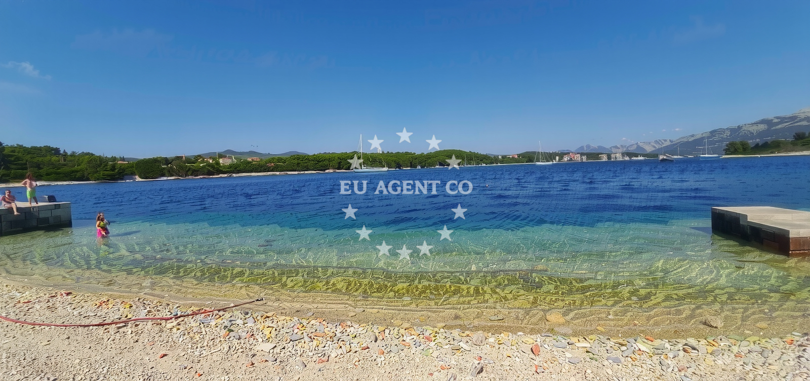
Otocic Vrnik lies along the southern coast of the island of Korčula, Croatia, in the village of Lumbarda. This 370-meter stretch of shoreline features a natural landscape defined by boulders and pebbles, with a moderate increase in depth as it extends into the Adriatic Sea. While the beach lacks formal amenities, its clean conditions and minimal crowds during peak season make it a quiet spot for leisure seekers.
Beach character
The beach’s straight shoreline contrasts with the rugged terrain of the surrounding area, offering a unique blend of natural features. Boulders dominate most of the shore, with pebbles forming the sea floor. The depth increases gradually, creating a moderate profile that suits casual swimmers. The absence of artificial structures preserves the beach’s raw character, though the lack of sand may influence its appeal for certain visitors.
Swimming and shore
The pebbled sea floor and moderate depth make Otocic Vrnik suitable for leisurely swimming, though the surface may not be ideal for young children. The gradual depth increase allows for safe wading, and the clean water conditions align with the beach’s overall rating. No formal lifeguard services or designated swimming zones are reported, reflecting its unstructured nature.
Facilities and activities
No structured amenities or activities are listed for Otocic Vrnik. The beach’s character is defined by its natural state, with no reported facilities such as showers, restrooms, or parking. Visitors are advised to prepare for a basic experience focused on the landscape and sea conditions.
Access and location
Located in Lumbarda, a village on the island of Korčula, Otocic Vrnik is part of a coastal area known for its traditional Mediterranean settlements. The beach’s position within Uvala Racisce, a bay on Korčula’s southern coast, places it near other natural attractions and cultural sites on the island. Access is likely via local roads serving the village, though specific details about parking or pathways are not documented.
What to expect
Otocic Vrnik is a secluded beach with minimal infrastructure, ideal for visitors seeking a quiet, natural setting. The beach’s boulder-strewn shoreline and pebbled seabed create a distinctive environment, while its clean conditions and low crowd levels during peak season offer a respite from busier coastal spots. The absence of formal amenities means visitors should plan accordingly, prioritizing comfort in an unstructured setting.
Practical tips
Given the beach’s natural character, visitors should bring appropriate footwear for the pebbled shoreline. The clean water conditions and moderate depth make it suitable for casual swimming, but the lack of facilities means self-sufficiency is necessary. The beach’s low crowd index suggests it may be less crowded than other coastal areas in the region.
Exploring the coast by yacht
As part of the Adriatic coastline near Korčula, Otocic Vrnik lies within a region popular with yacht charter guests exploring the Dalmatian coast. The nearby waters connect to established sailing routes between the islands of Korčula, Šolta, and Brač. While the beach itself is not a formal anchorage, its location offers a scenic vantage point for sailors navigating the area. Charter guests may find the surrounding waters suitable for leisurely cruising, with opportunities to explore nearby bays and coastal villages.
Regional Context
Lumbarda, the village hosting Otocic Vrnik, is known for its traditional architecture and proximity to Korčula Town, a historic center with medieval landmarks. The island of Korčula itself is part of the Pelješac Peninsula region, famed for its vineyards and coastal trails. Visitors may combine a beach visit with explorations of local wineries or the island’s UNESCO-listed Old Town.
Anchorages in the surrounding area
Anchorages in Lumbarda and Korcula offer nearby options with facilities in Lumbarda, a short distance away.
- Anchorage — lumbarda — korcula — 0.6 NM from beach
- Anchorage — badija — 0.8 NM from beach
- Anchorage — korcula — 1.5 NM from beach
- Anchorage — lumbarda — korcula — 1.5 NM from beach
- Anchorage — korcula — 1.9 NM from beach
- Anchorage — korcula — 2.4 NM from beach
- Anchorage — korcula — 2.7 NM from beach
- Anchorage — korcula — 2.8 NM from beach
Distances are straight-line geographic distances, not sailing routes.
Mooring buoys in the surrounding area
Mooring buoys at Vrnik Arts Club and Quay VRN are located near the beach, while others in Korcula and Stupe are further away.
- Vrnik Arts Club buoys — 0.1 NM from beach
- Quay — vrnik — 0.1 NM from beach
- Fuel jetty — korcula — 1.3 NM from beach
- Restaurant Moro buoys — stupe — 1.7 NM from beach
- Jetty — korcula — 2.9 NM from beach
Distances are straight-line geographic distances, not sailing routes.
Marine fuel stations
- Fuel station — korcula — 1.3 NM from beach
- Fuel station — ploce — 13.5 NM from beach
- Ina — ubli — lastovo — 19.1 NM from beach
- Ina — vela luka — korcula — 20.0 NM from beach
Distances are straight-line geographic distances, not sailing routes.
Harbours in the surrounding area
Harbors in Lumbarda and Korcula are situated nearby, with additional options in Orebic and Viganj further afield.
- Tatinja — lumbarda — korcula — 0.9 NM from beach
- Korčula E harbour — korcula — 1.9 NM from beach
- Korčula W harbour — korcula — 2.1 NM from beach
- Orebić — orebic — 2.2 NM from beach
- Kučišće — kucisce — 3.5 NM from beach
- Viganj — 4.0 NM from beach
Distances are straight-line geographic distances, not sailing routes.
Marinas in the surrounding area
Marinas in Lumbarda and Korcula are close to the beach, with larger options in Lastovo and Vela Luka at greater distances.
- Marina Lumbarda — korcula — 0.9 NM from beach
- ACI Marina Korčula — korcula — 1.9 NM from beach
- Marina Solitudo — lastovo — 18.4 NM from beach
- Marina Korkyra — vela luka — korcula — 20.1 NM from beach
- Marina Tučepi — marina tucepi — 20.1 NM from beach
Distances are straight-line geographic distances, not sailing routes.
Restaurants near the beach
- Vrnik Arts Club — 0.1 NM from beach
- Zure — lumbarda — korcula — 0.6 NM from beach
- Agroturizam Lovric — lumbarda — korcula — 0.7 NM from beach
- Dusica — lumbarda — korcula — 0.8 NM from beach
- Lina — lumbarda — korcula — 0.9 NM from beach
- Restoran Pizzeria Lina — lumbarda — korcula — 0.9 NM from beach
- Konoba More — lumbarda — korcula — 0.9 NM from beach
Distances are straight-line geographic distances, not sailing routes.
Navigation guides for the surrounding area
Navigation guides for Uvala Racisce, Lumbarda, and Orebic assist with approach routes to the area.
- Uvala Racisce — 0.6 NM from beach
- Otocic Badija — 0.8 NM from beach
- Lumbarda — 1.0 NM from beach
- Orebic — 2.2 NM from beach
- Uvala Banja — 2.5 NM from beach
Distances are straight-line geographic distances, not sailing routes.
Yachts from nearby departure bases
Sailing yachts
- Elan 40 Impression (Karleta) — Ploče City Port — 13.4 NM from departure base to beach
- Salona 44 (SAMOA) — Ploče City Port — 13.4 NM from departure base to beach
- Sun Odyssey 419 (Luka Ploce) — Ploče City Port — 13.4 NM from departure base to beach
- More 55 (MRS. ROBINSON) — Ploče City Port — 13.4 NM from departure base to beach
- Sun Odyssey 349 (Visnjica) — Ploče City Port — 13.4 NM from departure base to beach
- Elan 514 Impression (Cesarica III) — Ploče City Port — 13.4 NM from departure base to beach
- Sun Odyssey 349 (Porto Tolero) — Ploče City Port — 13.4 NM from departure base to beach
- Bavaria 40 Cruiser (LADY BUTTERFLY) — Tučepi Port — 20.1 NM from departure base to beach
Catamarans
- Lagoon 450 Fly (Alba Mouse) — Ploče City Port — 13.4 NM from departure base to beach
Motor yachts
- Princess V53 (Chablis) — Makarska Port — 22.2 NM from departure base to beach
Distances are straight-line geographic distances, not sailing routes.