Otinja, Sveti Juraj Beach, Croatia
Otinja, Sveti Juraj Beach is a compact shoreline located in the village of Otinja on Croatia’s Adriatic coast. Stretching approximately 30 meters, the beach consists of gravel and concrete/stone slabs, offering a straightforward, utilitarian access point to the sea. While not a traditional sandy beach, its proximity to the village and the broader coastal landscape of the region makes it a practical landing spot for those exploring the area by foot, bike, or boat.
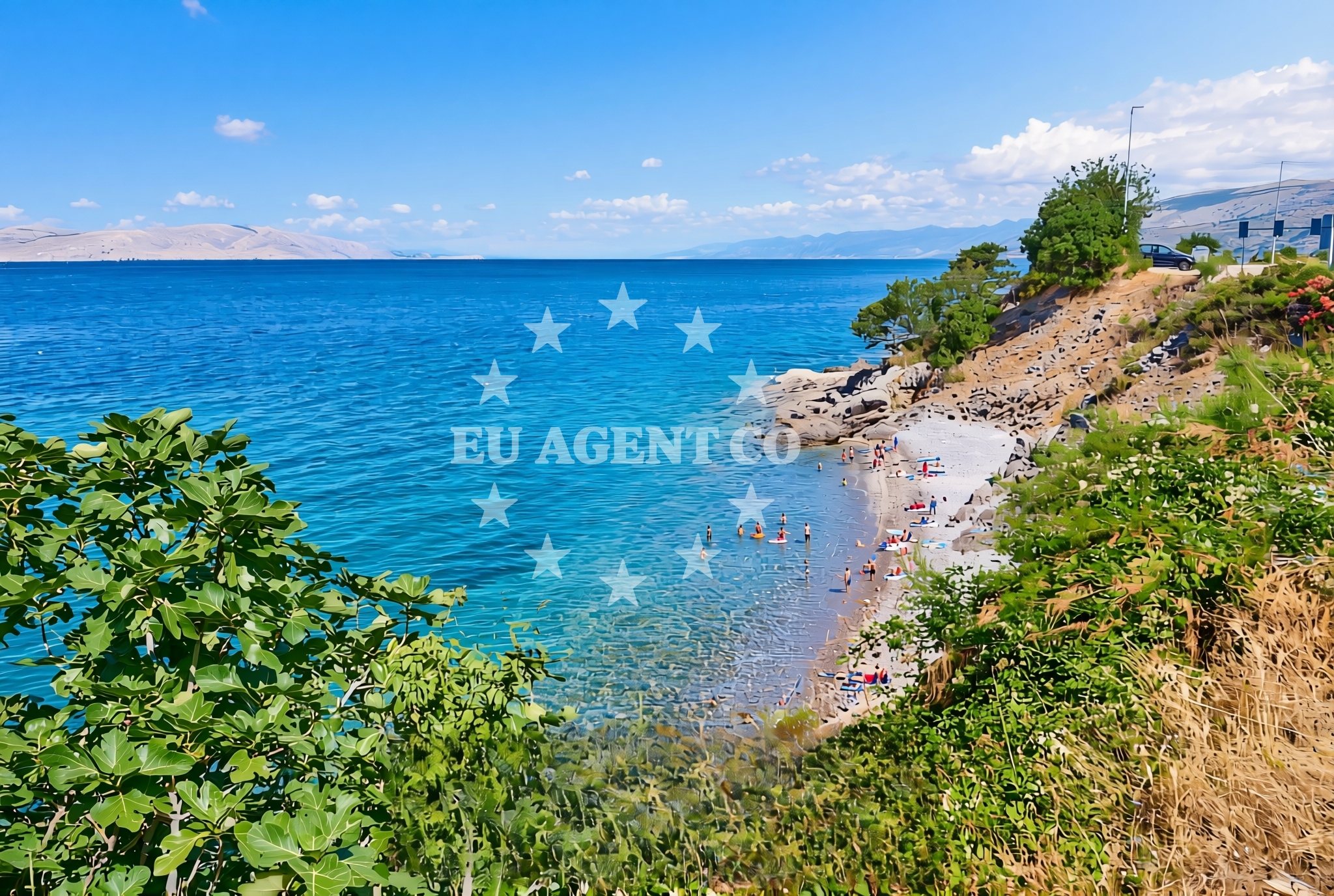
About this beach
Otinja, Sveti Juraj
Beach: Otinja
Location: Sveti Juraj
Characteristics and facilities
Gravel, concrete / stone slabs
30 m
Beach character
The beach’s surface is composed of gravel and concrete/stone slabs, reflecting its function as a transitional space between land and water. This composition suggests it is more suited for brief access rather than extended sunbathing or recreational use. The 30-meter length indicates a modest footprint, likely serving as a local access point rather than a major tourist destination. The lack of detailed natural features in the catalog implies that the beach’s character is defined by its materials and immediate surroundings rather than by unique geological or ecological traits.
Swimming and shore
Given the beach’s gravel and stone composition, swimming is unlikely to be a primary activity here. The shoreline’s structure suggests it may be more functional for foot traffic or vehicle access than for water-based recreation. Visitors should consider the practical nature of the beach when planning activities, as it does not appear to offer the typical amenities or conditions associated with leisurely swimming or water sports.
Facilities and activities
No specific facilities or activities are listed in the catalog, indicating that the beach does not host structured amenities such as showers, restrooms, or recreational equipment. Its role seems limited to basic access to the sea, with no evidence of organized activities or services. Nearby settlements or regions may offer additional opportunities, but these are not detailed in the beach’s authoritative features.
Access and location
Located in the village of Otinja, the beach is part of Croatia’s coastal network along the Adriatic Sea. Its coordinates place it in a region known for its rugged coastline and historic maritime routes. While the beach itself does not appear to be a major tourist hub, its position within the broader Adriatic context connects it to the sailing and cultural heritage of the area. Visitors should consider the beach as a minor access point within a larger coastal framework.
What to expect
Otinja, Sveti Juraj Beach is best approached with an understanding of its practical rather than recreational purpose. The gravel and stone surface suggests it is more suited for brief access than for extended stays. The beach’s short length and lack of detailed amenities mean it is unlikely to be a focal point for leisure activities. However, its location within the Adriatic region offers proximity to other coastal attractions, settlements, and sailing routes that may be of interest to visitors.
Practical tips
Visitors should be prepared for a beach that prioritizes access over comfort. Sturdy footwear is recommended for navigating the gravel and stone slabs. Given the absence of detailed facilities, it is advisable to check nearby settlements for additional services or amenities. The beach’s role as a minor access point means it may be less frequented than other coastal sites in the region.
Exploring the coast by yacht
The Adriatic Sea, where Otinja is located, is a well-known sailing destination, characterized by its clear waters, historic ports, and scenic coastlines. While the beach itself does not appear to be a major anchorage or marina, the broader region offers opportunities for yacht charter guests exploring Croatia’s coastline. Nearby settlements and islands may provide more developed sailing infrastructure, including marinas and fuel stations, which can be accessed via Euro-Agent’s navigation tools.
Regional Context and Nearby Exploration
The village of Otinja is part of the broader Dalmatian coast, a region rich in cultural heritage and natural beauty. While the beach itself is modest in scale, the surrounding area offers opportunities for exploring historic sites, local cuisine, and other coastal landmarks. Yacht charter guests may find the region’s mix of rugged coastline and developed marinas appealing for extended sailing trips.
Anchorages in the surrounding area
Anchorages near Jurjevo (Luka Sv. Juraj) and Uvala Sv. Jelena provide nearby mooring options.
- Anchorage — st juraj — 0.6 NM from beach
- Anchorage — zrnovnica — 1.9 NM from beach
- Anchorage — senj — 2.3 NM from beach
- Anchorage — senj — 4.9 NM from beach
- Anchorage — lukovo — 5.0 NM from beach
- Anchorage — senj — 5.6 NM from beach
- Vela Luka — krk — 5.8 NM from beach
- Mala Luka — krk — 6.1 NM from beach
Distances are straight-line geographic distances, not sailing routes.
Mooring buoys in the surrounding area
- Quay — zrnovnica — 1.9 NM from beach
- Quay — zrnovnica — 2.4 NM from beach
- Jetty — krk — 5.7 NM from beach
- Jetty — krk — 5.9 NM from beach
- Quay — goli otok — 7.6 NM from beach
Distances are straight-line geographic distances, not sailing routes.
Marine fuel stations
Fuel stations in Rab and Novi Vinodolski ensure refueling options for vessels.
- Ina — rab — 12.6 NM from beach
- INA — novi vinodolski — 12.8 NM from beach
- Flash — krk — 15.7 NM from beach
- Ina — krk — 15.8 NM from beach
Distances are straight-line geographic distances, not sailing routes.
Harbours in the surrounding area
Harbors at St. Juraj and Senj offer convenient port facilities.
- St. Juraj — st juraj — 0.4 NM from beach
- Senj — 3.5 NM from beach
- Lukovo — 5.0 NM from beach
- Baška — baska — krk — 7.1 NM from beach
- Melna — goli otok — 7.4 NM from beach
- Starigrad — starigrad senj — 8.4 NM from beach
Distances are straight-line geographic distances, not sailing routes.
Marinas in the surrounding area
- ACI Marina Supetarska Draga — rab — 11.6 NM from beach
- Mitan Marina — novi vinodolski — 12.2 NM from beach
- ACI Marina Rab — 12.7 NM from beach
- Marina Novi — novi vinodolski — 12.8 NM from beach
- Marina Punat — krk — 13.8 NM from beach
Distances are straight-line geographic distances, not sailing routes.
Restaurants near the beach
Restaurants near Riva in Senj serve local cuisine.
- Riva — senj — 3.4 NM from beach
Distances are straight-line geographic distances, not sailing routes.
Navigation guides for the surrounding area
Navigation guides for Jurjevo and Uvala Sv. Jelena assist in route planning.
- Jurjevo (Luka Sv. Juraj) — 0.2 NM from beach
- Senj — 3.4 NM from beach
- Uvala Sv. Jelena — 4.9 NM from beach
- Uvala Vela Luka — 5.5 NM from beach
- Baška — 6.9 NM from beach
Distances are straight-line geographic distances, not sailing routes.
Yachts from nearby departure bases
Sailing yachts
- Elan 494 Impression (LUCIJA I) — Vinodolski Novi Marina — 12.8 NM from departure base to beach
- Oceanis 50 (Elise) — Vinodolski Novi Marina — 12.8 NM from departure base to beach
- Bavaria Cruiser 37 (Maci) — Vinodolski Novi Marina — 12.8 NM from departure base to beach
- Elan 444 Impression (MARIJANA 48) — Vinodolski Novi Marina — 12.8 NM from departure base to beach
Catamarans
- Lagoon 40 (Paco) — Vinodolski Novi Marina — 12.8 NM from departure base to beach
- Lagoon 380 (Queen Mia) — Vinodolski Novi Marina — 12.8 NM from departure base to beach
- Aventura 37 (THOMAS) — Vinodolski Novi Marina — 12.8 NM from departure base to beach
Motor yachts
- Galeon 700 (Obsession two) — Vinodolski Novi Mitan Marina — 12.2 NM from departure base to beach
- Absolute 50 Fly (Acrobat) — Rab ACI Marina — 12.7 NM from departure base to beach
Motor boats
- Adriana 36 (Gaja) — Vinodolski Novi Marina — 12.8 NM from departure base to beach
Distances are straight-line geographic distances, not sailing routes.