Ošljak Beach: Coastal Exploration in Croatia's Adriatic Shores
About this beach
Ošljak (Ošljak): beaches and coves
Beach character
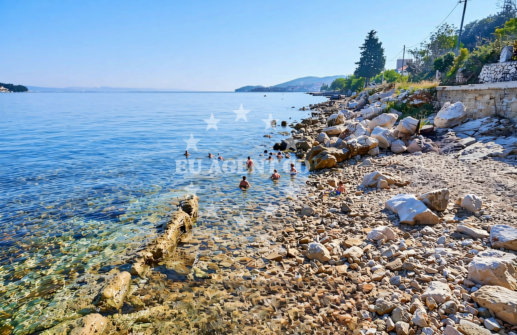
The beach at Ošljak consists of a mix of pebbles and small stones, typical of the Adriatic's rocky coastline. The shoreline is flanked by low-lying cliffs that rise gradually from the water's edge, creating natural shelter from direct winds. The sea here is known for its clear waters and moderate currents, making it a spot where experienced swimmers might find calm pockets between the rocky outcrops. The lack of formal amenities means the beach retains a raw, untouched character, appealing to those seeking solitude away from more developed coastal areas.Swimming and shore
Swimming conditions at Ošljak are influenced by the surrounding geology. The rocky shoreline creates variable depths near the shore, with deeper waters extending beyond the immediate cove. While the beach itself lacks designated swimming zones, the adjacent sea is generally safe for swimming during calm weather. The absence of lifeguard services or formal safety measures means visitors should exercise caution, particularly when exploring the rocky areas where submerged hazards may exist.Facilities and activities
There are no formal facilities directly at Ošljak Beach. However, the nearby settlement of Ošljak offers basic amenities including small shops, cafes, and seasonal accommodations. The surrounding area is popular with hikers and nature enthusiasts, with trails leading through the nearby hills and along the coast. While no specific activities are listed for the beach itself, the region is known for its historical sites, including medieval fortifications and churches that date back to the 15th century.Access and location
Ošljak Beach is accessible via a combination of road and coastal routes. The nearest major road is the A1 highway, which connects Šibenik to Zadar. For those arriving by boat, the nearby port of Šibenik offers access to the region's maritime routes. The beach's coordinates (44.0765388, 15.2073081) place it within reach of several coastal towns, including the historic city of Šibenik, which is approximately 25 kilometers to the southeast. The lack of direct parking facilities means visitors should plan to arrive by car or boat.What to expect
Visitors to Ošljak Beach should expect a natural, undeveloped shoreline that emphasizes raw coastal beauty over modern amenities. The beach is best suited for those seeking solitude and a connection with the Adriatic's rugged coastline. The surrounding area offers opportunities for exploring nearby settlements, hiking through the hills, and discovering historical sites. Due to the absence of formal facilities, visitors are advised to bring their own supplies, including water, snacks, and sun protection.Practical tips
Given the beach's undeveloped nature, visitors should consider arriving early to secure a spot on the shore. The rocky terrain means beachgoers should wear sturdy footwear when exploring the shoreline. For those interested in extended stays, nearby accommodations in Ošljak provide basic lodging options. Local guides may offer insights into the area's history and natural features, though these services are not formally listed in the beach's documentation.Exploring the coast by yacht
For yacht charter guests, Ošljak's location offers a strategic vantage point for exploring the eastern Adriatic. The nearby port of Šibenik serves as a common starting point for cruises along the coast, with routes extending toward the islands of Vis and Hvar. The surrounding waters are known for their scenic anchorages, including areas near the Krka National Park, where yacht charter guests can enjoy both coastal sailing and inland exploration. While Ošljak itself is not a formal marina, its proximity to established ports makes it a convenient stop for those navigating the region.Historical Context of the Region
The area around Ošljak has a long history tied to maritime trade and coastal defense. Medieval fortifications in the nearby town of Šibenik, a UNESCO World Heritage Site, reflect the region's strategic importance during the Renaissance. These historical landmarks, combined with the natural beauty of the coastline, create a unique blend of cultural and environmental significance that continues to attract visitors.Anchorages in the surrounding area
Anchorages in the surrounding area include locations near Kali, Zadar, and Ugljan.
- Anchorage — kali — ugljan — 1.8 NM from beach
- Anchorage — zadar — 3.1 NM from beach
- Puntamika — zadar — 3.5 NM from beach
- Anchorage — kukljica — ugljan — 3.5 NM from beach
- Anchorage — ugljan — 3.7 NM from beach
- Anchorage — kukljica — ugljan — 3.8 NM from beach
- Anchorage — ugljan — 3.9 NM from beach
- Anchorage — iz mali — 4.1 NM from beach
Distances are straight-line geographic distances, not sailing routes.
Mooring buoys in the surrounding area
- Ošljak — osljak — 0.0 NM from beach
- Buoy — kali — ugljan — 1.7 NM from beach
- Jetty — zadar — 3.0 NM from beach
- Jetty — zadar — 3.1 NM from beach
- Buoy field — kukljica — ugljan — 4.0 NM from beach
Distances are straight-line geographic distances, not sailing routes.
Marine fuel stations
Marine fuel stations are located in Preko, Zadar, Sukosan, and Zaglav.
- Ina — preko — ugljan — 0.6 NM from beach
- Ina — zadar — 2.6 NM from beach
- Fuel station — sukosan — 4.1 NM from beach
- Ina — zaglav — dugi otok — 8.1 NM from beach
Distances are straight-line geographic distances, not sailing routes.
Harbours in the surrounding area
Harbours in the surrounding area include Batalaža, Poljana, and Foša near Kali, Ugljan, and Zadar.
- Batalaža — kali — ugljan — 0.9 NM from beach
- Batalaža — kali — ugljan — 0.9 NM from beach
- Poljana — ugljan — 1.4 NM from beach
- Vela Lamjana — kali — ugljan — 1.9 NM from beach
- Sutomišćica — sutomiscica — ugljan — 2.1 NM from beach
- Foša — fosa — zadar — 2.2 NM from beach
Distances are straight-line geographic distances, not sailing routes.
Marinas in the surrounding area
Marinas in the surrounding area are situated in Preko, Sutomišćica, Zadar, and Kukljica.
- Marina Preko — ugljan — 0.8 NM from beach
- Olive Island Marina — sutomiscica — ugljan — 1.9 NM from beach
- Marina Zadar — 2.7 NM from beach
- Vitrenjak Zadar — 3.1 NM from beach
- Kukljica — ugljan — 3.1 NM from beach
Distances are straight-line geographic distances, not sailing routes.
Restaurants near the beach
Restaurants near the beach are clustered in Preko, Ugljan.
- Pazifik — preko — ugljan — 0.6 NM from beach
- Petrina — preko — ugljan — 0.6 NM from beach
- Barbara — preko — ugljan — 0.7 NM from beach
- Jardin — preko — ugljan — 0.8 NM from beach
- Dominik — preko — ugljan — 0.9 NM from beach
- Taverna Joso — preko — ugljan — 0.9 NM from beach
- Roko Konoba & Grill — preko — ugljan — 0.9 NM from beach
Distances are straight-line geographic distances, not sailing routes.
Navigation guides for the surrounding area
Navigation guides for the surrounding area cover Kali, Uvala Lamjana, and Marina Maslina.
- Kali — 0.6 NM from beach
- Uvala Lamjana Mala — 1.9 NM from beach
- Marina (Marina Maslina) — 1.9 NM from beach
- Uvala Lamjana Vela — 2.2 NM from beach
- Lukoran Veli — 2.8 NM from beach
Distances are straight-line geographic distances, not sailing routes.
Yachts from nearby departure bases
Sailing yachts
- Elan Impression 40 (Val) — Ugljan Sutomišćica Olive Island — 2.0 NM from departure base to beach
- Sun Odyssey 349 (ESTRELLA) — Zadar Marina — 2.7 NM from departure base to beach
- Bavaria Cruiser 36 (Zara) — Zadar Marina — 2.7 NM from departure base to beach
Catamarans
- Bali 4.6 (Jako 2) — Zadar Marina — 2.7 NM from departure base to beach
- Delta F40-XT (Veronchie) — Zadar Marina — 2.7 NM from departure base to beach
Motor yachts
- Bluegame BG74 (Kimani) — Zadar Port — 2.6 NM from departure base to beach
Gulets / Cruisers
- Gulet (Dolin) — Zadar Port — 2.6 NM from departure base to beach
Motor boats
- Quicksilver Activ 905 (Galeb) — Ugljan Sutomišćica Olive — 2.0 NM from departure base to beach
- Passport 430 cabin (Tijat) — Zadar Port — 2.6 NM from departure base to beach
- Shark BF 23 Sport (Hrvoje) — Zadar Marina — 2.7 NM from departure base to beach
Distances are straight-line geographic distances, not sailing routes.