Oleander, Cesarica Beach, Croatia
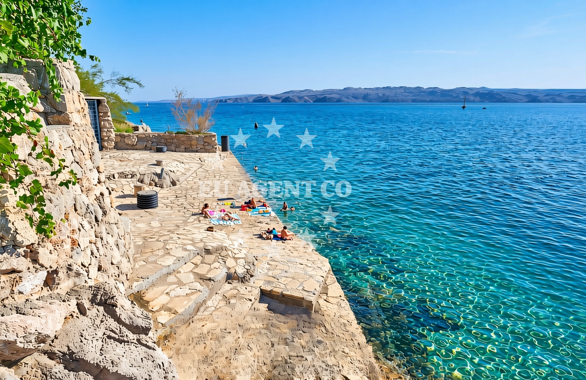
About this beach
Oleander, Cesarica
Beach: Oleander
Location: Cesarica
Characteristics and facilities
Concrete / stone slabs
Beach character
The beach's defining feature is its composition of concrete and stone slabs, which suggests a man-made or heavily modified shoreline. This characteristic may indicate historical land use, such as industrial activity or infrastructure development, rather than a naturally formed beach. The absence of detailed natural features in the catalog implies that the beach's primary appeal lies in its setting rather than recreational water access.Swimming and shore
Swimming conditions at Oleander, Cesarica Beach are not explicitly documented in the catalog. The concrete/stone slab composition may affect water access, potentially creating uneven entry points or limited shoreline for wading. Visitors should consider the beach's structural nature when planning aquatic activities, as the terrain could influence swim safety and comfort.Facilities and activities
No formal facilities or recreational activities are listed for this beach. The lack of structured amenities aligns with its apparent role as a coastal feature rather than a tourist destination. However, its proximity to Oleander and the broader Adriatic coast may offer indirect access to regional services, though these are not specified in the catalog.Access and location
Located in Oleander, the beach is positioned within a coastal area that connects to the wider Dalmatian coast. While specific road or maritime access details are not provided, its coordinates (44.557048, 15.028618) place it near settlements that may serve as bases for exploring the Adriatic. The beach's immediate surroundings likely include typical coastal elements such as rocky outcrops and open sea views.What to expect
Visitors to Oleander, Cesarica Beach should anticipate a shoreline defined by concrete and stone slabs, which may limit traditional beach activities like sunbathing or swimming in shallow waters. The beach appears to function more as a coastal marker than a recreational space. Its location in Oleander places it within reach of other coastal attractions, though specific details about nearby services or sights are not included in the catalog.Practical tips
Given the beach's structural composition, visitors might find it useful to check for alternative shorelines in the Oleander area for more conventional beach experiences. The lack of formal facilities means preparation for self-sufficiency is advisable.Exploring the coast by yacht
For yacht charter guests, the beach's location in Oleander offers proximity to the broader Adriatic sailing routes. While the beach itself is not an anchorage or marina, the surrounding coast includes established yacht bases that cater to Adriatic cruising. Charter yachts operating in this region may use nearby ports as starting points for exploring the Dalmatian coast, with Oleander serving as a reference point for navigation.Regional Coastal Context
The area around Oleander is part of the Dalmatian coast, known for its rugged cliffs, islands, and historic maritime routes. While Cesarica Beach itself is a minor coastal feature, the region as a whole supports yacht charter operations with marinas in nearby towns. Sailors navigating this part of the Adriatic may use Oleander as a directional landmark when approaching the area.Anchorages in the surrounding area
Anchorages near Cesarica, including those in Prizna and Pag.
- Anchorage — cesarica — 0.1 NM from beach
- Anchorage — cesarica — 0.5 NM from beach
- Anchorage — cesarica — 1.5 NM from beach
- Anchorage — prizna — 3.4 NM from beach
- Anchorage — novalja — pag — 4.6 NM from beach
- Anchorage — prizna — 5.3 NM from beach
- Anchorage — pag — 5.4 NM from beach
- Anchorage — pag — 5.6 NM from beach
Distances are straight-line geographic distances, not sailing routes.
Mooring buoys in the surrounding area
Mooring buoys in Pag and Novalja, located near the beach.
- Jetty — zubovici — pag — 2.9 NM from beach
- Jetty — zubovici — pag — 3.1 NM from beach
- Jetty — simuni — pag — 6.3 NM from beach
- Buoy field — novalja — pag — 6.6 NM from beach
- Drljanda — stara novalja — pag — 7.2 NM from beach
Distances are straight-line geographic distances, not sailing routes.
Marine fuel stations
Fuel stations in Rab and Mali Losinj, situated further from the beach.
- Ina — rab — 16.6 NM from beach
- Ina — mali losinj — 24.2 NM from beach
- Adria Oil — mali losinj — 24.5 NM from beach
- Ina — zadar — 27.7 NM from beach
Distances are straight-line geographic distances, not sailing routes.
Harbours in the surrounding area
- Karlobag — 2.6 NM from beach
- Žigljen — zigljen — pag — 3.7 NM from beach
- Prizna — 3.7 NM from beach
- Novalja — pag — 6.5 NM from beach
- Pag — 6.8 NM from beach
- Stara Novalja — pag — 7.0 NM from beach
Distances are straight-line geographic distances, not sailing routes.
Marinas in the surrounding area
- ACI Marina Šimuni — simuni — pag — 6.1 NM from beach
- ACI Marina Rab — 16.5 NM from beach
- ACI Marina Supetarska Draga — rab — 19.6 NM from beach
- Y/C Marina Mali Lošinj — mali losinj — 24.3 NM from beach
- Marina Lošinj — mali losinj — 24.5 NM from beach
Distances are straight-line geographic distances, not sailing routes.
Navigation guides for the surrounding area
Navigation guides for nearby areas including Prizna and Novalja.
- Uvala Prizna — 3.6 NM from beach
- Caska — 4.5 NM from beach
- Novalja — 6.1 NM from beach
- Uvala Bliznica — 6.8 NM from beach
- Uvala Zavratnica — 10.1 NM from beach
Distances are straight-line geographic distances, not sailing routes.
Yachts from nearby departure bases
Yachts departing from bases in Šimuni and Novalja, offering access to the beach.
Sailing yachts
- First 45 (Egeria) — Šimuni Kolan ACI Marina — 6.0 NM from departure base to beach
- Elan 40 Impression (Laali) — Mali Lošinj — 24.3 NM from departure base to beach
- Elan 344 Impression (Helios) — Mali Lošinj — 24.3 NM from departure base to beach
Motor yachts
- Absolute 50 Fly (Acrobat) — Rab ACI Marina — 16.5 NM from departure base to beach
Motor boats
- Balt 818 Titanium (Valentina) — Novalja — 6.3 NM from departure base to beach
- Balt 818 Titanium (Valentina 2) — Novalja — 6.3 NM from departure base to beach
- BWA Sport 22GT (BWA ) — Pag City Port — 6.9 NM from departure base to beach
- Merry Fisher 895 — Povljana Marina — 13.0 NM from departure base to beach
- Galeon Galia 630 — Mali Lošinj — 24.3 NM from departure base to beach
- Antares 36 (Joia) — Mali Lošinj — 24.3 NM from departure base to beach
Distances are straight-line geographic distances, not sailing routes.