Naburje sjever, Zastražišće (Hvar) Beach, Croatia
About this beach
Naburje sjever, Zastražišće (Hvar)
Beach: Naburje sjever
Location: Zastražišće (Hvar)
Characteristics and facilities
Gravel, concrete / stone slabs
Natural shade
Beach character
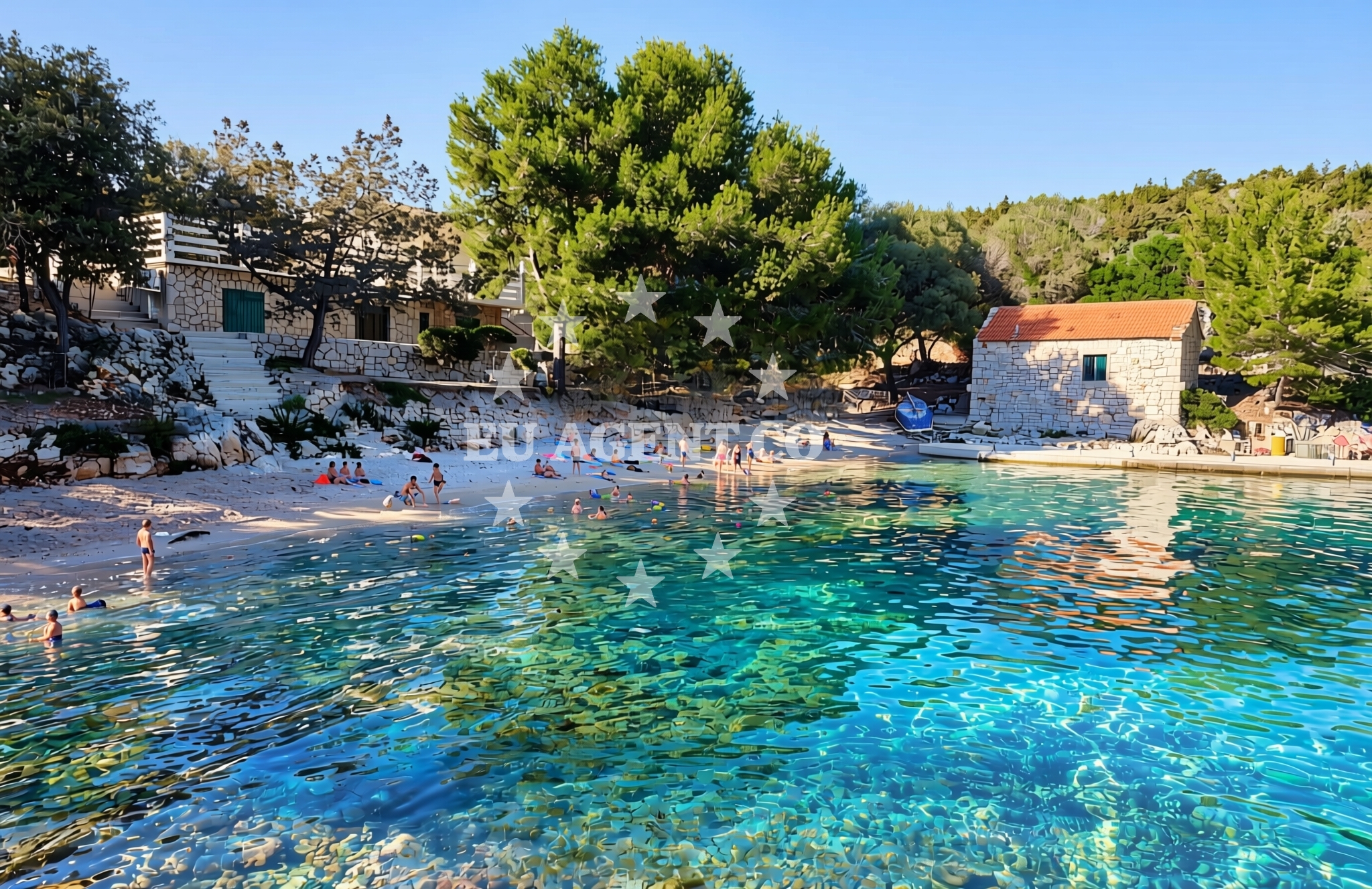
The beach's surface consists primarily of gravel and concrete/stone slabs, creating a rugged yet accessible shoreline. Natural shade is available through rock outcrops and coastal vegetation, offering respite from the sun. While not ideal for swimming, the area is suitable for walking, sunbathing on flat slabs, and enjoying the unspoiled coastal landscape. The absence of artificial amenities emphasizes its raw, natural character.Swimming and shore
The gravel and stone composition of Naburje sjever makes it less conventional for swimming but well-suited for exploring the shoreline. The beach's shallow, rocky terrain may appeal to those seeking a unique coastal experience. Nearby waters are part of the Adriatic Sea's broader sailing network, though no specific swimming facilities or water quality data are documented for this location.Facilities and activities
No structured amenities or activities are listed for Naburje sjever. The beach's primary attractions are its natural features: the gravel and stone surface, and the shade provided by coastal formations. Visitors may enjoy walking along the shore, photography, or simply observing the interplay of land and sea in this unmodified setting.Access and location
Naburje sjever is located in Zastražišće, a coastal village on the island of Hvar. The island is part of the Split-Dalmatia County, known for its historic towns, vineyards, and proximity to the Adriatic's sailing routes. Hvar itself is a popular destination for yacht charter guests, with marinas in Stari Grad and Hvar Town offering access to the surrounding islands and coastal towns. The beach's position on the island's western coast places it near routes connecting to Brac, Vis, and the mainland.What to expect
Expect a rugged shoreline composed of gravel and concrete/stone slabs, with natural shade from coastal vegetation and rock formations. The beach lacks artificial facilities, making it ideal for those seeking an unspoiled coastal experience. Its location on Hvar offers proximity to the island's cultural landmarks, including the historic town of Hvar and the famous vineyards of the region. The area is well-positioned for yacht charter guests exploring the Adriatic's southern coast.Practical tips
Wear sturdy footwear for walking on gravel and stone slabs. Use the natural shade during peak sunlight hours. Note that the beach's surface may be uneven, making it less suitable for standard sunbathing. Consider combining a visit with exploration of Hvar's nearby attractions, such as the town's historic center or the island's wineries.Exploring the coast by yacht
Naburje sjever's location on Hvar places it within a premier yacht charter region of the Adriatic. Charter guests may anchor nearby or use local marinas in Stari Grad or Hvar Town as bases for exploring the island and surrounding waters. The area is part of a sailing network connecting to Brac, Vis, and the mainland, with routes passing through the Hvar Channel and along the Dalmatian coast. Yacht charter companies operating in the region often highlight Hvar's proximity to both cultural sites and natural anchorages.Cultural and Historical Context
Zastražišće, like much of Hvar, has a history tied to maritime trade and agriculture. The island's medieval fortifications and Renaissance architecture reflect its historical significance. Local vineyards produce Plavac Mali, a robust red wine that is a regional specialty. Visitors may explore Hvar Town's harbor, which has been a hub for sailors and traders for centuries.Anchorages in the surrounding area
Anchorages in Pokrivenik, Hvar, near the Zastražišće (Hvar) shoreline.
- Anchorage — pokrivenik — hvar — 0.3 NM from beach
- Anchorage — pokrivenik — hvar — 0.5 NM from beach
- Anchorage — pokrivenik — hvar — 0.5 NM from beach
- Anchorage — hvar — 2.4 NM from beach
- Anchorage — dugi dolac — hvar — 2.4 NM from beach
- Anchorage — dugi dolac — hvar — 2.5 NM from beach
- Anchorage — dugi dolac — hvar — 2.7 NM from beach
- Anchorage — dugi dolac — hvar — 2.9 NM from beach
Distances are straight-line geographic distances, not sailing routes.
Mooring buoys in the surrounding area
Mooring buoys in Pokrivenik, Hvar, and nearby coastal locations.
- Restaurant Preza quay — pokrivenik — hvar — 0.5 NM from beach
- Jetty — velika stiniva — hvar — 2.9 NM from beach
- Quay — hvar — 2.9 NM from beach
- Quay — bogomolje — hvar — 6.0 NM from beach
- Jetty — zavala — hvar — 8.2 NM from beach
Distances are straight-line geographic distances, not sailing routes.
Marine fuel stations
- Fuel station — sumartin — brac — 7.9 NM from beach
- Ina — vrboska — hvar — 9.1 NM from beach
- Ina — makarska — 10.3 NM from beach
- Fuel station — bol — brac — 11.7 NM from beach
Distances are straight-line geographic distances, not sailing routes.
Harbours in the surrounding area
Harbours on Hvar and nearby islands including Brac and Makarska.
- Sumartin — brac — 7.8 NM from beach
- Port Jelsa — hvar — 8.1 NM from beach
- Vrboska — hvar — 9.2 NM from beach
- Podgora — 9.9 NM from beach
- Lovište — loviste — 10.1 NM from beach
- Tučepi — tucepi — 10.1 NM from beach
Distances are straight-line geographic distances, not sailing routes.
Marinas in the surrounding area
Marinas in Vrboska, Tucepi, and other Hvar coastal towns.
- ACI Marina Vrboska — hvar — 9.1 NM from beach
- Marina Tučepi — marina tucepi — 10.1 NM from beach
- Marina Ramova — krvavica — 11.0 NM from beach
- Marina Baška Voda — marina baska voda — 12.5 NM from beach
- Marina Korkyra — vela luka — korcula — 13.9 NM from beach
Distances are straight-line geographic distances, not sailing routes.
Restaurants near the beach
Restaurants in Pokrivenik, Hvar, and the surrounding area.
- Restaurant Timun — pokrivenik — hvar — 0.5 NM from beach
- Pakomina — hvar — 2.9 NM from beach
Distances are straight-line geographic distances, not sailing routes.
Navigation guides for the surrounding area
Navigation guides for Uvala Pokrivenik and other Hvar coastal inlets.
- Uvala Pokrivenik — 0.6 NM from beach
- Uvala Studena — 7.1 NM from beach
- Uvala Duboka — 7.7 NM from beach
- Su martin — 7.8 NM from beach
- Uvala Kozja — 7.9 NM from beach
Distances are straight-line geographic distances, not sailing routes.
Yachts from nearby departure bases
Sailing yachts
- Bavaria 40 Cruiser (LADY BUTTERFLY) — Tučepi Port — 10.1 NM from departure base to beach
- Hanse 445 (HELIOS) — Baška Voda — 12.5 NM from departure base to beach
- Oceanis 45 (FORTUNE) — Baška Voda — 12.5 NM from departure base to beach
Catamarans
- Lagoon 450 (LAMANTIN) — Baška Voda — 12.5 NM from departure base to beach
Motor yachts
- Princess V53 (Chablis) — Makarska Port — 10.2 NM from departure base to beach
- Canados 86 (Karisma) — Baška Voda — 12.5 NM from departure base to beach
Motor boats
- Jeanneau NC 37 (Black Pearl) — Makarska Port — 10.2 NM from departure base to beach
- Galeon 430 Skydeck (Bellagio) — Makarska Port — 10.2 NM from departure base to beach
- Jeanneau NC 37 (Black Pearl) — Makarska Port — 10.2 NM from departure base to beach
- Galeon 430 Skydeck (BELLAGIO) — Makarska Port — 10.2 NM from departure base to beach
Distances are straight-line geographic distances, not sailing routes.